Bogies' Hole

Coastal Feature, Headland, Point in Aberdeenshire

Scotland

Bogies' Hole

Whinnyfold: Scotland's third oil boom Just under my feet there is a major pipeline bringing ashore Scotland's oil. The complex Forties pipeline system carries about 700 thousand barrels per day, 30% of the UK's oil. It is owned and operated by UK-based global energy company BP. The system, which consists of a 36-inch pipeline originating at the Forties Charlie platform, carries crude oil 169 kilometres to the Cruden Bay pumping station,  mile or so from here. From there, the crude flows a further 209 km south to the processing facility at Grangemouth on the Firth of Forth.

North Sea oil is in fact Scotland's third oil industry. The first was based not on petroleum oil but on whale oil. In the 18th and 19th centuries whalers sailed to Greenland from Scottish ports, particularly Dundee, Aberdeen and Peterhead. There they harpooned Bowhead whales and brought back their blubber in barrels. The blubber was boiled back in Scotland and the oil used for a range of purposes including street lighting and textile and jute manufacture. 

The second oil industry came about thanks to one James 'Paraffin' Young. In 1851 he began to distil oil, at first from coal and later from rock shales, near to Bathgate, in West Lothian. This was the foundation of the modern oil industry, providing the raw material for a new range of chemicals. His legacy can still be seen in the landscape of West Lothian in the form of huge red mounds or bings, of spent shale from which oil has been extracted <a href="https://www.geograph.org.uk/photo/1789176">NT0873 : Red bing and dark sky</a>.
Whinnyfold: Scotland's third oil boom Credit: Martyn Gorman

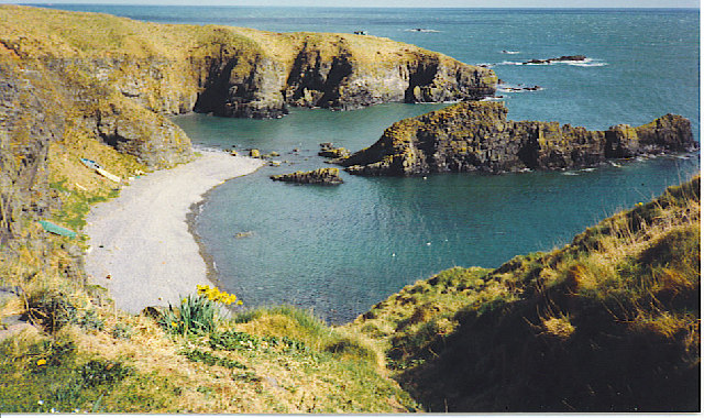
Bogies' Hole is a prominent coastal feature located in Aberdeenshire, Scotland. Situated on a headland, this stunning site is renowned for its dramatic cliffs and breathtaking views of the North Sea. The point is named after the distinctive geological formation it possesses, known as a "hole," which refers to a natural archway that has been eroded through the rock over centuries.

The headland itself is composed of rugged sandstone and shale, providing a striking contrast against the deep blue waters below. The cliffs, reaching heights of up to 30 meters, offer a mesmerizing sight as they stand tall and majestic against the crashing waves. These cliffs also serve as a nesting site for various seabirds, including fulmars, kittiwakes, and guillemots, making it a popular spot for birdwatchers and nature enthusiasts.

Access to Bogies' Hole is relatively easy, with a well-maintained footpath leading visitors to the edge of the headland. From this vantage point, one can marvel at the stunning panoramic views of the coastline and the distant horizon.

In addition to its natural beauty, Bogies' Hole holds historical significance. It is believed that the area was once used by smugglers due to its secluded location and hidden caves. Today, remnants of this illicit past can still be found, adding an air of mystery and intrigue to the site.

Overall, Bogies' Hole is a captivating coastal feature that offers both natural wonders and historical intrigue, making it a must-visit destination for those exploring Aberdeenshire.

If you have any feedback on the listing, please let us know in the comments section below.

Bogies' Hole Images

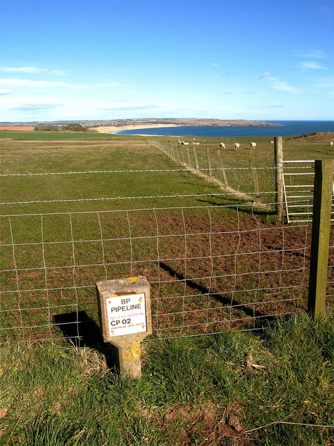
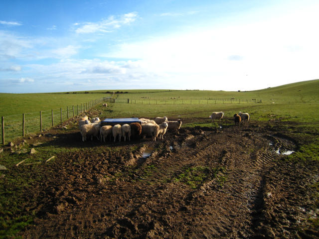
Images are sourced within 2km of 57.377555/-1.8823787 or Grid Reference NK0731. Thanks to Geograph Open Source API. All images are credited.

Whinnyfold: Scotland's third oil boom Just under my feet there is a major pipeline bringing ashore Scotland's oil. The complex Forties pipeline system carries about 700 thousand barrels per day, 30% of the UK's oil. It is owned and operated by UK-based global energy company BP. The system, which consists of a 36-inch pipeline originating at the Forties Charlie platform, carries crude oil 169 kilometres to the Cruden Bay pumping station,  mile or so from here. From there, the crude flows a further 209 km south to the processing facility at Grangemouth on the Firth of Forth.

North Sea oil is in fact Scotland's third oil industry. The first was based not on petroleum oil but on whale oil. In the 18th and 19th centuries whalers sailed to Greenland from Scottish ports, particularly Dundee, Aberdeen and Peterhead. There they harpooned Bowhead whales and brought back their blubber in barrels. The blubber was boiled back in Scotland and the oil used for a range of purposes including street lighting and textile and jute manufacture. 

The second oil industry came about thanks to one James 'Paraffin' Young. In 1851 he began to distil oil, at first from coal and later from rock shales, near to Bathgate, in West Lothian. This was the foundation of the modern oil industry, providing the raw material for a new range of chemicals. His legacy can still be seen in the landscape of West Lothian in the form of huge red mounds or bings, of spent shale from which oil has been extracted <a href="https://www.geograph.org.uk/photo/1789176">NT0873 : Red bing and dark sky</a>.
Whinnyfold: Scotland's third oil boom
Just under my feet there is a major pipeline bringing ashore Scotland's oil. The complex Forties pipeline system carries about 700 thousand barrels per day, 30% of the UK's oil. It is owned and operated by UK-based global energy company BP. The system, which consists of a 36-inch pipeline originating at the Forties Charlie platform, carries crude oil 169 kilometres to the Cruden Bay pumping station, mile or so from here. From there, the crude flows a further 209 km south to the processing facility at Grangemouth on the Firth of Forth. North Sea oil is in fact Scotland's third oil industry. The first was based not on petroleum oil but on whale oil. In the 18th and 19th centuries whalers sailed to Greenland from Scottish ports, particularly Dundee, Aberdeen and Peterhead. There they harpooned Bowhead whales and brought back their blubber in barrels. The blubber was boiled back in Scotland and the oil used for a range of purposes including street lighting and textile and jute manufacture. The second oil industry came about thanks to one James 'Paraffin' Young. In 1851 he began to distil oil, at first from coal and later from rock shales, near to Bathgate, in West Lothian. This was the foundation of the modern oil industry, providing the raw material for a new range of chemicals. His legacy can still be seen in the landscape of West Lothian in the form of huge red mounds or bings, of spent shale from which oil has been extracted NT0873 : Red bing and dark sky.
Whinnyfold: the deadly Godman Whinnyfold is a tiny village sitting atop the cliffs at the southern end of the Bay of Cruden in Aberdeenshire. The village consists of a handful of old fisher cottages built in the 1860s. Whinnyfold has no harbour, just this natural haven and the fisherfolk had to scramble up and down a steep grass slope to reach their boats hauled up on the shingle beach and to land their catches. In the nineteenth century and early twentieth century the village housed a thriving fishing community, with some 200 fishermen operating around 20 boats. Today, however, there is no commercial fishing and no local amenities, and the houses are occupied by commuters and holiday makers.

The seas around Whinnyfold are treacherous with numerous rocky headlands and offshore a semi-submerged reef known as the Skares, the site of many shipwrecks. Little wonder that every rock and headland has its own name; the large rock in the foreground, for example is the Godman while the headland beyond is the Cruner.
Whinnyfold: the deadly Godman
Whinnyfold is a tiny village sitting atop the cliffs at the southern end of the Bay of Cruden in Aberdeenshire. The village consists of a handful of old fisher cottages built in the 1860s. Whinnyfold has no harbour, just this natural haven and the fisherfolk had to scramble up and down a steep grass slope to reach their boats hauled up on the shingle beach and to land their catches. In the nineteenth century and early twentieth century the village housed a thriving fishing community, with some 200 fishermen operating around 20 boats. Today, however, there is no commercial fishing and no local amenities, and the houses are occupied by commuters and holiday makers. The seas around Whinnyfold are treacherous with numerous rocky headlands and offshore a semi-submerged reef known as the Skares, the site of many shipwrecks. Little wonder that every rock and headland has its own name; the large rock in the foreground, for example is the Godman while the headland beyond is the Cruner.
A species from the deep past The common horse-tail, Equisetum arvense, is an ancient species of plant whose ancestors were browsed by dinosaurs. Modern horsetails are only a few centimetres high but their ancestors included tree-like species up to 200 feet in height living in the Carboniferous forests. They all evolved long before the flowering plants came along and they produce spores rather than seeds. 

Horsetails grow in moist, rich soils in all parts of the world except Australasia. Some, including ours, produce two kinds of shoots. The first shoots to emerge in the spring are the reproductive squad and are topped with cone-like clusters of spore capsules. These are the ones in the photograph. In a couple of weeks time they will be replaced with green shoots whose role in life will be photosynthesis, growth and replenishing the energy stores.
A species from the deep past
The common horse-tail, Equisetum arvense, is an ancient species of plant whose ancestors were browsed by dinosaurs. Modern horsetails are only a few centimetres high but their ancestors included tree-like species up to 200 feet in height living in the Carboniferous forests. They all evolved long before the flowering plants came along and they produce spores rather than seeds. Horsetails grow in moist, rich soils in all parts of the world except Australasia. Some, including ours, produce two kinds of shoots. The first shoots to emerge in the spring are the reproductive squad and are topped with cone-like clusters of spore capsules. These are the ones in the photograph. In a couple of weeks time they will be replaced with green shoots whose role in life will be photosynthesis, growth and replenishing the energy stores.
Particoloured Tup This smart and rather unusual fellow was one of half a dozen tups roaming the cliffs. The others were mostly uniform in colour.
Particoloured Tup
This smart and rather unusual fellow was one of half a dozen tups roaming the cliffs. The others were mostly uniform in colour.
Fold Hinge Although it looks like a continuation, the section of the hinge in the black rocks is actually separated from the part on the left by a narrow sea inlet. This can be seen in <a href="https://www.geograph.org.uk/photo/1945678">NK0630 : Still More of the Recumbent Fold</a>.
Fold Hinge
Although it looks like a continuation, the section of the hinge in the black rocks is actually separated from the part on the left by a narrow sea inlet. This can be seen in NK0630 : Still More of the Recumbent Fold.
Folding the other way The most prominent hinges here close to the left, but this shows the other part of the structure, closing to the right, the whole forming an S-shaped fold.
Folding the other way
The most prominent hinges here close to the left, but this shows the other part of the structure, closing to the right, the whole forming an S-shaped fold.
Field Mushroom? I can't be certain what this is. There were several in the grass by the path. Any help with identification will be welcome.
Field Mushroom?
I can't be certain what this is. There were several in the grass by the path. Any help with identification will be welcome.
Mushrooms or Toadstools? Someone or something had uprooted the large fungus, so I moved it closer to the ones still in situ. I do not know what they are; I can only say that the large one did not smell at all appetising. Any help with identification welcome.
Mushrooms or Toadstools?
Someone or something had uprooted the large fungus, so I moved it closer to the ones still in situ. I do not know what they are; I can only say that the large one did not smell at all appetising. Any help with identification welcome.
South Newclochtow A clump of thistles clusters round the fence near South Newclochtow. There is barley on the field to the right, and grass with clover in the field on the left.
South Newclochtow
A clump of thistles clusters round the fence near South Newclochtow. There is barley on the field to the right, and grass with clover in the field on the left.
Whinnyfold Former fishing village perched on a clifftop above a small bay.
Whinnyfold
Former fishing village perched on a clifftop above a small bay.
Bay at Whinnyfold Not much shelter, but this was the beach used by the fisherman who used to live in the village.
Bay at Whinnyfold
Not much shelter, but this was the beach used by the fisherman who used to live in the village.
The bay at  Whinnyfold Whinnyfold (pron. Finnyfa' by the locals) is a small Heugh-head hamlet, a former fishing settlement. Today a few small boats are still hauled up off the beach.
The bay at Whinnyfold
Whinnyfold (pron. Finnyfa' by the locals) is a small Heugh-head hamlet, a former fishing settlement. Today a few small boats are still hauled up off the beach.
Berry's Loup
Berry's Loup
Postbox at Whinnyfold Looking in the direction of Cruden Bay.
Postbox at Whinnyfold
Looking in the direction of Cruden Bay.
Whinnyfold small hamlet perched above high cliffs.
Whinnyfold
small hamlet perched above high cliffs.
Oil Pipeline Booster Station The pipeline bringing oil from the Forties Field and other integrated locations makes its landfall just south of Cruden Bay... (Cruden Bay / Crude Oil - very apt) Pumping Station to assist the black gold's onward route to Grangemouth Refinery.
Oil Pipeline Booster Station
The pipeline bringing oil from the Forties Field and other integrated locations makes its landfall just south of Cruden Bay... (Cruden Bay / Crude Oil - very apt) Pumping Station to assist the black gold's onward route to Grangemouth Refinery.
sheep grazing, Sandend Farm near Whinnyfold. Location of this snap gives a better than usual perspective of the 'Bay' aspect of Cruden Bay. Brooding ruin of Slains Castle to the right
sheep grazing, Sandend Farm
near Whinnyfold. Location of this snap gives a better than usual perspective of the 'Bay' aspect of Cruden Bay. Brooding ruin of Slains Castle to the right
Sheep, mud and grass A typical agricultural scene in the rich farming land bordering the North Sea, North of Collieston.
Sheep, mud and grass
A typical agricultural scene in the rich farming land bordering the North Sea, North of Collieston.
Show me another place!

Bogies' Hole is located at Grid Ref: NK0731 (Lat: 57.377555, Lng: -1.8823787)

Unitary Authority: Aberdeenshire

Police Authority: North East

What 3 Words

///drop.gravel.youths. Near Port Erroll, Aberdeenshire

Nearby Locations

The Veshels Bogies' Hole

Related Wikis

Nearby Amenities

Located within 500m of 57.377555,-1.8823787
Source: OS7
Lat/Long: 57.3800959/-1.8765218
Source: OS7
Lat/Long: 57.3799918/-1.8772953
Source: OS7
Lat/Long: 57.3797021/-1.8789004
Source: OS7
Lat/Long: 57.3794077/-1.8796847
Source: OS7
Lat/Long: 57.3791573/-1.8810558
Source: OS7
Lat/Long: 57.3786304/-1.8816234
Source: OS7
Lat/Long: 57.3776824/-1.8824716
Source: OS7
Lat/Long: 57.3773487/-1.8834376
Source: OS7
Lat/Long: 57.3767975/-1.8834698
Source: OS7
Lat/Long: 57.3763648/-1.8841758
Source: Old Landsat image trace
Lat/Long: 57.3765713/-1.8850351
Source: OS7
Lat/Long: 57.3747013/-1.885681
Source: OS7
Lat/Long: 57.3742773/-1.8871498
The data included in this document is from www.openstreetmap.org. The data is made available under ODbL.

Have you been to Bogies' Hole?

Leave your review of Bogies' Hole below (or comments, questions and feedback).