Bodinnar, Lower

Settlement in Cornwall

England

Bodinnar, Lower

Newbridge Methodist Church
Newbridge Methodist Church Credit: Paul Barnett

Bodinnar is a small village located in the district of Lower Cornwall, in the southwestern region of England. Situated amidst picturesque countryside, this tranquil village offers a serene and peaceful environment for its residents and visitors alike.

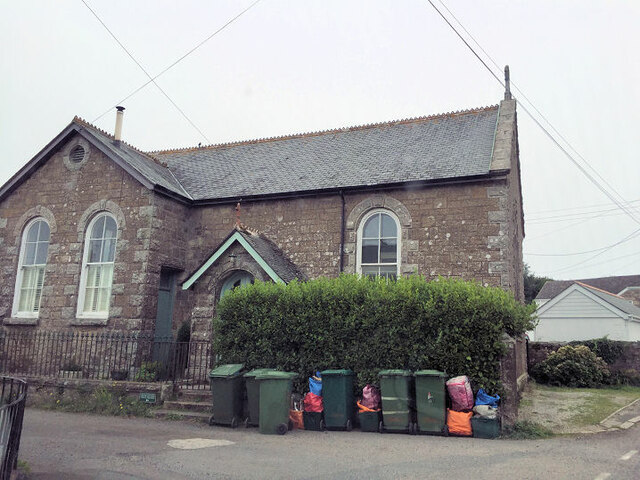
With a population of around 500 residents, Bodinnar exudes a close-knit community atmosphere. The village is characterized by its charming traditional stone houses, adorned with colorful flowers and well-manicured gardens. The local residents take great pride in maintaining the village's aesthetic appeal and preserving its historical heritage.

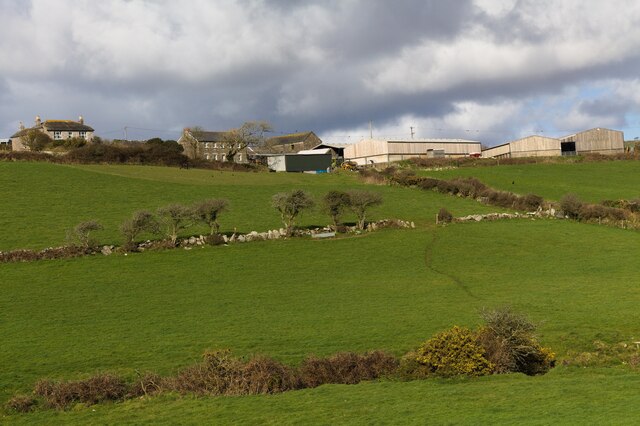
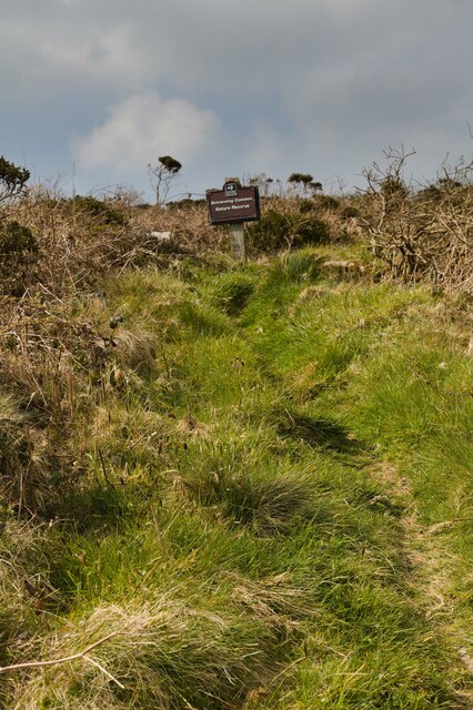
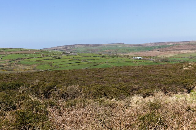
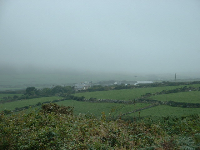
Bodinnar is surrounded by lush green fields and rolling hills, providing ample opportunities for outdoor activities such as hiking, cycling, and picnicking. The nearby Bodinnar Woods is a popular spot for nature enthusiasts, offering scenic walking trails that showcase the region's diverse flora and fauna.

The village is well-connected to the rest of Cornwall, with convenient transportation links to nearby towns and cities. The local economy primarily relies on agriculture, with several farms in the surrounding area producing a range of crops and livestock.

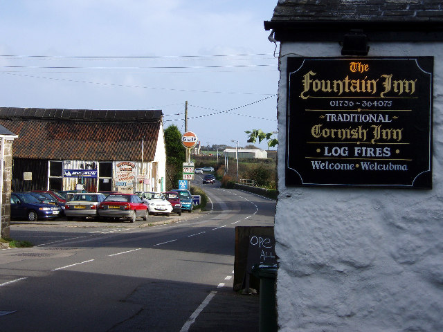
Although Bodinnar is a small village, it boasts a strong sense of community spirit. The village hall serves as a hub for various social events, including fairs, festivals, and community gatherings. Additionally, the local pub is a popular meeting spot, offering a warm and friendly atmosphere for locals and visitors to socialize and enjoy traditional Cornish cuisine.

Overall, Bodinnar offers a unique blend of natural beauty, community spirit, and rural charm, making it an idyllic destination for those seeking a peaceful retreat in the heart of Lower Cornwall.

If you have any feedback on the listing, please let us know in the comments section below.

Bodinnar, Lower Images

Images are sourced within 2km of 50.132186/-5.6100816 or Grid Reference SW4232. Thanks to Geograph Open Source API. All images are credited.

Newbridge Methodist Church
Former Bible Christian chapel
View to Bosence Farm I walked uphill along the public bridleway. Standing at a field gate I looked across the valley to Bosence Farm.
View to Bosence Farm
I walked uphill along the public bridleway. Standing at a field gate I looked across the valley to Bosence Farm.
View to Derval Farm At the junction of the public bridleway and the lane to Bosence Farm, there's a view across the valley to Derval Farm.
View to Derval Farm
At the junction of the public bridleway and the lane to Bosence Farm, there's a view across the valley to Derval Farm.
View to Trannack Farm Looking across a field to Trannack Farm.
View to Trannack Farm
Looking across a field to Trannack Farm.
Bend in the road The road bends at 90 degrees here.
Bend in the road
The road bends at 90 degrees here.
View to Ennestreven Farm A view to Ennestreven Farm from the road beneath Sancreed Beacon.
View to Ennestreven Farm
A view to Ennestreven Farm from the road beneath Sancreed Beacon.
Track to Hewes Common The track branches off the road at this junction.
Track to Hewes Common
The track branches off the road at this junction.
Footpath to Bosvenning Common The footpath goes uphill through scrubland with some willow trees.
Footpath to Bosvenning Common
The footpath goes uphill through scrubland with some willow trees.
Bosvenning Common Bosvenning Common is owned by Cornwall Wildlife Trust.
Bosvenning Common
Bosvenning Common is owned by Cornwall Wildlife Trust.
Public bridleway above Trannack Farm The public bridleway ascends gently here.
Public bridleway above Trannack Farm
The public bridleway ascends gently here.
View from Bosvenning Common 1 Looking across the common to farms on the distant hillside. The strange Air Traffic Control Beacon can also be seen on the far left. See also <a href="https://www.geograph.org.uk/photo/7460424">SW4131 : View from Bosvenning Common 2</a>.
View from Bosvenning Common 1
Looking across the common to farms on the distant hillside. The strange Air Traffic Control Beacon can also be seen on the far left. See also SW4131 : View from Bosvenning Common 2.
View from Bosvenning Common 2 Another look across the common to distant farms. The far distant rocky outcrop is Carn Galver. See also <a href="https://www.geograph.org.uk/photo/7460419">SW4131 : View from Bosvenning Common 1</a>.
View from Bosvenning Common 2
Another look across the common to distant farms. The far distant rocky outcrop is Carn Galver. See also SW4131 : View from Bosvenning Common 1.
View to sallows As the footpath descends the ground becomes wetter and there's a small cluster of willows.
View to sallows
As the footpath descends the ground becomes wetter and there's a small cluster of willows.
Main road where the footpath emerges Houses on the A3071 opposite the footpath.
Main road where the footpath emerges
Houses on the A3071 opposite the footpath.
Footpath onto the common Footpath over heath and scrub, looking towards Bosvenning Common.
Footpath onto the common
Footpath over heath and scrub, looking towards Bosvenning Common.
Early September on Bosvenning Common In early September Bosvenning Common is a wonderful swathe of flowering gorse, ling, bell heather and cross-leaved heath.
Early September on Bosvenning Common
In early September Bosvenning Common is a wonderful swathe of flowering gorse, ling, bell heather and cross-leaved heath.
Lanyon Quoit, Cornwall
Show me another place!

Bodinnar, Lower is located at Grid Ref: SW4232 (Lat: 50.132186, Lng: -5.6100816)

Unitary Authority: Cornwall

Police Authority: Devon and Cornwall

What 3 Words

///sulked.contrived.quote. Near Penzance, Cornwall

Related Wikis

Lower Bodinnar

Lower Bodinnar is a hamlet in the parish of Sancreed (where the 2011 census population was included.), Cornwall, England, UK. Lower Bodinnar is approximately...

Newbridge, Cornwall

Newbridge (Cornish: Hal an Tegen) is a hamlet in the civil parish of Madron on the Penwith peninsula in west Cornwall, England, United Kingdom. It is...

Great Bosullow

Great Bosullow (Cornish: Bos Chiwolow, meaning dwelling of the house of light) is a hamlet south-east of Morvah in west Cornwall, England, UK. Bosullow...
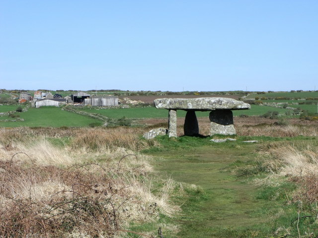
West Lanyon Quoit

West Lanyon Quoit, also known as Lower Lanyon Quoit, is the remains of a prehistoric dolmen situated in the parish of Madron in Cornwall grid reference...

Nearby Amenities

Located within 500m of 50.132186,-5.6100816
Newbridge
Is In: Cornwall, England, UK
Is In Country: England
Is In Country Code: GB
Is In County: Cornwall
Name Kw: Hal an Tegen
Name Uk: Ньюбридж
Place: village
Postal Code: TR20 8
Source: npe
Wikidata: Q7017052
Lat/Long: 50.1290192/-5.6051583
Pub
Fountain Inn
Addr City: Penzance
Addr Country: GB
Addr Place: Newbridge
Addr Postcode: TR20 8QH
Fhrs Id: 502464
Wikidata: Q26436675
Lat/Long: 50.128662/-5.6059273
Lower Bodina
Is In: Cornwall, England, UK
Place: hamlet
Source: NPE
Lat/Long: 50.1320607/-5.6078579
Bus Stop
The Fountain Inn
Bus: yes
Naptan AtcoCode: 0800COD40179
Naptan Bearing: E
Naptan CommonName: The Fountain Inn
Naptan Crossing: Bodinnar Lane
Naptan Indicator: Opp
Naptan NaptanCode: coradjpj
Naptan Street: A3071
Naptan Verified: no
Public Transport: platform
Source: naptan_import
Lat/Long: 50.1288531/-5.6055491
Bus Stop
Telephone Box
Bus: yes
Naptan AtcoCode: 0800COD40200
Naptan Bearing: W
Naptan CommonName: Telephone Box
Naptan Crossing: Bodinnar Lane
Naptan NaptanCode: coradjpa
Naptan Street: A3071
Naptan Verified: no
Public Transport: platform
Source: naptan_import
Lat/Long: 50.1288366/-5.6078152
Higher Receven
Is In: Cornwall, England, UK
Is In Country: England
Is In County: Cornwall
Is In State Code: GB
Place: hamlet
Source: NLS
Lat/Long: 50.1322601/-5.6148301
Post Box
Collection Times: Mo-Fr 11:45; Sa 11:45
Operator: Royal Mail
Post Box Type: lamp
Ref: TR20 74
Royal Cypher: EIIR
Royal Cypher Wikidata: Q33102113
Source: survey
Survey Date: 2017-10-24
Lat/Long: 50.1296008/-5.6057189
Generator Method: photovoltaic
Generator Output Electricity: small_installation
Generator Source: solar
Generator Type: solar_photovoltaic_panel
Location: platform
Power: generator
Source: bing
Lat/Long: 50.1299946/-5.6042276
Direction: SW
Generator Method: photovoltaic
Generator Output Electricity: small_installation
Generator Source: solar
Generator Type: solar_photovoltaic_panel
Location: roof
Power: generator
Source: bing
Lat/Long: 50.129097/-5.6060153
Power: pole
Lat/Long: 50.1317789/-5.6139413
Power: pole
Lat/Long: 50.1317376/-5.6137589
Power: pole
Lat/Long: 50.1335614/-5.6037033
Power: pole
Lat/Long: 50.1333852/-5.6046876
Power: pole
Lat/Long: 50.1331961/-5.6057619
Power: pole
Lat/Long: 50.1329545/-5.6071861
Power: pole
Lat/Long: 50.1326278/-5.6090342
Power: pole
Lat/Long: 50.1324189/-5.6102559
Power: pole
Lat/Long: 50.1320364/-5.6124245
Power: pole
Lat/Long: 50.1315954/-5.6150088
Power: pole
Lat/Long: 50.1314337/-5.6159395
Power: pole
Lat/Long: 50.1312687/-5.6168541
Power: pole
Lat/Long: 50.131199/-5.6168447
Power: pole
Lat/Long: 50.1313598/-5.6159744
Power: pole
Lat/Long: 50.1315266/-5.6150021
Power: pole
Lat/Long: 50.1319736/-5.6123856
Power: pole
Lat/Long: 50.1323467/-5.610213
Power: pole
Lat/Long: 50.1325479/-5.6091119
Power: pole
Lat/Long: 50.1328496/-5.6072666
Power: pole
Lat/Long: 50.1331144/-5.6057873
Power: pole
Lat/Long: 50.1332554/-5.6049612
Power: pole
Lat/Long: 50.133466/-5.603777
Power: pole
Lat/Long: 50.1321679/-5.6083234
Power: pole
Transformer: distribution
Lat/Long: 50.1317002/-5.6079787
Power: pole
Lat/Long: 50.1311105/-5.6070399
Power: pole
Lat/Long: 50.1305663/-5.6062272
Power: pole
Lat/Long: 50.1290231/-5.6053112
Power: pole
Lat/Long: 50.1300101/-5.6051999
Power: pole
Lat/Long: 50.1299654/-5.6053367
Power: pole
Lat/Long: 50.1297573/-5.6058088
Power: pole
Lat/Long: 50.1294014/-5.6064901
Power: pole
Lat/Long: 50.1288907/-5.6075656
Power: pole
Lat/Long: 50.1281273/-5.6080082
Power: pole
Lat/Long: 50.1335674/-5.6164169
Power: pole
Lat/Long: 50.1328745/-5.6156337
Power: pole
Lat/Long: 50.1325135/-5.6154996
Power: pole
Transformer: distribution
Lat/Long: 50.1319289/-5.615171
Power: pole
Lat/Long: 50.1314329/-5.6151375
Power: pole
Lat/Long: 50.1307718/-5.6150195
Power: pole
Lat/Long: 50.1300771/-5.61488
Power: pole
Transformer: distribution
Lat/Long: 50.1294461/-5.6147754
The data included in this document is from www.openstreetmap.org. The data is made available under ODbL.

Have you been to Bodinnar, Lower?

Leave your review of Bodinnar, Lower below (or comments, questions and feedback).