Garron Point
Coastal Feature, Headland, Point in Kincardineshire
Scotland
Garron Point
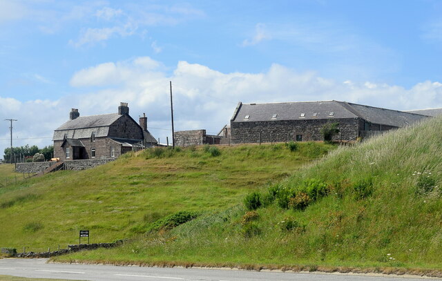
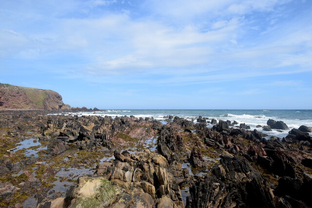
Garron Point is a prominent coastal feature located in Kincardineshire, Scotland. It is a headland, often referred to as a point, that juts out into the North Sea. The point is situated approximately 3 miles south of Stonehaven, a small coastal town known for its picturesque views and historic landmarks.
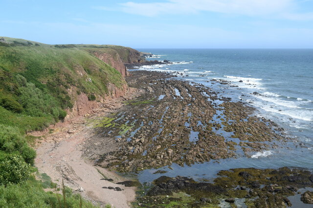
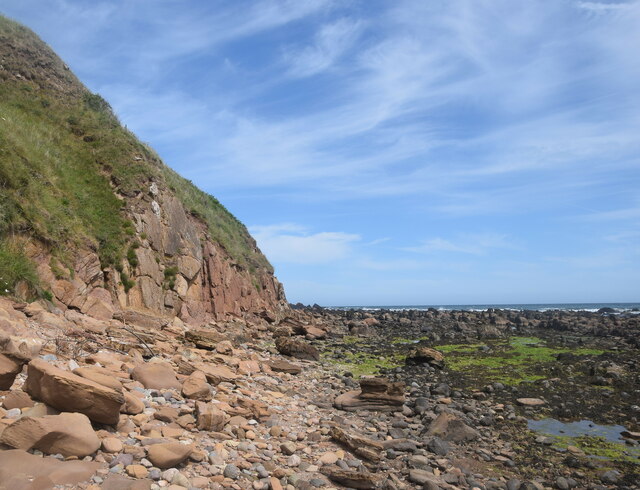
The geography of Garron Point is characterized by steep cliffs that plunge into the sea below, creating a dramatic and rugged coastline. The cliffs are composed mainly of sandstone and shale, showcasing layers of sedimentary rock that have been weathered over time by the relentless action of the waves.
The point itself is a popular destination for outdoor enthusiasts and nature lovers. It offers breathtaking panoramic views of the surrounding area, including the expansive sea and the nearby Dunnottar Castle, perched on a cliff overlooking the point. The castle is a significant historical site and adds to the allure of the landscape.
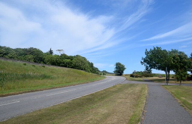
The coastal path that winds along Garron Point provides a great opportunity for hikers and walkers to explore the area's natural beauty. It offers glimpses of various seabirds that nest along the cliffs, such as puffins, guillemots, and gulls. Additionally, the point is known for its diverse marine life, making it a popular spot for snorkeling and diving.
Overall, Garron Point in Kincardineshire is a striking headland that showcases Scotland's rugged coastal beauty. Its towering cliffs, stunning views, and abundant wildlife make it a must-visit destination for those seeking an immersive experience in nature.
If you have any feedback on the listing, please let us know in the comments section below.
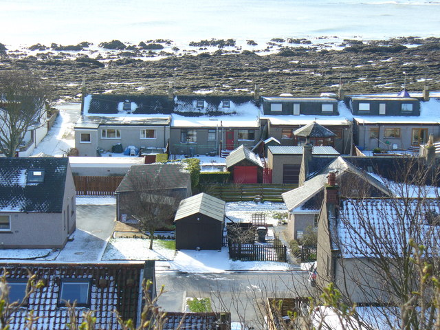
Garron Point Images
Images are sourced within 2km of 56.980394/-2.1759397 or Grid Reference NO8987. Thanks to Geograph Open Source API. All images are credited.


Garron Point is located at Grid Ref: NO8987 (Lat: 56.980394, Lng: -2.1759397)
Unitary Authority: Aberdeenshire
Police Authority: North East
What 3 Words
///tadpole.incur.honestly. Near Stonehaven, Aberdeenshire
Nearby Locations
Related Wikis

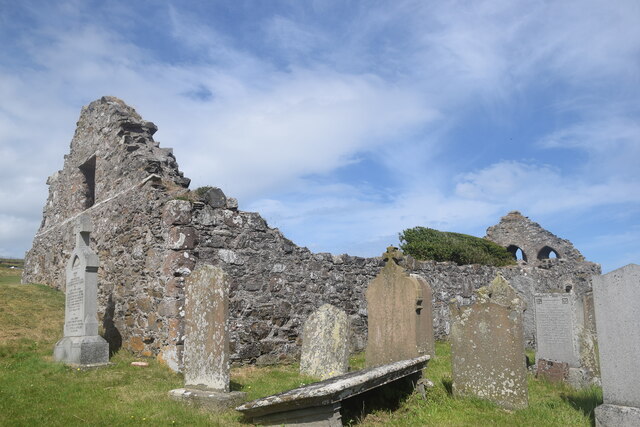
Chapel of St Mary and St Nathalan
The Chapel of St. Mary and St. Nathalan is a ruined chapel overlooking the North Sea immediately north of Stonehaven, in the Mearns of Scotland, along...

Limpet Mill railway station
Limpet Mill was a railway station in Kincardineshire, Scotland from 1849 to 1850 on the Aberdeen Railway. == History == This station was opened on 1 November...
Cowie Castle
Cowie Castle is a ruined fortress in Aberdeenshire, Scotland. The site lies at the northern end of Stonehaven on the North Sea coast. To the immediate...
Limpet Burn
Limpet Burn is a watercourse in Aberdeenshire, Scotland whose discharge is deemed part of the North Sea coastal drainage. Prominent geographic features...
Megray Hill
Megray Hill is a low-lying coastal mountainous landform in Aberdeenshire, Scotland within the Mounth Range of the Grampian Mountains. The peak elevation...
Cowie, Aberdeenshire
Cowie is an historic fishing village in Kincardineshire, Scotland. This village has existed since the Middle Ages, but in current times it is effectively...
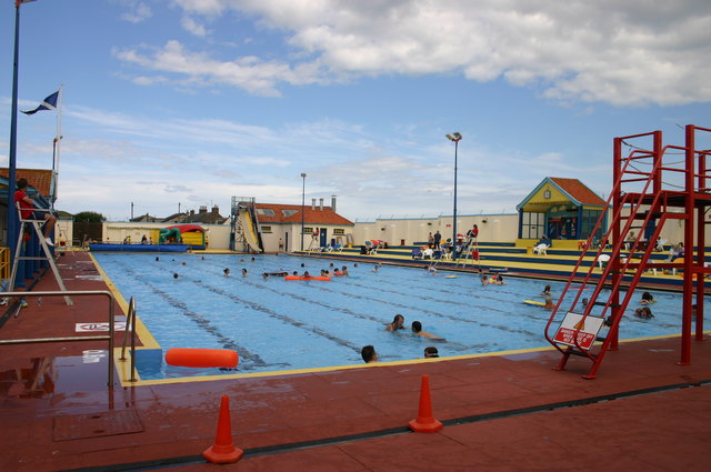
Stonehaven Open Air Pool
Stonehaven Open Air Swimming Pool, Queen Elizabeth Park, Stonehaven, Aberdeenshire, is an Olympic sized heated open air public pool opened in 1934. It...
Stonehaven Bay
Stonehaven Bay is a natural harbour in Aberdeenshire, Scotland. The town of Stonehaven is built along the shore of Stonehaven Bay. The mouths of the Carron...
Nearby Amenities
Located within 500m of 56.980394,-2.1759397Have you been to Garron Point?
Leave your review of Garron Point below (or comments, questions and feedback).