Sandy Geo

Coastal Feature, Headland, Point in Orkney

Scotland

Sandy Geo

North Ronaldsay: the lighthouse The lighthouse was built after a complicated history of lighthouse arrangements in Orkney. The first beacon here was the Old Beacon, which survives to the southeast, built in 1789. It was extinguished in 1809 after Start Point lighthouse (on Sanday) had begun operation as it was considered superfluous. However, this proved inauspicious and the present lighthouse was constructed in 1852. 

Thanks to the low-lying nature of North Ronaldsay, the lighthouse is the tallest land-based one in Britain, standing 42m in height to reach the 43m elevation of the light above sea level.

The lighthouse was automated in 1998, since when the various outbuildings have been converted to holiday accommodation, a café/small museum, and a wool mill.
North Ronaldsay: the lighthouse Credit: Chris Downer

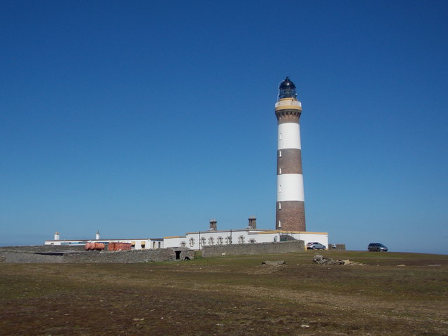
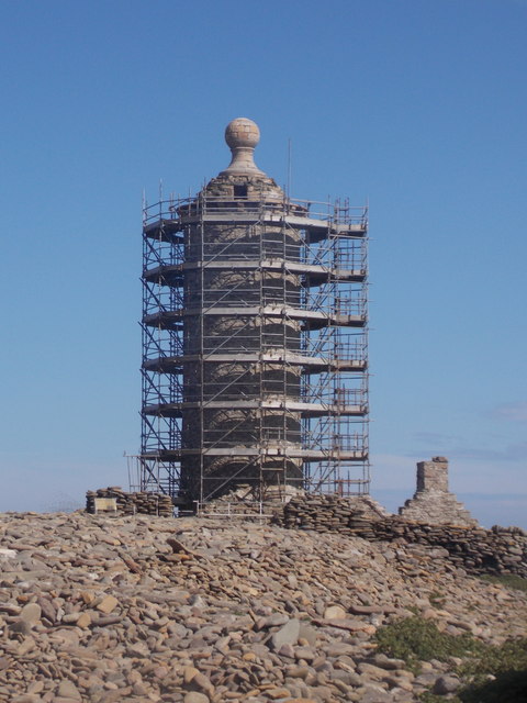
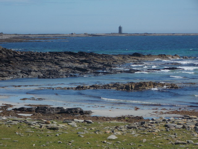
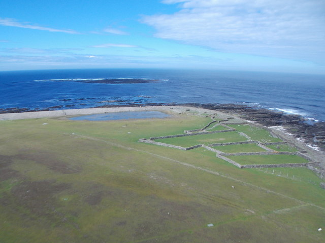
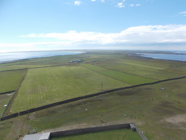
Sandy Geo is a prominent coastal feature located on the island of Orkney in Scotland. It is classified as a headland or point due to its distinct shape and geographical characteristics. The name "Sandy Geo" refers to a narrow strip of sandy beach that extends out into the sea, forming a natural barrier between the land and the water.

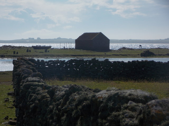
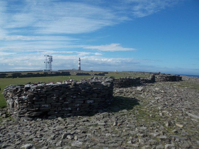
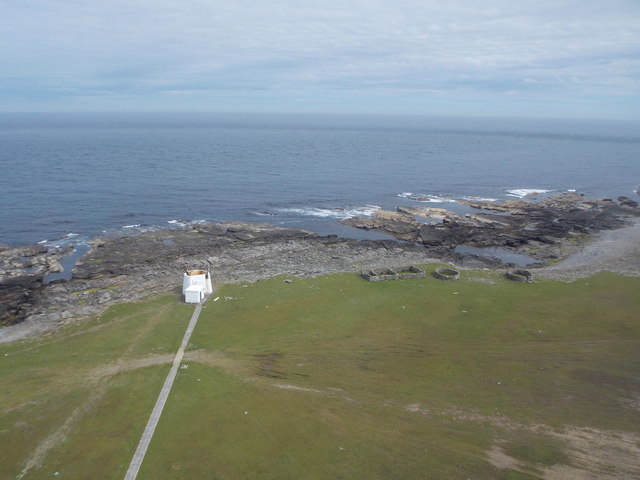
Situated on the northeastern coast of Orkney, Sandy Geo is known for its stunning views and picturesque surroundings. The headland is characterized by steep cliffs that rise up from the beach, providing a dramatic backdrop to the sandy shoreline. The cliffs are composed of sedimentary rocks, showcasing layers of geological history.

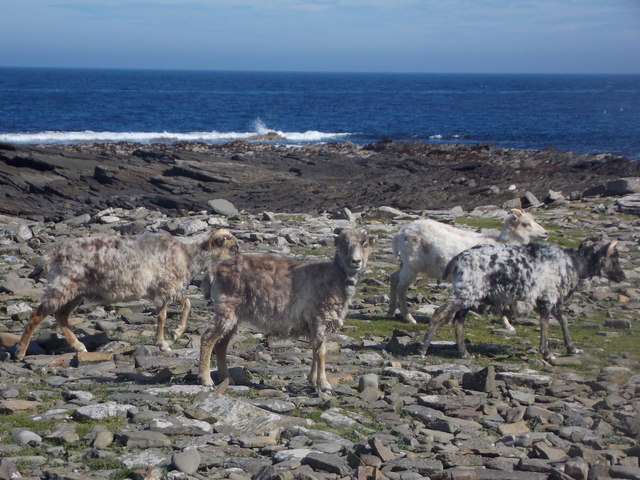
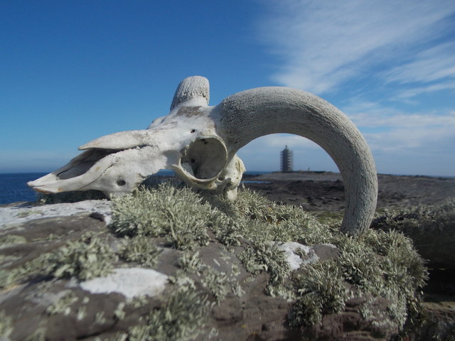
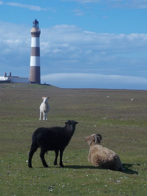
The headland is also home to a diverse range of flora and fauna, making it a popular destination for nature enthusiasts and birdwatchers. Species such as puffins, guillemots, and razorbills can be spotted nesting on the cliffs, while seals and dolphins occasionally visit the waters surrounding Sandy Geo.

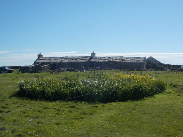
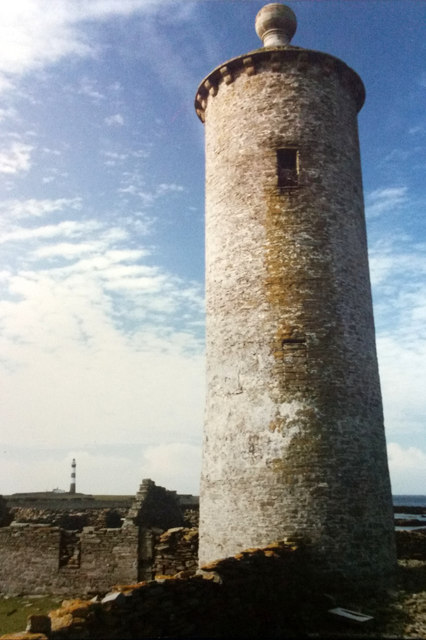
In addition to its natural beauty, Sandy Geo holds historical significance. The area is dotted with ancient ruins and archaeological sites, including the remains of a Viking settlement and a Neolithic burial mound. These remnants serve as a testament to the rich cultural heritage of the Orkney Islands.

Overall, Sandy Geo is a captivating coastal feature that showcases the rugged charm and natural wonders of Orkney. Its combination of sandy beaches, towering cliffs, and historical sites make it a must-visit destination for those exploring the region.

If you have any feedback on the listing, please let us know in the comments section below.

Sandy Geo Images

Images are sourced within 2km of 59.392575/-2.3794456 or Grid Reference HY7856. Thanks to Geograph Open Source API. All images are credited.

North Ronaldsay: the lighthouse The lighthouse was built after a complicated history of lighthouse arrangements in Orkney. The first beacon here was the Old Beacon, which survives to the southeast, built in 1789. It was extinguished in 1809 after Start Point lighthouse (on Sanday) had begun operation as it was considered superfluous. However, this proved inauspicious and the present lighthouse was constructed in 1852. 

Thanks to the low-lying nature of North Ronaldsay, the lighthouse is the tallest land-based one in Britain, standing 42m in height to reach the 43m elevation of the light above sea level.

The lighthouse was automated in 1998, since when the various outbuildings have been converted to holiday accommodation, a café/small museum, and a wool mill.
North Ronaldsay: the lighthouse
The lighthouse was built after a complicated history of lighthouse arrangements in Orkney. The first beacon here was the Old Beacon, which survives to the southeast, built in 1789. It was extinguished in 1809 after Start Point lighthouse (on Sanday) had begun operation as it was considered superfluous. However, this proved inauspicious and the present lighthouse was constructed in 1852. Thanks to the low-lying nature of North Ronaldsay, the lighthouse is the tallest land-based one in Britain, standing 42m in height to reach the 43m elevation of the light above sea level. The lighthouse was automated in 1998, since when the various outbuildings have been converted to holiday accommodation, a café/small museum, and a wool mill.
North Ronaldsay: looking down from the lighthouse A vertical view from the balcony of <a href="https://www.geograph.org.uk/photo/4705846">HY7855 : North Ronaldsay: the lighthouse</a>, on some of the associated buildings; those in the picture have been converted to holiday accommodation since the lighthouse's automation in 1998.
North Ronaldsay: looking down from the lighthouse
A vertical view from the balcony of HY7855 : North Ronaldsay: the lighthouse, on some of the associated buildings; those in the picture have been converted to holiday accommodation since the lighthouse's automation in 1998.
North Ronaldsay: the light in the lighthouse A closer look at the light and lenses at the top of <a href="https://www.geograph.org.uk/photo/4705846">HY7855 : North Ronaldsay: the lighthouse</a>.

The light here is surrounded by lenses and the whole apparatus revolves at a speed such that the lenses are ten seconds apart from any given viewpoint. This gives the appearance of the light flashing every ten seconds, which is the distinctive 'character' of this particular light, although the light itself does not physically flash.
North Ronaldsay: the light in the lighthouse
A closer look at the light and lenses at the top of HY7855 : North Ronaldsay: the lighthouse. The light here is surrounded by lenses and the whole apparatus revolves at a speed such that the lenses are ten seconds apart from any given viewpoint. This gives the appearance of the light flashing every ten seconds, which is the distinctive 'character' of this particular light, although the light itself does not physically flash.
North Ronaldsay: towards Dennis Head from the lighthouse Looking across the eastern edge of the island from the top of the lighthouse, towards its predecessor, the Old Beacon, on Dennis Head.
North Ronaldsay: towards Dennis Head from the lighthouse
Looking across the eastern edge of the island from the top of the lighthouse, towards its predecessor, the Old Beacon, on Dennis Head.
North Ronaldsay: across Dennis Loch Looking along a dry-stone enclosure wall and across Dennis Loch, with a distant view beyond Linklet Bay of some of the buildings in the more populated southwest of the island.
North Ronaldsay: across Dennis Loch
Looking along a dry-stone enclosure wall and across Dennis Loch, with a distant view beyond Linklet Bay of some of the buildings in the more populated southwest of the island.
North Ronalsday: crues on Dennis Head The coast along this eastern edge of Dennis Head is peppered with crues, mainly circular. A crue is a dry-stone enclosure used for the gathering of sheep. There are many sheep in this area - a large group of them can be seen in the background, towards the lighthouse.

I notice that the large-scale OS map marks them as planticrues. A web search for planticrue suggests that this is an alternate word for 'planticrub', which appears to be based in Shetland and is a similar structure for growing crops (hence the 'plant' bit, I guess).
North Ronalsday: crues on Dennis Head
The coast along this eastern edge of Dennis Head is peppered with crues, mainly circular. A crue is a dry-stone enclosure used for the gathering of sheep. There are many sheep in this area - a large group of them can be seen in the background, towards the lighthouse. I notice that the large-scale OS map marks them as planticrues. A web search for planticrue suggests that this is an alternate word for 'planticrub', which appears to be based in Shetland and is a similar structure for growing crops (hence the 'plant' bit, I guess).
North Ronaldsay: fog horn and some crues Looking down from the lighthouse towards the fog horn and, to the right, some crues both square and circular.

For more information on the word crue, see <a href="https://www.geograph.org.uk/photo/4705941">HY7855 : North Ronalsday: crues on Dennis Head</a>.
North Ronaldsay: fog horn and some crues
Looking down from the lighthouse towards the fog horn and, to the right, some crues both square and circular. For more information on the word crue, see HY7855 : North Ronalsday: crues on Dennis Head.
North Ronaldsay: sheep on the rocks of Bay of Sjaivar North Ronaldsay is known for its seaweed-eating sheep, which graze at will around this eastern coast. Four of them here scarper as I approach; another followed later and, being further out in the midst of the rocks, was quite well camouflaged.
North Ronaldsay: sheep on the rocks of Bay of Sjaivar
North Ronaldsay is known for its seaweed-eating sheep, which graze at will around this eastern coast. Four of them here scarper as I approach; another followed later and, being further out in the midst of the rocks, was quite well camouflaged.
North Ronaldsay: a sheep’s skull on a crue at Dennis Head An ornament, presumably placed there by hand, on the wall of one of the crues on the coast of Dennis Head. The Old Beacon, clad in scaffolding, is in the background.

See <a href="https://www.geograph.org.uk/photo/4705941">HY7855 : North Ronalsday: crues on Dennis Head</a> for more information on the crues.
North Ronaldsay: a sheep’s skull on a crue at Dennis Head
An ornament, presumably placed there by hand, on the wall of one of the crues on the coast of Dennis Head. The Old Beacon, clad in scaffolding, is in the background. See HY7855 : North Ronalsday: crues on Dennis Head for more information on the crues.
North Ronaldsay: the Old Beacon The Old Beacon was the island's first lighthouse, established in 1789, and stands almost perfectly on the eastern gridline of this square.

Its period of operation was rather short - it was extinguished in 1809 when the Start Point lighthouse (on Sanday) was built. However, this was a short-sighted decision and just over 40 years later the lighthouse behind us was built as a replacement for the Old Beacon.
North Ronaldsay: the Old Beacon
The Old Beacon was the island's first lighthouse, established in 1789, and stands almost perfectly on the eastern gridline of this square. Its period of operation was rather short - it was extinguished in 1809 when the Start Point lighthouse (on Sanday) was built. However, this was a short-sighted decision and just over 40 years later the lighthouse behind us was built as a replacement for the Old Beacon.
North Ronaldsay: rocky coastline along Linklet Bay The fine sandy beach just off to our right gives way to this stretch of low rocks, as we look towards the Old Beacon at the distant Dennis Head.
North Ronaldsay: rocky coastline along Linklet Bay
The fine sandy beach just off to our right gives way to this stretch of low rocks, as we look towards the Old Beacon at the distant Dennis Head.
North Ronaldsay: workings in the wool mill The small yarn industry has been a reality on the island since the mid 1990s, and has been based here in one of the former lighthouse buildings since 2003. The visitor is guided around all the workings for a small additional charge to the lighthouse tour.

More information will be found on their website: <span class="nowrap"><a title="http://www.northronaldsayyarn.co.uk/about.asp" rel="nofollow ugc noopener" href="http://www.northronaldsayyarn.co.uk/about.asp">Link</a><img style="margin-left:2px;" alt="External link" title="External link - shift click to open in new window" src="https://s1.geograph.org.uk/img/external.png" width="10" height="10"/></span>

Such is the multi-tasking way of these island communities, I would see the same young lady who showed us round later in the day, donning a high-vis jacket marshalling at the airfield when the plane home came in.
North Ronaldsay: workings in the wool mill
The small yarn industry has been a reality on the island since the mid 1990s, and has been based here in one of the former lighthouse buildings since 2003. The visitor is guided around all the workings for a small additional charge to the lighthouse tour. More information will be found on their website: LinkExternal link Such is the multi-tasking way of these island communities, I would see the same young lady who showed us round later in the day, donning a high-vis jacket marshalling at the airfield when the plane home came in.
North Ronaldsay: Point of Sinsoss and Seal Skerry Looking north from the top of the lighthouse, across the headland at Point of Sinsoss. Seal Skerry is just an offshore rock but, from the map, it is clear that at higher tides it is larger and almost meets the island itself. The loch in front of the shore is the curiously named Trolla Vatn.
North Ronaldsay: Point of Sinsoss and Seal Skerry
Looking north from the top of the lighthouse, across the headland at Point of Sinsoss. Seal Skerry is just an offshore rock but, from the map, it is clear that at higher tides it is larger and almost meets the island itself. The loch in front of the shore is the curiously named Trolla Vatn.
North Ronaldsay: a view over the island Looking southwest across the whole island from the top of the lighthouse.
North Ronaldsay: a view over the island
Looking southwest across the whole island from the top of the lighthouse.
North Ronaldsay: a typical island croft house Many of the croft houses of North Ronaldsay have these flagstone roofs; it seems to be a particular feature of this island.
North Ronaldsay: a typical island croft house
Many of the croft houses of North Ronaldsay have these flagstone roofs; it seems to be a particular feature of this island.
North Ronaldsay: rocks, sand and a lighthouse view Looking across the northwest edge of Linklet Bay, the distant lighthouse faintly reflected in the sand between outcrops of rock.
North Ronaldsay: rocks, sand and a lighthouse view
Looking across the northwest edge of Linklet Bay, the distant lighthouse faintly reflected in the sand between outcrops of rock.
North Ronaldsay: different coloured sheep Three sheep, each a different colour, on the large expanse of grass to the south of the lighthouse.
North Ronaldsay: different coloured sheep
Three sheep, each a different colour, on the large expanse of grass to the south of the lighthouse.
The old beacon, North Ronaldsay One of the oldest lighthouses in Britain; the modern lighthouse can be seen in the background.
The old beacon, North Ronaldsay
One of the oldest lighthouses in Britain; the modern lighthouse can be seen in the background.
Show me another place!

Sandy Geo is located at Grid Ref: HY7856 (Lat: 59.392575, Lng: -2.3794456)

Unitary Authority: Orkney Islands

Police Authority: Highlands and Islands

What 3 Words

///mixing.released.displays. Near Hollandstoun, Orkney Islands

Related Wikis

Ancumtoun

Ancumtoun is a small settlement in the north of the island of North Ronaldsay, Orkney, Scotland. The settlement is within the parish of Cross and Burness...

North Ronaldsay Airport

North Ronaldsay Airport (IATA: NRL, ICAO: EGEN) is located on North Ronaldsay island, 28 NM (52 km; 32 mi) northeast by north of Kirkwall, Orkney Islands...

Bustatoun

Bustatoun is a village on the island of North Ronaldsay, in Orkney, Scotland. The settlement is within the parish of Cross and Burness. == References... ==

Broch of Burrian

The Broch of Burrian is an Iron Age broch located on North Ronaldsay in the Orkney Islands, in Scotland (grid reference HY76275138). == Location == The...

Nearby Amenities

Located within 500m of 59.392575,-2.3794456
Created By: almien_coastlines mod
Lat/Long: 59.392553/-2.38147
North Ronaldsay Lighthouse
Description: North Ronaldsay ("New") Lighthouse
Man Made: lighthouse
Seamark Light Character: Fl
Seamark Light Colour: white
Seamark Light Height: 43
Seamark Light Period: 10
Seamark Light Range: 24
Seamark Light Reference: A 3722
Seamark Light Sequence: 0.3+(9.7)
Seamark Name: North Ronaldsay
Seamark Radar Transponder Category: racon
Seamark Type: light_major
Wikidata: Q17826758
Lat/Long: 59.38966/-2.3813879
Man Made: mast
Tower Type: communication
Lat/Long: 59.3881758/-2.3804198
Generator Method: wind_turbine
Generator Source: wind
Generator Type: horizontal_axis
Power: generator
Lat/Long: 59.3898134/-2.3836989
Material: wood
Power: pole
Lat/Long: 59.3890112/-2.383298
Man Made: flagpole
Lat/Long: 59.3894805/-2.3810414
Point of Sinsoss
Place: locality
Wikidata: Q24638602
Lat/Long: 59.3930166/-2.3806605
Versa Geo
Natural: bay
Lat/Long: 59.3907893/-2.3785424
Couls Geo
Natural: bay
Lat/Long: 59.3898224/-2.376933
Sandy Geo
Natural: bay
Lat/Long: 59.3925866/-2.3794972
Generator Method: wind_turbine
Generator Source: wind
Generator Type: horizontal_axis
Power: generator
Lat/Long: 59.3904445/-2.3857605
Generator Method: wind_turbine
Generator Source: wind
Generator Type: horizontal_axis
Power: generator
Lat/Long: 59.3901208/-2.3856613
Generator Method: wind_turbine
Generator Source: wind
Generator Type: horizontal_axis
Power: generator
Lat/Long: 59.3902/-2.3843685
The data included in this document is from www.openstreetmap.org. The data is made available under ODbL.

Have you been to Sandy Geo?

Leave your review of Sandy Geo below (or comments, questions and feedback).