Cove Hill

Coastal Feature, Headland, Point in Kincardineshire

Scotland

Cove Hill

East Long Skelly Rocks Exposed rocky wave-cut platform at Johnshaven.
East Long Skelly Rocks Credit: Colin Smith

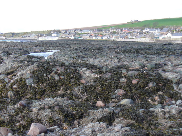
Cove Hill is a prominent headland located in Kincardineshire, Scotland. Situated along the east coast of the country, it offers stunning views of the North Sea. The headland is characterized by its rugged cliffs, which rise dramatically from the sea, creating a striking coastal feature.

Cove Hill is known for its unique geology, with layers of sedimentary rocks that have been shaped and eroded by the relentless forces of the ocean over millions of years. The cliffs display a variety of colors, ranging from deep red to light gray, providing a visually captivating landscape.

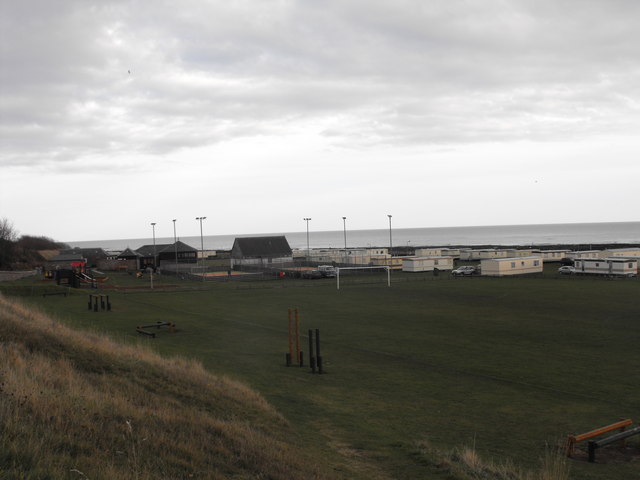
At the top of Cove Hill, there is a grassy plateau that offers a panoramic view of the surrounding area. This vantage point provides an excellent opportunity for visitors to observe the diverse marine life inhabiting the coastal waters, including seabirds, seals, and occasionally dolphins.

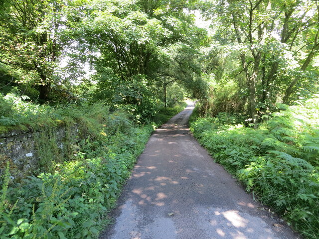
The headland is accessible via a well-maintained footpath that winds its way along the cliff edge. This path offers visitors a chance to explore the area and appreciate the natural beauty of Cove Hill up close. However, caution is advised as the cliffs can be steep and unstable in some areas.

Cove Hill is also a popular spot for outdoor activities such as hiking and birdwatching. Its remote location and unspoiled environment make it an ideal destination for nature enthusiasts and those seeking a peaceful retreat.

In summary, Cove Hill in Kincardineshire is a stunning coastal feature with its rugged cliffs, diverse geology, and breathtaking views of the North Sea. It offers visitors a chance to immerse themselves in nature and experience the beauty of Scotland's east coast.

If you have any feedback on the listing, please let us know in the comments section below.

Cove Hill Images

Images are sourced within 2km of 56.787504/-2.3560633 or Grid Reference NO7866. Thanks to Geograph Open Source API. All images are credited.

East Long Skelly Rocks Exposed rocky wave-cut platform at Johnshaven.
East Long Skelly Rocks
Exposed rocky wave-cut platform at Johnshaven.
Campsite, Johnshaven View of the campsite facing east. Football pitch in the foreground with climbing equipment and playpark on left. Camping area behind goal posts and all-weather courts surrounded by lighting. Building with pitched roof is the toilet block. domed building to the left is the office changing rooms and bowling club. The site is right by the sea and you can hear the waves on the shore while going to sleep. Very special place.
Campsite, Johnshaven
View of the campsite facing east. Football pitch in the foreground with climbing equipment and playpark on left. Camping area behind goal posts and all-weather courts surrounded by lighting. Building with pitched roof is the toilet block. domed building to the left is the office changing rooms and bowling club. The site is right by the sea and you can hear the waves on the shore while going to sleep. Very special place.
Seaweed and Rockpools This is one of these squares where there is only land at low tide. The rocks are Old Red Sandstone conglomerate, like most of the foreshore on this coast.
Seaweed and Rockpools
This is one of these squares where there is only land at low tide. The rocks are Old Red Sandstone conglomerate, like most of the foreshore on this coast.
Conglomerate Channel A shallow channel between the ridges of Old Red Sandstone conglomerate at Johnshaven.
Conglomerate Channel
A shallow channel between the ridges of Old Red Sandstone conglomerate at Johnshaven.
Tidal Land This shows most of the land in this square - seaweed-covered ridges of Old Red Sandstone conglomerate that are only exposed at low tide.
Tidal Land
This shows most of the land in this square - seaweed-covered ridges of Old Red Sandstone conglomerate that are only exposed at low tide.
Johnshaven Foreshore These rocks on the foreshore at Johnshaven are Old Red Sandstones, but not the conglomerates that are the prevailing rock type along this shoreline.
Johnshaven Foreshore
These rocks on the foreshore at Johnshaven are Old Red Sandstones, but not the conglomerates that are the prevailing rock type along this shoreline.
South Street, Johnshaven Looking north-eastward.
South Street, Johnshaven
Looking north-eastward.
Minor road joining the A92 at Elsinor Looking north-westward.
Minor road joining the A92 at Elsinor
Looking north-westward.
Minor road between Milton of Mathers and Elsinor Looking north-westward.
Minor road between Milton of Mathers and Elsinor
Looking north-westward.
Tree-lined minor road near to Miltonhaven Caravan Park
Johnshaven Looking down from the A92, which bypasses the town.
Johnshaven
Looking down from the A92, which bypasses the town.
Ordnance Survey Cut Mark This mark can be found on the wall of a house in West Street, Johnshaven.
The recorded details give a height of 7.7328 metres above sea level.
For more detail see : <span class="nowrap"><a title="https://www.bench-marks.org.uk/bm162462" rel="nofollow ugc noopener" href="https://www.bench-marks.org.uk/bm162462">Link</a><img style="margin-left:2px;" alt="External link" title="External link - shift click to open in new window" src="https://s1.geograph.org.uk/img/external.png" width="10" height="10"/></span>
Ordnance Survey Cut Mark
This mark can be found on the wall of a house in West Street, Johnshaven. The recorded details give a height of 7.7328 metres above sea level. For more detail see : LinkExternal link
Ordnance Survey Cut Mark This mark can be found on the wall of Elsinore.
The recorded details give a height of 62.634 metres above sea level.
For more detail see : <span class="nowrap"><a title="https://www.bench-marks.org.uk/bm162467" rel="nofollow ugc noopener" href="https://www.bench-marks.org.uk/bm162467">Link</a><img style="margin-left:2px;" alt="External link" title="External link - shift click to open in new window" src="https://s1.geograph.org.uk/img/external.png" width="10" height="10"/></span>
Ordnance Survey Cut Mark
This mark can be found on the wall of Elsinore. The recorded details give a height of 62.634 metres above sea level. For more detail see : LinkExternal link
Benholm War Memorial The Benholm Parish War Memorial in the centre of Johnshaven.
Benholm War Memorial
The Benholm Parish War Memorial in the centre of Johnshaven.
Shoreline at Johnshaven Looking along the shoreline at Johnshaven to the east of the harbour area.
Shoreline at Johnshaven
Looking along the shoreline at Johnshaven to the east of the harbour area.
Milton Ness, Aberdeenshire, Scotland Milton Ness was formerly in Kincardineshire but due to boundary changes is now in Aberdeenshire. The headland of Milton Ness is included in a designated Site of Special (SSSI) and is particularly interesting due to modern day birds and to fossils of the Devonian Period.
Milton Ness, Aberdeenshire, Scotland
Milton Ness was formerly in Kincardineshire but due to boundary changes is now in Aberdeenshire. The headland of Milton Ness is included in a designated Site of Special (SSSI) and is particularly interesting due to modern day birds and to fossils of the Devonian Period.
Milton Ness promontory, Aberdeenshire, Scotland The photo shows an ESE view of the promontory of Milton Ness. The promontory is a low lying area of wave-cut platform containing rock pools.
Milton Ness promontory, Aberdeenshire, Scotland
The photo shows an ESE view of the promontory of Milton Ness. The promontory is a low lying area of wave-cut platform containing rock pools.
Ruined building at Milton Ness, Aberdeenshire This photo shows a ruined building beside the coastal path at Milton Ness. The shelly soil is similar to machair and it is suitable for growing a variety of garden crops including potatoes.
Ruined building at Milton Ness, Aberdeenshire
This photo shows a ruined building beside the coastal path at Milton Ness. The shelly soil is similar to machair and it is suitable for growing a variety of garden crops including potatoes.
Show me another place!

Cove Hill is located at Grid Ref: NO7866 (Lat: 56.787504, Lng: -2.3560633)

Unitary Authority: Aberdeenshire

Police Authority: North East

What 3 Words

///tractor.depths.likening. Near St Cyrus, Aberdeenshire

Nearby Locations

Cove Hill

Related Wikis

Johnshaven railway station

Johnshaven railway station served the area of Johnshaven, Aberdeenshire, Scotland from 1865 to 1951 on the Montrose and Bervie Railway. == History == The...

Johnshaven

Johnshaven is a coastal village along the North Sea located in Aberdeenshire, Scotland. About 2 miles (3 km) southwest of Johnshaven lies Milton Ness,...

Milton Ness

Milton Ness is a coastal landform along the coast of the North Sea approximately two miles south of the village of Johnshaven, Scotland. This headland...
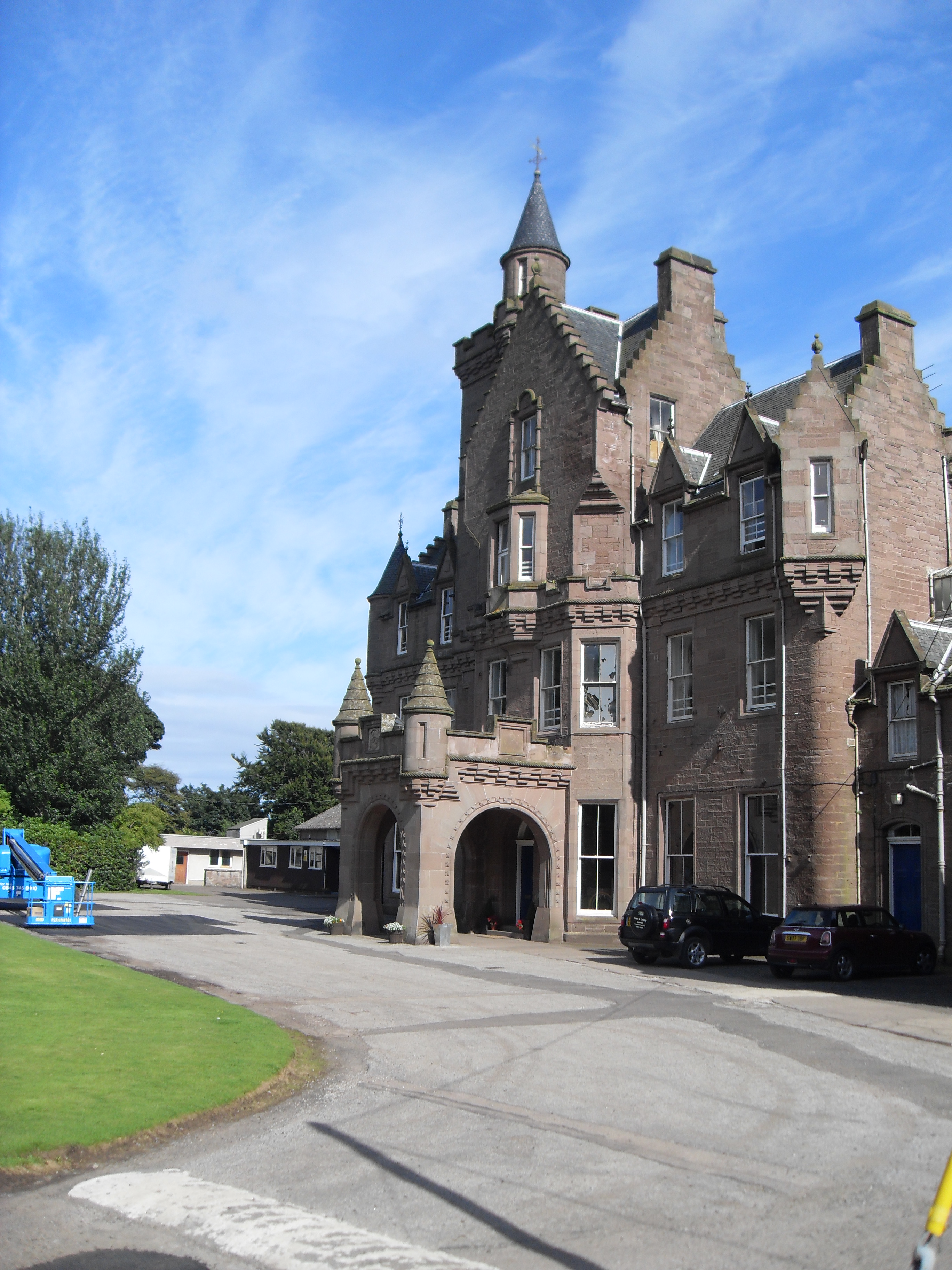
Lathallan School

Lathallan School is a co-educational all-through independent school at Brotherton Castle in Scotland, UK. It also offers outdoor learning programs on its...

Lauriston Castle, Aberdeenshire

Lauriston Castle stands on a clifftop site near the Aberdeenshire village of St Cyrus and just over a mile inland from the North Sea coast of Scotland...

Lauriston railway station

Lauriston railway station served the village of Bush, Aberdeenshire, Scotland from 1865 to 1966 on the Montrose and Bervie Railway. == History == The station...

Birnie Road Halt railway station

Birnie Road Halt railway station served the settlement of Benholm, Aberdeenshire, Scotland from 1865 to 1966 on the Montrose and Bervie Railway. ��2�...

Benholm Mill

Benholm Mill in Kincardineshire, Scotland, is a restored and fully working water-powered meal mill. It is sited in ancient woodland near Johnshaven (13...

Nearby Amenities

Located within 500m of 56.787504,-2.3560633
Source: PGS
Lat/Long: 56.7884514/-2.3504791
Source: PGS
Lat/Long: 56.7885017/-2.3502609
Source: PGS
Lat/Long: 56.7894416/-2.3490409
Source: PGS
Lat/Long: 56.787253/-2.3556968
Source: PGS
Lat/Long: 56.7872505/-2.3548507
Source: PGS
Lat/Long: 56.7874689/-2.3541381
Source: PGS
Lat/Long: 56.7877553/-2.3528452
Source: PGS
Lat/Long: 56.7877507/-2.3527629
Source: PGS
Lat/Long: 56.7879379/-2.3528361
Source: PGS
Lat/Long: 56.7881458/-2.3524463
Source: PGS
Lat/Long: 56.7882665/-2.3521697
Source: PGS
Lat/Long: 56.7884634/-2.3512181
Source: PGS
Lat/Long: 56.7883919/-2.3505594
Cove Hill
Ele: 20
Natural: peak
Lat/Long: 56.7875937/-2.3548923
East Mathers
Place: hamlet
Lat/Long: 56.7869614/-2.3640228
Power: pole
Lat/Long: 56.7896278/-2.3494316
Power: pole
Lat/Long: 56.7892622/-2.3504053
The data included in this document is from www.openstreetmap.org. The data is made available under ODbL.

Have you been to Cove Hill?

Leave your review of Cove Hill below (or comments, questions and feedback).