Bearwood, Lower

Settlement in Herefordshire

England

Bearwood, Lower

Children's play area, Pembridge
Children's play area, Pembridge Credit: Jonathan Thacker

Bearwood is a small village located in Lower Herefordshire, England. Situated in the picturesque Wye Valley, the village is surrounded by beautiful countryside and offers a tranquil and idyllic setting. It is approximately 7 miles northwest of the city of Hereford and is easily accessible via the A49 road.

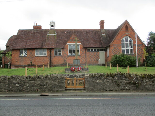
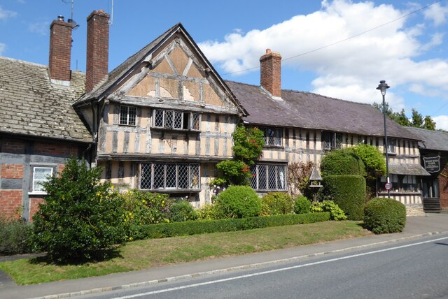
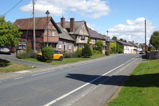
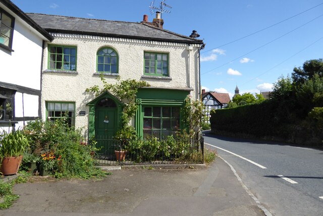
Despite its small size, Bearwood boasts a tight-knit community and a rich history. The village is known for its charming traditional cottages and historic buildings, including the Grade II listed Bearwood House, a stunning Georgian mansion that dates back to the 18th century.

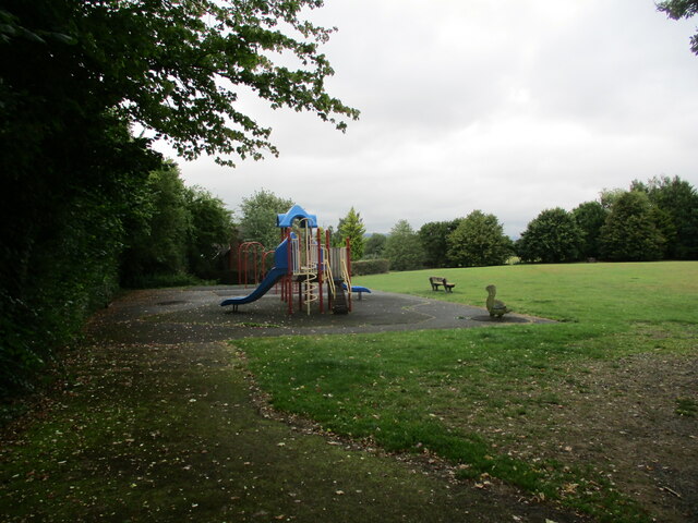
The village is surrounded by lush green fields and rolling hills, making it a popular destination for nature lovers and outdoor enthusiasts. The nearby River Wye offers opportunities for fishing and leisurely walks along its banks, while the surrounding woodlands are perfect for hiking and exploring.

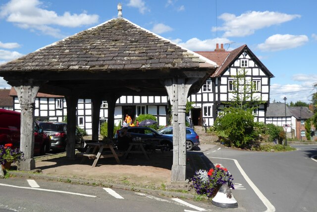
Although Bearwood is primarily a residential area, there are a few amenities within the village, including a local pub and a village hall which hosts various community events throughout the year. For more extensive amenities, residents can easily access the nearby city of Hereford, which offers a wide range of shops, restaurants, and leisure facilities.

Overall, Bearwood is a charming and peaceful village that offers a serene countryside lifestyle while still providing convenient access to nearby towns and cities. Its natural beauty and sense of community make it an attractive place to live or visit for those seeking a slower pace of life.

If you have any feedback on the listing, please let us know in the comments section below.

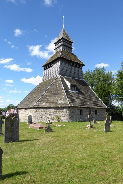
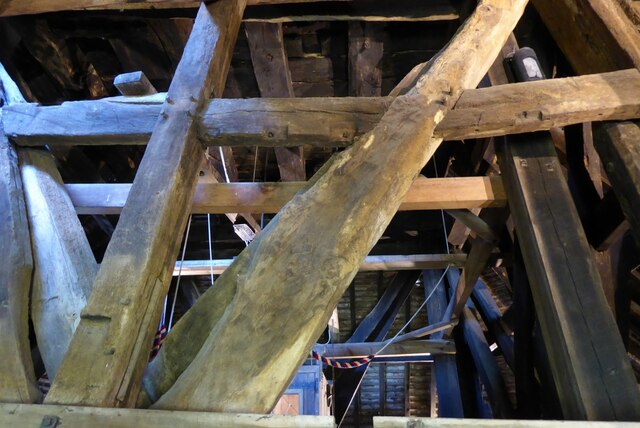
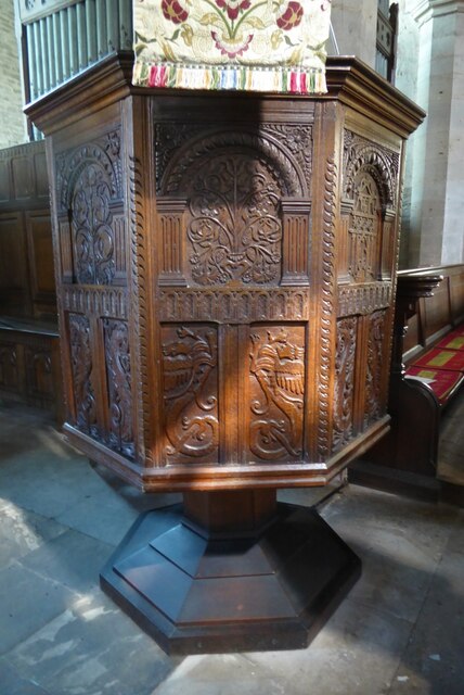
Bearwood, Lower Images

Images are sourced within 2km of 52.20854/-2.8906303 or Grid Reference SO3957. Thanks to Geograph Open Source API. All images are credited.

Children's play area, Pembridge
School and War Memorial, Pembridge
West End Farmhouse West End Farmhouse in Pembridge.  This timber-framed house may date back to the 14th century; the house is Grade II listed, see: <span class="nowrap"><a title="https://historicengland.org.uk/listing/the-list/list-entry/1301087?section=official-list-entry" rel="nofollow ugc noopener" href="https://historicengland.org.uk/listing/the-list/list-entry/1301087?section=official-list-entry">Link</a><img style="margin-left:2px;" alt="External link" title="External link - shift click to open in new window" src="https://s1.geograph.org.uk/img/external.png" width="10" height="10"/></span>
West End Farmhouse
West End Farmhouse in Pembridge. This timber-framed house may date back to the 14th century; the house is Grade II listed, see: LinkExternal link
The A44 entering Pembridge The A44 entering Pembridge from the west.
The A44 entering Pembridge
The A44 entering Pembridge from the west.
Georgian house on West Street Georgian house on West Street in Pembridge.
Georgian house on West Street
Georgian house on West Street in Pembridge.
The Market Hall, Pembridge Pembridge's Market Hall is Grade II* listed and dates from the 16th century <span class="nowrap"><a title="https://historicengland.org.uk/listing/the-list/list-entry/1081729?section=official-list-entry" rel="nofollow ugc noopener" href="https://historicengland.org.uk/listing/the-list/list-entry/1081729?section=official-list-entry">Link</a><img style="margin-left:2px;" alt="External link" title="External link - shift click to open in new window" src="https://s1.geograph.org.uk/img/external.png" width="10" height="10"/></span> The New Inn can be seen in the background.
The Market Hall, Pembridge
Pembridge's Market Hall is Grade II* listed and dates from the 16th century LinkExternal link The New Inn can be seen in the background.
Pembridge Church St Mary's church, Pembridge dates back to the 12th century and is Grade I listed <span class="nowrap"><a title="https://historicengland.org.uk/listing/the-list/list-entry/1081754?section=official-list-entry" rel="nofollow ugc noopener" href="https://historicengland.org.uk/listing/the-list/list-entry/1081754?section=official-list-entry">Link</a><img style="margin-left:2px;" alt="External link" title="External link - shift click to open in new window" src="https://s1.geograph.org.uk/img/external.png" width="10" height="10"/></span>.  The church is rare due to its detached bell tower which is reminiscent of Norwegian stave churches.  Detached towers are a feature of Herefordshire, this is one of seven churches in the county with detached bell towers.  Some of the timbers in the bell tower date from the early 13th century and is Grade I listed, see: <span class="nowrap"><a title="https://historicengland.org.uk/listing/the-list/list-entry/1081754?section=official-list-entry" rel="nofollow ugc noopener" href="https://historicengland.org.uk/listing/the-list/list-entry/1081754?section=official-list-entry">Link</a><img style="margin-left:2px;" alt="External link" title="External link - shift click to open in new window" src="https://s1.geograph.org.uk/img/external.png" width="10" height="10"/></span>
Pembridge Church
St Mary's church, Pembridge dates back to the 12th century and is Grade I listed LinkExternal link. The church is rare due to its detached bell tower which is reminiscent of Norwegian stave churches. Detached towers are a feature of Herefordshire, this is one of seven churches in the county with detached bell towers. Some of the timbers in the bell tower date from the early 13th century and is Grade I listed, see: LinkExternal link
Pembridge bell tower The bell tower which is reminiscent of Norwegian stave churches.  Detached bell towers are a feature of Herefordshire, this is one of seven churches in the county with detached bell towers.  Some of the timbers in the bell tower date from the early 13th century and is Grade I listed, see: <span class="nowrap"><a title="https://historicengland.org.uk/listing/the-list/list-entry/1081754?section=official-list-entry" rel="nofollow ugc noopener" href="https://historicengland.org.uk/listing/the-list/list-entry/1081754?section=official-list-entry">Link</a><img style="margin-left:2px;" alt="External link" title="External link - shift click to open in new window" src="https://s1.geograph.org.uk/img/external.png" width="10" height="10"/></span>
Pembridge bell tower
The bell tower which is reminiscent of Norwegian stave churches. Detached bell towers are a feature of Herefordshire, this is one of seven churches in the county with detached bell towers. Some of the timbers in the bell tower date from the early 13th century and is Grade I listed, see: LinkExternal link
Timbers within Pembridge bell tower Some of these timbers within the bell tower at Pembridge have been dated to the beginning of the 13th century.  Here is a view of the tower from outside <a href="https://www.geograph.org.uk/photo/7269358">SO3958 : Pembridge bell tower</a> <a href="https://www.geograph.org.uk/photo/7269352">SO3958 : Pembridge Church</a>.  It is reminiscent of Stave churches I have seen in Norway when travelling in Scandinavia many years ago, though the timbers are much heavier in this tower.
Timbers within Pembridge bell tower
Some of these timbers within the bell tower at Pembridge have been dated to the beginning of the 13th century. Here is a view of the tower from outside SO3958 : Pembridge bell tower SO3958 : Pembridge Church. It is reminiscent of Stave churches I have seen in Norway when travelling in Scandinavia many years ago, though the timbers are much heavier in this tower.
Memorial effigies in Pembridge church These two late 14th century memorial effigies are thought to be of John Gour and his wife.  He is thought to be wearing the clothes of someone in the legal profession or possibly a Sergent-at-Law in the service of the Mortimers.
Memorial effigies in Pembridge church
These two late 14th century memorial effigies are thought to be of John Gour and his wife. He is thought to be wearing the clothes of someone in the legal profession or possibly a Sergent-at-Law in the service of the Mortimers.
Memorial in Pembridge church Memorial effigies from the mid-14th century possibly of Nicholas Gour and his wife.
Memorial in Pembridge church
Memorial effigies from the mid-14th century possibly of Nicholas Gour and his wife.
Memorial effigies, Pembridge church These 14th century memorial effigies in Pembridge church are thought to be of Nicholas Gour and his wife in the foreground and beyond the effigy of his son John and his wife.
Memorial effigies, Pembridge church
These 14th century memorial effigies in Pembridge church are thought to be of Nicholas Gour and his wife in the foreground and beyond the effigy of his son John and his wife.
Pulpit in Pembridge church Jacobean pulpit in Pembridge church.
Pulpit in Pembridge church
Jacobean pulpit in Pembridge church.
Pulpit in Pembridge church Jacobean pulpit in Pembridge church.
Pulpit in Pembridge church
Jacobean pulpit in Pembridge church.
Jacobean lectern Jacobean lectern with intricate carving in St Mary the Virgin church, Pembridge.
Jacobean lectern
Jacobean lectern with intricate carving in St Mary the Virgin church, Pembridge.
Show me another place!

Bearwood, Lower is located at Grid Ref: SO3957 (Lat: 52.20854, Lng: -2.8906303)

Unitary Authority: County of Herefordshire

Police Authority: West Mercia

What 3 Words

///width.spreading.cared. Near Weobley, Herefordshire

Related Wikis

Pembridge

Pembridge is a village and civil parish in the Arrow valley in Herefordshire, England. The village is on the A44 road about 6 miles (10 km) east of Kington...

Pembridge railway station

Pembridge railway station was a station in Pembridge, Herefordshire, England. The station was opened in 1856 and closed in 1955. The station was located...

Eardisland

Eardisland ( URDZ-lənd) is a village and civil parish on the River Arrow, about 5 miles (8 km) west of the market town of Leominster, Herefordshire. The...

Burton Court, Eardisland

Burton Court is a Grade II* listed English country manor house in the Parish of Eardisland, southwest of Leominster, Herefordshire, England. The manor...

Nearby Amenities

Located within 500m of 52.20854,-2.8906303
Lower Bearwood
Is In: Herefordshire,England,UK
Place: hamlet
Source: NPE
Lat/Long: 52.2076826/-2.889489
Power: pole
Lat/Long: 52.2125505/-2.8894942
Power: pole
Lat/Long: 52.212521/-2.8906193
Power: pole
Lat/Long: 52.2124675/-2.8927705
Generator Method: photovoltaic
Generator Output Electricity: yes
Generator Source: solar
Generator Type: solar_photovoltaic_panel
Location: roof
Power: generator
Lat/Long: 52.20975/-2.8915635
Barrier: stile
Lat/Long: 52.21185/-2.8920727
Barrier: stile
Lat/Long: 52.2122481/-2.8925852
The data included in this document is from www.openstreetmap.org. The data is made available under ODbL.

Have you been to Bearwood, Lower?

Leave your review of Bearwood, Lower below (or comments, questions and feedback).