Thro'let
Coastal Feature, Headland, Point in Angus
Scotland
Thro'let

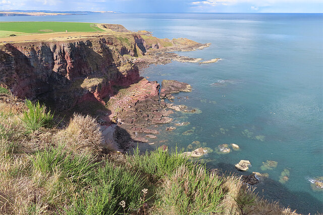
Thro'let, Angus is a prominent coastal feature located in the northeast of Scotland, near the town of Arbroath. This headland juts out into the North Sea, offering stunning views of the surrounding coastline and sea. Thro'let is known for its rugged cliffs, which tower over the crashing waves below, creating a dramatic and picturesque landscape.
The headland is popular with hikers and nature enthusiasts, who come to explore the coastal trails and enjoy the breathtaking scenery. Thro'let is also home to a variety of seabirds, including puffins, guillemots, and kittiwakes, making it a haven for birdwatchers.
In addition to its natural beauty, Thro'let has historical significance as well. The headland is dotted with ancient ruins and archaeological sites, dating back to the Iron Age and Viking era. Visitors can explore these remnants of the past while taking in the stunning coastal views.
Overall, Thro'let, Angus is a must-visit destination for those seeking a mix of natural beauty, wildlife, and history along the rugged Scottish coastline.
If you have any feedback on the listing, please let us know in the comments section below.
Thro'let Images
Images are sourced within 2km of 56.625248/-2.4796506 or Grid Reference NO7048. Thanks to Geograph Open Source API. All images are credited.


Thro'let is located at Grid Ref: NO7048 (Lat: 56.625248, Lng: -2.4796506)
Unitary Authority: Angus
Police Authority: Tayside
What 3 Words
///clutches.cook.prestige. Near Arbroath, Angus
Nearby Locations
Related Wikis
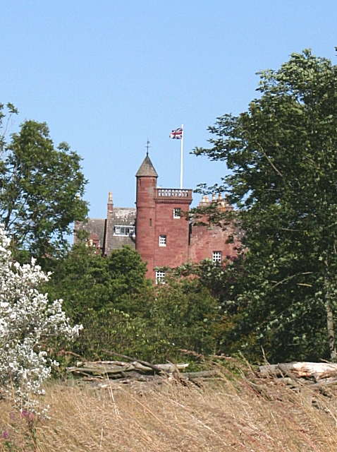
Ethie Castle
Ethie Castle is a 15,091 square feet (1,402.0 m2) 14th-century castle, situated around 3 miles north of the fishing town of Arbroath in Angus, Scotland...
Lunan Water
The Lunan Water is an easterly flowing river in Angus, Scotland, that discharges to the North Sea 11 kilometres (6.8 mi) north of the town of Arbroath...

Red Castle, Angus
Red Castle of Lunan is a ruined fortified house on the coast of Angus, Scotland. It is about 4 miles (6.4 km) south-southwest of Montrose. == History... ==

Lunan, Angus
Lunan is a hamlet in Angus, Scotland, in the parish of the same name, 6 kilometres (3.7 mi) south of Montrose. The hamlet overlooks Lunan Bay, which is...
Nearby Amenities
Located within 500m of 56.625248,-2.4796506Have you been to Thro'let?
Leave your review of Thro'let below (or comments, questions and feedback).