Black Rock

Coastal Feature, Headland, Point in Angus

Scotland

Black Rock

Second Knowes The beach at the Second Knowes is covered with large boulders. On the left is a sea stack of volcanic rock.
Second Knowes Credit: Anne Burgess

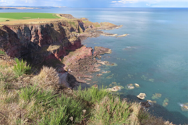
Black Rock is a prominent coastal feature located in Angus, Scotland. This headland, also known as Black Rock Point, juts out into the North Sea and is characterized by its striking dark-colored cliffs. It is situated approximately 2 miles south of the town of Montrose and is a well-known landmark in the region.

Black Rock is composed mainly of sandstone and shale, resulting in its unique blackish appearance. The cliffs rise steeply from the sea, reaching heights of up to 30 meters in some areas. The continuous wave action of the North Sea has shaped these cliffs over time, creating fascinating rock formations and caves along the coastline.

The area around Black Rock offers breathtaking panoramic views of the sea and the surrounding coastline. On clear days, visitors can see as far as the North Sea horizon, with views extending to the nearby Montrose Basin and the hills of Aberdeenshire in the distance.

Black Rock is also notable for its rich biodiversity. The cliffs provide nesting sites for a variety of seabirds, including fulmars, kittiwakes, and guillemots. The surrounding waters are home to diverse marine life, with seals often seen basking on the rocks and dolphins occasionally spotted offshore.

Due to its natural beauty and ecological significance, Black Rock is a popular destination for nature enthusiasts, hikers, and birdwatchers. It offers opportunities for coastal walks, photography, and exploration of the rock formations and caves. The area is accessible by foot from Montrose, and there is parking available nearby for those who prefer to drive.

If you have any feedback on the listing, please let us know in the comments section below.
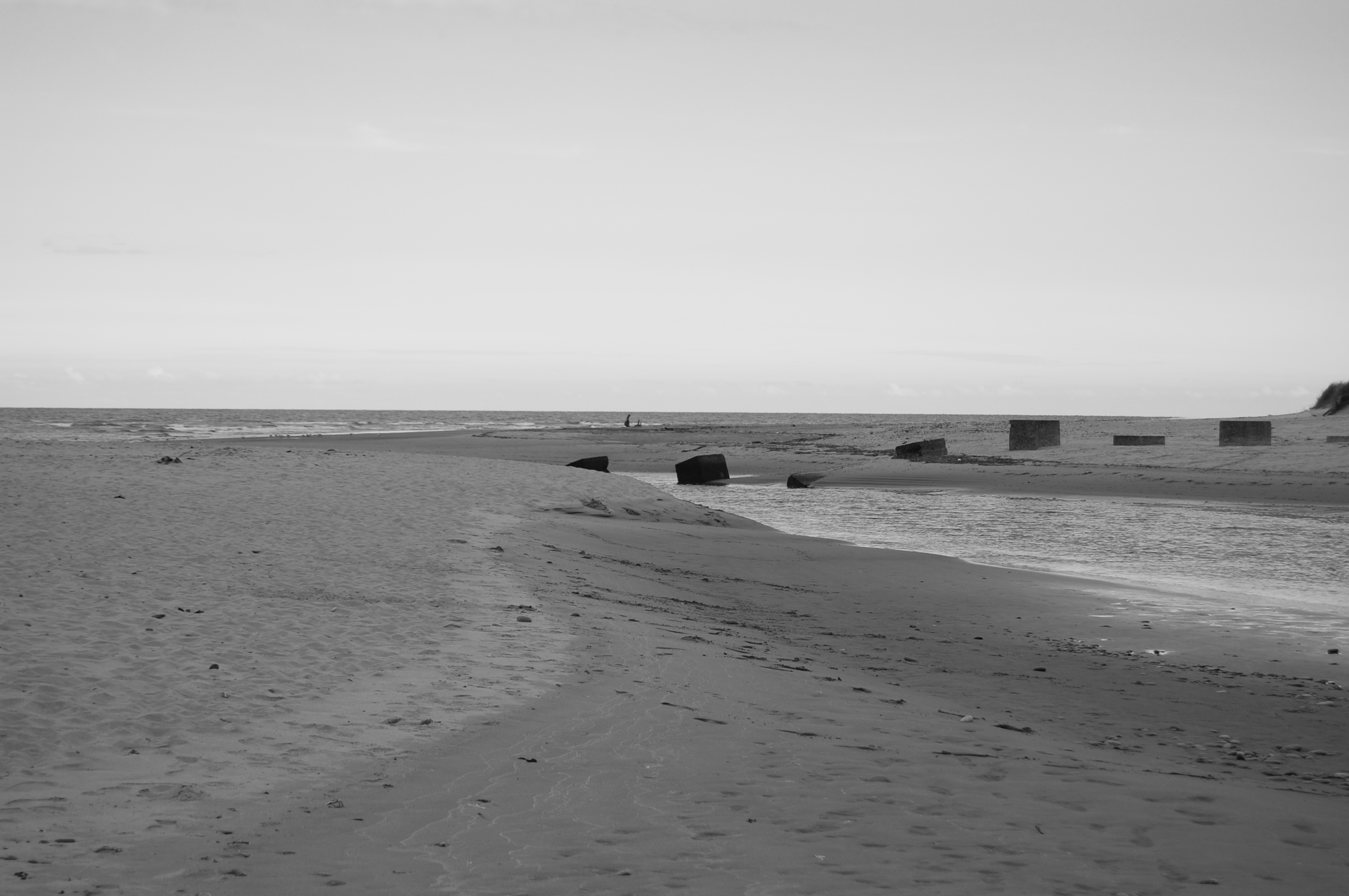
Black Rock Images

Images are sourced within 2km of 56.630375/-2.5008241 or Grid Reference NO6948. Thanks to Geograph Open Source API. All images are credited.

Second Knowes The beach at the Second Knowes is covered with large boulders. On the left is a sea stack of volcanic rock.
Second Knowes
The beach at the Second Knowes is covered with large boulders. On the left is a sea stack of volcanic rock.
Second Knowes The west end of the beach is made up of pebbles and cobbles, and supports a variety of plants including Sea Mayweed (Tripleurospermum maritimum).
Second Knowes
The west end of the beach is made up of pebbles and cobbles, and supports a variety of plants including Sea Mayweed (Tripleurospermum maritimum).
The Knowes at Sunset The setting sun has tinged the red volcanic rocks with pink.
The Knowes at Sunset
The setting sun has tinged the red volcanic rocks with pink.
Interesting Clouds Wispy Cirrus clouds being blown about above the Knowes, with a contrail through the middle of the view.
Interesting Clouds
Wispy Cirrus clouds being blown about above the Knowes, with a contrail through the middle of the view.
Second Knowes Or, to be more precise, the boulder beach beside the Second Knowes. Oddly, it never seems to become covered with seaweed, even in the lowest part of the intertidal zone.
Second Knowes
Or, to be more precise, the boulder beach beside the Second Knowes. Oddly, it never seems to become covered with seaweed, even in the lowest part of the intertidal zone.
Rocky Shore The all the rocks here are volcanic and red in colour. The pale creamy colour of the ones in the middle is a thick crust of millions of barnacles, and the furthest ones are covered in dark seaweeds.
Rocky Shore
The all the rocks here are volcanic and red in colour. The pale creamy colour of the ones in the middle is a thick crust of millions of barnacles, and the furthest ones are covered in dark seaweeds.
Ancient Lava These rocks are part of the Ethie Lavas, which belong to the Montrose Volcanics, and were erupted about 400 million years ago.
Ancient Lava
These rocks are part of the Ethie Lavas, which belong to the Montrose Volcanics, and were erupted about 400 million years ago.
Sea Lion Rock With the eye of imagination, the pillar on the right looks like a sea lion propping itself up on its front flippers. In the background is the north end of the beach at Lunan Bay.
Sea Lion Rock
With the eye of imagination, the pillar on the right looks like a sea lion propping itself up on its front flippers. In the background is the north end of the beach at Lunan Bay.
Sitka Spruce (Picea abies) Young cones developing.
Sitka Spruce (Picea abies)
Young cones developing.
The View from Red Head The neat headland, with the sloping island rock at its foot, is East Comb. You can get a kayak through the narrow gap when the tide is high enough. The next island rock is Marshall's Craig, and the peninsula beyond it is Auld Mains, a popular spot for fishing. On the far side of Lunan Bay is Scurdie Ness and, the Kincardineshire coast between St Cyrus and Inverbervie is in the far distance.
The View from Red Head
The neat headland, with the sloping island rock at its foot, is East Comb. You can get a kayak through the narrow gap when the tide is high enough. The next island rock is Marshall's Craig, and the peninsula beyond it is Auld Mains, a popular spot for fishing. On the far side of Lunan Bay is Scurdie Ness and, the Kincardineshire coast between St Cyrus and Inverbervie is in the far distance.
Red Head Triangulation Pillar The trig point is 81 metres above sea level. A path goes along the margin of the field. This was part of the waymarked Angus coastal path, but concerns for safety led to the waymarked route being diverted away from the cliffs altogether. Long before the development of the waymarked path, the actual path used to go along the cliffs outside the cultivated land altogether, but this probably wasn't very safe as the cliff edge is crumbling, and the old path is now overgrown and pretty much unusuable.
Red Head Triangulation Pillar
The trig point is 81 metres above sea level. A path goes along the margin of the field. This was part of the waymarked Angus coastal path, but concerns for safety led to the waymarked route being diverted away from the cliffs altogether. Long before the development of the waymarked path, the actual path used to go along the cliffs outside the cultivated land altogether, but this probably wasn't very safe as the cliff edge is crumbling, and the old path is now overgrown and pretty much unusuable.
Remains of a Dyke The drystane dyke between the cliff edge and the arable fields has fallen to form what looks like a series of unstable pillars.
Remains of a Dyke
The drystane dyke between the cliff edge and the arable fields has fallen to form what looks like a series of unstable pillars.
Soay Sheep A flock of Soay sheep grazes the cliff top and slopes between Lang Craig and Prail Castle. They are pretty wild and always flee when anyone approaches.
Soay Sheep
A flock of Soay sheep grazes the cliff top and slopes between Lang Craig and Prail Castle. They are pretty wild and always flee when anyone approaches.
Irrigation The eastern coastal fringe of Scotland has an average annual rainfall similar to that of parts of Kent and East Anglia, but most of the rain falls in the autumn and winter, so irrigation has long been a feature of farming here. This installation is providing water for a crop of potatoes.
Irrigation
The eastern coastal fringe of Scotland has an average annual rainfall similar to that of parts of Kent and East Anglia, but most of the rain falls in the autumn and winter, so irrigation has long been a feature of farming here. This installation is providing water for a crop of potatoes.
Red Head, Marshall's Craig and Auld Mains, Angus The foreground of the photo shows the promontory of Red Head where archaeological fieldwork in 1961 revealed the site of what is thought to be an Iron Age fort.
Using a direct line of sight over the seaward extremity of Red Head, the small east-northeast trending Marshall's Island can be seen. In the distance, beyond Marshall's Island, lies the peninsula of Auld Mains. According to Scotland's Places, Auld Mains is the "name applied to the furthest projecting point of Rock Skelly. It is very remarkable from the sea."
Red Head, Marshall's Craig and Auld Mains, Angus
The foreground of the photo shows the promontory of Red Head where archaeological fieldwork in 1961 revealed the site of what is thought to be an Iron Age fort. Using a direct line of sight over the seaward extremity of Red Head, the small east-northeast trending Marshall's Island can be seen. In the distance, beyond Marshall's Island, lies the peninsula of Auld Mains. According to Scotland's Places, Auld Mains is the "name applied to the furthest projecting point of Rock Skelly. It is very remarkable from the sea."
Farm track serving as a coastal path at Red Head, Angus Although the rocky coast and associated sea birds in this area make spectacular viewing, there is no formal coastal path which permits easy access. While good access and paths designed for walking can be desirable, it is also true that too many visitors to an area can spoil the elemental assets, like solitude, which is, in fact, the thing they have come to experience.
Farm track serving as a coastal path at Red Head, Angus
Although the rocky coast and associated sea birds in this area make spectacular viewing, there is no formal coastal path which permits easy access. While good access and paths designed for walking can be desirable, it is also true that too many visitors to an area can spoil the elemental assets, like solitude, which is, in fact, the thing they have come to experience.
Southward view of Red Head and fringing islands, Angus This photo was taken from the clifftop near East Comb and it looks south to Red Head and to a number of small islands which lie on the seaward side of it in the Cove of the Head. The islands, which have been eroded from the mainland, and caves undermining the headland, both show that active erosion is taking place at Red Head.
Southward view of Red Head and fringing islands, Angus
This photo was taken from the clifftop near East Comb and it looks south to Red Head and to a number of small islands which lie on the seaward side of it in the Cove of the Head. The islands, which have been eroded from the mainland, and caves undermining the headland, both show that active erosion is taking place at Red Head.
Show me another place!

Black Rock is located at Grid Ref: NO6948 (Lat: 56.630375, Lng: -2.5008241)

Unitary Authority: Angus

Police Authority: Tayside

What 3 Words

///employ.ruffling.humans. Near Arbroath, Angus

Nearby Locations

Black Rock Lime Craig

Related Wikis

Ethie Castle

Ethie Castle is a 15,091 square feet (1,402.0 m2) 14th-century castle, situated around 3 miles north of the fishing town of Arbroath in Angus, Scotland...

Lunan Water

The Lunan Water is an easterly flowing river in Angus, Scotland, that discharges to the North Sea 11 kilometres (6.8 mi) north of the town of Arbroath...
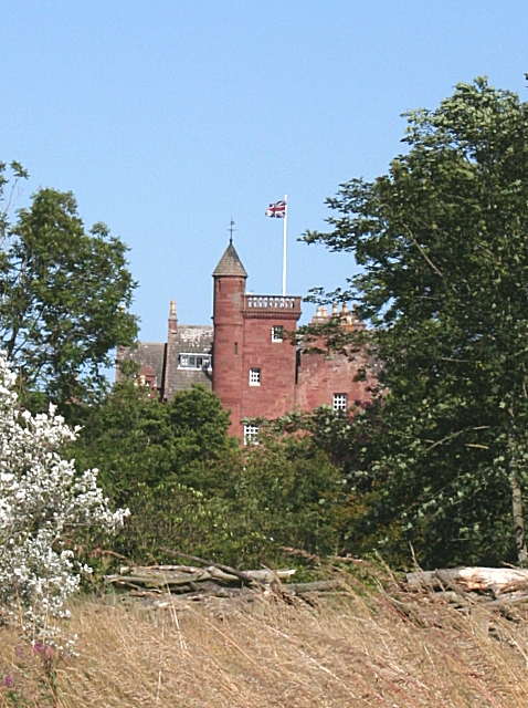
Red Castle, Angus

Red Castle of Lunan is a ruined fortified house on the coast of Angus, Scotland. It is about 4 miles (6.4 km) south-southwest of Montrose. == History... ==

Inverkeilor railway station

Inverkeilor railway station served the village of Inverkeilor, Angus, Scotland from 1883 to 1930 on the North British, Arbroath and Montrose Railway....

Nearby Amenities

Located within 500m of 56.630375,-2.5008241
Source: PGS
Lat/Long: 56.6295893/-2.4994362
Source: PGS
Lat/Long: 56.62953/-2.5006775
Source: PGS
Lat/Long: 56.6295645/-2.5008498
Source: PGS
Lat/Long: 56.6298193/-2.501375
Source: PGS
Lat/Long: 56.6301268/-2.5019153
Source: PGS
Lat/Long: 56.6303975/-2.5022963
Source: PGS
Lat/Long: 56.6306646/-2.5025842
Source: PGS
Lat/Long: 56.6314809/-2.5033356
Source: PGS
Lat/Long: 56.6321559/-2.5039352
Source: PGS
Lat/Long: 56.633152/-2.504583
Created By: almien_coastlines
Source: PGS
Lat/Long: 56.634122/-2.505131
Corbie Knowe
Place: isolated_dwelling
Lat/Long: 56.6305997/-2.5032889
Power: pole
Lat/Long: 56.6278786/-2.5074911
Power: pole
Lat/Long: 56.6280454/-2.5065036
Power: pole
Lat/Long: 56.6282181/-2.5054057
Power: pole
Lat/Long: 56.6283932/-2.5043078
Power: pole
Lat/Long: 56.6285599/-2.5032792
Power: pole
Lat/Long: 56.6287374/-2.5022376
Power: pole
Lat/Long: 56.6289078/-2.5011591
Power: pole
Lat/Long: 56.6289888/-2.5006329
The data included in this document is from www.openstreetmap.org. The data is made available under ODbL.

Have you been to Black Rock?

Leave your review of Black Rock below (or comments, questions and feedback).