South Geo
Coastal Feature, Headland, Point in Orkney
Scotland
South Geo

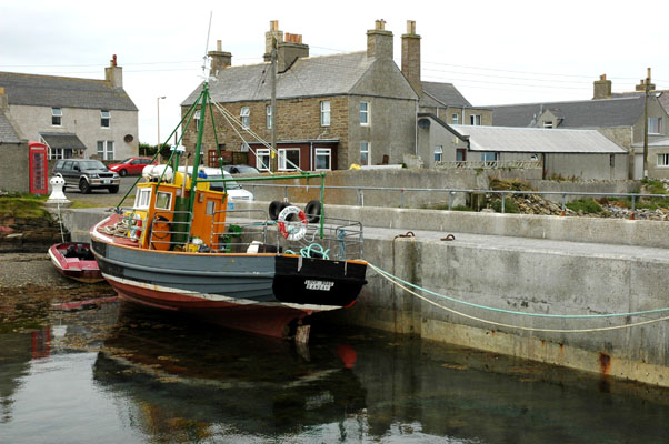
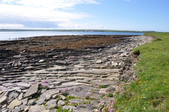
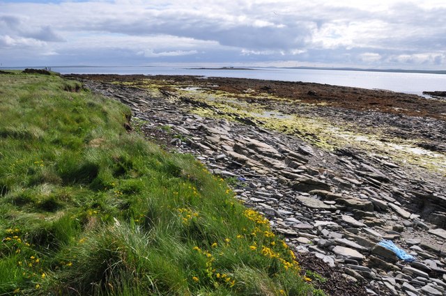
South Geo is a prominent coastal feature located in the Orkney Islands, an archipelago situated off the northeastern coast of Scotland. It is specifically positioned on the southernmost part of the island of Hoy. South Geo is a remarkable headland that juts out into the North Atlantic Ocean, forming a distinctive point on the island's coastline.
The headland is characterized by its rugged cliffs, which rise dramatically from the sea, reaching heights of up to 300 meters (984 feet). These cliffs are composed of layers of sedimentary rock, displaying a variety of colors and textures, including sandstone, shale, and limestone. Over time, the relentless power of the ocean has eroded the base of the cliffs, creating sea caves and natural arches that add to the area's unique beauty.
South Geo is renowned for its exceptional panoramic views, offering breathtaking vistas of the surrounding seascape, neighboring islands, and the mainland of Scotland in the distance. It is a popular spot for nature enthusiasts, hikers, and photographers, who come to admire the stunning coastal scenery and abundant wildlife. Visitors may spot various seabirds, such as puffins, razorbills, and guillemots, nesting along the cliffs, while seals and even whales can sometimes be spotted swimming offshore.
In addition to its natural allure, South Geo holds historical significance as well. The headland is home to the Old Man of Hoy, a striking sea stack that stands independently just off the coast. This iconic landmark attracts climbers from around the world, seeking to conquer its challenging vertical ascent.
Overall, South Geo in Orkney is a captivating and diverse coastal feature, offering a blend of natural beauty, geological wonders, and cultural heritage that make it a must-visit destination for locals and tourists alike.
If you have any feedback on the listing, please let us know in the comments section below.
South Geo Images
Images are sourced within 2km of 59.220838/-2.5916743 or Grid Reference HY6637. Thanks to Geograph Open Source API. All images are credited.


South Geo is located at Grid Ref: HY6637 (Lat: 59.220838, Lng: -2.5916743)
Unitary Authority: Orkney Islands
Police Authority: Highlands and Islands
What 3 Words
///feathers.sonic.trading. Near Kettletoft, Orkney Islands
Nearby Locations
Related Wikis

Kettletoft
Kettletoft is a settlement on the island of Sanday in Orkney, Scotland. The B9068 road runs from Kettletoft to Scar and the B9069 from Kettletoft to Northwall...

Sanday Airport
Sanday Airport (IATA: NDY, ICAO: EGES) is located 20 NM (37 km; 23 mi) north northeast of Kirkwall Airport on Sanday, Orkney Islands, Scotland. Sanday...

Sanday, Orkney
Sanday (, Scots: Sandee) is one of the inhabited islands of Orkney that lies off the north coast of mainland Scotland. With an area of 50.43 km2 (19.5...

Broughtown
Broughtown is a village on the island of Sanday, in Orkney, Scotland. The settlement is within the parish of Cross and Burness. Sanday Airport is adjacent...

Braeswick
Braeswick is a settlement on the island of Sanday, in Orkney, Scotland. The settlement is within the parish of Cross and Burness, and is situated on the...
Sanday Light Railway
The Sanday Light Railway was a privately owned ridable miniature railway situated in Braeswick, on the island of Sanday, Orkney, Scotland. The railway...

East Sanday Coast
The East Sanday Coast is a protected wetland area on and around the island of Sanday, the third-largest of the Orkney islands off the north coast of Scotland...

Holm of Huip
The Holm of Huip is a small island in the Orkney Islands, in Spurness Sound to the north west of Stronsay. The Holm has a cairn on it, and a number of...
Related Videos
Stywick Bay in Sanday island, Orkney
Sanday is one of the inhabited islands of Orkney that lies off the north coast of mainland Scotland. With an area of 50.43 km2, it is ...
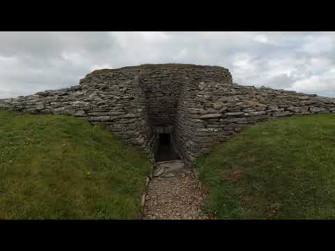
Neolithic burial monument of Quoyness, Sanday Island Orkney
Quoyness chambered cairn is a Neolithic burial monument located on the island of Sanday in Orkney, Scotland. Similar to ...
Nearby Amenities
Located within 500m of 59.220838,-2.5916743Have you been to South Geo?
Leave your review of South Geo below (or comments, questions and feedback).