Buddo Ness

Coastal Feature, Headland, Point in Fife

Scotland

Buddo Ness

Golfers on Kittocks Kittocks Course is one of the courses in St Andrews Bay golf complex associated with the Fairmont Hotel.
Golfers on Kittocks Credit: James Allan

Buddo Ness is a prominent headland located on the east coast of Scotland, specifically in Fife. Situated between the towns of St. Andrews and Anstruther, this coastal feature is recognized for its geographical significance and natural beauty.

Jutting out into the North Sea, Buddo Ness forms a distinctive point that offers stunning panoramic views of the surrounding area. The headland is characterized by steep cliffs, which have been eroded by the relentless power of the sea over time. These cliffs provide nesting sites for various seabirds, including guillemots, razorbills, and kittiwakes, making Buddo Ness a popular spot for bird watchers and nature enthusiasts.

The headland also boasts a rich history, with archaeological evidence suggesting human habitation in the area dating back thousands of years. Ruins of an Iron Age fort, known as the Kaims, can still be seen on the headland, adding to its historical allure.

In addition to its natural and historical attractions, Buddo Ness is known for its recreational activities. The rugged coastal path that runs along the headland offers an opportunity for walkers and hikers to enjoy the breathtaking scenery and invigorating sea air. Fishing is also a popular pastime in the area, with anglers often casting their lines from the cliffs or rocky outcrops.

Overall, Buddo Ness is a captivating coastal feature that combines natural beauty, historical significance, and recreational opportunities. Whether exploring its cliffs, observing the diverse birdlife, or simply enjoying the panoramic views, visitors to Buddo Ness are in for a memorable experience.

If you have any feedback on the listing, please let us know in the comments section below.
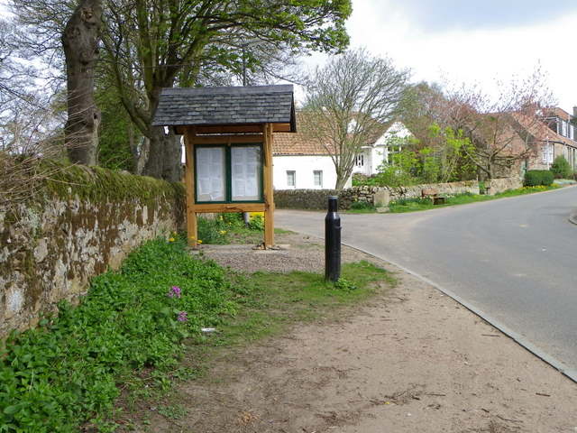
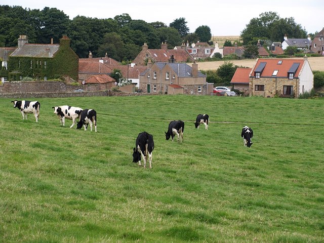
Buddo Ness Images

Images are sourced within 2km of 56.328538/-2.7145762 or Grid Reference NO5515. Thanks to Geograph Open Source API. All images are credited.

Golfers on Kittocks Kittocks Course is one of the courses in St Andrews Bay golf complex associated with the Fairmont Hotel.
Golfers on Kittocks
Kittocks Course is one of the courses in St Andrews Bay golf complex associated with the Fairmont Hotel.
Holiday cottages Balmashie holiday cottages seen from Kittocks golf course at St Andrews Bay.
Holiday cottages
Balmashie holiday cottages seen from Kittocks golf course at St Andrews Bay.
Kittock's Den With the North Sea in the background.
Kittock's Den
With the North Sea in the background.
14th tee at Kittock's A foursome of golfers driving off the 14th tee on the Kittocks Course.
14th tee at Kittock's
A foursome of golfers driving off the 14th tee on the Kittocks Course.
Near Buddo Ness North Sea coastline, with Buddo Rock on the right.
Near Buddo Ness
North Sea coastline, with Buddo Rock on the right.
Coastal rocks Near Buddo Rock.
Coastal rocks
Near Buddo Rock.
Buddo Rock Seen from the top of former sea cliffs on the edge of Kittock's golf course.
Buddo Rock
Seen from the top of former sea cliffs on the edge of Kittock's golf course.
Tending the land, Prior Muir I am not totally sure be I think the tractor is planting seed then harrowing it into the soil.
Tending the land, Prior Muir
I am not totally sure be I think the tractor is planting seed then harrowing it into the soil.
Milestone, Thornbank The milestone stands beside the A917.

Milestones are the original roadside heritage features with many dating back hundreds of years and these historic items are under threat from highway developments.
Milestone, Thornbank
The milestone stands beside the A917. Milestones are the original roadside heritage features with many dating back hundreds of years and these historic items are under threat from highway developments.
Milestone and bench mark, Thornbank The Ordnance Survey bench mark is to be found on the side of the milestone.  For a wider view of the stone <a href="https://www.geograph.org.uk/photo/2754944">NO5414 : Milestone, Thornbank</a> and for further information on the cut mark and others in the area <span class="nowrap"><a title="http://www.bench-marks.org.uk/bm34452" rel="nofollow ugc noopener" href="http://www.bench-marks.org.uk/bm34452">Link</a><img style="margin-left:2px;" alt="External link" title="External link - shift click to open in new window" src="https://s1.geograph.org.uk/img/external.png" width="10" height="10"/></span>
Milestone and bench mark, Thornbank
The Ordnance Survey bench mark is to be found on the side of the milestone. For a wider view of the stone NO5414 : Milestone, Thornbank and for further information on the cut mark and others in the area LinkExternal link
Milestone, Thornbank For a view of the other side of the milestone <a href="https://www.geograph.org.uk/photo/2754952">NO5414 : Milestone and bench mark, Thornbank</a> and a wider view <a href="https://www.geograph.org.uk/photo/2754944">NO5414 : Milestone, Thornbank</a> .

Milestones did not come into general use until the Turnpike Act of 1766 made them compulsory on turnpike roads, these roads were built by private enterprise under licence from the Government and maintained by tolls on those who used them.  Before this Act milestones were put up occasionally, often as charitable acts and commemorations.   Many Turnpike Act stones still exist.  They are usually 2-3 ft high, with the initial letter or abbreviation of the nearest market town shown on two faces, and the distance from it.
Milestone, Thornbank
For a view of the other side of the milestone NO5414 : Milestone and bench mark, Thornbank and a wider view NO5414 : Milestone, Thornbank . Milestones did not come into general use until the Turnpike Act of 1766 made them compulsory on turnpike roads, these roads were built by private enterprise under licence from the Government and maintained by tolls on those who used them. Before this Act milestones were put up occasionally, often as charitable acts and commemorations. Many Turnpike Act stones still exist. They are usually 2-3 ft high, with the initial letter or abbreviation of the nearest market town shown on two faces, and the distance from it.
Seed Drilling The tractor with a variety of machines attached is seed drilling.
Seed Drilling
The tractor with a variety of machines attached is seed drilling.
Boarhills and Dunino Parish Kirk The building, which stands on the site of an earlier kirk was built in 1826 and was designed by James Gillespie Graham and many of the additions are by P MacGregor Chalmers and were completed in 1928.

There is an Ordnance Survey bench mark on the south face of the building.
Boarhills and Dunino Parish Kirk
The building, which stands on the site of an earlier kirk was built in 1826 and was designed by James Gillespie Graham and many of the additions are by P MacGregor Chalmers and were completed in 1928. There is an Ordnance Survey bench mark on the south face of the building.
Bench Mark, Boarhills and Dunino Parish Kirk The Ordnance Survey bench mark is to be found on the south face of the building.  For a view of the kirk <a href="https://www.geograph.org.uk/photo/2755175">NO5613 : Boarhills and Dunino Parish Kirk</a> and for further information on the cut mark and others in the area <span class="nowrap"><a title="http://www.bench-marks.org.uk/bm38205" rel="nofollow ugc noopener" href="http://www.bench-marks.org.uk/bm38205">Link</a><img style="margin-left:2px;" alt="External link" title="External link - shift click to open in new window" src="https://s1.geograph.org.uk/img/external.png" width="10" height="10"/></span>
Bench Mark, Boarhills and Dunino Parish Kirk
The Ordnance Survey bench mark is to be found on the south face of the building. For a view of the kirk NO5613 : Boarhills and Dunino Parish Kirk and for further information on the cut mark and others in the area LinkExternal link
Tending the land, Boarhills The land is being made ready for this year's crop.  The picture is taken from the kirkyard of Boarhills and Dunino Parish Kirk.
Tending the land, Boarhills
The land is being made ready for this year's crop. The picture is taken from the kirkyard of Boarhills and Dunino Parish Kirk.
Junction, Kenlygreen Cottages The minor road joins A917.  There is an Ordnance Survey bench mark on the corner of the cottages.
Junction, Kenlygreen Cottages
The minor road joins A917. There is an Ordnance Survey bench mark on the corner of the cottages.
Bench Mark, Kenlygreen Cottages The Ordnance Survey bench mark is to be found on the south face of the building.  For a view of the building <a href="https://www.geograph.org.uk/photo/2756296">NO5613 : Junction, Kenlygreen Cottages</a> and for further information on the cut mark and others in the area <span class="nowrap"><a title="http://www.bench-marks.org.uk/bm40867" rel="nofollow ugc noopener" href="http://www.bench-marks.org.uk/bm40867">Link</a><img style="margin-left:2px;" alt="External link" title="External link - shift click to open in new window" src="https://s1.geograph.org.uk/img/external.png" width="10" height="10"/></span>
Bench Mark, Kenlygreen Cottages
The Ordnance Survey bench mark is to be found on the south face of the building. For a view of the building NO5613 : Junction, Kenlygreen Cottages and for further information on the cut mark and others in the area LinkExternal link
Village scene, Boarhills Boarhills is a small hamlet situated near the sea on the East Neuk.
Village scene, Boarhills
Boarhills is a small hamlet situated near the sea on the East Neuk.
Show me another place!

Buddo Ness is located at Grid Ref: NO5515 (Lat: 56.328538, Lng: -2.7145762)

Unitary Authority: Fife

Police Authority: Fife

What 3 Words

///flattery.noodle.generals. Near St Andrews, Fife

Nearby Locations

Buddo Ness

Related Wikis

Fairmont St Andrews

The Fairmont St Andrews Bay is a 5-star resort hotel situated 2 miles (3.2 km) outside the town of St. Andrews in Fife, Scotland. The hotel is managed...

Scottish Championship (golf)

The Scottish Championship was a professional golf tournament that was held 15–18 October 2020 at Fairmont St Andrews, in Fife, Scotland. The principal...

Hero Open

The Hero Open was a professional golf tournament played on the European Tour. The event was created as part of the tour's overhaul in response to the COVID...

Boarhills

Boarhills is a hamlet close to Kingsbarns in the East Neuk of Fife, Scotland. It is located off the A917 road, 4+1⁄2 miles (7 km) from St Andrews and 5...

Related Videos

Walking from Boarhills to Dunino Airfield [Fife]

A short walk from the village of Boarhills to the disused airstrip near Dunino. We covered around 8-9 miles in glorious sunshine ...

#ValentinesDay #2023 #hotel #stay #travel #vacation #happy #couple #love #life #enjoy #reels #vlog

I love you even when I'm really really Hangry! Happy Valentine's Day my favourite human. . #HappyValentinesDay ...

#anniversary #celebration #travel #love #staycation #happy #couple #enjoy #fun #live #life #reels

Cheers to a lifetime of amazing adventures, treasured memories and happy anniversaries! #HappyAnniversary #Fairmont ...

#Fairmont #StAndrews #staycation #2023 #travel #love #happy #couple #reels #shorts #video #fun #vlog

It was an amazing 2 nights stay at the Fairmont Hotel and Spa Resort celebrating Valentine's Day and our Anniversary! The resort ...

Nearby Amenities

Located within 500m of 56.328538,-2.7145762
Created By: Potlatch 0.10f
Military: bunker
Lat/Long: 56.3272173/-2.7155791
The data included in this document is from www.openstreetmap.org. The data is made available under ODbL.

Have you been to Buddo Ness?

Leave your review of Buddo Ness below (or comments, questions and feedback).