Three Kings

Coastal Feature, Headland, Point in Banffshire

Scotland

Three Kings

Rock outcrop This outcrop is partly in Cullen Links and partly on the Cullen Sands.
Rock outcrop Credit: don cload

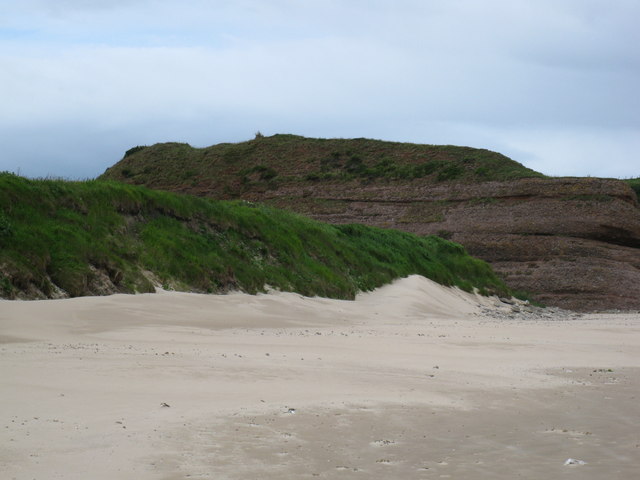
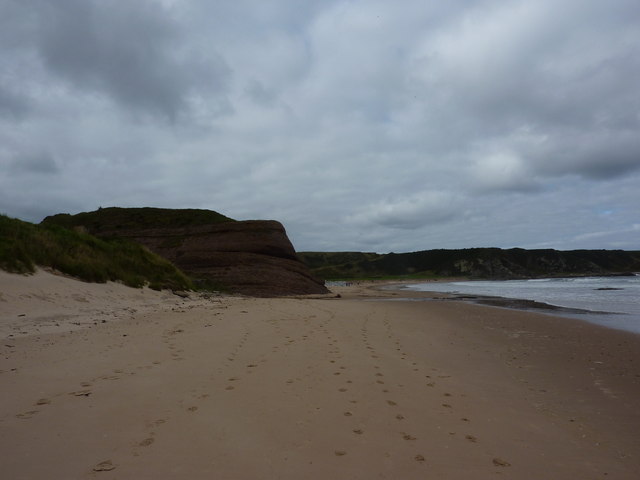
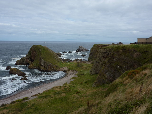
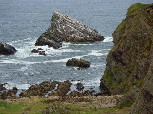
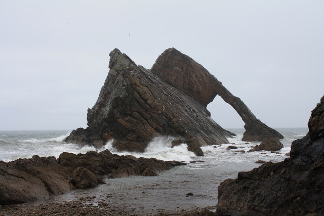
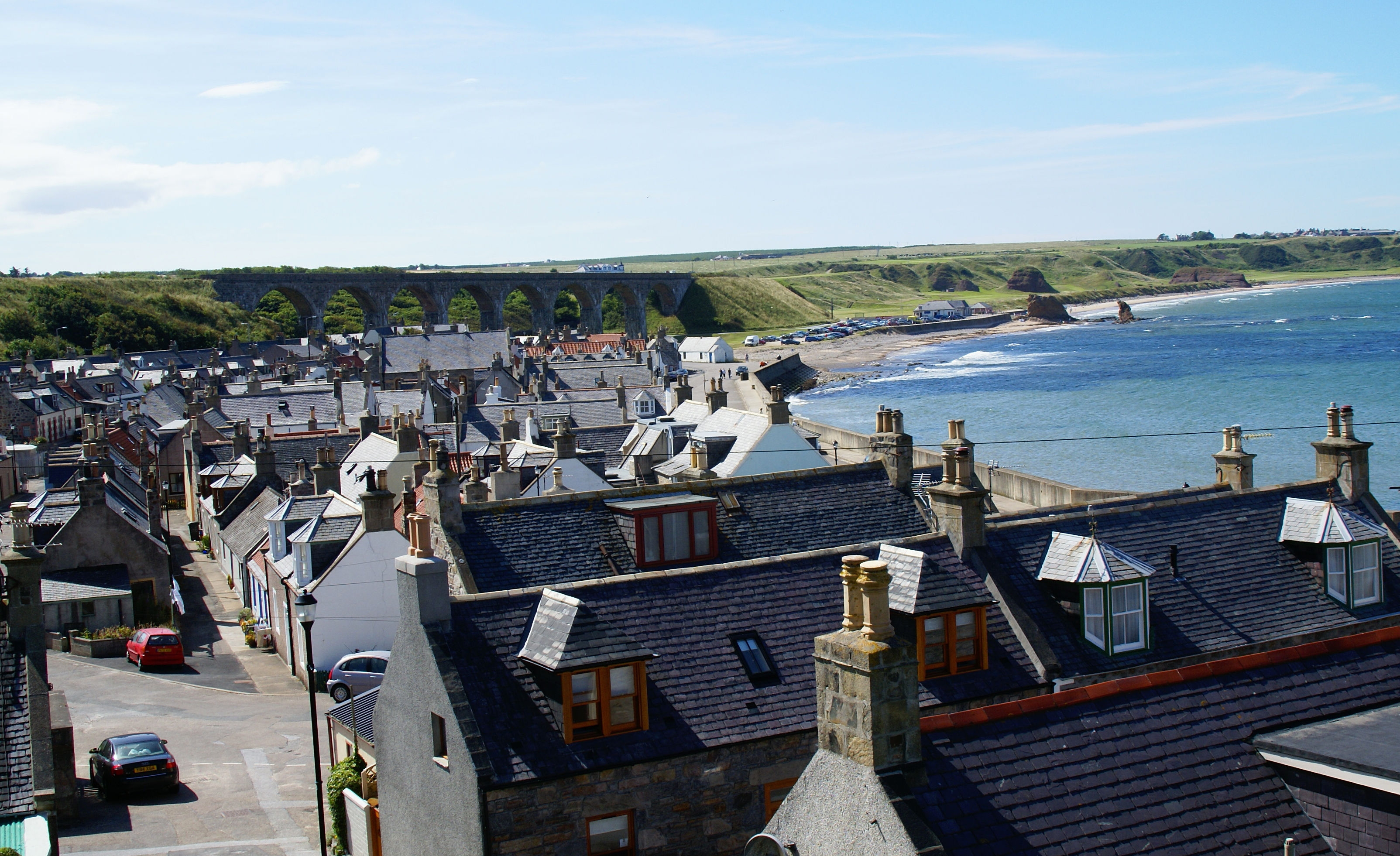
Three Kings is a prominent coastal feature located in Banffshire, Scotland. Situated on the eastern coast of the country, it is known for its distinctive headland and dramatic cliffs that jut out into the North Sea. This captivating landmark is also referred to as the Three Kings Point due to its triangular shape, resembling three peaks.

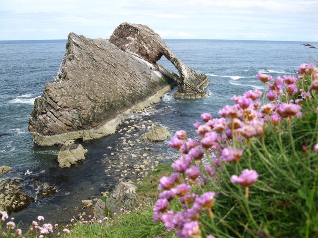
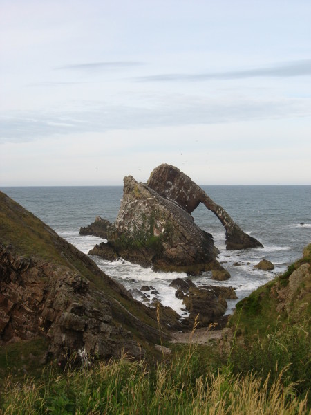
The headland is composed of steep cliffs that reach heights of up to 100 meters, providing breathtaking views of the surrounding landscape. The cliffs are formed from layers of sedimentary rocks, creating a visually striking display of earth's history. Due to its exposed location, the area is subjected to strong winds and powerful waves, which have eroded the cliffs over time, resulting in unique formations and sea stacks.

Three Kings is a popular destination for outdoor enthusiasts and nature lovers alike. The headland offers excellent opportunities for hiking, birdwatching, and photography. Visitors can explore the rugged coastline, observe various seabirds nesting on the cliffs, and spot marine life such as seals and dolphins. The site is also of historical significance, as it was once used as a lookout point during World War II.

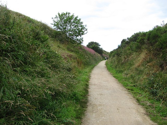
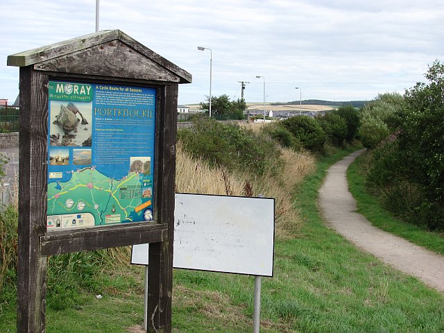
Access to Three Kings is relatively easy, with parking available nearby and a well-maintained footpath leading to the headland. However, caution should be exercised while navigating the area, as the cliffs can be unstable and the strong coastal winds can be hazardous. Nonetheless, Three Kings remains a captivating coastal feature, drawing visitors with its natural beauty, geological wonders, and historical significance.

If you have any feedback on the listing, please let us know in the comments section below.

Three Kings Images

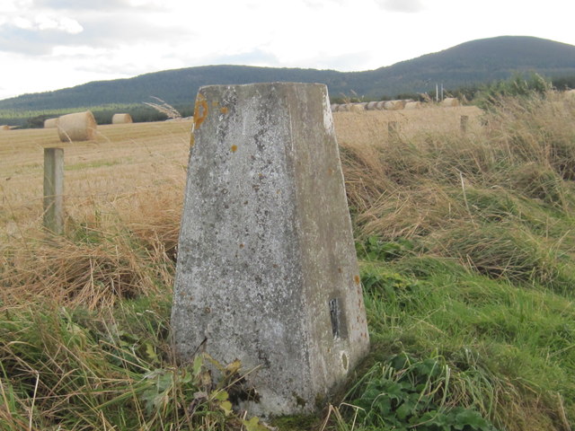
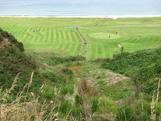
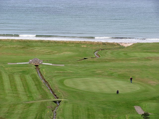
Images are sourced within 2km of 57.693835/-2.8329153 or Grid Reference NJ5067. Thanks to Geograph Open Source API. All images are credited.

Rock outcrop This outcrop is partly in Cullen Links and partly on the Cullen Sands.
Rock outcrop
This outcrop is partly in Cullen Links and partly on the Cullen Sands.
Bow Fiddle Rock Famous rock feature at Portknockie.
Bow Fiddle Rock
Famous rock feature at Portknockie.
Bow Fiddle Rock
Bow Fiddle Rock
Reddish rock outcrop in Cullen Bay
Coast at Portknockie Triangular rock in the middle is Shitten Craig. The cat sitting on the fence in <a href="https://www.geograph.org.uk/photo/2620784">NJ4968 : Wee cat on fence</a> has cleared off.
Coast at Portknockie
Triangular rock in the middle is Shitten Craig. The cat sitting on the fence in NJ4968 : Wee cat on fence has cleared off.
Wee cat on fence By a chapel on the coast at Portknockie.
Wee cat on fence
By a chapel on the coast at Portknockie.
Cormorants and gulls on Shitten Craig Rocky coastline at Portknockie, Moray Firth.
Cormorants and gulls on Shitten Craig
Rocky coastline at Portknockie, Moray Firth.
Youth Centre, Portknockie
New house, Church Street, Portknockie
Moray Coast Railway A cutting behind Cullen Links. The trackbed is now a path.
Moray Coast Railway
A cutting behind Cullen Links. The trackbed is now a path.
Moray Coast Railway The start of a section of trackbed which has been turned into a path to Cullen.
Moray Coast Railway
The start of a section of trackbed which has been turned into a path to Cullen.
Bow Fiddle Rock Bow Fiddle Rock is a classic example of a sea stack with a dramatic natural arch. It is named after its unusual shape which is supposed to resemble a violin bow, and it is the most visited tourist attraction in the village of Portknockie.
Bow Fiddle Rock
Bow Fiddle Rock is a classic example of a sea stack with a dramatic natural arch. It is named after its unusual shape which is supposed to resemble a violin bow, and it is the most visited tourist attraction in the village of Portknockie.
Triangulation Pillar S7179 at Portknockie
Ordnance Survey  Flush Bracket G4051 This can be found on a boundary wall at Cullen Bay Hotel.
For more detail see : <span class="nowrap"><a title="http://www.bench-marks.org.uk/bm16939" rel="nofollow ugc noopener" href="http://www.bench-marks.org.uk/bm16939">Link</a><img style="margin-left:2px;" alt="External link" title="External link - shift click to open in new window" src="https://s1.geograph.org.uk/img/external.png" width="10" height="10"/></span>
Ordnance Survey Flush Bracket G4051
This can be found on a boundary wall at Cullen Bay Hotel. For more detail see : LinkExternal link
Cullen Golf Club A links course tucked in between sea and the former Moray Coast Railway. There has been some slippage of the steep slope beneath the railway trackbed here.
Cullen Golf Club
A links course tucked in between sea and the former Moray Coast Railway. There has been some slippage of the steep slope beneath the railway trackbed here.
Cullen Golf Club View from the old railway.
Cullen Golf Club
View from the old railway.
Public garden, Portknockie With a very tidy looking bus shelter.
Public garden, Portknockie
With a very tidy looking bus shelter.
Portknockie Foot of Victoria Street.
Portknockie
Foot of Victoria Street.
Show me another place!

Three Kings is located at Grid Ref: NJ5067 (Lat: 57.693835, Lng: -2.8329153)

Unitary Authority: Moray

Police Authority: North East

What 3 Words

///branching.nuggets.vanished. Near Cullen, Moray

Nearby Locations

Three Kings

Related Wikis

Cullen Castle

Cullen Castle was a royal castle about 0.5 miles (0.80 km) west of Cullen, Moray, Scotland, west of the burn of Deskford, and south of Seatown. The remains...
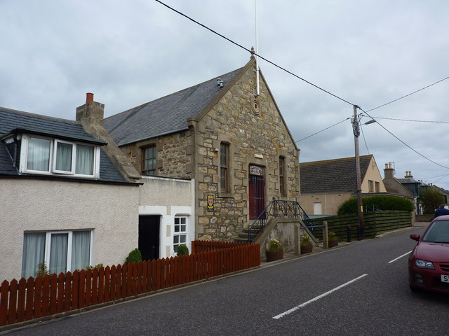
Cullen, Moray

Cullen (Scottish Gaelic: Inbhir Cuilinn) is a village and former royal burgh in Moray but historically in Banffshire, Scotland, on the North Sea coast...

Cullen Town Hall

Cullen Town Hall is a municipal building in The Square, Cullen, Moray, Scotland. The structure, which is currently used as a heritage centre, is a Category...

Cullen railway station

Cullen railway station was a railway station that served the small fishing village of Cullen, close to Portknockie in Moray. The railway station was opened...

Nearby Amenities

Located within 500m of 57.693835,-2.8329153
Source: PGS
Lat/Long: 57.6925654/-2.8271349
Source: PGS
Lat/Long: 57.6927273/-2.8283109
Source: PGS
Lat/Long: 57.6927763/-2.8286299
Source: PGS
Lat/Long: 57.6930162/-2.8302223
Source: PGS
Lat/Long: 57.6933002/-2.8310348
Source: PGS
Lat/Long: 57.6935259/-2.8318486
Source: PGS
Lat/Long: 57.6937622/-2.8324151
Source: PGS
Lat/Long: 57.6941411/-2.8346675
Source: PGS
Lat/Long: 57.6942575/-2.8351524
Source: PGS
Lat/Long: 57.6943955/-2.8357436
Source: PGS
Lat/Long: 57.6946243/-2.8365694
Source: PGS
Lat/Long: 57.6950258/-2.837914
Source: PGS
Lat/Long: 57.6952269/-2.8385882
Source: PGS
Lat/Long: 57.6955053/-2.8394106
Source: PGS
Lat/Long: 57.695743/-2.8400126
Ncn Milepost: mills
Source: survey
Sustrans Ref: MP524
Lat/Long: 57.6913513/-2.8281247
Mobile Speed Camera Route 6 end
Website: http://www.nescamp.co.uk/details?cid=96
Lat/Long: 57.6922358/-2.8315603
Access: no
Barrier: swing_gate
Bicycle: yes
Foot: yes
Material: metal
Lat/Long: 57.6918556/-2.8298713
Power: pole
Lat/Long: 57.6930205/-2.8411138
Barrier: bollard
Bicycle: yes
Foot: yes
Lat/Long: 57.6924553/-2.8294132
Barrier: bollard
Bicycle: yes
Foot: yes
Lat/Long: 57.6925525/-2.8298903
Entrance: yes
Male: yes
Ref: loons
Lat/Long: 57.6935409/-2.8330434
Entrance: yes
Female: yes
Ref: quines
Lat/Long: 57.6935144/-2.8329265
Post Box
Collection Times: Mo-Fr 15:45; Sa 11:30
Operator: Royal Mail
Post Box Type: pillar
Ref: AB56 69
Royal Cypher: GR
Royal Cypher Wikidata: Q33102273
Lat/Long: 57.6917758/-2.8260405
Power: pole
Lat/Long: 57.6930917/-2.8323776
Golf: pin
Lat/Long: 57.6935945/-2.838556
Golf: pin
Lat/Long: 57.693375/-2.8409031
Golf: pin
Lat/Long: 57.6940718/-2.8371212
Golf: pin
Lat/Long: 57.6938385/-2.8386891
Golf: pin
Lat/Long: 57.6934682/-2.8342349
Seatown
Bin: yes
Bus: yes
Lit: yes
Naptan AtcoCode: 638050731
Naptan Bearing: NW
Naptan CommonName: Seatown
Naptan Indicator: NW-bound
Naptan NaptanCode: 67923953
Naptan Street: Castle Terrace
Naptan Verified: no
Public Transport: platform
Shelter: yes
Tactile Paving: no
Lat/Long: 57.6913798/-2.8268163
Seatown
Bench: yes
Bin: no
Bus: yes
Lit: yes
Naptan AtcoCode: 638055001
Naptan Bearing: SE
Naptan CommonName: Seatown
Naptan Indicator: SE-bound
Naptan NaptanCode: 67923954
Naptan Street: Castle Terrace
Naptan Verified: no
Public Transport: platform
Tactile Paving: no
Lat/Long: 57.6913755/-2.8263154
The data included in this document is from www.openstreetmap.org. The data is made available under ODbL.

Have you been to Three Kings?

Leave your review of Three Kings below (or comments, questions and feedback).