North Peat Geo

Coastal Feature, Headland, Point in Orkney

Scotland

North Peat Geo

Craw Nev Having got accustomed to all the rocks in Orkney being in fairly orderly strata with a gentle dip, I was astonished to see this headland of extensively deformed rock.
Craw Nev Credit: Anne Burgess

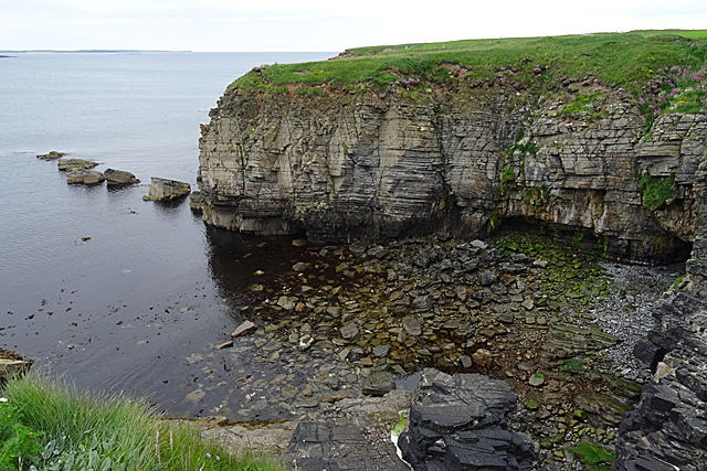
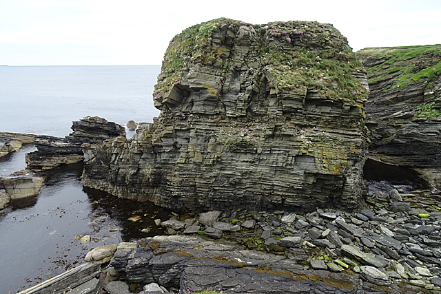
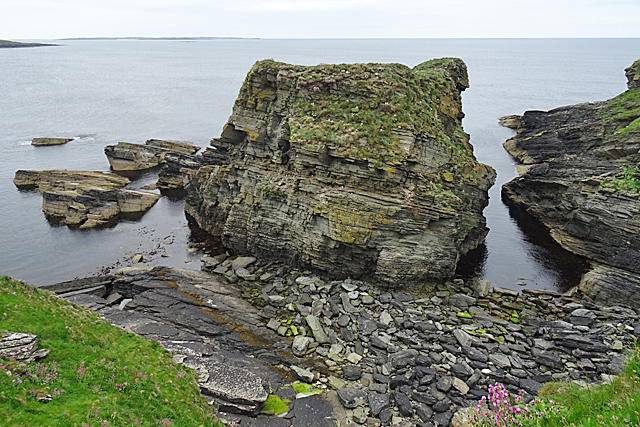
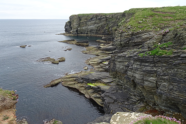
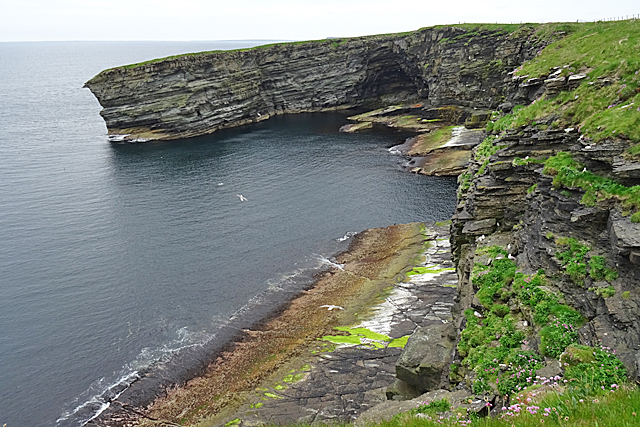
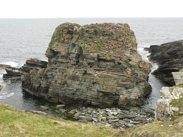
North Peat Geo is a prominent coastal feature located in Orkney, a group of islands situated off the northeastern coast of Scotland. It is classified as a headland and point due to its distinctive geological formation and its position as a narrow strip of land extending into the sea.

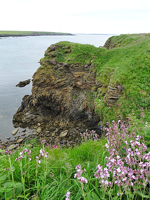
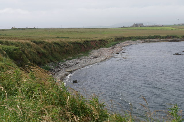
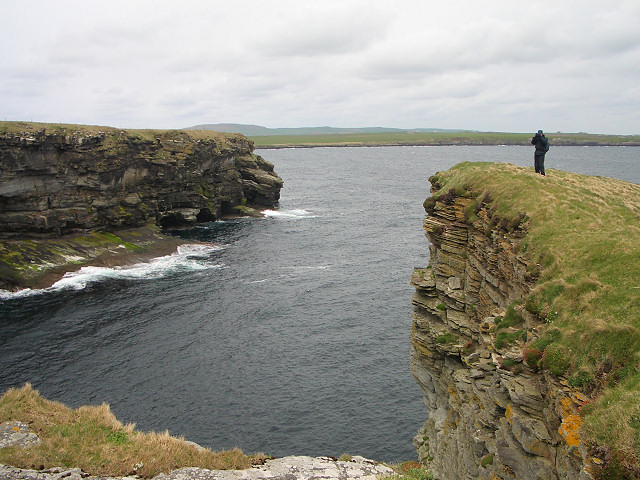
North Peat Geo is characterized by its towering cliffs, which rise up to 30 meters above the sea level. These cliffs are composed primarily of layers of peat, a type of partially decayed vegetation that has accumulated over thousands of years. The peat layers give the cliffs a unique reddish-brown color, creating a striking contrast against the deep blue of the surrounding sea.

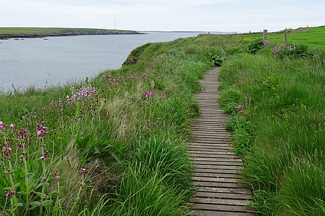
The headland is surrounded by rugged coastline and is known for its dramatic landscape, with steep slopes and sheer cliff faces. Its exposed location makes it susceptible to powerful waves and strong winds, adding to its natural beauty.

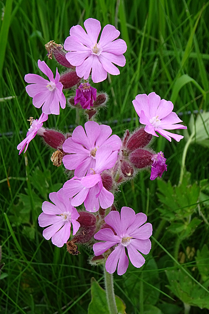
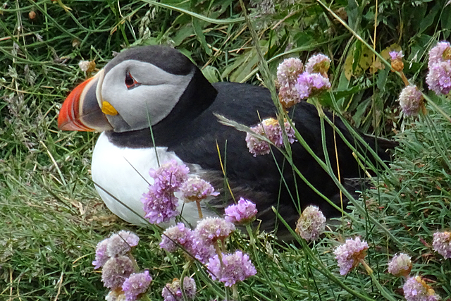
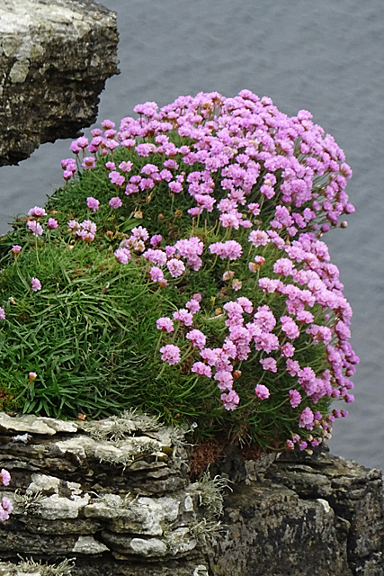
The area around North Peat Geo is rich in biodiversity, with various seabird colonies nesting on the cliffs. Species such as fulmars, kittiwakes, and guillemots can be observed in large numbers during the breeding season. The coastal waters below the headland are also home to a diverse range of marine life, including seals, dolphins, and various fish species.

Due to its geological significance and ecological value, North Peat Geo is a popular destination for nature enthusiasts and photographers. Visitors can enjoy stunning panoramic views of the surrounding coastline and immerse themselves in the natural wonders of this unique coastal feature.

If you have any feedback on the listing, please let us know in the comments section below.

North Peat Geo Images

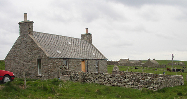
Images are sourced within 2km of 59.27375/-2.8833544 or Grid Reference HY4943. Thanks to Geograph Open Source API. All images are credited.

Craw Nev Having got accustomed to all the rocks in Orkney being in fairly orderly strata with a gentle dip, I was astonished to see this headland of extensively deformed rock.
Craw Nev
Having got accustomed to all the rocks in Orkney being in fairly orderly strata with a gentle dip, I was astonished to see this headland of extensively deformed rock.
Boardwalk For the convenience of those walking to and from the cliff path, a boardwalk has been provided to get across a rough or wet patch.
Boardwalk
For the convenience of those walking to and from the cliff path, a boardwalk has been provided to get across a rough or wet patch.
Pink Campion Red Campion and White Campion, both of which occur here, are known to hybridise. This pale-flowered plant is probably such a hybrid.
Pink Campion
Red Campion and White Campion, both of which occur here, are known to hybridise. This pale-flowered plant is probably such a hybrid.
Puffin (Fratercula arctica) Although we were assured by several people that there were hundreds of Puffins at the Castle of Burrian, we saw only a few, of which this one posed obligingly for several minutes for us.
Puffin (Fratercula arctica)
Although we were assured by several people that there were hundreds of Puffins at the Castle of Burrian, we saw only a few, of which this one posed obligingly for several minutes for us.
Cove at Saaclay The old six-inch map suggests that Saaclay is the name of the promontory from which this view was taken, but none of the maps names the cove itself.
Cove at Saaclay
The old six-inch map suggests that Saaclay is the name of the promontory from which this view was taken, but none of the maps names the cove itself.
Castle o' Burrian The name seems to be applied to the sea stack rather than just to the prehistoric site on its summit. It is supposed to be one of the best places to see Puffins, but we saw even fewer here than we had seen at the Brough of Birsay or the Brough of Bigging the previous day.
Castle o' Burrian
The name seems to be applied to the sea stack rather than just to the prehistoric site on its summit. It is supposed to be one of the best places to see Puffins, but we saw even fewer here than we had seen at the Brough of Birsay or the Brough of Bigging the previous day.
Castle o' Burrian From here you can clearly see that this is a rock stack, cut off from the land at high tide.
Castle o' Burrian
From here you can clearly see that this is a rock stack, cut off from the land at high tide.
Bare Rowa Bare Rowa seems to be the name of the bay or cove enclosed by the headland here.
Bare Rowa
Bare Rowa seems to be the name of the bay or cove enclosed by the headland here.
White Campion (Silene latifolia) The cliffs were thick with both White Campion and Red Campion, and a range of hybrids of all shades of pink.
White Campion (Silene latifolia)
The cliffs were thick with both White Campion and Red Campion, and a range of hybrids of all shades of pink.
Bight of Stangerhead The bay and the cliffs on the right are in this square, but Stanger Head itself is in the next square.
Bight of Stangerhead
The bay and the cliffs on the right are in this square, but Stanger Head itself is in the next square.
Red Campion (Silene dioica) One of the numerous fine large clumps of Red Campion along the cliffs.
Red Campion (Silene dioica)
One of the numerous fine large clumps of Red Campion along the cliffs.
Sea Campion (Silene uniflora) This campion is fairly common alongside the clifftop path.
Sea Campion (Silene uniflora)
This campion is fairly common alongside the clifftop path.
Thrift (Armeria maritima) A particularly fine clump of Thrift or Sea Pink.
Thrift (Armeria maritima)
A particularly fine clump of Thrift or Sea Pink.
Rack Wick A bay which penetrates towards the central spine of Westray.
Rack Wick
A bay which penetrates towards the central spine of Westray.
Rapness Mill, Westray Two storey grain mill with repairs in modern materials that was placed on the at risk register in 1990. Canmore date it to the 18th century but a walking guide apparently by Orkney Island Council claims it to be built about 1850. Immediately prior to 1933 the Harcus family are said to work the mill. The 1843-1882 OS map shows the mill but I can't find an earlier detailed map.
Rapness Mill, Westray
Two storey grain mill with repairs in modern materials that was placed on the at risk register in 1990. Canmore date it to the 18th century but a walking guide apparently by Orkney Island Council claims it to be built about 1850. Immediately prior to 1933 the Harcus family are said to work the mill. The 1843-1882 OS map shows the mill but I can't find an earlier detailed map.
Stanger Head Looking out to the mouth of a narrow inlet, with an intrepid geographer on the tip of Stanger Head taking pictures in the opposite direction.
Stanger Head
Looking out to the mouth of a narrow inlet, with an intrepid geographer on the tip of Stanger Head taking pictures in the opposite direction.
Croft house near Sangar A network of minor roads links the croft houses on the Rapness peninsula of Westray.
Croft house near Sangar
A network of minor roads links the croft houses on the Rapness peninsula of Westray.
Castle o'Burrian, Westray The "castle" is a natural rock stack. It is a good place to see many seabirds, including puffins. There are the remains of a building on top of the stack, thought to be an early Christian hermitage.
Castle o'Burrian, Westray
The "castle" is a natural rock stack. It is a good place to see many seabirds, including puffins. There are the remains of a building on top of the stack, thought to be an early Christian hermitage.
Show me another place!

North Peat Geo is located at Grid Ref: HY4943 (Lat: 59.27375, Lng: -2.8833544)

Unitary Authority: Orkney Islands

Police Authority: Highlands and Islands

What 3 Words

///enchanted.animals.daunting. Near Pierowall, Orkney Islands

Related Wikis

Rapness

Rapness is a settlement on the island of Westray in Orkney, Scotland. The slipway is the ferry terminal for the Orkney Ferries crossing from Kirkwall on...

Westside Church

Westside Church, (also known as Cross Kirk), is a ruined 12th century church located on the island of Westray in Orkney, Scotland. Archaeological excavations...

Holm of Faray

The Holm of Faray is a small island in Orkney, Scotland, near Faray and Westray, which it lies between. Together with its neighbour Faray, it is designated...

Westray

Westray (, Scots: Westree) is one of the Orkney Islands in Scotland, with a usual resident population of just under 600 people. Its main village is Pierowall...

Nearby Amenities

Located within 500m of 59.27375,-2.8833544
Power: pole
Lat/Long: 59.2696198/-2.8866631
Power: pole
Lat/Long: 59.2701256/-2.8872666
Power: pole
Lat/Long: 59.2707766/-2.8877869
Power: pole
Lat/Long: 59.2713728/-2.8882778
Power: pole
Lat/Long: 59.2720512/-2.8887445
Power: pole
Lat/Long: 59.2726652/-2.8889725
Power: pole
Lat/Long: 59.2733682/-2.8891924
Power: pole
Lat/Long: 59.2740466/-2.8894043
Power: pole
Lat/Long: 59.2746962/-2.8895786
Power: pole
Lat/Long: 59.2753485/-2.8897825
Power: pole
Lat/Long: 59.2759213/-2.8901258
The data included in this document is from www.openstreetmap.org. The data is made available under ODbL.

Have you been to North Peat Geo?

Leave your review of North Peat Geo below (or comments, questions and feedback).