Muckle Geo

Coastal Feature, Headland, Point in Orkney

Scotland

Muckle Geo

Triangulation pillar, Burray Ness, Burray, Orkney Looking towards Copinsay.
Triangulation pillar, Burray Ness, Burray, Orkney Credit: Claire Pegrum

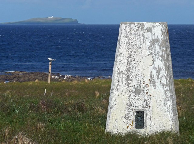
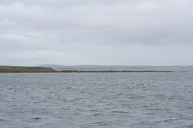
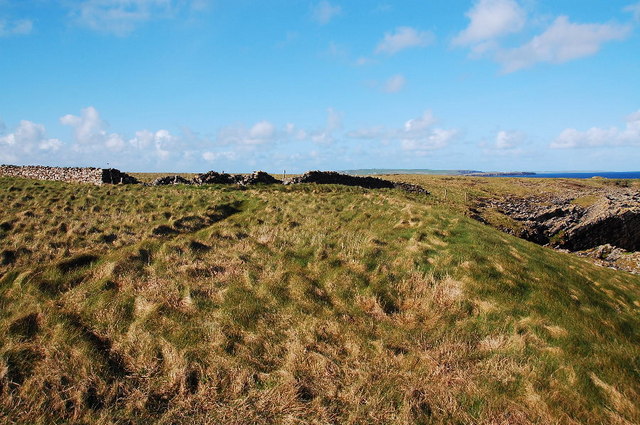
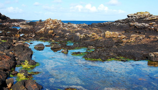
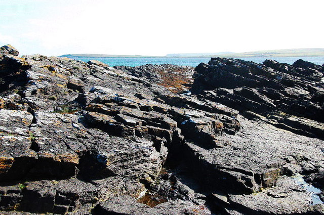
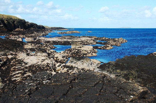
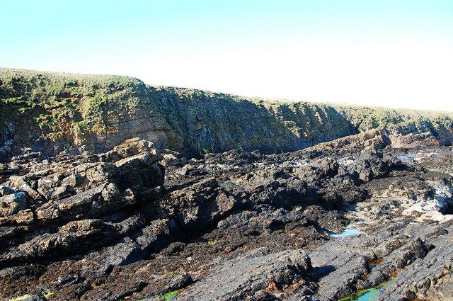
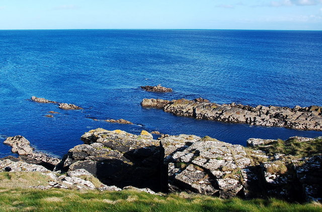
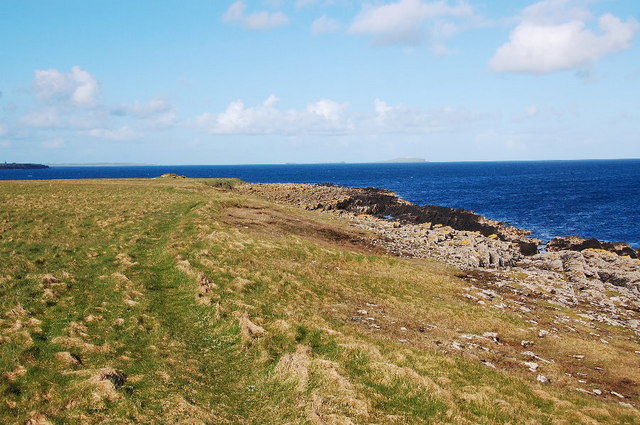
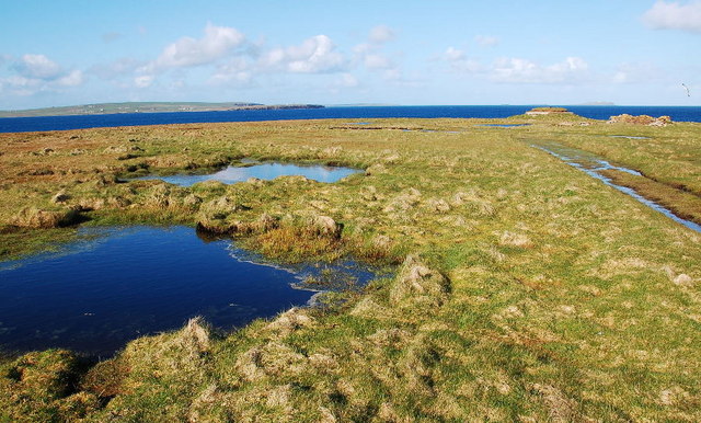
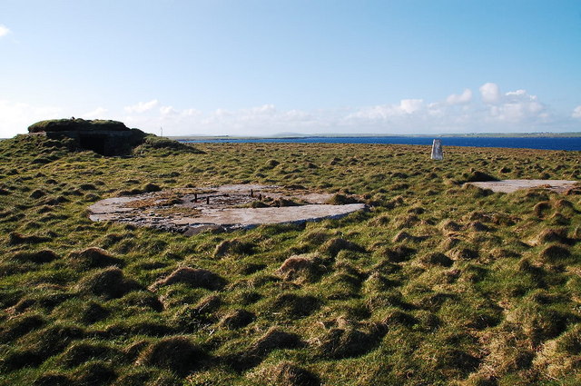
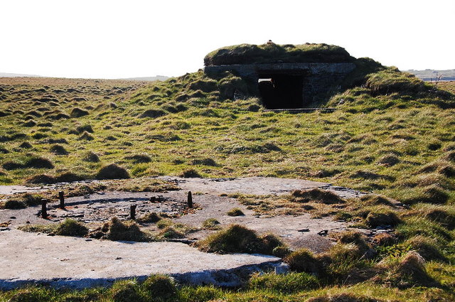
Muckle Geo is a prominent coastal feature located in Orkney, a group of islands off the northeastern coast of Scotland. Positioned on the east coast of the Orkney Mainland, Muckle Geo is a headland that juts out into the North Sea, forming a distinctive point along the rugged coastline.

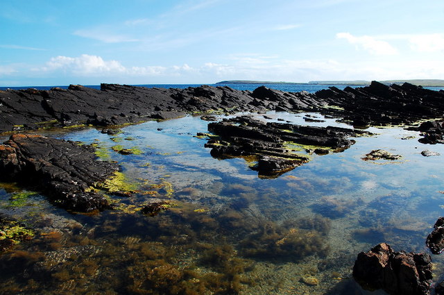
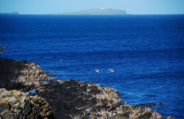
This geological formation is characterized by its towering sea cliffs, which are composed of layers of Old Red Sandstone and Devonian rocks. The cliffs at Muckle Geo reach heights of up to 30 meters (98 feet), offering breathtaking panoramic views of the surrounding sea and coastline.

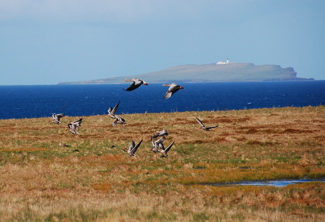
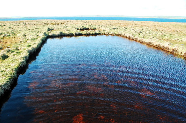
The headland of Muckle Geo is renowned for its dramatic natural beauty and rich biodiversity. The area is home to a variety of seabird species, including puffins, guillemots, and fulmars, which nest in the cliff faces during the breeding season. The surrounding waters are also teeming with marine life, making it a popular spot for fishing and wildlife enthusiasts.

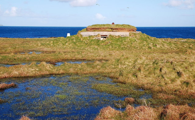
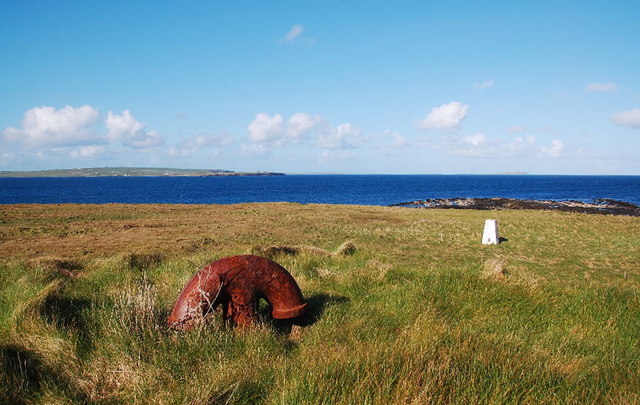
In addition to its natural wonders, Muckle Geo holds historical significance as well. The headland is believed to have been inhabited since prehistoric times, with archaeological evidence suggesting human activity in the area dating back thousands of years. Nearby, there are also remnants of ancient settlements and burial sites, adding to the cultural importance of the site.

Overall, Muckle Geo is a captivating coastal feature that combines stunning natural scenery, diverse wildlife, and a rich historical heritage. It attracts visitors from near and far, who come to admire its rugged cliffs, explore its archaeological sites, and immerse themselves in the unique charm of Orkney's coastal landscape.

If you have any feedback on the listing, please let us know in the comments section below.

Muckle Geo Images

Images are sourced within 2km of 58.853367/-2.8728988 or Grid Reference ND4996. Thanks to Geograph Open Source API. All images are credited.

Triangulation pillar, Burray Ness, Burray, Orkney Looking towards Copinsay.
Triangulation pillar, Burray Ness, Burray, Orkney
Looking towards Copinsay.
Burray Ness. Just one more of the countless shipping hazards on Orkney.
Burray Ness.
Just one more of the countless shipping hazards on Orkney.
Exposed wave-cut platform The tide was on the flood and everything was disappearing rather too quickly. South Ronaldsay in the distance.
Exposed wave-cut platform
The tide was on the flood and everything was disappearing rather too quickly. South Ronaldsay in the distance.
Old wall at Brattlee Ber Mainland Orkney on the horizon.
Old wall at Brattlee Ber
Mainland Orkney on the horizon.
Quick-growing Rock Pool Taken from a rapidly-submerging wave-cut platform. Not that the rocks were noticeably moving. Eustasy rather than isostasy.
Quick-growing Rock Pool
Taken from a rapidly-submerging wave-cut platform. Not that the rocks were noticeably moving. Eustasy rather than isostasy.
Wave-cut platform near Wife's Geo With South Ronaldsay on the horizon.
Wave-cut platform near Wife's Geo
With South Ronaldsay on the horizon.
Exposed reef near Wife's Geo With Copinsay on the horizon.
Exposed reef near Wife's Geo
With Copinsay on the horizon.
Wave-cut platform near Wife's Geo The cliffs, although not vertiginously high, are very difficult to get down, or up. I had to walk quite a way along them to find access to the wave-cut platform.
Wave-cut platform near Wife's Geo
The cliffs, although not vertiginously high, are very difficult to get down, or up. I had to walk quite a way along them to find access to the wave-cut platform.
Submerging reef Taken from the clifftops near Ness. Where I had taken my photos from earlier was already underwater.
Submerging reef
Taken from the clifftops near Ness. Where I had taken my photos from earlier was already underwater.
Geese and moorland at Burray Ness With Copinsay in the distance. This is only a mile from my house and it's the first time I've been. That's not because I don't go out much, it's because Orkney has thousands of other places to see too.
Geese and moorland at Burray Ness
With Copinsay in the distance. This is only a mile from my house and it's the first time I've been. That's not because I don't go out much, it's because Orkney has thousands of other places to see too.
Sea kayakers near Burray Ness With Copinsay in the background. Kayakers are deceptively fast travellers.
Sea kayakers near Burray Ness
With Copinsay in the background. Kayakers are deceptively fast travellers.
Approaching Burray Ness I couldn't work out why the OS pillar wasn't visible.
Approaching Burray Ness
I couldn't work out why the OS pillar wasn't visible.
Near Burray Ness The pools are marked on the 1:25,000 map. Several turned out to be the flooded foundations (concrete floored), of old military buildings.
Near Burray Ness
The pools are marked on the 1:25,000 map. Several turned out to be the flooded foundations (concrete floored), of old military buildings.
Flooded foundations, Burray Ness The water was just an inch or two deep and covered a concrete floor. Part of the military infrastructure which supported the gun emplacement which was once here.
Flooded foundations, Burray Ness
The water was just an inch or two deep and covered a concrete floor. Part of the military infrastructure which supported the gun emplacement which was once here.
Trig Point, Burray Ness Hidden behind the low-lying building (possibly a magazine), until the very last moment.
Trig Point, Burray Ness
Hidden behind the low-lying building (possibly a magazine), until the very last moment.
Trig point, Burray Ness Taken from the roof of what I think was a magazine. The upturned anchor is an air-vent.
Trig point, Burray Ness
Taken from the roof of what I think was a magazine. The upturned anchor is an air-vent.
Old gun battery site, Burray Ness The concrete circles will have been bases for the guns, with the building probably housing the ammunition.
Old gun battery site, Burray Ness
The concrete circles will have been bases for the guns, with the building probably housing the ammunition.
Site of gun battery, Burray Ness The mountings for the guns in the foreground, magazine in the background.
Site of gun battery, Burray Ness
The mountings for the guns in the foreground, magazine in the background.
Show me another place!

Muckle Geo is located at Grid Ref: ND4996 (Lat: 58.853367, Lng: -2.8728988)

Unitary Authority: Orkney Islands

Police Authority: Highlands and Islands

What 3 Words

///charts.drawn.scatter. Near Holm, Orkney Islands

Related Wikis

Burray

Burray () is one of the Orkney Islands in Scotland. It lies to the east of Scapa Flow and is one of a chain of islands linked by the Churchill Barriers...

A961 road

The A961 is a single-carriageway road on the eastern side of Scapa Flow in the Orkney Islands, connecting the town of Kirkwall on the Orkney Mainland to...

Glimps Holm

Glimps Holm or Glims Holm (Old Norse: Glums Holm) is a small uninhabited islet in Orkney, Scotland. == Geography == Glimps Holm lies in Holm Sound, one...

Grim Ness

Grimness is a cliff-girt headland on the island of South Ronaldsay, in the Orkney archipelago of Scotland. It is located between Honeysgeo and Skipi Geo...

Nearby Amenities

Located within 500m of 58.853367,-2.8728988
Burray Haas
Place: locality
Lat/Long: 58.8522367/-2.8655664
Ness
Place: locality
Lat/Long: 58.8493006/-2.8760869
Generator Method: wind_turbine
Generator Source: wind
Power: generator
Lat/Long: 58.8499201/-2.8747798
The data included in this document is from www.openstreetmap.org. The data is made available under ODbL.

Have you been to Muckle Geo?

Leave your review of Muckle Geo below (or comments, questions and feedback).