Sand Geo

Coastal Feature, Headland, Point in Orkney

Scotland

Sand Geo

Shapinsay: Lairo Water from the air Looking down from a Westray-to-Kirkwall flight on this small lake on the northern shore of Shapinsay. The Tankerness and Deerness peninsulas of the Orkney mainland are in the distance.
Shapinsay: Lairo Water from the air Credit: Chris Downer

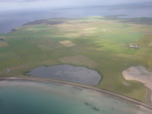
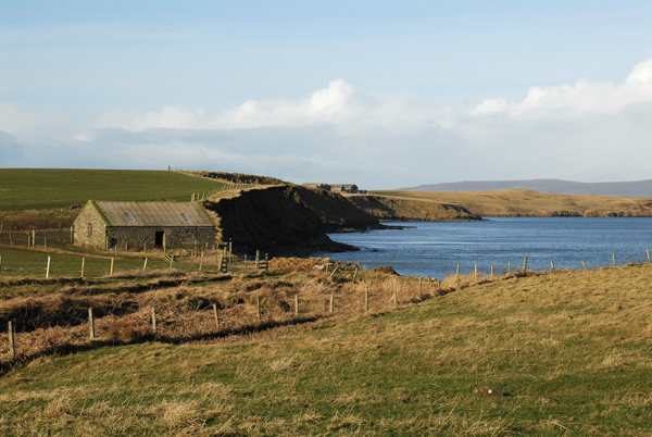
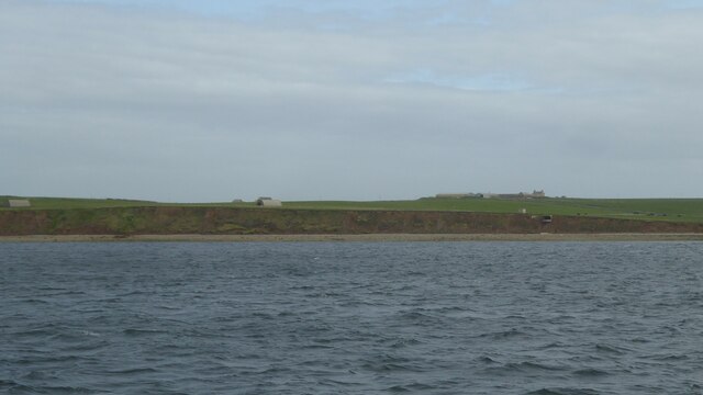
Sand Geo is a prominent coastal feature located in Orkney, an archipelago in northern Scotland. It is categorized as a headland or point due to its distinct geographical characteristics. The name "Sand Geo" is derived from the Old Norse term "geirr," meaning a triangular-shaped piece of land. This accurately describes the shape of the feature, which juts out into the North Sea.

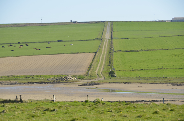
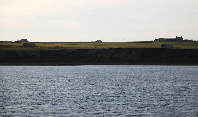
This headland is composed primarily of sandstone and has been shaped by the relentless forces of erosion over thousands of years. The constant action of wind, waves, and tides has created a rugged and dramatic landscape. Sand Geo is characterized by steep cliffs, jagged rocks, and deep crevices, which add to its unique charm and allure.

The headland offers breathtaking panoramic views of the surrounding coastline, with its vantage point providing an ideal spot for whale watching and bird spotting. Visitors can expect to see a variety of seabirds nesting on the cliffs, including fulmars, guillemots, and puffins.

Sand Geo is also known for its rich marine life. The surrounding waters are home to a diverse range of species, including seals, dolphins, and porpoises. The headland is a popular destination for fishing enthusiasts, who come to catch species such as mackerel and cod.

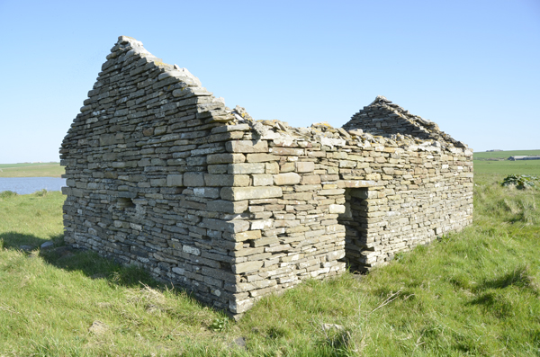
In addition to its natural beauty, Sand Geo also holds historical significance. The area is dotted with archaeological sites, including ancient burial mounds and the remains of Norse settlements, providing a glimpse into the region's rich heritage.

Overall, Sand Geo is a captivating coastal feature that offers a stunning display of natural beauty, abundant wildlife, and cultural history, making it a must-visit destination for nature lovers and history enthusiasts alike.

If you have any feedback on the listing, please let us know in the comments section below.

Sand Geo Images

Images are sourced within 2km of 59.061474/-2.8886199 or Grid Reference HY4919. Thanks to Geograph Open Source API. All images are credited.

Shapinsay: Lairo Water from the air Looking down from a Westray-to-Kirkwall flight on this small lake on the northern shore of Shapinsay. The Tankerness and Deerness peninsulas of the Orkney mainland are in the distance.
Shapinsay: Lairo Water from the air
Looking down from a Westray-to-Kirkwall flight on this small lake on the northern shore of Shapinsay. The Tankerness and Deerness peninsulas of the Orkney mainland are in the distance.
Track going away from The Ouse This track is sign posted To The Odin Stone at the upper end.  However, finding the Odin Stone is very difficult.
Track going away from The Ouse
This track is sign posted To The Odin Stone at the upper end. However, finding the Odin Stone is very difficult.
Old building near to the location of Odin Stone At least that is the theory. Finding the said Odin Stone is another matter.
Old building near to the location of Odin Stone
At least that is the theory. Finding the said Odin Stone is another matter.
Shapinsay: ayre between Lairo Water and Veantrow Bay The narrow strip of land separating Lairo Water (left) from the open sea of Veantrow Bay (right). It is perhaps unusual in these northern isles, which have a fair few ayres such as this, that it does not have a mapped name.
Shapinsay: ayre between Lairo Water and Veantrow Bay
The narrow strip of land separating Lairo Water (left) from the open sea of Veantrow Bay (right). It is perhaps unusual in these northern isles, which have a fair few ayres such as this, that it does not have a mapped name.
Lairo Water This water on the north coast of Shapinsay is separated from Veantrow Bay by an ayre. Orcadians use the name ayre for the storm beaches dividing sea from lochs.
Lairo Water
This water on the north coast of Shapinsay is separated from Veantrow Bay by an ayre. Orcadians use the name ayre for the storm beaches dividing sea from lochs.
The Ouse This is a shallow tidal bay sheltered behind a storm beach. It is sandy bottomed and is a haunt of ducks and oyster catchers.
The Ouse
This is a shallow tidal bay sheltered behind a storm beach. It is sandy bottomed and is a haunt of ducks and oyster catchers.
Track by Odinstone This track runs downhill from Shapinsay's spinal road to The Ouse, a sandy, tidal bay. The fields are mainly used for beef and dairy cattle for which Orkney is famed. Some cows are sent to Aberdeenshire for fattening.
Track by Odinstone
This track runs downhill from Shapinsay's spinal road to The Ouse, a sandy, tidal bay. The fields are mainly used for beef and dairy cattle for which Orkney is famed. Some cows are sent to Aberdeenshire for fattening.
Storm Beach by Ling Holm A tangle of fishing net has been left high and dry on the shingle bar between Veantrow Bay and the tidal Ouse. Beyond are some of the parks of Shapinsay, used mainly for beef and dairy cattle.
Storm Beach by Ling Holm
A tangle of fishing net has been left high and dry on the shingle bar between Veantrow Bay and the tidal Ouse. Beyond are some of the parks of Shapinsay, used mainly for beef and dairy cattle.
The shallow mossy banked Ouse The waters are very placid in the Ouse, since this inlet is very sheltered from the open sea.
The shallow mossy banked Ouse
The waters are very placid in the Ouse, since this inlet is very sheltered from the open sea.
Lairo Water and Veantrow Bay Showing the natural barrier between Lairo Water and the sea. Lairo Water is essentially a freshwater lake, but frequent ingress by the sea during storms makes it brackish.
Lairo Water and Veantrow Bay
Showing the natural barrier between Lairo Water and the sea. Lairo Water is essentially a freshwater lake, but frequent ingress by the sea during storms makes it brackish.
Banks of Runabout Several Nissen Huts stand as reminder of WWII activities in this area which housed a coastal battery to protect Kirkwall.
Banks of Runabout
Several Nissen Huts stand as reminder of WWII activities in this area which housed a coastal battery to protect Kirkwall.
Banks of Runabout Low cliffs and a precariously placed building on the north side of Shapinsay.
Banks of Runabout
Low cliffs and a precariously placed building on the north side of Shapinsay.
Banks of Runabout The steep sandy banks don't look very stable. On top is one of the Nissen huts supporting the coastal defences on Salt Ness.
Banks of Runabout
The steep sandy banks don't look very stable. On top is one of the Nissen huts supporting the coastal defences on Salt Ness.
Coastal erosion The soft cliffs are collapsing and eroding away. A worry as the remains of a wartime coastal battery lie here and some of the features are in danger of collapsing into the sea. The buildings in the middle distance, looking a little like Nissen huts, will have been generator houses for searchlights etc.
Coastal erosion
The soft cliffs are collapsing and eroding away. A worry as the remains of a wartime coastal battery lie here and some of the features are in danger of collapsing into the sea. The buildings in the middle distance, looking a little like Nissen huts, will have been generator houses for searchlights etc.
The Galt Viewed from the Varagen, an inter-island ferry. Veantrow Bay is beyond.
The Galt
Viewed from the Varagen, an inter-island ferry. Veantrow Bay is beyond.
Shapinsay, Farm of Garth Farm of Garth has an excellent stock of Orkney rare farm animals.
Shapinsay, Farm of Garth
Farm of Garth has an excellent stock of Orkney rare farm animals.
Ware Geo, Shapinsay Looking along Veantrow Bay toward Ware Geo.
Ware Geo, Shapinsay
Looking along Veantrow Bay toward Ware Geo.
Coastal erosion at Banks of Runabout
Show me another place!

Sand Geo is located at Grid Ref: HY4919 (Lat: 59.061474, Lng: -2.8886199)

Unitary Authority: Orkney Islands

Police Authority: Highlands and Islands

What 3 Words

///exhaling.daredevil.bookmark. Near Balfour, Orkney Islands

Related Wikis

Shapinsay

Shapinsay (, Scots: Shapinsee) is one of the Orkney Islands off the north coast of mainland Scotland. With an area of 29.5 square kilometres (11.4 sq mi...

Veantro Bay

Veantro Bay is a bay on the northwest coast of Shapinsay in the Orkney Islands, Scotland. At the head of the bay is a large stone, thought to be associated...

The Ouse

The Ouse is a tidal estuary in northern Shapinsay, Orkney Islands. This water body has been shown on early maps of the island in a very similar shape to...

Lairo Water

Lairo Water is a surface water body known as an ayre situated on the western coast of Shapinsay in the Orkney Islands. This brackish water body is separated...

Nearby Amenities

Located within 500m of 59.061474,-2.8886199
Weland (old farmstead)
Historic: archaeological_site
Lat/Long: 59.0603123/-2.8876097
Burnt Mound (Prehistoric)
Historic: archaeological_site
Lat/Long: 59.0580955/-2.8913481
The data included in this document is from www.openstreetmap.org. The data is made available under ODbL.

Have you been to Sand Geo?

Leave your review of Sand Geo below (or comments, questions and feedback).