Long Man

Coastal Feature, Headland, Point in Banffshire

Scotland

Long Man

Rock outcrop This outcrop is partly in Cullen Links and partly on the Cullen Sands.
Rock outcrop Credit: don cload

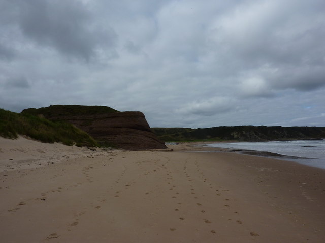
Long Man is a prominent coastal feature located in Banffshire, Scotland. It is a headland, also known as a point, that juts out into the North Sea. This geological formation is situated along the northeastern coast of Scotland, approximately 10 kilometers east of the town of Banff.

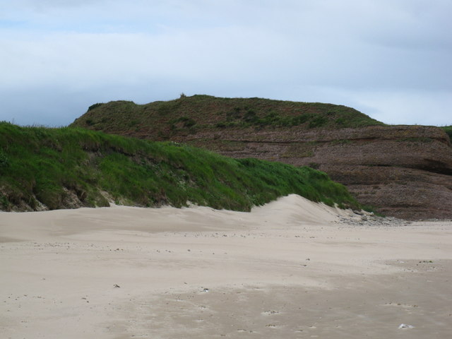
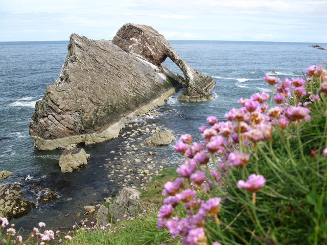
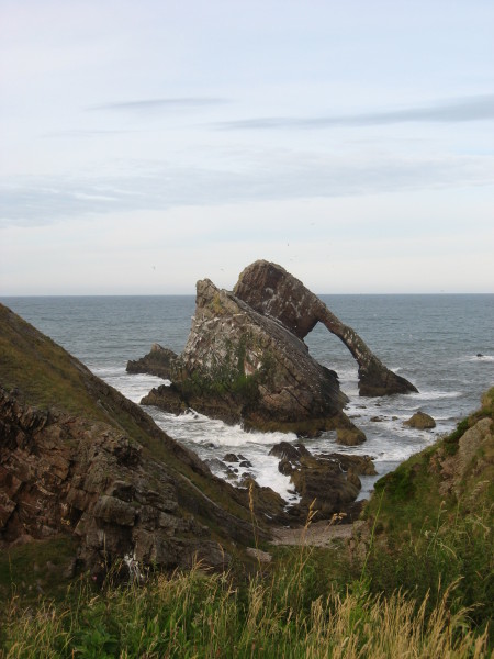
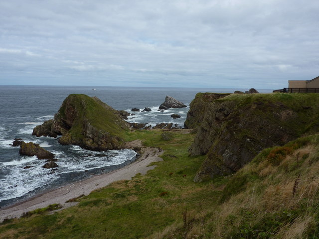
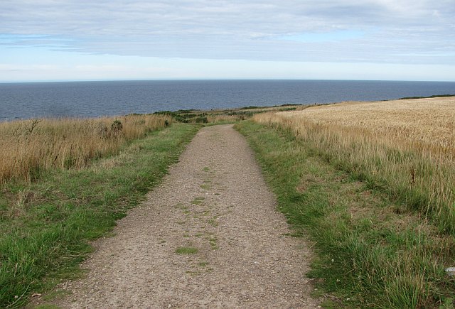
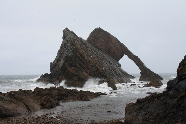
The Long Man headland is characterized by its rugged cliffs, which rise steeply from the sea and tower over the surrounding landscape. These cliffs are primarily composed of sandstone, giving them a distinctive reddish-brown coloration. The sheer height of the cliffs offers breathtaking panoramic views of the North Sea and the surrounding coastline.

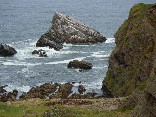
The headland is also home to a variety of wildlife, including seabirds such as puffins, gannets, and fulmars, which nest on the cliffs during the breeding season. The surrounding waters are known to be rich in marine life, with seals and dolphins often spotted in the area.

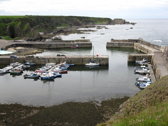
Long Man is a popular destination for nature enthusiasts and outdoor enthusiasts alike. Its dramatic scenery and picturesque views attract visitors who enjoy hiking along the coastal trails, birdwatching, and photography. The headland is also a favorite spot for fishing, with anglers taking advantage of the abundant marine life in the area.

Overall, Long Man in Banffshire is a remarkable coastal feature that showcases Scotland's natural beauty. Its towering cliffs, diverse wildlife, and stunning views make it a must-visit destination for anyone exploring the northeastern coast of Scotland.

If you have any feedback on the listing, please let us know in the comments section below.

Long Man Images

Images are sourced within 2km of 57.703841/-2.8690203 or Grid Reference NJ4868. Thanks to Geograph Open Source API. All images are credited.

Rock outcrop This outcrop is partly in Cullen Links and partly on the Cullen Sands.
Rock outcrop
This outcrop is partly in Cullen Links and partly on the Cullen Sands.
Bow Fiddle Rock Famous rock feature at Portknockie.
Bow Fiddle Rock
Famous rock feature at Portknockie.
Portknockie Harbour
Portknockie Harbour
Bow Fiddle Rock
Bow Fiddle Rock
Reddish rock outcrop in Cullen Bay
Coast at Portknockie Triangular rock in the middle is Shitten Craig. The cat sitting on the fence in <a href="https://www.geograph.org.uk/photo/2620784">NJ4968 : Wee cat on fence</a> has cleared off.
Coast at Portknockie
Triangular rock in the middle is Shitten Craig. The cat sitting on the fence in NJ4968 : Wee cat on fence has cleared off.
Wee cat on fence By a chapel on the coast at Portknockie.
Wee cat on fence
By a chapel on the coast at Portknockie.
Cormorants and gulls on Shitten Craig Rocky coastline at Portknockie, Moray Firth.
Cormorants and gulls on Shitten Craig
Rocky coastline at Portknockie, Moray Firth.
Fishing boat leaving Portknockie harbour A few boats out at sea; the hills of Cromarty in the distance.
Fishing boat leaving Portknockie harbour
A few boats out at sea; the hills of Cromarty in the distance.
Youth Centre, Portknockie
New house, Church Street, Portknockie
Moray Coast Railway A cutting behind Cullen Links. The trackbed is now a path.
Moray Coast Railway
A cutting behind Cullen Links. The trackbed is now a path.
Moray Coast Railway The start of a section of trackbed which has been turned into a path to Cullen.
Moray Coast Railway
The start of a section of trackbed which has been turned into a path to Cullen.
Portknockie Harbour Fishing off the harbour wall at Portknockie.
Portknockie Harbour
Fishing off the harbour wall at Portknockie.
Coast path, Banffshire Well surfaced but not tarred section of the cycle route. It runs through a barley field by Tronach Head. A line on the horizon may be the haar, out at sea but ready to return.
Coast path, Banffshire
Well surfaced but not tarred section of the cycle route. It runs through a barley field by Tronach Head. A line on the horizon may be the haar, out at sea but ready to return.
Sandy Creek, Findochty A view from the cycle path.
Sandy Creek, Findochty
A view from the cycle path.
Bow Fiddle Rock Bow Fiddle Rock is a classic example of a sea stack with a dramatic natural arch. It is named after its unusual shape which is supposed to resemble a violin bow, and it is the most visited tourist attraction in the village of Portknockie.
Bow Fiddle Rock
Bow Fiddle Rock is a classic example of a sea stack with a dramatic natural arch. It is named after its unusual shape which is supposed to resemble a violin bow, and it is the most visited tourist attraction in the village of Portknockie.
Triangulation Pillar S7179 at Portknockie
Show me another place!

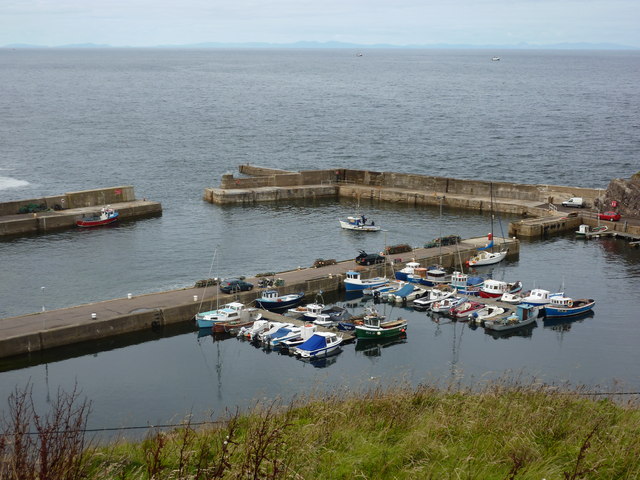
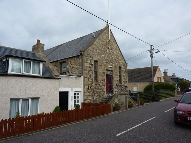
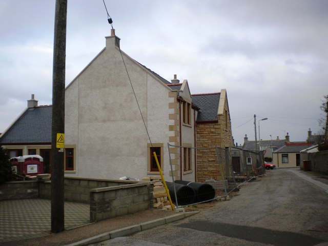
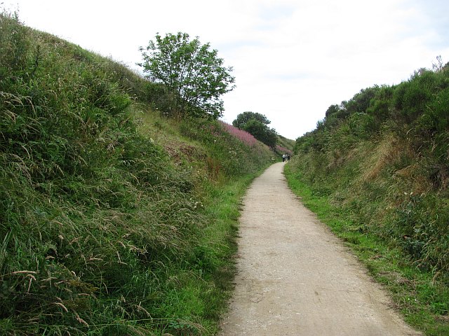
Long Man is located at Grid Ref: NJ4868 (Lat: 57.703841, Lng: -2.8690203)

Unitary Authority: Moray

Police Authority: North East

What 3 Words

///ears.defrost.tarred. Near Portknockie, Moray

Related Wikis

Portknockie railway station

Portknockie railway station was a railway station that served the small fishing village of Portknockie, close to Cullen in Moray. The railway station was...
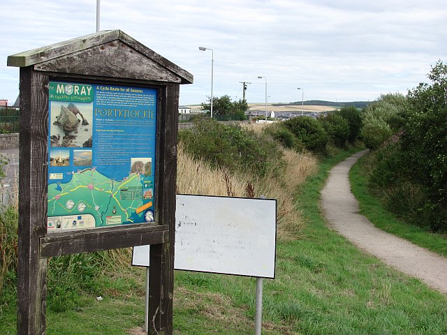
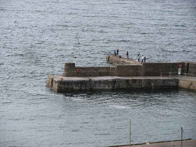
Portknockie

Portknockie (Scottish Gaelic: Port Chnocaidh, the hilly port) is a coastal village on the Moray Firth within Moray, Scotland. The village's name is written...

Tronach Castle

Tronach Castle was a castle, about 0.5 miles (0.80 km) east of Portknockie, Moray, Scotland, near the shore. == Description == The first Statistical Account...

Green Castle, Portknockie

Green Castle is a naturally defended rocky outcrop in the village of Portknockie in Moray, Scotland, that was occupied successively by small promontory...

Nearby Amenities

Located within 500m of 57.703841,-2.8690203
Source: PGS
Lat/Long: 57.7051631/-2.8750932
Source: PGS
Lat/Long: 57.7052071/-2.8753041
Created By: almien_coastlines
Source: PGS
Lat/Long: 57.70509/-2.875831
Created By: almien_coastlines
Source: PGS
Lat/Long: 57.705091/-2.876309
Created By: almien_coastlines
Source: PGS
Lat/Long: 57.705091/-2.876787
Post Box
Collection Times: Mo-Fr 09:00; Sa 07:00
Operator: Royal Mail
Post Box Mounting: pole
Post Box Type: lamp
Ref: AB56 97D
Royal Cypher: scottish_crown
Lat/Long: 57.702943/-2.8636862
Portknockie
Historic Railway: station
Wikidata: Q20712955
Wikipedia: en:Portknockie railway station
Lat/Long: 57.7018339/-2.8642428
Bus Stop
Station Court
Bus: yes
Naptan AtcoCode: 638050771
Naptan Bearing: NE
Naptan CommonName: Station Court
Naptan Indicator: opp
Naptan NaptanCode: 67924653
Naptan Street: A942
Naptan Verified: no
Public Transport: platform
Lat/Long: 57.7019676/-2.8651664
Bench
Lat/Long: 57.7040033/-2.8624509
Bench
Lat/Long: 57.7040043/-2.8625297
Bench
Lat/Long: 57.7040062/-2.8626085
Bench
Lat/Long: 57.7040186/-2.8626926
Bench
Lat/Long: 57.7040196/-2.8628216
Power: pole
Lat/Long: 57.7007084/-2.8644265
The data included in this document is from www.openstreetmap.org. The data is made available under ODbL.

Have you been to Long Man?

Leave your review of Long Man below (or comments, questions and feedback).