Bean

Settlement in Kent Dartford

England

Bean

Closed pub, Green Street Green, near Dartford The Ship pub in the hamlet of Green Street Green, near Dartford in Kent.  The pub had been closed for about two years when this image was taken.
Closed pub, Green Street Green, near Dartford Credit: Malc McDonald

Bean is a small village located in the county of Kent, England. Situated in the southeastern part of the country, Bean is a rural settlement that falls within the administrative district of Dartford. The village is surrounded by picturesque countryside and offers a peaceful and idyllic setting.

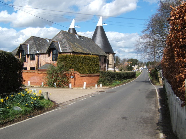
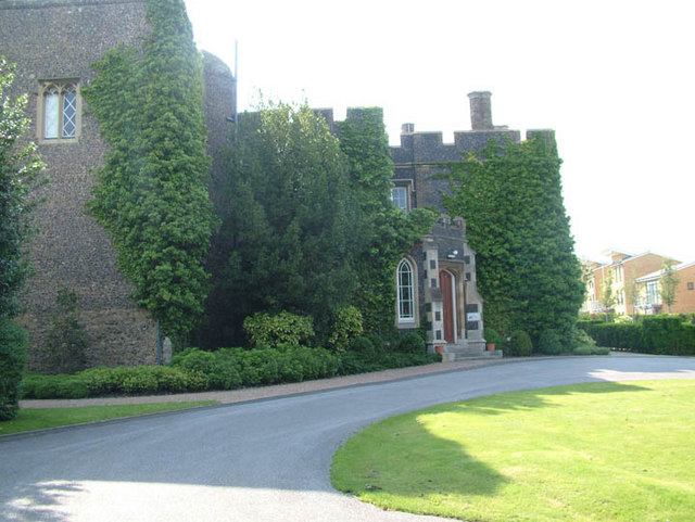
Bean has a rich history dating back to medieval times, with evidence of settlement in the area from as early as the 12th century. The village is characterized by its traditional architecture, with many historic buildings still standing, including the Grade II listed Bean Church, dedicated to St Nicholas.

Despite its small size, Bean benefits from its proximity to nearby towns and cities. The village is just a short distance from Dartford, which offers a range of amenities and services, including shops, restaurants, and leisure facilities. Additionally, London is easily accessible from Bean, with excellent transport links via road and rail.

Bean is surrounded by beautiful countryside, making it an ideal location for nature lovers and outdoor enthusiasts. The village is close to the Darenth Country Park, which offers scenic walking trails and opportunities for bird-watching. The nearby Thames River and Bluewater Shopping Centre also provide additional recreational options.

In terms of community, Bean has a friendly and close-knit atmosphere. The village holds regular events and activities, such as the annual Bean Festival, which brings residents together and fosters a sense of community spirit.

Overall, Bean is a charming village in Kent that offers a peaceful rural lifestyle, while still providing easy access to nearby amenities and attractions.

If you have any feedback on the listing, please let us know in the comments section below.
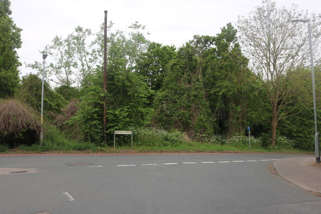
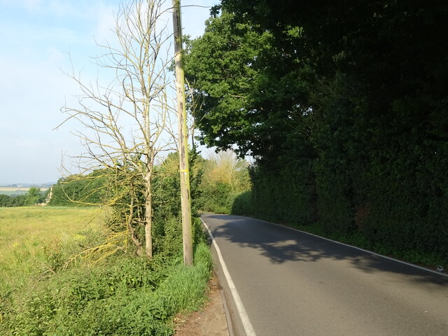
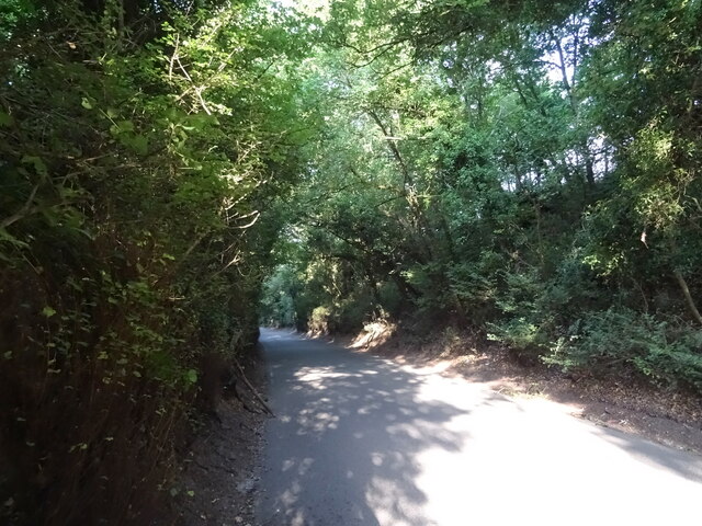
Bean Images

Images are sourced within 2km of 51.426777/0.283633 or Grid Reference TQ5872. Thanks to Geograph Open Source API. All images are credited.

Closed pub, Green Street Green, near Dartford The Ship pub in the hamlet of Green Street Green, near Dartford in Kent.  The pub had been closed for about two years when this image was taken.
Closed pub, Green Street Green, near Dartford
The Ship pub in the hamlet of Green Street Green, near Dartford in Kent. The pub had been closed for about two years when this image was taken.
Bean Village sign
Bean Village sign
Mounts Road, Greenhithe
National Cycle Route 1 Beside the A296.
National Cycle Route 1
Beside the A296.
Millennium Milepost, National Cycle Route 1 Beside the A296.
Millennium Milepost, National Cycle Route 1
Beside the A296.
National Cycle Route 1 towards Gravesend Beside the A296.
National Cycle Route 1 towards Gravesend
Beside the A296.
National Cycle Route 1 beside the A296 Towards Gravesend.
National Cycle Route 1 beside the A296
Towards Gravesend.
B255 bridge over National Cycle Route 1 Beside the A296.
B255 bridge over National Cycle Route 1
Beside the A296.
Roadworks on National Cycle Route 1 Beside the A296 - towards Gravesend.
Roadworks on National Cycle Route 1
Beside the A296 - towards Gravesend.
Woodland beside the A296
Merry Chest Cafe & Bar On Watling Street (A296).
Merry Chest Cafe & Bar
On Watling Street (A296).
Roadworks on National Cycle Route 1 Beside the A296 - towards Gravesend.
Roadworks on National Cycle Route 1
Beside the A296 - towards Gravesend.
Watling Street (A2)
Watling Street (A2)
Watling Street (A2) Looking east from a footbridge.
Watling Street (A2)
Looking east from a footbridge.
Crop field off the B262
B262 towards Green Street Green
Track off Sandbanks Hill
Sandbanks Hill (B262) Towards Green Street Green.
Sandbanks Hill (B262)
Towards Green Street Green.
Show me another place!

Bean is located at Grid Ref: TQ5872 (Lat: 51.426777, Lng: 0.283633)

Administrative County: Kent

District: Dartford

Police Authority: Kent

What 3 Words

///able.fried.ripe. Near Darenth, Kent

Nearby Locations

Bean

Related Wikis

Bean, Kent

Bean is a village and civil parish in the Borough of Dartford, Kent, England. It is located 4.4 miles south east of Dartford and 5.4 miles south west of...

Beacon Wood Country Park

Beacon Wood Country Park is a public woodland in Bean near Dartford, in Kent, England. It was previously an industrial claypit then re-claimed as woodland...

North West Kent

North West Kent is a geographical area in Kent, a county in south-east England. The term North West Kent may refer to one or both of two distinct areas...

Darenth Wood

Darenth Wood is a 122.9-hectare (304-acre) biological Site of Special Scientific Interest east of Dartford in Kent.This ancient semi-natural wood has many...

Ebbsfleet Valley

Ebbsfleet Valley is a new town and redevelopment area in Kent, South East England, and part of the Thames Gateway, southwest of Gravesend. Development...

Bluewater (shopping centre)

Bluewater Shopping Centre (commonly referred to as Bluewater) is an out-of-town shopping centre in Stone (postally Greenhithe), Kent, England, just outside...

Betsham

Betsham is a hamlet in the parish of Southfleet in Kent, England.Betsham is a mile north-west from the village of Southfleet, which is situated nearly...

Stone Castle

Stone Castle is a castle at Stone, near Bluewater in Kent, England. It was built between 1135 and 1140 on the site where William the Conqueror signed a...

Nearby Amenities

Located within 500m of 51.426777,0.283633
Crossing
Lat/Long: 51.4251056/0.2853146
Mini Roundabout
Direction: clockwise
Lat/Long: 51.4275133/0.2830195
Bean
Created By: Potlatch 0.10f
Place: village
Source: npe
Lat/Long: 51.4264576/0.2866341
Mini Roundabout
Direction: clockwise
Lat/Long: 51.4267384/0.2837695
Turning Circle
Lat/Long: 51.4266819/0.2862887
Post Box
Operator: Royal Mail
Lat/Long: 51.4257029/0.2876134
Bus Stop
Bramble Avenue
Naptan AtcoCode: 2400105109
Naptan Bearing: NW
Naptan CommonName: Bramble Avenue
Naptan Indicator: opp
Naptan Landmark: Bramble Avenue
Naptan NaptanCode: kntjpwad
Naptan Street: Beacon Drive
Public Transport: platform
Ref: kntjpwad
Source: NAPTAN
Source Date: 2012-04-16T09:24:00
Lat/Long: 51.4280624/0.2861564
Bus Stop
Bramble Avenue
Naptan AtcoCode: 2400105107
Naptan Bearing: SE
Naptan CommonName: Bramble Avenue
Naptan Indicator: adj
Naptan Landmark: Bramble Avenue
Naptan NaptanCode: kntjptwt
Naptan Street: Beacon Drive
Public Transport: platform
Ref: kntjptwt
Source: NAPTAN
Source Date: 2012-04-16T09:21:00
Lat/Long: 51.4281674/0.2863054
Bus Stop
Public Transport: platform
Lat/Long: 51.4275699/0.2832918
Post Box
Brand: Royal Mail
Brand Wikidata: Q638098
Operator: Royal Mail
Operator Wikidata: Q638098
Post Box Mounting: pier
Post Box Type: lamp
Lat/Long: 51.4275219/0.2832449
Bus Stop
Hope Cottages
Naptan AtcoCode: 2400A019940A
Naptan Bearing: S
Naptan CommonName: Hope Cottages
Naptan Indicator: opp
Naptan Landmark: A2
Naptan NaptanCode: kntawagp
Naptan Street: Bean Road
Naptan Verified: no
Public Transport: platform
Ref: kntawagp
Source: naptan_import
Source Date: 2011-03-07T09:56:00
Lat/Long: 51.428735/0.2825646
Bus Stop
The Black Horse
Naptan AtcoCode: 2400A019950A
Naptan Bearing: SE
Naptan CommonName: The Black Horse
Naptan Indicator: opp
Naptan Landmark: The Black Horse
Naptan NaptanCode: kntawagt
Naptan Street: High Street
Naptan Verified: no
Public Transport: platform
Ref: kntawagt
Source: naptan_import
Source Date: 2018-08-20T12:27:00
Lat/Long: 51.4257239/0.2847881
Bus Stop
Foxwood Road
Naptan AtcoCode: 2400A019960A
Naptan Bearing: SW
Naptan CommonName: Foxwood Road
Naptan Indicator: adj
Naptan Landmark: Bean Lane
Naptan NaptanCode: kntawagw
Naptan Street: Beacon Drive
Naptan Verified: no
Public Transport: platform
Ref: kntawagw
Source: naptan_import
Source Date: 2018-08-20T12:22:00
Lat/Long: 51.4276491/0.2835487
Bus Stop
Hope Cottages
Naptan AtcoCode: 2400A019970A
Naptan Bearing: N
Naptan CommonName: Hope Cottages
Naptan Indicator: adj
Naptan Landmark: A2
Naptan NaptanCode: kntawaja
Naptan Street: Bean Lane
Naptan Verified: no
Public Transport: platform
Ref: kntawaja
Source: naptan_import
Source Date: 2018-08-20T12:26:00
Lat/Long: 51.4289806/0.2824186
Post Office
Bean Post Office
Addr Postcode: DA2 8BS
Branch: Bean
Brand: Post Office
Brand Wikidata: Q1783168
Check Date: 2020-02-20
Contact Website: https://www.postoffice.co.uk/branch-finder/0540145/bean
Ref Pol Id: 18024
Lat/Long: 51.4250393/0.2858225
Power: tower
Lat/Long: 51.4306717/0.2809081
Power: tower
Lat/Long: 51.4303944/0.2870192
Power: tower
Lat/Long: 51.4304075/0.2843317
Power: tower
Lat/Long: 51.4300887/0.287038
Pub
Black Horse
Addr Postcode: DA2 8AS
Addr Street: High Street
Contact Phone: +44 1474 709379
Website: https://www.theblackhorsebean.com/
Lat/Long: 51.4254789/0.2846808
Bench
Lat/Long: 51.4227753/0.2861067
Leisure: picnic_table
Lat/Long: 51.4229746/0.2808043
Leisure: picnic_table
Lat/Long: 51.4234467/0.2866353
Bench
Backrest: no
Seats: 3
Lat/Long: 51.4227927/0.2856055
Bench
Backrest: no
Seats: 3
Lat/Long: 51.4227763/0.2856296
Barrier: stile
Material: wood
Lat/Long: 51.4233525/0.2802832
Barrier: stile
Material: wood
Lat/Long: 51.4235087/0.2802238
Bramble Avenue
Bus: yes
Public Transport: stop_position
Lat/Long: 51.4281065/0.2862801
Foxwood Road
Bus: yes
Public Transport: stop_position
Lat/Long: 51.4276788/0.2835028
Foxwood Road
Bus: yes
Public Transport: stop_position
Lat/Long: 51.4277538/0.2836858
Bus Stop
Foxwood Road
Naptan AtcoCode: 2400104436
Naptan Bearing: NE
Naptan CommonName: Foxwood Road
Naptan Indicator: opp
Naptan Landmark: Foxwood Road
Naptan NaptanCode: kntjpdjm
Naptan Street: Beacon Drive
Naptan Verified: no
Public Transport: platform
Ref: kntjpdjm
Source: NAPTAN
Source Date: 2018-08-20T12:24:00
Lat/Long: 51.4278065/0.2835973
Hope Cottages
Bus: yes
Public Transport: stop_position
Lat/Long: 51.4289742/0.2825568
Hope Cottages
Bus: yes
Public Transport: stop_position
Lat/Long: 51.4287403/0.2825164
Crossing
Lat/Long: 51.4274248/0.2830528
Crossing
Lat/Long: 51.4255398/0.2848762
Post Box
Brand: Royal Mail
Brand Wikidata: Q638098
Mapillary: 3323488147916862
Operator: Royal Mail
Operator Wikidata: Q638098
Post Box Type: pillar
Survey Date: 2023-05-07
Lat/Long: 51.4249618/0.2856595
Defibrillator
Defibrillator Location: On post outside Bean Post Office on Southfleet Road, next to post box
Emergency: defibrillator
Indoor: no
Mapillary: 3323488147916862
Survey Date: 2023-05-07
Lat/Long: 51.4249679/0.2857197
The data included in this document is from www.openstreetmap.org. The data is made available under ODbL.

Have you been to Bean?

Leave your review of Bean below (or comments, questions and feedback).