Kaiser Clett

Coastal Feature, Headland, Point in Orkney

Scotland

Kaiser Clett

The Gatehouse Bar Fantastic end to a great day. Having visited the local school with my family for a fund-raising event, they then returned to Kirkwall. I was left to cycle around Shapinsay Geographing on a gorgeous November day. Then, to cap it all, my wait for the ferry could be spent in the bar!
The Gatehouse Bar Credit: Ian Balcombe

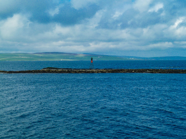
Kaiser Clett is a prominent coastal feature located in Orkney, a group of islands situated off the northeastern coast of Scotland. It is classified as a headland or a point due to its distinct and elevated geographical formation that extends into the sea. Kaiser Clett is positioned on the mainland of Orkney, specifically in the parish of Birsay.

This coastal feature stands out due to its rugged and rocky terrain, which is characteristic of the Orkney coastline. The headland is composed of ancient sandstone cliffs that have been shaped by the relentless force of the North Atlantic Ocean. These cliffs rise steeply from the sea, creating an impressive and imposing sight.

Kaiser Clett offers breathtaking views of the surrounding coastline and the vast ocean beyond. It is a popular spot for nature enthusiasts, hikers, and photographers who are drawn to its dramatic landscape and unspoiled beauty. In addition, the headland serves as a habitat for various bird species, including fulmars and kittiwakes, making it an ideal location for birdwatching.

Due to its exposed location, Kaiser Clett experiences the full force of the Atlantic weather, with strong winds and crashing waves being common occurrences. This, combined with its striking appearance, adds to its allure and appeal.

Overall, Kaiser Clett is a notable coastal feature in Orkney, known for its rugged cliffs, stunning views, and abundant wildlife. It stands as a testament to the raw and untouched beauty of the Orkney coastline.

If you have any feedback on the listing, please let us know in the comments section below.

Kaiser Clett Images

Images are sourced within 2km of 59.040686/-2.929193 or Grid Reference HY4617. Thanks to Geograph Open Source API. All images are credited.

The Gatehouse Bar Fantastic end to a great day. Having visited the local school with my family for a fund-raising event, they then returned to Kirkwall. I was left to cycle around Shapinsay Geographing on a gorgeous November day. Then, to cap it all, my wait for the ferry could be spent in the bar!
The Gatehouse Bar
Fantastic end to a great day. Having visited the local school with my family for a fund-raising event, they then returned to Kirkwall. I was left to cycle around Shapinsay Geographing on a gorgeous November day. Then, to cap it all, my wait for the ferry could be spent in the bar!
Ordnance Survey Gate keepers at the bar.
Ordnance Survey
Gate keepers at the bar.
Gallic Gun Ruelle was a French make of artillery. This piece was cast in 1810.
Gallic Gun
Ruelle was a French make of artillery. This piece was cast in 1810.
The Gatehouse Bar Ambition fulfilled: a pint in The Gatehouse. Currently the only place to buy a pint on the island.
The Gatehouse Bar
Ambition fulfilled: a pint in The Gatehouse. Currently the only place to buy a pint on the island.
Looking across Vasa loch
Traditional hay stooking method
Skerry of Vasa A small ferry by the small Skerry of Vasa
Skerry of Vasa
A small ferry by the small Skerry of Vasa
Balfour Castle Balfour Castle on Shapinsay
Balfour Castle
Balfour Castle on Shapinsay
Old Smithy The old Smithy on Shapinsay
Old Smithy
The old Smithy on Shapinsay
Gate posts Some old gate posts from a side entrance to the Balfour Castle
Gate posts
Some old gate posts from a side entrance to the Balfour Castle
Pheasants A brace of pheasants shot with only a camera
Pheasants
A brace of pheasants shot with only a camera
Window out of the garden A window allowing a view out of the walled garden by the side of Balfour Castle
Window out of the garden
A window allowing a view out of the walled garden by the side of Balfour Castle
Passing by Strombery View to Strombery Head with Hellier Holm and Saeva Ness lighthouse on the horizon to the right of picture.
Passing by Strombery
View to Strombery Head with Hellier Holm and Saeva Ness lighthouse on the horizon to the right of picture.
Passing Back of the Ness Looking east from the ferry to Westray.
Passing Back of the Ness
Looking east from the ferry to Westray.
Furrow of Agricola View east from the ferry to coastal grasslands.
Furrow of Agricola
View east from the ferry to coastal grasslands.
Skerry of Vasa Looking west to mainland Orkney.
Skerry of Vasa
Looking west to mainland Orkney.
Furrowend View to the farm from the ferry to Westray.
Furrowend
View to the farm from the ferry to Westray.
Vasa Loch Passing by the loch on the west coast of Shapinsay, seen from Vasa Point.
Vasa Loch
Passing by the loch on the west coast of Shapinsay, seen from Vasa Point.
Show me another place!

Kaiser Clett is located at Grid Ref: HY4617 (Lat: 59.040686, Lng: -2.929193)

Unitary Authority: Orkney Islands

Police Authority: Highlands and Islands

What 3 Words

///snapper.cheeses.radically. Near Balfour, Orkney Islands

Related Wikis

Vasa Loch

Vasa Loch is a brackish lagoon in southwestern Shapinsay, Orkney Islands. (Ordnance, 2002) This water body has been shown on early maps of the island...

Balfour Castle

Balfour Castle is a historic building on the southwest of Shapinsay, Orkney Islands. Though built around an older structure that dates at least from the...

Balfour, Orkney

Balfour is a village on the island of Shapinsay, Orkney. The village is situated on Elwick Bay, which was used as an anchorage by Haakon IV of Norway before...

Mill Dam

Mill Dam is a wetland in western Shapinsay, in Orkney, Scotland. This water body was not shown on the 1840 survey map of the island, since it is a man...

Have you been to Kaiser Clett?

Leave your review of Kaiser Clett below (or comments, questions and feedback).