Maes Taing

Coastal Feature, Headland, Point in Orkney

Scotland

Maes Taing

Seal Skerry A small lighthouse on the Seal Skerry - but no seals!
Seal Skerry Credit: Graeme Smith

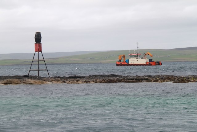
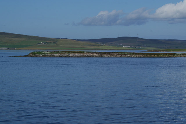
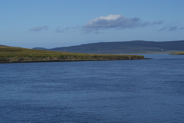
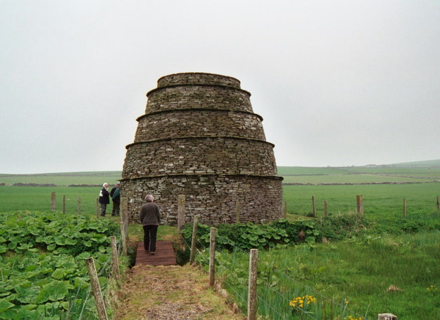
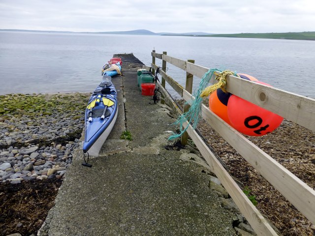
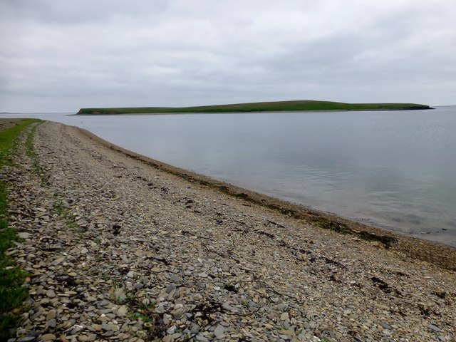
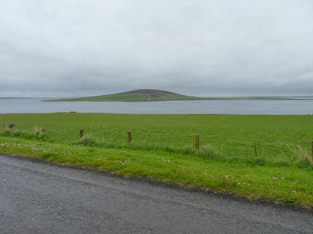
Maes Taing is a prominent coastal feature located on the west coast of the Orkney Islands in Scotland. It is a headland that juts out into the Atlantic Ocean, forming a distinctive point that offers breathtaking views of the surrounding landscape.

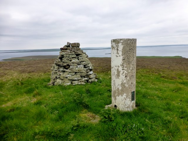
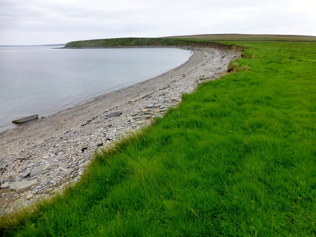
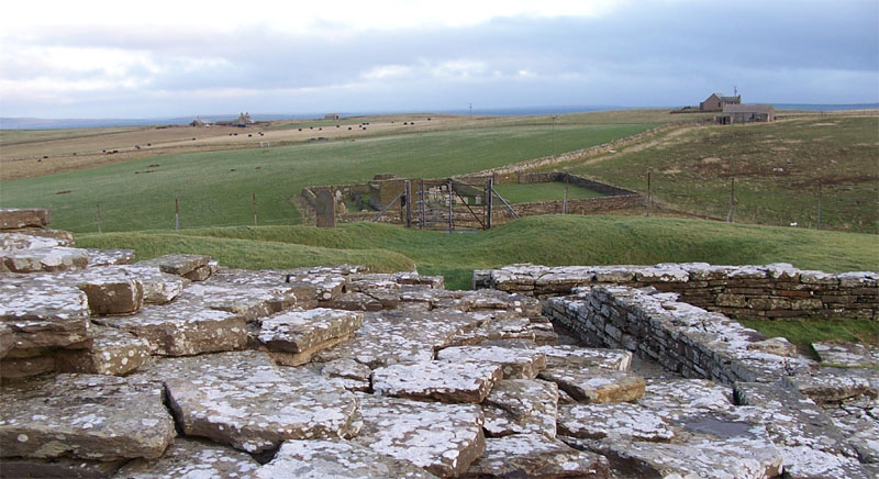
The name "Maes Taing" is derived from the Old Norse language, meaning "field of the isthmus." This is fitting, as the headland is formed by a narrow strip of land that connects to the main Orkney mainland. The area is characterized by rugged cliffs, with the highest point reaching approximately 50 meters above sea level.

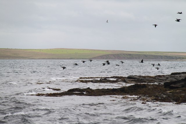
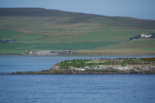
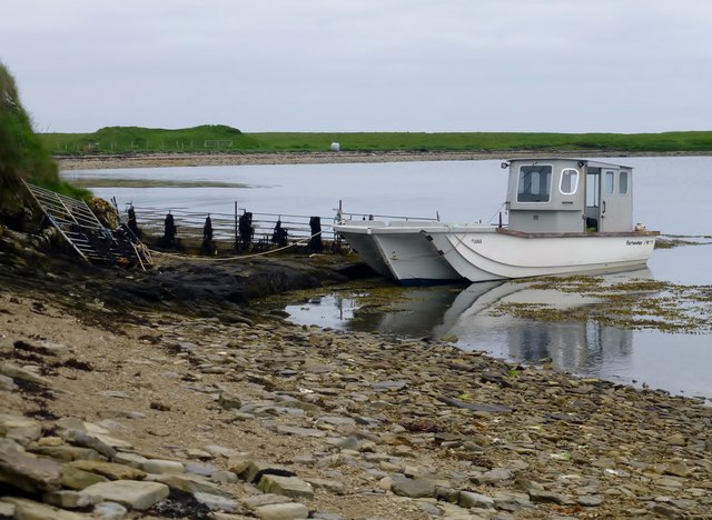
The headland is a haven for wildlife, with numerous seabirds including puffins, guillemots, and razorbills nesting along the cliffs. Visitors to Maes Taing can often spot seals basking on the rocks or swimming in the surrounding waters.

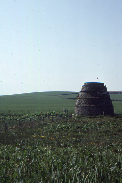
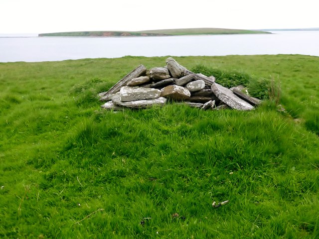
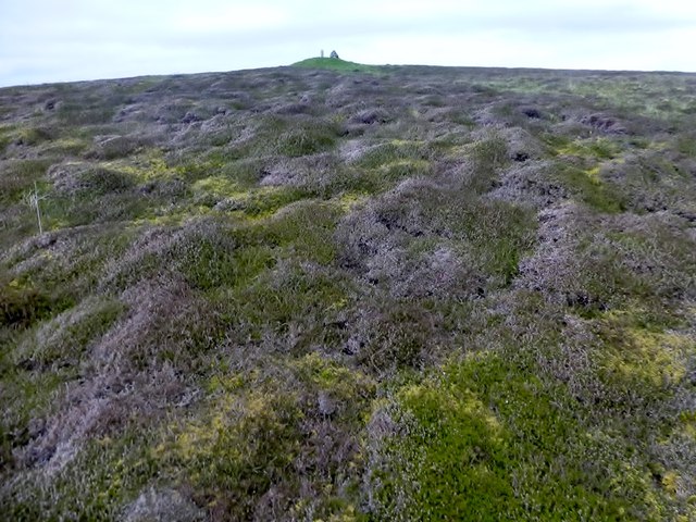
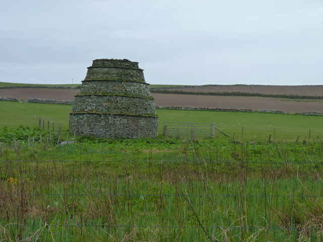
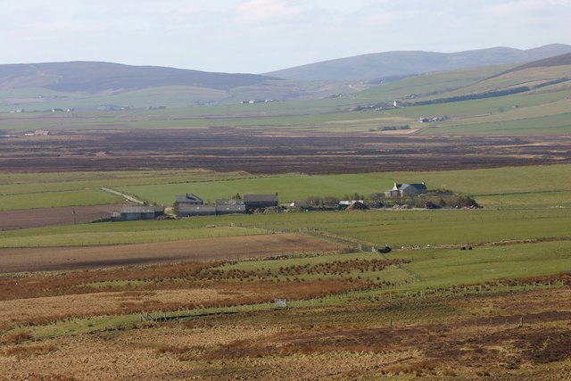
The landscape surrounding Maes Taing is a mix of grassy fields, heather-covered moorland, and rocky outcrops. This diverse habitat supports a variety of plant species, including sea pinks, thrift, and wild orchids.

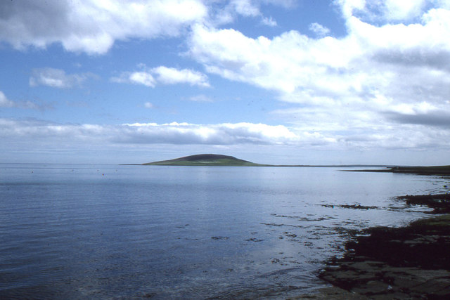
Access to Maes Taing is relatively easy, with a well-maintained footpath leading to the headland. The location is a popular spot for hiking and photography, as it provides stunning panoramic views of the coastline, the Atlantic Ocean, and the nearby islands of Hoy and Graemsay.

Overall, Maes Taing is a remarkable coastal feature that offers a unique blend of natural beauty and wildlife, making it a must-visit destination for nature enthusiasts and outdoor adventurers.

If you have any feedback on the listing, please let us know in the comments section below.

Maes Taing Images

Images are sourced within 2km of 59.076464/-2.9771221 or Grid Reference HY4421. Thanks to Geograph Open Source API. All images are credited.

Seal Skerry A small lighthouse on the Seal Skerry - but no seals!
Seal Skerry
A small lighthouse on the Seal Skerry - but no seals!
Holm of Rendall The eastern edge of the Holm of Rendall
Holm of Rendall
The eastern edge of the Holm of Rendall
View of Gairsay, from the ferry terminal at Tingwall
Rendall Doocot, Hall of Rendall, Mainland This dovecot is the only such one on Orkney, although dovecots are relatively common at medieval or early modern sites, as a way of keeping a supply of protein on site.  The ridged sides apparently are to make it difficult for rats to scale the dovecot.
Rendall Doocot, Hall of Rendall, Mainland
This dovecot is the only such one on Orkney, although dovecots are relatively common at medieval or early modern sites, as a way of keeping a supply of protein on site. The ridged sides apparently are to make it difficult for rats to scale the dovecot.
Holm of Boray As seen from the ferry to the Northern Isles. West Mainland stands behind.
Holm of Boray
As seen from the ferry to the Northern Isles. West Mainland stands behind.
Closer view of the Holm of Boray The southern end of the island showing the colony of cormorants.
Closer view of the Holm of Boray
The southern end of the island showing the colony of cormorants.
Hen of Gairsay As seen from the ferry to Westray, with Rousay standing behind.
Hen of Gairsay
As seen from the ferry to Westray, with Rousay standing behind.
Rendall doocot
Rendall doocot
Rendall doocot 17th Century beehive-type dovecote, 10 ft in diameter at the top, 18 ft high.
Rendall doocot
17th Century beehive-type dovecote, 10 ft in diameter at the top, 18 ft high.
North Head, Gairsay North Head, Gairsay with a view towards Sweyn Holm.
North Head, Gairsay
North Head, Gairsay with a view towards Sweyn Holm.
Ward of Gairsay Bagged this island on an Alan Holmes boat trip as a group of twelve via Harvey's boat the Charles Ann from Tingwall.
Name: Ward of Gairsay
Hill number: 4930
Height: 102m / 335ft
Parent (Ma/M): none
Area: 23: Orkney Islands
Class: Hu,1
Grid ref: HY441223 (est)
Drop: 102m
Col: Sea
Ward of Gairsay
Bagged this island on an Alan Holmes boat trip as a group of twelve via Harvey's boat the Charles Ann from Tingwall. Name: Ward of Gairsay Hill number: 4930 Height: 102m / 335ft Parent (Ma/M): none Area: 23: Orkney Islands Class: Hu,1 Grid ref: HY441223 (est) Drop: 102m Col: Sea
View Towards Ward of Gairsay A taste of the moorland on the island of Gairsay as I head towards its summit.
View Towards Ward of Gairsay
A taste of the moorland on the island of Gairsay as I head towards its summit.
Jetty At Gairsay Gairsay (Old Norse: Gáreksey) is a small island in Orkney, Scotland, located in the parish of Rendall, 1.5 miles (2.4 km) off the coast, astride one of the approaches to the bays of Firth and Kirkwall. It is about 2 miles (3.2 km) long and 1 mile (1.6 km) wide and includes one conical hill and a small harbour called Millburn Bay, which is sheltered by the peninsula known as the Hen of Gairsay.
Jetty At Gairsay
Gairsay (Old Norse: Gáreksey) is a small island in Orkney, Scotland, located in the parish of Rendall, 1.5 miles (2.4 km) off the coast, astride one of the approaches to the bays of Firth and Kirkwall. It is about 2 miles (3.2 km) long and 1 mile (1.6 km) wide and includes one conical hill and a small harbour called Millburn Bay, which is sheltered by the peninsula known as the Hen of Gairsay.
Gravel Beach A view along the gravel beach on Gairsay towards Sweyn Holm.
Gravel Beach
A view along the gravel beach on Gairsay towards Sweyn Holm.
Hen of Gairsay A view along the northern edge of the Hen of Gairsay with its gravel beach.
Hen of Gairsay
A view along the northern edge of the Hen of Gairsay with its gravel beach.
Jetty At Millburn Bay, Gairsay
Doocot at Hall of Rendall
Coastal fields With Gairsay island in the distance.
Coastal fields
With Gairsay island in the distance.
Show me another place!

Maes Taing is located at Grid Ref: HY4421 (Lat: 59.076464, Lng: -2.9771221)

Unitary Authority: Orkney Islands

Police Authority: Highlands and Islands

What 3 Words

///taster.scam.fruitcake. Near Rendall, Orkney Islands

Related Wikis

Gairsay

Gairsay (Old Norse: Gáreksey) is a small island in Orkney, Scotland, located in the parish of Rendall, 1.5 miles (2.4 km) off the coast, astride one of...

Sweyn Holm

Note: There is also a "Sweyn Holm" off St Ninian's Isle, Shetland Sweyn Holm is a small island in the Orkney Islands, next to Gairsay. It is thought to...

Vasa Loch

Vasa Loch is a brackish lagoon in southwestern Shapinsay, Orkney Islands. (Ordnance, 2002) This water body has been shown on early maps of the island...

Wyre, Orkney

Wyre (historically known as Viera and Veira) is one of the Orkney Islands, lying south-east of Rousay. It is 311 hectares (1.20 sq mi) and 32 metres (105...

Rendall

Rendall (Old Norse: Rennudalr or Rennadal) is a parish on Mainland, Orkney, Scotland. It is in the north west of the island and lies east of the parishes...

St. Mary's Chapel, Wyre

St. Mary's Chapel is a ruined 12th century chapel found on the island of Wyre, in Orkney, Scotland. It is thought to have been built by a Norse chieftain...

Cobbie Row's Castle

Cobbie Row's (or Cubbie Roo's) Castle is the oldest medieval castle known to exist in Scotland. The castle ruins are located on the island of Wyre in Orkney...

Mill Dam

Mill Dam is a wetland in western Shapinsay, in Orkney, Scotland. This water body was not shown on the 1840 survey map of the island, since it is a man...

Nearby Amenities

Located within 500m of 59.076464,-2.9771221
Created By: almien_coastlines mod
Lat/Long: 59.072556/-2.972837
Created By: almien_coastlines mod
Lat/Long: 59.076012/-2.974575
The data included in this document is from www.openstreetmap.org. The data is made available under ODbL.

Have you been to Maes Taing?

Leave your review of Maes Taing below (or comments, questions and feedback).