Sand Taing

Coastal Feature, Headland, Point in Orkney

Scotland

Sand Taing

Scapa Flow Seen from Olaf summit viewpoint on the A961.
Scapa Flow Credit: Graeme Yuill

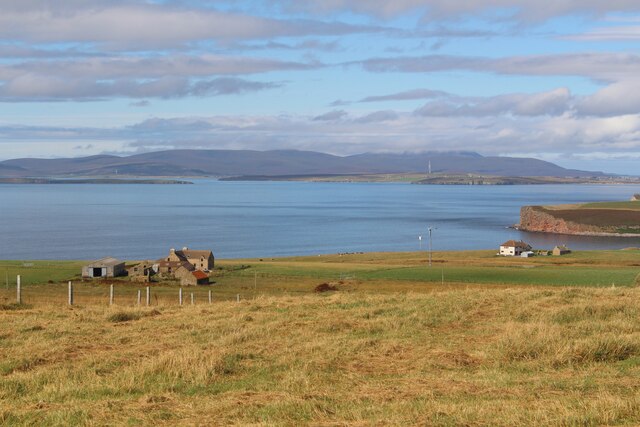
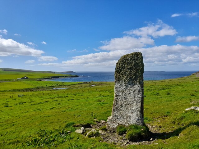
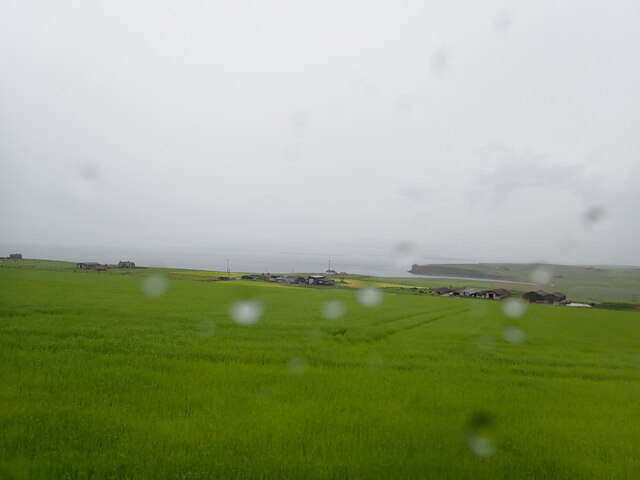
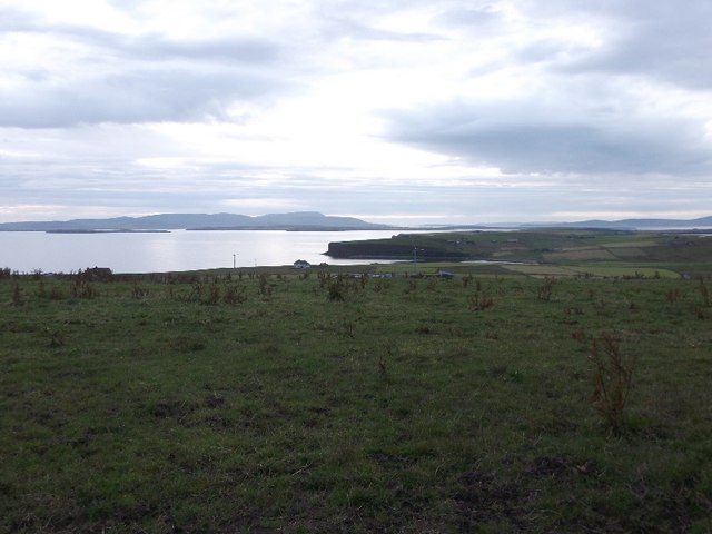
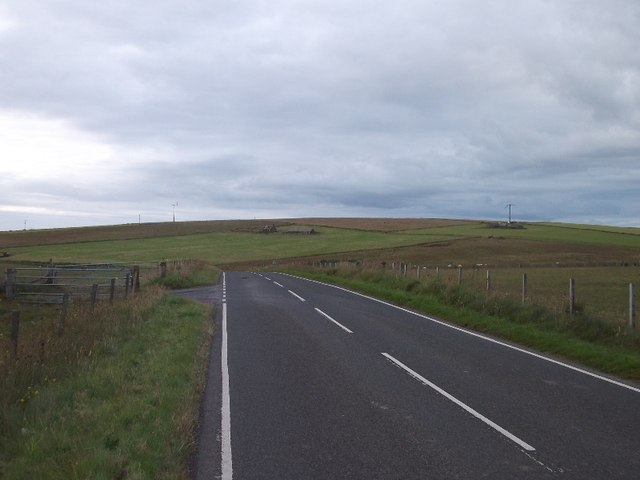
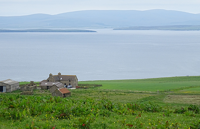
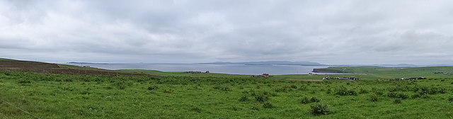
Sand Taing is a prominent coastal feature located on the mainland of Orkney, an archipelago in northern Scotland. It is a headland that extends out into the North Sea, forming a distinctive point along the coastline. Situated near the village of Birsay, Sand Taing stands as a notable geographical landmark in the region.

The headland is characterized by its rugged and rocky terrain, with steep cliffs that tower above the surrounding sea. These cliffs are composed of layers of sedimentary rock, showcasing the geological history of the area. The exposed rocks provide a glimpse into the ancient past, with fossilized remains often found embedded within them.

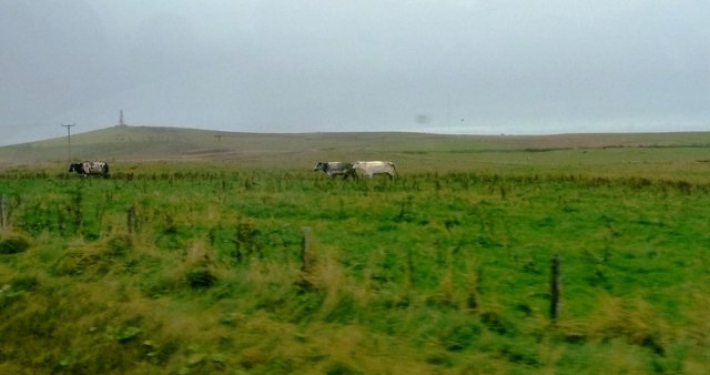
Sand Taing offers breathtaking views of the surrounding coastal landscape. From its vantage point, visitors can witness the crashing waves of the North Sea against the cliffs, creating a dramatic spectacle. The headland is also a popular spot for birdwatching, as it provides an ideal habitat for various seabird species, including fulmars, razorbills, and kittiwakes.

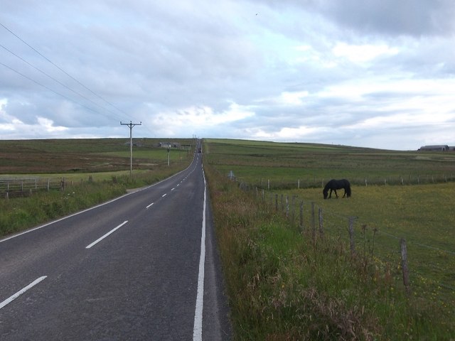
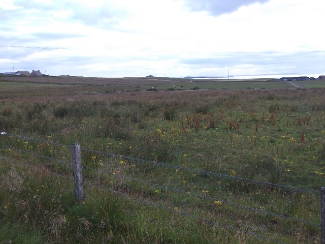
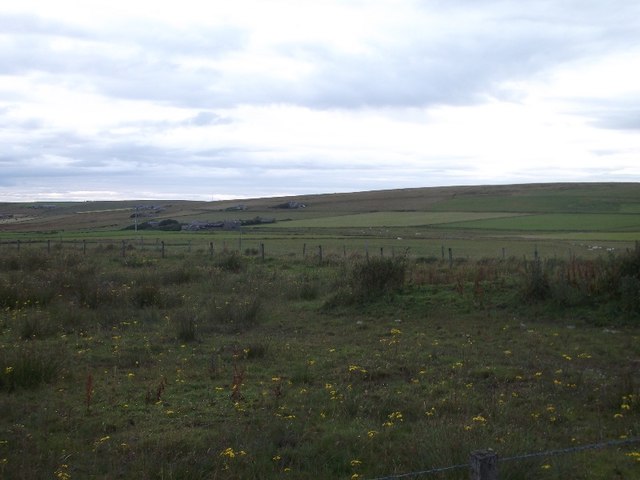
Access to Sand Taing is relatively straightforward, with a footpath leading from Birsay village to the headland. The walk offers a chance to explore the diverse flora and fauna that thrive in this coastal environment. It is advisable to exercise caution when navigating the headland, as the cliffs can be unstable and slippery, particularly during wet weather.

Sand Taing is not only a natural wonder but also a place of historical significance. In close proximity to the headland, the ruins of the Norse-era Birsay Palace can be found, adding to the cultural richness of the area. With its striking beauty and intriguing history, Sand Taing is a must-visit destination for nature enthusiasts and history buffs alike.

If you have any feedback on the listing, please let us know in the comments section below.
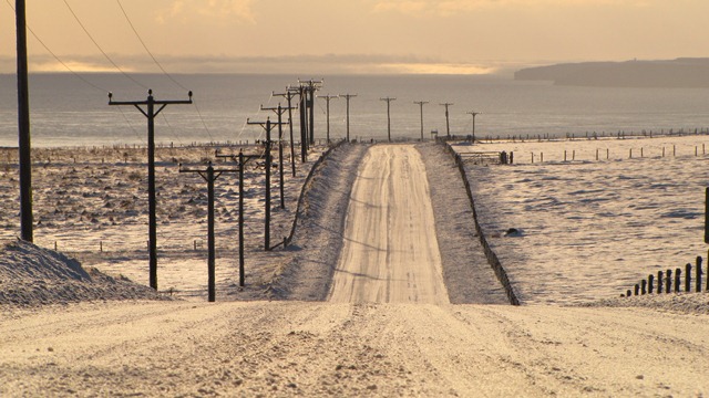
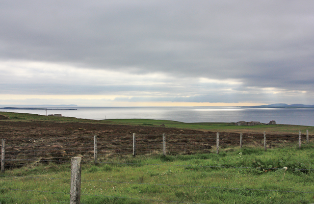
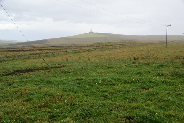
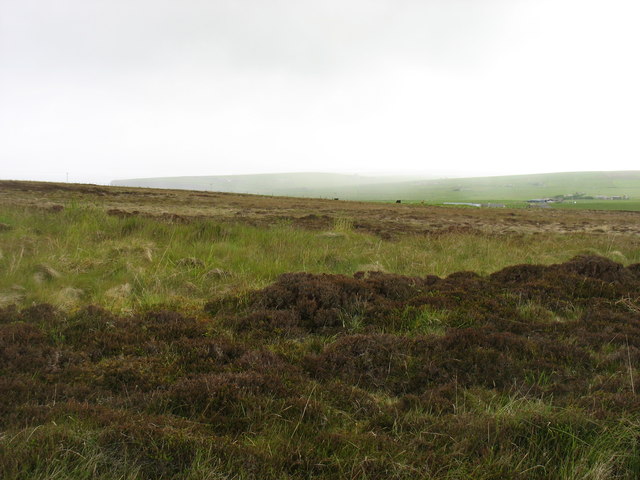
Sand Taing Images

Images are sourced within 2km of 58.784818/-2.9811782 or Grid Reference ND4388. Thanks to Geograph Open Source API. All images are credited.

Scapa Flow Seen from Olaf summit viewpoint on the A961.
Scapa Flow
Seen from Olaf summit viewpoint on the A961.
Cloddyhall Standing Stone A standing stone on South Ronaldsay measuring 8'6" in height.
Cloddyhall Standing Stone
A standing stone on South Ronaldsay measuring 8'6" in height.
View west from the Olad summit viewpoint Marred by rain
View west from the Olad summit viewpoint
Marred by rain
View to Ward Hill With a transmitter at the top
View to Ward Hill
With a transmitter at the top
Road to somewhere
Road to somewhere
Towards Upper Serrigar Extensive views of coastal scenery are available almost everywhere on the Orkney Islands and especially on South Ronaldsay.
Towards Upper Serrigar
Extensive views of coastal scenery are available almost everywhere on the Orkney Islands and especially on South Ronaldsay.
Viewpoint on Olad Hill The headland straight ahead is The Nev. A rain shower is sweeping in from the left.
Viewpoint on Olad Hill
The headland straight ahead is The Nev. A rain shower is sweeping in from the left.
Grassland on Olad Hill Looking towards Ward Hill, with a sharp rain shower just starting. Several of the islands have a Ward Hill, signifying a good place to have a beacon.
Grassland on Olad Hill
Looking towards Ward Hill, with a sharp rain shower just starting. Several of the islands have a Ward Hill, signifying a good place to have a beacon.
Rough country below Ward Hill A view in rather dull conditions. The rain came down before I reached the car, only 500 metres away!
Rough country below Ward Hill
A view in rather dull conditions. The rain came down before I reached the car, only 500 metres away!
View from the A961 There is a viewpoint symbol on the map here, where the road crosses a spur off Ward Hill. There is a fine view of the southern approaches to Scapa Flow and Hoy.
View from the A961
There is a viewpoint symbol on the map here, where the road crosses a spur off Ward Hill. There is a fine view of the southern approaches to Scapa Flow and Hoy.
A961, South Ronaldsay A climb to a spur of Ward Hill.  I had just come down this hill.
A961, South Ronaldsay
A climb to a spur of Ward Hill. I had just come down this hill.
Near Cools, South Ronaldsay View westward from the A961.
Near Cools, South Ronaldsay
View westward from the A961.
Road to Lythes A pair of wire fences enclose a road leaving South Ronaldsay's spine road.
Road to Lythes
A pair of wire fences enclose a road leaving South Ronaldsay's spine road.
A961, South Ronaldsay
Cowfield from  A961 Cows enjoy grassland in South Ronaldsay. Visible in background to left is the mast on Wind Hill.
Cowfield from A961
Cows enjoy grassland in South Ronaldsay. Visible in background to left is the mast on Wind Hill.
View from the Viewpoint The car park at the highest point of the A961 on South Ronaldsay is both marked on the map and signposted as a panoramic view point, so we had to go and take a look. This is looking west towards Scapa Flow and the island of Hoy. All of the foreground is in this square, but the farm of Serrigar is in the next square.
View from the Viewpoint
The car park at the highest point of the A961 on South Ronaldsay is both marked on the map and signposted as a panoramic view point, so we had to go and take a look. This is looking west towards Scapa Flow and the island of Hoy. All of the foreground is in this square, but the farm of Serrigar is in the next square.
View from Olad Hill Viewpoint Looking south-east-ish from the highest point of the A961 on South Ronaldsay. The first 500 metres of foreground are in this square, but not as eye-catching as the vista to Wind Wick and beyond to assorted islets, skerries and the Scottish mainland.
View from Olad Hill Viewpoint
Looking south-east-ish from the highest point of the A961 on South Ronaldsay. The first 500 metres of foreground are in this square, but not as eye-catching as the vista to Wind Wick and beyond to assorted islets, skerries and the Scottish mainland.
Sandwick House The minor road that follows the contour of Kirkie Hill offers views down to the various farms on the lower ground, including Sandwick House. Not to be confused with at least one more Sandwick in Orkney and two in Shetland.
Sandwick House
The minor road that follows the contour of Kirkie Hill offers views down to the various farms on the lower ground, including Sandwick House. Not to be confused with at least one more Sandwick in Orkney and two in Shetland.
Show me another place!

Sand Taing is located at Grid Ref: ND4388 (Lat: 58.784818, Lng: -2.9811782)

Unitary Authority: Orkney Islands

Police Authority: Highlands and Islands

What 3 Words

///trophy.silence.musically. Near St Margaret's Hope, Orkney Islands

Related Wikis

South Ronaldsay

South Ronaldsay (, also , Scots: Sooth Ronalshee) is one of the Orkney Islands off the north coast of Scotland. It is linked to the Orkney Mainland by...

Herston, Orkney

Herston is a village on South Ronaldsay, Orkney, Scotland, United Kingdom. Herston is historically a fishing village but its only industry to speak of...

HMS Opal (1915)

HMS Opal was an Admiralty M-class destroyer of the Royal Navy. She served in the First World War following her construction at Sunderland in 1915. Attached...

Hoxa, Orkney

Hoxa is a small settlement on the island of South Ronaldsay in the Orkney Islands north of mainland Scotland. Hoxa is located 1+1⁄4 miles (2.0 km) west...

Nearby Amenities

Located within 500m of 58.784818,-2.9811782
Sandwick
Name En: Sandwick
Name Non: Sandvík
Name Nrn: Sandvik
Place: locality
Wikidata: Q7417102
Wikipedia: en:Sandwick, Orkney
Lat/Long: 58.7876452/-2.9763807
The Cairns
Place: locality
Lat/Long: 58.7828456/-2.9787802
Sandwick Bay
Natural: bay
Lat/Long: 58.7854667/-2.9842706
Power: pole
Lat/Long: 58.7862346/-2.9745349
Power: pole
Lat/Long: 58.7858885/-2.9755917
Power: pole
Lat/Long: 58.7857718/-2.9769006
Power: pole
Lat/Long: 58.7865668/-2.9735559
Power: pole
Lat/Long: 58.7871958/-2.973863
Site of hut and searchlight emplacement (WW2)
Place: locality
Lat/Long: 58.7877653/-2.9789398
Burnt Mound (Prehistoric)
Historic: archaeological_site
Lat/Long: 58.7884016/-2.9761778
Burnt Mound (Prehistoric)
Historic: archaeological_site
Lat/Long: 58.7883775/-2.9792207
Old landing point, pier and slipway (C20)
Place: locality
Lat/Long: 58.7873632/-2.9845839
Generator Method: wind_turbine
Generator Source: wind
Power: generator
Lat/Long: 58.7883892/-2.9835088
Start - South Ronaldsay West Coast Walk
Tourism: attraction
Lat/Long: 58.7883409/-2.9839837
Leisure: slipway
Lat/Long: 58.7874315/-2.9843963
Weems Castle broch (remains of)
Historic: archaeological_site
Lat/Long: 58.7834753/-2.9814671
Power: pole
Lat/Long: 58.7886838/-2.984836
The data included in this document is from www.openstreetmap.org. The data is made available under ODbL.

Have you been to Sand Taing?

Leave your review of Sand Taing below (or comments, questions and feedback).