Bar Taing

Coastal Feature, Headland, Point in Orkney

Scotland

Bar Taing

Lober Salmon Farm The complex, which consists of twelve 80-metre pens and a 200-tonne barge is situated just off Lober Rock and close to St Margaret’s Hope in the Scapa Flow. It began operation in 2019 (<span class="nowrap"><a title="https://www.thenational.scot/news/16693882.scottish-salmon-industry-benefit-new-3m-orkney-fish-farm/" rel="nofollow ugc noopener" href="https://www.thenational.scot/news/16693882.scottish-salmon-industry-benefit-new-3m-orkney-fish-farm/">Link</a><img style="margin-left:2px;" alt="External link" title="External link - shift click to open in new window" src="https://s1.geograph.org.uk/img/external.png" width="10" height="10"/></span> The National).
Lober Salmon Farm Credit: David Dixon

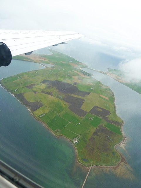
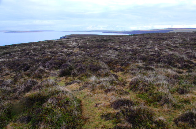
Bar Taing is a prominent coastal feature located in Orkney, an archipelago in the Northern Isles of Scotland. Positioned on the northeastern coast of the main island, it is recognized as a headland or point due to its protruding shape into the North Sea.

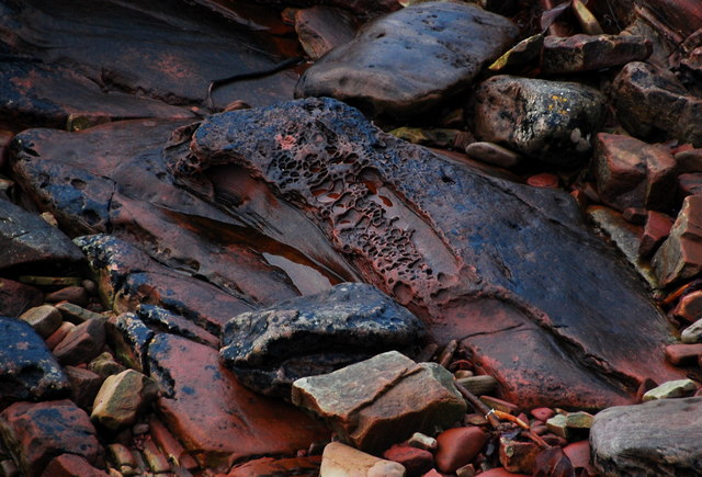
This coastal formation is characterized by its rugged cliffs, which rise to considerable heights and offer stunning panoramic views of the surrounding landscape. The cliffs are primarily composed of sandstone, with layers of sedimentary rocks providing a unique geological composition. The constant battering of the sea against the cliffs has resulted in the formation of sea caves and natural arches, further enhancing the visual appeal of Bar Taing.

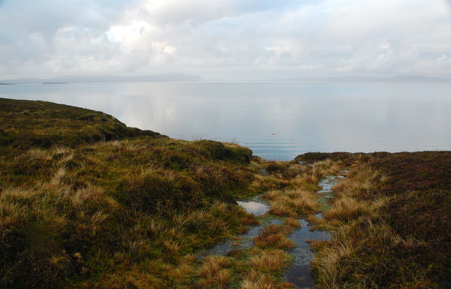
The headland is adorned with lush vegetation, including hardy grasses, heather, and wildflowers, which add a splash of color to the rugged terrain. The area is also home to a diverse range of seabirds, including gulls, fulmars, and kittiwakes, which nest on the cliff ledges.

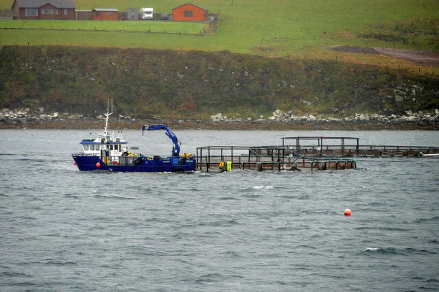
Bar Taing offers a picturesque location for coastal walks and exploration. Visitors can traverse along the cliff tops, enjoying the invigorating sea breeze and observing the abundant wildlife. The headland also provides an excellent vantage point for spotting marine life, such as seals and dolphins, that frequently inhabit the surrounding waters.

Due to its natural beauty and ecological significance, Bar Taing has been designated as a Site of Special Scientific Interest (SSSI). This status ensures the protection and preservation of its unique coastal ecosystem.

Overall, Bar Taing stands as a captivating coastal feature in Orkney, offering a harmonious blend of stunning geological formations, diverse flora, and rich wildlife.

If you have any feedback on the listing, please let us know in the comments section below.
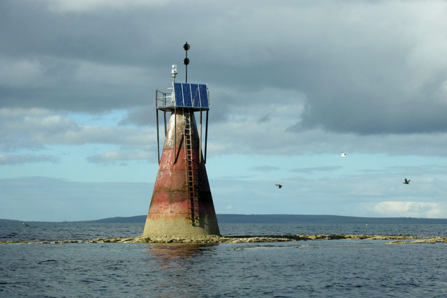
Bar Taing Images

Images are sourced within 2km of 58.852182/-2.9887685 or Grid Reference ND4396. Thanks to Geograph Open Source API. All images are credited.

Lober Salmon Farm The complex, which consists of twelve 80-metre pens and a 200-tonne barge is situated just off Lober Rock and close to St Margaret’s Hope in the Scapa Flow. It began operation in 2019 (<span class="nowrap"><a title="https://www.thenational.scot/news/16693882.scottish-salmon-industry-benefit-new-3m-orkney-fish-farm/" rel="nofollow ugc noopener" href="https://www.thenational.scot/news/16693882.scottish-salmon-industry-benefit-new-3m-orkney-fish-farm/">Link</a><img style="margin-left:2px;" alt="External link" title="External link - shift click to open in new window" src="https://s1.geograph.org.uk/img/external.png" width="10" height="10"/></span> The National).
Lober Salmon Farm
The complex, which consists of twelve 80-metre pens and a 200-tonne barge is situated just off Lober Rock and close to St Margaret’s Hope in the Scapa Flow. It began operation in 2019 (LinkExternal link The National).
The causeway to Hunda At present (2022) there are some GOML issues here. Try to find a route which avoids Littlequoy Farm itself.
The causeway to Hunda
At present (2022) there are some GOML issues here. Try to find a route which avoids Littlequoy Farm itself.
The 42m summit of Hunda Looking back across Hunda Reef (the causeway) to Berryhill, the 80m high point of Burray, itself one of the smaller Orkney Islands.

At present (2022) there are some GOML issues here. Try to find a route which avoids Littlequoy Farm itself.
The 42m summit of Hunda
Looking back across Hunda Reef (the causeway) to Berryhill, the 80m high point of Burray, itself one of the smaller Orkney Islands. At present (2022) there are some GOML issues here. Try to find a route which avoids Littlequoy Farm itself.
Burray - Western Peninsula with Churchill Barrier No.4 Taken from a Flybe flight over the Orkney Islands looking down on the western peninsula of the island of Burray. Nearest the bottom of the image the straight line is a minor road across Hunda Reef linking Burray to Hunda. The farm just up and to the left of this is Littlequoy, which I have arbitrarily taken as the subject reference for the image. In the distance, i.e. at the top of the image Churchill Barrier No.4 can be seen linking Burray to South Ronaldsay, while just to the west (below left) of this can be seen Burray Village. The little bay between the village and the barrier is the Ayre of Westermill. The noddy-hat shaped lake on the left is Echna Loch, the arterial A961 crosses across the spit of land separating the loch from Echnaloch Bay.
Burray - Western Peninsula with Churchill Barrier No.4
Taken from a Flybe flight over the Orkney Islands looking down on the western peninsula of the island of Burray. Nearest the bottom of the image the straight line is a minor road across Hunda Reef linking Burray to Hunda. The farm just up and to the left of this is Littlequoy, which I have arbitrarily taken as the subject reference for the image. In the distance, i.e. at the top of the image Churchill Barrier No.4 can be seen linking Burray to South Ronaldsay, while just to the west (below left) of this can be seen Burray Village. The little bay between the village and the barrier is the Ayre of Westermill. The noddy-hat shaped lake on the left is Echna Loch, the arterial A961 crosses across the spit of land separating the loch from Echnaloch Bay.
Dyke with lichen, The Hope, Hunda Midday, gloomy and already getting darker - Winter Solstice in just three days. This was as close to colour as I could find here.
Dyke with lichen, The Hope, Hunda
Midday, gloomy and already getting darker - Winter Solstice in just three days. This was as close to colour as I could find here.
The Hope, Hunda The word "Hope" is an anglicised corruption of the Norse word "Hop", meaning "shallow bay". Locals refer to nearby St Margaret's Hope as "The Hop", showing that the Norse influence still remains powerful under certain circumstances.
The Hope, Hunda
The word "Hope" is an anglicised corruption of the Norse word "Hop", meaning "shallow bay". Locals refer to nearby St Margaret's Hope as "The Hop", showing that the Norse influence still remains powerful under certain circumstances.
Weird Rock A natural feature.... if this were volcanic I'd think of gas bubbles but this is sandstone. Sometimes limpets can cut vertically downwards into stone... but not to this extent. Is it just the product of differential denudation... harder bands eroding more slowly than softer sections?


Thanks to Anne Burgess for the following:

It's differential weathering. This happens when the sand grains are partly cemented by calcium carbonate. The CaCO2 is soluble in water, and therefore erodes more readily, leaving sinuous ridges where the cement was less calcareous. See other examples in search 
<a title="https://www.geograph.org.uk/search.php?i=38701574" href="https://www.geograph.org.uk/search.php?i=38701574">Link</a>
Weird Rock
A natural feature.... if this were volcanic I'd think of gas bubbles but this is sandstone. Sometimes limpets can cut vertically downwards into stone... but not to this extent. Is it just the product of differential denudation... harder bands eroding more slowly than softer sections? Thanks to Anne Burgess for the following: It's differential weathering. This happens when the sand grains are partly cemented by calcium carbonate. The CaCO2 is soluble in water, and therefore erodes more readily, leaving sinuous ridges where the cement was less calcareous. See other examples in search Link
More Weird Rock The same feature as the previous photo, but here in-situ in bedrock.
More Weird Rock
The same feature as the previous photo, but here in-situ in bedrock.
Curious Cormorants. Who Are You Looking At?
Curious Cormorants.
Who Are You Looking At?
Hunda Coastline A flat calm Scapa Flow, with Mainland (Orkney) on the horizon.
Hunda Coastline
A flat calm Scapa Flow, with Mainland (Orkney) on the horizon.
Hunda Coastline Looking SW with Flotta on the right horizon.
Hunda Coastline
Looking SW with Flotta on the right horizon.
Hunda Coastline Looking NE with Mainland, Orkney on the horizon.
Hunda Coastline
Looking NE with Mainland, Orkney on the horizon.
Hunda Coastline Sloping strata exposed by wave action. A flat calm Scapa Flow in the background, with Mainland, Orkney, on the horizon.
Hunda Coastline
Sloping strata exposed by wave action. A flat calm Scapa Flow in the background, with Mainland, Orkney, on the horizon.
Coastal Moorland, Hunda Looking NE along a sheep track.
Coastal Moorland, Hunda
Looking NE along a sheep track.
Angle in the fence Sheep are grazed on Hunda, although today there were none on the island.
Angle in the fence
Sheep are grazed on Hunda, although today there were none on the island.
Burn on Hunda Surface water flowing to the cliff edge. Scapa Flow beyond.
Burn on Hunda
Surface water flowing to the cliff edge. Scapa Flow beyond.
Coastal Moorland, Hunda Looking East towards (unsurprisingly) East Ayre. An Ayre is the local term for a spit.
Coastal Moorland, Hunda
Looking East towards (unsurprisingly) East Ayre. An Ayre is the local term for a spit.
Boulder Beach, Hunda Difficult access to this isolated beach. Gales three days ago, hence the flotsam stranded along the high-tide mark.
Boulder Beach, Hunda
Difficult access to this isolated beach. Gales three days ago, hence the flotsam stranded along the high-tide mark.
Show me another place!

Bar Taing is located at Grid Ref: ND4396 (Lat: 58.852182, Lng: -2.9887685)

Unitary Authority: Orkney Islands

Police Authority: Highlands and Islands

What 3 Words

///sobbed.riverbank.tweeted. Near St Margaret's Hope, Orkney Islands

Related Wikis

Hunda

Hunda is an uninhabited island in the Orkney archipelago in Scotland. It is 100 hectares (0.39 sq mi) in extent and rises to 42 metres (138 ft) above sea...

Nevi Skerry

Nevi Skerry is a skerry situated in Scapa Flow in the Orkney Islands. The skerry is situated approximately 1 km (0.62 mi) east of Flotta and approximately...

Hoxa, Orkney

Hoxa is a small settlement on the island of South Ronaldsay in the Orkney Islands north of mainland Scotland. Hoxa is located 1+1⁄4 miles (2.0 km) west...

Burray

Burray () is one of the Orkney Islands in Scotland. It lies to the east of Scapa Flow and is one of a chain of islands linked by the Churchill Barriers...

Nearby Amenities

Located within 500m of 58.852182,-2.9887685
Bar Taing
Place: locality
Lat/Long: 58.8532282/-2.9907092
The Hope
Natural: bay
Lat/Long: 58.8502189/-2.9848915
The Cairn Head
Place: locality
Lat/Long: 58.8499641/-2.9817457
Man Made: cairn
Lat/Long: 58.8490366/-2.98258
The data included in this document is from www.openstreetmap.org. The data is made available under ODbL.

Have you been to Bar Taing?

Leave your review of Bar Taing below (or comments, questions and feedback).