South Bis Geo
Coastal Feature, Headland, Point in Orkney
Scotland
South Bis Geo

South Bis Geo is a prominent coastal feature located on the island of Orkney, Scotland. Situated on the eastern coast of the island, it is a headland that juts out into the North Sea, forming a distinctive point. The name "Geo" refers to a narrow inlet or cove, often found along the rugged and rocky coastline of Orkney.
South Bis Geo is characterized by its striking geological formations and dramatic cliffs, which are composed of rugged sandstone and shale. These cliffs rise steeply from the sea, reaching heights of up to 100 feet, providing breathtaking views of the surrounding coastline and the vast expanse of the North Sea.
The headland is a popular destination for nature enthusiasts and hikers, offering opportunities for exploration and wildlife spotting. The area is home to a diverse range of flora and fauna, including seabirds, such as fulmars and puffins, which nest along the cliffs. Visitors can also spot seals basking on the rocks or swimming in the coastal waters.
Due to its exposed location, South Bis Geo is subject to the powerful forces of the North Sea, making it an ideal spot for observing the dynamic interplay between land and sea. Erosion from the relentless waves has sculpted the coastline, creating sea caves, arches, and stacks that add to the area's natural beauty.
Overall, South Bis Geo is a captivating coastal feature that showcases the raw and untamed beauty of Orkney's coastline. Its rugged cliffs, diverse wildlife, and geological formations make it a must-visit destination for nature lovers and those seeking to experience the awe-inspiring power of the North Sea.
If you have any feedback on the listing, please let us know in the comments section below.
South Bis Geo Images
Images are sourced within 2km of 59.31206/-3.031337 or Grid Reference HY4147. Thanks to Geograph Open Source API. All images are credited.


South Bis Geo is located at Grid Ref: HY4147 (Lat: 59.31206, Lng: -3.031337)
Unitary Authority: Orkney Islands
Police Authority: Highlands and Islands
What 3 Words
///postage.amazed.skills. Near Pierowall, Orkney Islands
Nearby Locations
Related Wikis

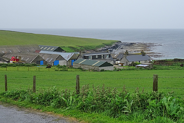
Pierowall
Pierowall is a village of Westray in the Orkney Islands, off the coast of the northern Scottish mainland. The village is the island's largest settlement...

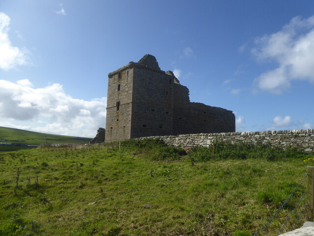
Noltland Castle
Noltland Castle is located near Pierowall on the island of Westray in the Orkney Islands of Scotland. It dates mainly to the later 16th century, although...

Links of Noltland
Links of Noltland is a large prehistoric settlement located on the north coast of the island of Westray in Orkney, Scotland. The extensive ruins includes...

Westray
Westray (, Scots: Westree) is one of the Orkney Islands in Scotland, with a usual resident population of just under 600 people. Its main village is Pierowall...
Nearby Amenities
Located within 500m of 59.31206,-3.031337Have you been to South Bis Geo?
Leave your review of South Bis Geo below (or comments, questions and feedback).