Stanemora

Coastal Feature, Headland, Point in Orkney

Scotland

Stanemora

West Winni Skerry on Swona
West Winni Skerry on Swona Credit: John Ferguson

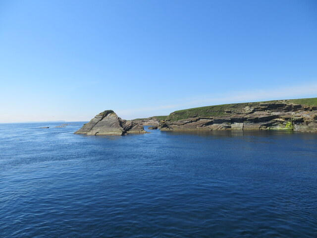
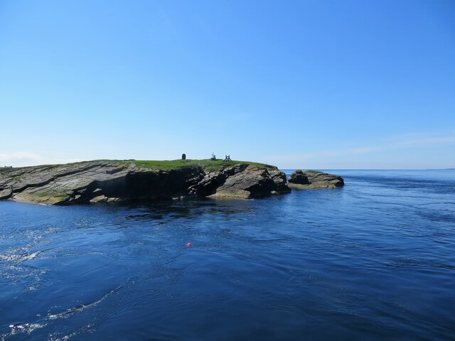
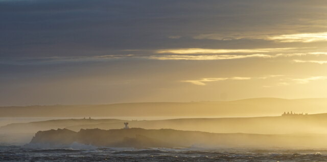
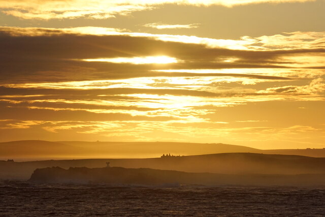
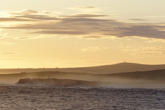
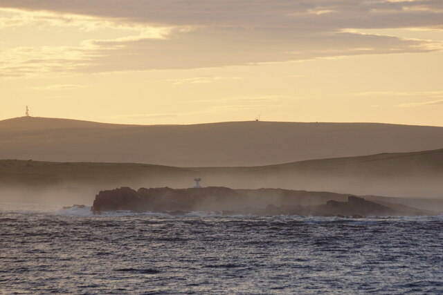
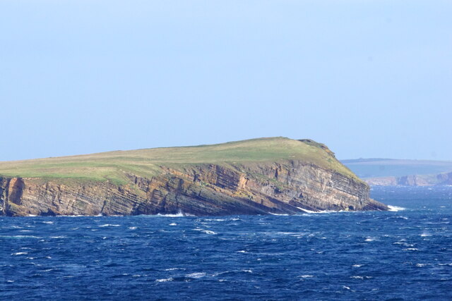
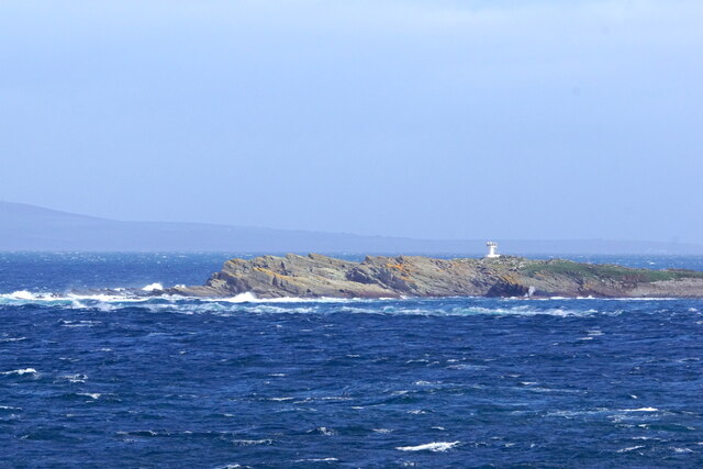
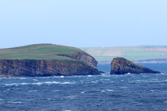
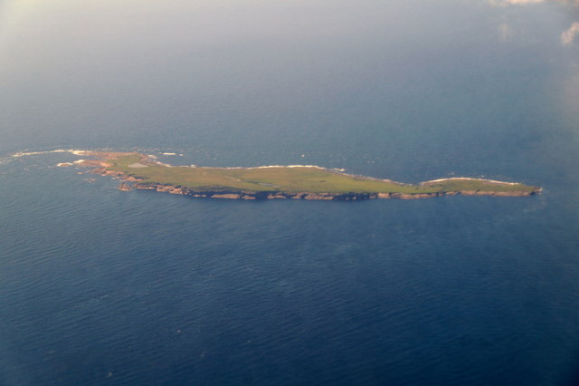
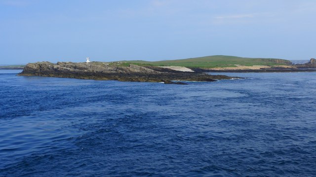
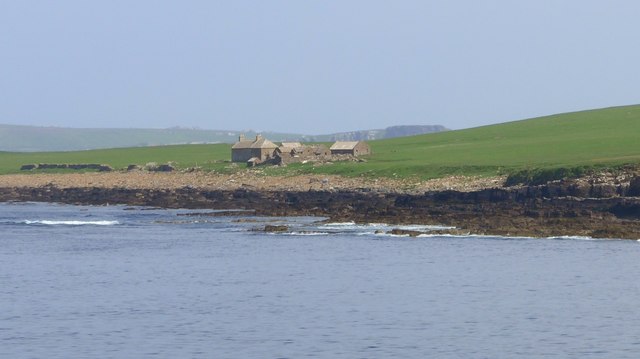
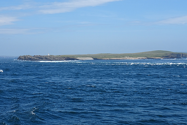
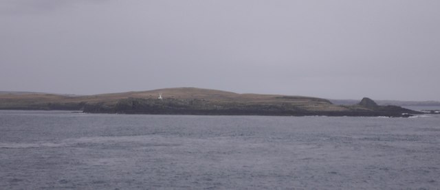
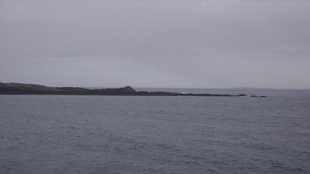
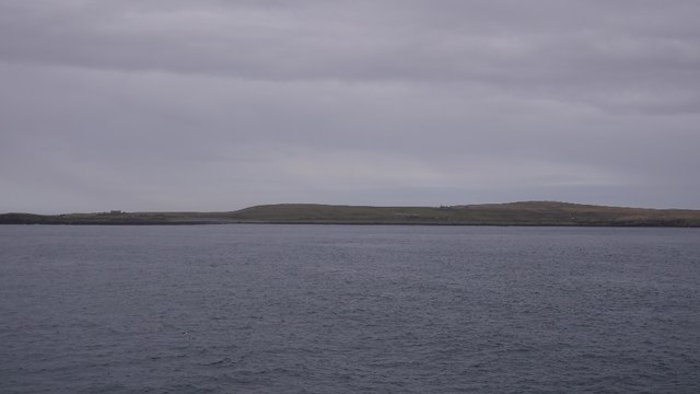
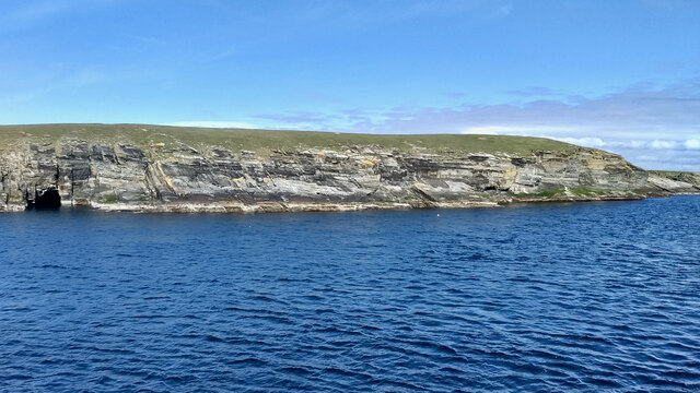
Stanemora is a prominent headland located on the Orkney Islands, an archipelago situated off the northeastern coast of Scotland. It is positioned on the eastern shore of the main island and overlooks the North Sea. The headland is characterized by its rugged cliffs, which rise dramatically from the sea, providing breathtaking panoramic views of the surrounding coastline.

Stanemora is composed of layers of sandstone and shale, formed over millions of years through geological processes. The constant erosion caused by the crashing waves has sculpted the cliffs into various shapes and formations, adding to the headland's striking appearance. The exposed rocks on the headland offer valuable insights into the area's geological history, providing evidence of ancient marine environments and fossilized remains.

The headland serves as a vital habitat for a diverse range of bird species, making it a popular spot for birdwatching enthusiasts. Resident seabirds such as kittiwakes, fulmars, and guillemots can be spotted nesting on the steep cliffs, while migratory species like puffins visit during the summer months. The coastal waters surrounding Stanemora are also home to seals and dolphins, which can sometimes be seen swimming close to the headland.

Stanemora is a popular destination for hikers and nature enthusiasts, who are drawn to its scenic beauty and rich wildlife. Several walking trails wind their way around the headland, providing opportunities for visitors to explore the area and marvel at its natural wonders. Its proximity to other notable landmarks, such as the nearby Neolithic village of Skara Brae, further enhances the appeal of Stanemora as a must-visit location for both locals and tourists alike.

If you have any feedback on the listing, please let us know in the comments section below.

Stanemora Images

Images are sourced within 2km of 58.73601/-3.0652427 or Grid Reference ND3883. Thanks to Geograph Open Source API. All images are credited.

West Winni Skerry on Swona
The North Head, Swona
Beacon on Swona, Pentland Firth, at dawn
Dawn over Swona, Pentland Firth
Dawn over Swona, Pentland Firth South Ronaldsay in the background.
Dawn over Swona, Pentland Firth
South Ronaldsay in the background.
Beacon on the Tarf, Swona, Pentland Firth
Swona from the south Taken from about ND 3922
Swona from the south
Taken from about ND 3922
The Tarf, Swona, from the south
Sooth Clett, Swona, from the sea Taken from about ND 3681
Sooth Clett, Swona, from the sea
Taken from about ND 3681
Swona, Orkney, from the air
Skerries at SW tip of Swona The navigation light visible in the background.

Photo taken from "Pentalina" ferry between Gills Bay and St Margaret's Hope.
Skerries at SW tip of Swona
The navigation light visible in the background. Photo taken from "Pentalina" ferry between Gills Bay and St Margaret's Hope.
Buildings on Swona
Buildings on Swona
Tails of the Tarf The disturbed water shows some of the dangers of the Pentland Firth for small vessels. Only a small part of the tip of the island of Swona is in this square.
Tails of the Tarf
The disturbed water shows some of the dangers of the Pentland Firth for small vessels. Only a small part of the tip of the island of Swona is in this square.
The Tarf, Swona A navigation beacon at the southern end of the island.
The Tarf, Swona
A navigation beacon at the southern end of the island.
Tails of the Tarf Skerries on the southern tip of Swona, Pentland Firth.
Tails of the Tarf
Skerries on the southern tip of Swona, Pentland Firth.
Swona View from the Pentland Ferries boat passing to the west.
Swona
View from the Pentland Ferries boat passing to the west.
Swona The island is situated in the Pentland Firth where it creates an obstruction to the strong tides producing tidal races, over-falls and whirlpools. One of these whirlpools is known as the ‘Wells of Swona’, and legend has it is caused by a witch struggling to save herself. To quote directly from Westwood and Kingshill’s book “The Lore of Scotland: A guide to Scottish legends”:

"A witch once took a fancy to a dark and handsome young man and wanted him for her lover. When she asked him to go to the beach with her, however, he refused, as his sweetheart was at that moment on her way to join him. Concealing her anger, the witch persuaded the young man and his girl to come out with her in her boat. As they approached Swona, she worked a spell on the boat and it overturned. The young man caught his girl’s hand in an attempt to save her, but at the same moment the witch caught hold of his to drag him under the waves and into her power. The three were so entangled that they could not be pulled apart. The young man and his sweetheart were drowned, but the witch is still struggling to get free, and it is her frantic churning of the waters that causes the Wells of Swona."

Adapted from my daily photo diary <span class="nowrap"><a title="http://www.fhithich.uk/?p=25760" rel="nofollow ugc noopener" href="http://www.fhithich.uk/?p=25760">Link</a><img style="margin-left:2px;" alt="External link" title="External link - shift click to open in new window" src="https://s1.geograph.org.uk/img/external.png" width="10" height="10"/></span>
Swona
The island is situated in the Pentland Firth where it creates an obstruction to the strong tides producing tidal races, over-falls and whirlpools. One of these whirlpools is known as the ‘Wells of Swona’, and legend has it is caused by a witch struggling to save herself. To quote directly from Westwood and Kingshill’s book “The Lore of Scotland: A guide to Scottish legends”: "A witch once took a fancy to a dark and handsome young man and wanted him for her lover. When she asked him to go to the beach with her, however, he refused, as his sweetheart was at that moment on her way to join him. Concealing her anger, the witch persuaded the young man and his girl to come out with her in her boat. As they approached Swona, she worked a spell on the boat and it overturned. The young man caught his girl’s hand in an attempt to save her, but at the same moment the witch caught hold of his to drag him under the waves and into her power. The three were so entangled that they could not be pulled apart. The young man and his sweetheart were drowned, but the witch is still struggling to get free, and it is her frantic churning of the waters that causes the Wells of Swona." Adapted from my daily photo diary LinkExternal link
Show me another place!

Stanemora is located at Grid Ref: ND3883 (Lat: 58.73601, Lng: -3.0652427)

Unitary Authority: Orkney Islands

Police Authority: Highlands and Islands

What 3 Words

///skyrocket.notifying.winter. Near John o' Groats, Highland

Related Wikis

Swona

Swona is an uninhabited privately owned island in the Pentland Firth off the north coast of Scotland. It has a herd of feral cattle resulting from the...

MV Cemfjord

The Cemfjord was a Cyprus-registered cargo ship which foundered in the Pentland Firth off the north-east coast of Scotland on 2 January 2015. Built as...

SM U-29 (Germany)

SM U-29 was a Type U-27 U-boat of the Imperial German Navy. She served during the First World War. U-29's last commander was Captain Otto Weddigen. U-29...

Burwick, Orkney

Burwick () is a small harbour on the island of South Ronaldsay in the Orkney Islands, Scotland. It is the closest Orkney harbour to the Scottish mainland...

Nearby Amenities

Located within 500m of 58.73601,-3.0652427
Created By: almien_coastlines mod
Lat/Long: 58.737503/-3.061224
Created By: almien_coastlines mod
Lat/Long: 58.73699/-3.062208
Created By: almien_coastlines mod
Lat/Long: 58.739677/-3.064921
Created By: almien_coastlines mod
Lat/Long: 58.739421/-3.065413
Created By: almien_coastlines mod
Lat/Long: 58.737375/-3.061471
Created By: almien_coastlines mod
Lat/Long: 58.740189/-3.06443
Swona Minor Lighthouse
Man Made: lighthouse
Seamark Light 1 Character: Fl
Seamark Light 1 Colour: white
Seamark Light 1 Height: 17
Seamark Light 1 Period: 8
Seamark Light 1 Range: 9
Seamark Light 1 Sector End: 210
Seamark Light 1 Sector Start: 261
Seamark Light 1 Sequence: 0.4+(7.6)
Seamark Light Reference: A 3566
Seamark Name: Tarf
Seamark Type: light_minor
Source: US NGA Pub. 114. 2011-05-26.
Lat/Long: 58.7374521/-3.0704275
Historic: archaeological_site
Note: chambered cairns
Lat/Long: 58.7366443/-3.067002
The Tarf
Place: locality
Lat/Long: 58.7371043/-3.0682785
The data included in this document is from www.openstreetmap.org. The data is made available under ODbL.

Have you been to Stanemora?

Leave your review of Stanemora below (or comments, questions and feedback).