Horse Geo

Coastal Feature, Headland, Point in Caithness

Scotland

Horse Geo

Layby on the A99 between Keiss and Nybster The A99 follows the east coast of Caithness from Latheron, where it leaves the A9, though the town of Wick to John o' Groats at the north-east corner of the Highlands. The road is a trunk road between Latheron and Wick. It was part of the A9 until 1997, when the A9 was re-routed along what had been the A895-A882 link between Latheron and Thurso.

The A99 forms part of the North Coast 500 (NC500) which was launched in 2015. NC500 is a 516-mile scenic route around the north coast of Scotland, starting and ending at Inverness Castle,
Layby on the A99 between Keiss and Nybster Credit: David Dixon

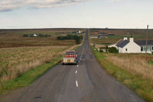
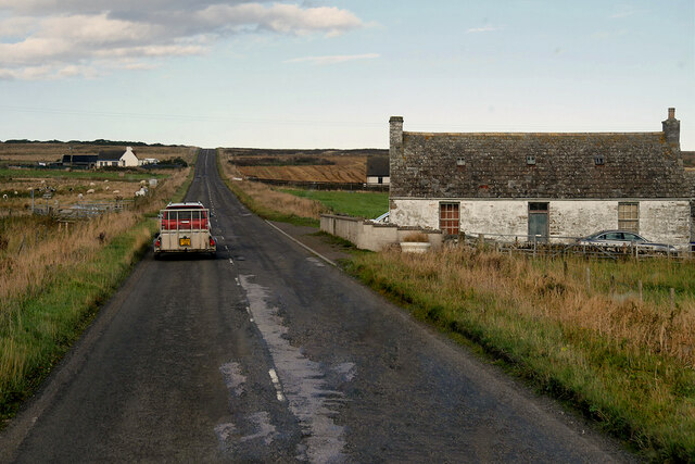
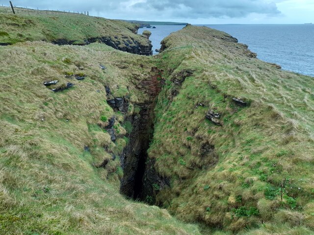
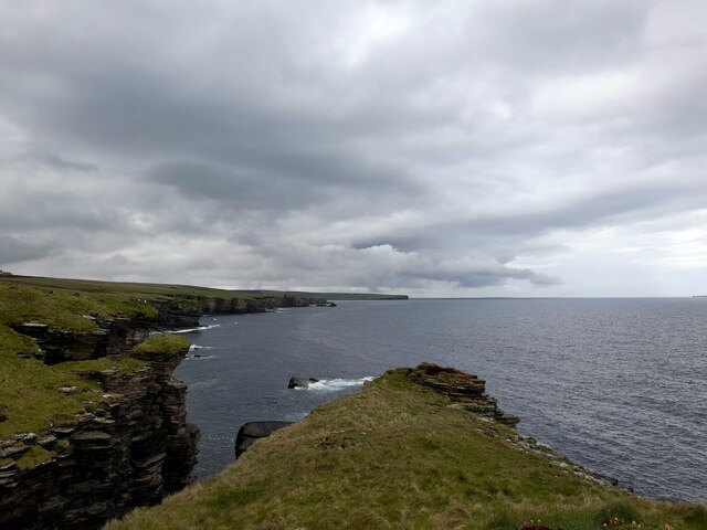
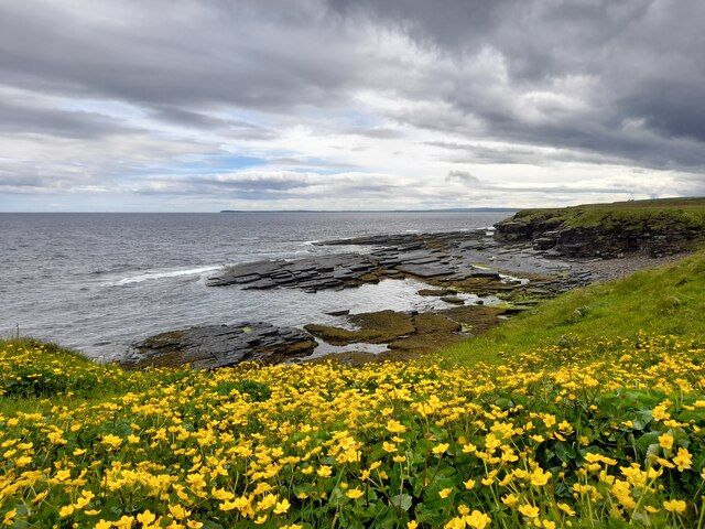
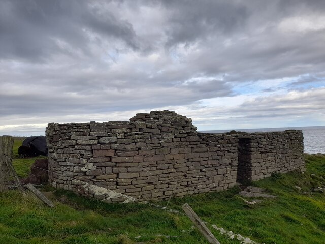
Horse Geo is a prominent coastal feature located in Caithness, Scotland. It is a headland that juts out into the North Sea, forming a distinctive point that is easily recognizable. Situated along the rugged coastline of Caithness, Horse Geo offers breathtaking views of the surrounding landscape and the vast expanse of the ocean.

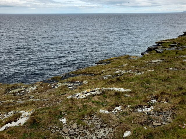
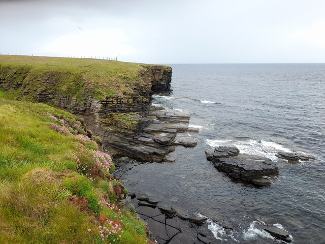
The headland is characterized by its towering cliffs that rise dramatically from the sea, creating a striking natural formation. These cliffs provide a nesting site for various seabirds, including kittiwakes, guillemots, and puffins, making Horse Geo an ideal spot for birdwatching enthusiasts.

The area surrounding Horse Geo is rich in geological diversity. The headland is composed of layers of sedimentary rock, which have been shaped by thousands of years of erosion caused by the relentless crashing waves. This erosion has resulted in the formation of sea caves and arches along the coastline, adding to the charm and intrigue of the site.

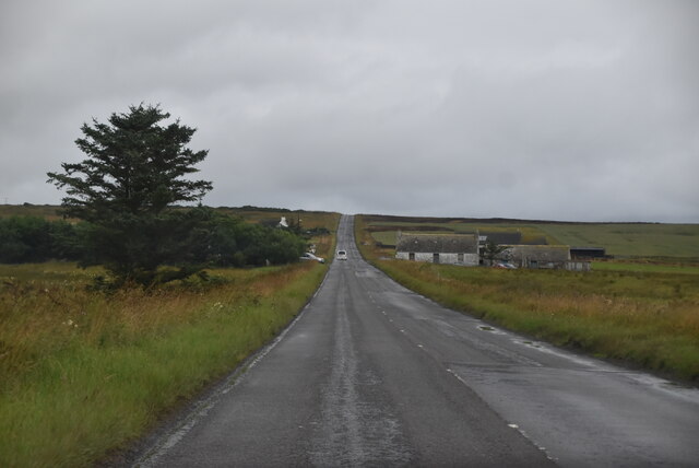
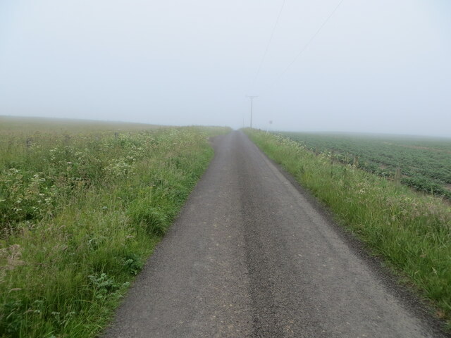
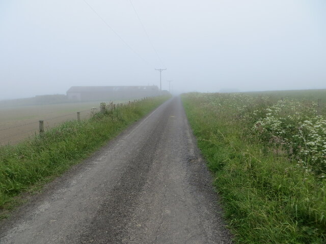
Horse Geo is a popular destination for hikers and nature lovers who are drawn to its rugged beauty and the opportunity to explore the surrounding coastal trails. The headland offers stunning panoramic views of the North Sea, providing visitors with a sense of tranquility and awe-inspiring natural beauty.

It is important to note that Horse Geo can be dangerous, especially during stormy weather or high tide, due to the strong currents and powerful waves. Visitors are advised to exercise caution and stay within designated safe areas while exploring this coastal feature.

Overall, Horse Geo in Caithness is a captivating headland that showcases the raw beauty of Scotland's coastal landscape, offering visitors a unique and unforgettable experience.

If you have any feedback on the listing, please let us know in the comments section below.

Horse Geo Images

Images are sourced within 2km of 58.553399/-3.083202 or Grid Reference ND3763. Thanks to Geograph Open Source API. All images are credited.

Layby on the A99 between Keiss and Nybster The A99 follows the east coast of Caithness from Latheron, where it leaves the A9, though the town of Wick to John o' Groats at the north-east corner of the Highlands. The road is a trunk road between Latheron and Wick. It was part of the A9 until 1997, when the A9 was re-routed along what had been the A895-A882 link between Latheron and Thurso.

The A99 forms part of the North Coast 500 (NC500) which was launched in 2015. NC500 is a 516-mile scenic route around the north coast of Scotland, starting and ending at Inverness Castle,
Layby on the A99 between Keiss and Nybster
The A99 follows the east coast of Caithness from Latheron, where it leaves the A9, though the town of Wick to John o' Groats at the north-east corner of the Highlands. The road is a trunk road between Latheron and Wick. It was part of the A9 until 1997, when the A9 was re-routed along what had been the A895-A882 link between Latheron and Thurso. The A99 forms part of the North Coast 500 (NC500) which was launched in 2015. NC500 is a 516-mile scenic route around the north coast of Scotland, starting and ending at Inverness Castle,
Keiss Baptist Kirk and Manse An early 19th century, symmetrical 2-storey, 3-bay house and a mid-19th century, simple rectangular single-storey church. Both are Category C listed buildings (LB14080 <span class="nowrap"><a title="http://portal.historicenvironment.scot/designation/LB14080" rel="nofollow ugc noopener" href="http://portal.historicenvironment.scot/designation/LB14080">Link</a><img style="margin-left:2px;" alt="External link" title="External link - shift click to open in new window" src="https://s1.geograph.org.uk/img/external.png" width="10" height="10"/></span> and LB14081 <span class="nowrap"><a title="http://portal.historicenvironment.scot/designation/LB14081" rel="nofollow ugc noopener" href="http://portal.historicenvironment.scot/designation/LB14081">Link</a><img style="margin-left:2px;" alt="External link" title="External link - shift click to open in new window" src="https://s1.geograph.org.uk/img/external.png" width="10" height="10"/></span> Historic Environment Scotland).
Keiss Baptist Kirk and Manse
An early 19th century, symmetrical 2-storey, 3-bay house and a mid-19th century, simple rectangular single-storey church. Both are Category C listed buildings (LB14080 LinkExternal link and LB14081 LinkExternal link Historic Environment Scotland).
A99, Auckengill The A99 follows the east coast of Caithness from Latheron, where it leaves the A9, though the town of Wick to John o' Groats at the north-east corner of the Highlands. The road is a trunk road between Latheron and Wick. It was part of the A9 until 1997, when the A9 was re-routed along what had been the A895-A882 link between Latheron and Thurso.

The A99 forms part of the North Coast 500 (NC500) which was launched in 2015. NC500 is a 516-mile scenic route around the north coast of Scotland, starting and ending at Inverness Castle,
A99, Auckengill
The A99 follows the east coast of Caithness from Latheron, where it leaves the A9, though the town of Wick to John o' Groats at the north-east corner of the Highlands. The road is a trunk road between Latheron and Wick. It was part of the A9 until 1997, when the A9 was re-routed along what had been the A895-A882 link between Latheron and Thurso. The A99 forms part of the North Coast 500 (NC500) which was launched in 2015. NC500 is a 516-mile scenic route around the north coast of Scotland, starting and ending at Inverness Castle,
A99, Springwell House The A99 follows the east coast of Caithness from Latheron, where it leaves the A9, though the town of Wick to John o' Groats at the north-east corner of the Highlands. The road is a trunk road between Latheron and Wick. It was part of the A9 until 1997, when the A9 was re-routed along what had been the A895-A882 link between Latheron and Thurso.

The A99 forms part of the North Coast 500 (NC500) which was launched in 2015. NC500 is a 516-mile scenic route around the north coast of Scotland, starting and ending at Inverness Castle,
A99, Springwell House
The A99 follows the east coast of Caithness from Latheron, where it leaves the A9, though the town of Wick to John o' Groats at the north-east corner of the Highlands. The road is a trunk road between Latheron and Wick. It was part of the A9 until 1997, when the A9 was re-routed along what had been the A895-A882 link between Latheron and Thurso. The A99 forms part of the North Coast 500 (NC500) which was launched in 2015. NC500 is a 516-mile scenic route around the north coast of Scotland, starting and ending at Inverness Castle,
A99, Milltown The A99 follows the east coast of Caithness from Latheron, where it leaves the A9, though the town of Wick to John o' Groats at the north-east corner of the Highlands. The road is a trunk road between Latheron and Wick. It was part of the A9 until 1997, when the A9 was re-routed along what had been the A895-A882 link between Latheron and Thurso.

The A99 forms part of the North Coast 500 (NC500) which was launched in 2015. NC500 is a 516-mile scenic route around the north coast of Scotland, starting and ending at Inverness Castle,
A99, Milltown
The A99 follows the east coast of Caithness from Latheron, where it leaves the A9, though the town of Wick to John o' Groats at the north-east corner of the Highlands. The road is a trunk road between Latheron and Wick. It was part of the A9 until 1997, when the A9 was re-routed along what had been the A895-A882 link between Latheron and Thurso. The A99 forms part of the North Coast 500 (NC500) which was launched in 2015. NC500 is a 516-mile scenic route around the north coast of Scotland, starting and ending at Inverness Castle,
A99, northbound The A99 runs 34 miles, across Caithness, from Latheron to John O' Groats <a href="https://www.geograph.org.uk/photo/7086935">ND3773 : The end of the road (A99)</a>.
<span class="nowrap"><a title="https://www.sabre-roads.org.uk/wiki/index.php?title=A99" rel="nofollow ugc noopener" href="https://www.sabre-roads.org.uk/wiki/index.php?title=A99">Link</a><img style="margin-left:2px;" alt="External link" title="External link - shift click to open in new window" src="https://s1.geograph.org.uk/img/external.png" width="10" height="10"/></span>
A99, northbound
The A99 runs 34 miles, across Caithness, from Latheron to John O' Groats ND3773 : The end of the road (A99). LinkExternal link
A99, Milltown The A99 runs 34 miles, across Caithness, from Latheron to John O' Groats <a href="https://www.geograph.org.uk/photo/7086935">ND3773 : The end of the road (A99)</a>.
<span class="nowrap"><a title="https://www.sabre-roads.org.uk/wiki/index.php?title=A99" rel="nofollow ugc noopener" href="https://www.sabre-roads.org.uk/wiki/index.php?title=A99">Link</a><img style="margin-left:2px;" alt="External link" title="External link - shift click to open in new window" src="https://s1.geograph.org.uk/img/external.png" width="10" height="10"/></span>
A99, Milltown
The A99 runs 34 miles, across Caithness, from Latheron to John O' Groats ND3773 : The end of the road (A99). LinkExternal link
Coast near Auckengill It seems like the roof of a sea cave has collapsed forming a gloup.
Coast near Auckengill
It seems like the roof of a sea cave has collapsed forming a gloup.
Coast at The Kilns The area in the foreground is within the grid square.
Coast at The Kilns
The area in the foreground is within the grid square.
The Kilns A small area of coastline is within this grid square.
The Kilns
A small area of coastline is within this grid square.
Coast at Milltown The yellow of the flowers brightened a dull afternoon.
Coast at Milltown
The yellow of the flowers brightened a dull afternoon.
Coast near Auckengill Sea pinks brightening the scene.
Coast near Auckengill
Sea pinks brightening the scene.
Kiln Barn at Milltown A well-preserved kiln barn near the shore at Milltown.
Kiln Barn at Milltown
A well-preserved kiln barn near the shore at Milltown.
Kiln Barn at Milltown An internal view. The building is shown on the first edition O.S map of 1873.
Kiln Barn at Milltown
An internal view. The building is shown on the first edition O.S map of 1873.
Kiln Barn at Milltown This photograph shows the distinctive rounded end to the building.
Kiln Barn at Milltown
This photograph shows the distinctive rounded end to the building.
Minor road near Auckengill Looking north-westward.
Minor road near Auckengill
Looking north-westward.
Minor road approaching the A99 at Auckengill Looking south-eastward.
Minor road approaching the A99 at Auckengill
Looking south-eastward.
A section of the Stroupster Windfarm roadway Looking south-eastward in the direction of Nybster. An inland sea fret was affecting visibility.
A section of the Stroupster Windfarm roadway
Looking south-eastward in the direction of Nybster. An inland sea fret was affecting visibility.
Show me another place!

Horse Geo is located at Grid Ref: ND3763 (Lat: 58.553399, Lng: -3.083202)

Unitary Authority: Highland

Police Authority: Highlands and Islands

What 3 Words

///beaker.joke.manifests. Near John o' Groats, Highland

Related Wikis

Nybster

Nybster is a scattered rural and crofting township, situated in Caithness and is in the Scottish council area of Highland. It is located along the A9 road...
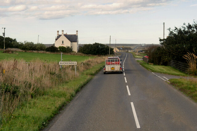
Auckengill

Auckengill is a settlement, 6 miles (10 kilometres) south of John o' Groats, on the east coast of Caithness, within the Scottish council area of Highland...

Keiss Castle

Keiss Castle is a partially ruined castle in Scotland, which stands on sheer cliffs overlooking Sinclair's Bay less than one mile north of Keiss village...

Keiss

Keiss (Scottish Gaelic: Cèis) is a fishing village at the northern end of Sinclair's Bay on the east coast of Caithness county in Scotland's Highland...

Freswick

Freswick ( FREZZ-ik) or Skirsa, is a small remote hamlet, overlooking Freswick Bay to the east, in eastern Caithness, Scottish Highlands and is in the...

Skirza

Skirza or Skirsa, is a small remote linear fishing village, overlooking Freswick Bay to the south and Skirza Head to the southeast, in eastern Caithness...

Sinclairs Bay

Sinclairs Bay is a large remote, breast shaped, or left leaf of a tear drop shaped, coastal embayment, on the east coast of Scotland, in east Caithness...

Wester Pipe Railway

The Wester Pipe Railway is a narrow gauge railway that runs from Hastigrow on the B876 road to Westerloch on the A99, all within Caithness. The line is...

Nearby Amenities

Located within 500m of 58.553399,-3.083202
Source: PGS
Lat/Long: 58.5501382/-3.0837942
Source: PGS
Lat/Long: 58.5499729/-3.0848439
Source: PGS
Lat/Long: 58.550191/-3.0843752
Source: PGS
Lat/Long: 58.5504107/-3.0837234
Source: PGS
Lat/Long: 58.5505955/-3.0831422
Created By: dmgroom_coastlines
Source: PGS
Lat/Long: 58.550766/-3.082935
Source: PGS
Lat/Long: 58.5508558/-3.0829469
Source: PGS
Lat/Long: 58.5509996/-3.0828725
Source: PGS
Lat/Long: 58.5512815/-3.0828304
Source: PGS
Lat/Long: 58.5514917/-3.0827044
Created By: dmgroom_coastlines
Source: PGS
Lat/Long: 58.55179/-3.082937
Source: PGS
Lat/Long: 58.5521565/-3.0846734
Created By: dmgroom_coastlines
Source: PGS
Lat/Long: 58.552301/-3.083918
Source: PGS
Lat/Long: 58.552557/-3.0834862
Created By: dmgroom_coastlines
Source: PGS
Lat/Long: 58.553069/-3.083675
Source: PGS
Lat/Long: 58.5530997/-3.0833272
Source: PGS
Lat/Long: 58.5534295/-3.0831824
Source: PGS
Lat/Long: 58.5537596/-3.0826175
Source: PGS
Lat/Long: 58.5539454/-3.0821087
Source: PGS
Lat/Long: 58.5537078/-3.0835823
Source: PGS
Lat/Long: 58.554003/-3.0836628
Source: PGS
Lat/Long: 58.5545821/-3.0830209
Source: PGS
Lat/Long: 58.5548494/-3.083113
Source: PGS
Lat/Long: 58.5549128/-3.0828957
Created By: dmgroom_coastlines
Source: PGS
Lat/Long: 58.555118/-3.082701
Created By: dmgroom_coastlines
Source: PGS
Lat/Long: 58.556142/-3.082214
Created By: dmgroom_coastlines
Source: PGS
Lat/Long: 58.556654/-3.081969
Created By: dmgroom_coastlines
Source: PGS
Lat/Long: 58.556782/-3.08099
Created By: dmgroom_coastlines
Source: PGS
Lat/Long: 58.556911/-3.080746
Created By: dmgroom_coastlines
Source: PGS
Lat/Long: 58.557038/-3.0805
Created By: dmgroom_coastlines
Source: PGS
Lat/Long: 58.557167/-3.079521
Parking
Lat/Long: 58.555211/-3.0836323
Natural: spring
Lat/Long: 58.5513495/-3.0847969
Power: pole
Lat/Long: 58.5555899/-3.0897766
Power: pole
Lat/Long: 58.5551074/-3.0904446
Power: pole
Lat/Long: 58.5559039/-3.0883197
Power: pole
Lat/Long: 58.5562587/-3.0880761
Power: pole
Lat/Long: 58.5566443/-3.087804
Tourism: artwork
Lat/Long: 58.5517605/-3.0845482
The data included in this document is from www.openstreetmap.org. The data is made available under ODbL.

Have you been to Horse Geo?

Leave your review of Horse Geo below (or comments, questions and feedback).