The Lash

Coastal Feature, Headland, Point in Orkney

Scotland

The Lash

Hoy Low Lighthouse, Graemesay
Hoy Low Lighthouse, Graemesay Credit: Mike Pennington

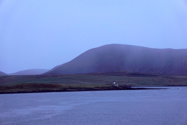
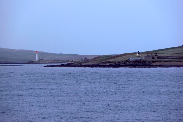
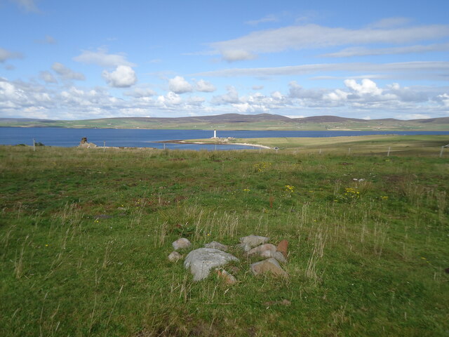
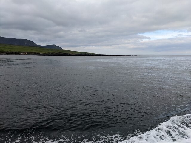
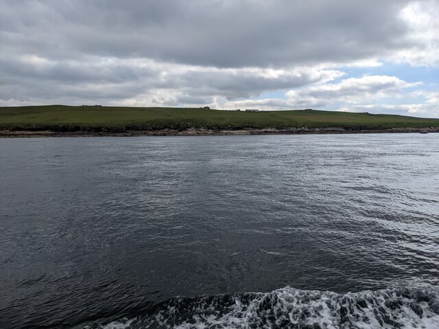
The Lash is a prominent coastal feature located in the Orkney Islands, off the northeastern coast of Scotland. It is a headland that juts out into the North Atlantic Ocean, forming a distinct point on the island's coastline. The Lash is known for its rugged and dramatic appearance, characterized by towering cliffs, rocky outcrops, and crashing waves.

Situated on the western side of the island, The Lash offers breathtaking views of the surrounding sea and the nearby islands. Its elevated position provides a vantage point for observing marine wildlife, including seabirds, seals, and occasionally even dolphins and whales. The area surrounding The Lash is also rich in flora, with grasses, heathers, and wildflowers dotting the landscape.

Access to The Lash is primarily by foot, with paths and trails leading visitors along the coastline. The headland is a popular spot for hikers, nature enthusiasts, and photographers, who are drawn to its natural beauty and the opportunity to capture the stunning vistas.

As a coastal feature, The Lash is subject to the forces of erosion, with the relentless waves and strong winds shaping its cliffs over time. The exposed nature of the headland means that it can experience harsh weather conditions, adding to its allure and sense of wildness.

Overall, The Lash is a captivating coastal feature in the Orkney Islands, offering visitors a chance to experience the rugged beauty of the Scottish coastline and immerse themselves in the untamed nature of this remote region.

If you have any feedback on the listing, please let us know in the comments section below.

The Lash Images

Images are sourced within 2km of 58.937729/-3.2903685 or Grid Reference HY2506. Thanks to Geograph Open Source API. All images are credited.

Hoy Low Lighthouse, Graemesay
Hoy Low and Hoy High Lighthouses, Graemesay
The summit of West Hill, Graemsay Looking past the Sandside Lighthouse to Mid Hill and Ward Hill on Orkney Mainland.
The summit of West Hill, Graemsay
Looking past the Sandside Lighthouse to Mid Hill and Ward Hill on Orkney Mainland.
Outer Skerry rock bank The skerry is the thin dark line below the horizon. Seen from the Hoy Ferry.
Outer Skerry rock bank
The skerry is the thin dark line below the horizon. Seen from the Hoy Ferry.
The western shore of Graemsay I see from the map that the farm just visible in the distance is called 'Windywalls'. Probably a very apt name!
The western shore of Graemsay
I see from the map that the farm just visible in the distance is called 'Windywalls'. Probably a very apt name!
The lighthouse at Point of Oxan
Buildings at Ness Battery
The Skerry of Ness The white pole is a navigation mark on the edge of the reef. Taken from the Hoy ferry.
The Skerry of Ness
The white pole is a navigation mark on the edge of the reef. Taken from the Hoy ferry.
Outer Holm The island has a high point of 8m on the OS map.
Outer Holm
The island has a high point of 8m on the OS map.
The southern end of Outer Holm Where the high point of 8m is located.
The southern end of Outer Holm
Where the high point of 8m is located.
The lighthouse at Sandside, Graemsay From across Hoy Sound
The lighthouse at Sandside, Graemsay
From across Hoy Sound
Point of Ness The last headland before entering harbour at Stromness, with the bulky outline of Hoy in the distance.
Point of Ness
The last headland before entering harbour at Stromness, with the bulky outline of Hoy in the distance.
North Cardinal Buoy and Hoy Sound (High) Lighthouse The north cardinal buoy, its two triangles pointing upwards and its black over yellow colour scheme, has a white light which flashes quickly continuously.
The characteristic of the lighthouse is an occulting light (ie it is more off than on) having red and white sectors which flashes every 8 seconds.
North Cardinal Buoy and Hoy Sound (High) Lighthouse
The north cardinal buoy, its two triangles pointing upwards and its black over yellow colour scheme, has a white light which flashes quickly continuously. The characteristic of the lighthouse is an occulting light (ie it is more off than on) having red and white sectors which flashes every 8 seconds.
Port lateral buoy in Stromness Harbour Taken from HV Hamnavoe as it enters Stromness harbour, the buoy to the left of the shot lies within the gridsquare and marks the port side of the deep channel as you enter the harbour.  The buoy has a red light which flashes quickly and continuously.  The north cardinal buoy <a href="https://www.geograph.org.uk/photo/2634487">HY2606 : North Cardinal Buoy and Hoy Sound (High) Lighthouse</a> and Hoy Sound (High) Lighthouse <a href="https://www.geograph.org.uk/photo/1422280">HY2606 : Hoy High Lighthouse, Graemsay.</a>can be seen in the background.
Port lateral buoy in Stromness Harbour
Taken from HV Hamnavoe as it enters Stromness harbour, the buoy to the left of the shot lies within the gridsquare and marks the port side of the deep channel as you enter the harbour. The buoy has a red light which flashes quickly and continuously. The north cardinal buoy HY2606 : North Cardinal Buoy and Hoy Sound (High) Lighthouse and Hoy Sound (High) Lighthouse HY2606 : Hoy High Lighthouse, Graemsay.can be seen in the background.
Skerry of Ness beacon Navigation beacon marking the location of the rocky outcrop near the Point of Ness.  The beacon has a white sector and a smaller green sector which can be seen in the dark as the beacon flashes once every four seconds.  The green sector generally points westwards.
Skerry of Ness beacon
Navigation beacon marking the location of the rocky outcrop near the Point of Ness. The beacon has a white sector and a smaller green sector which can be seen in the dark as the beacon flashes once every four seconds. The green sector generally points westwards.
Taing of Sandside lighthouse On Graemsay Island, viewed from the ferry just entering Stromness Harbour.
Taing of Sandside lighthouse
On Graemsay Island, viewed from the ferry just entering Stromness Harbour.
A relatively intact gun emplacement at Point of Ness, Stromness
On the links at Stromness golf club
Show me another place!

The Lash is located at Grid Ref: HY2506 (Lat: 58.937729, Lng: -3.2903685)

Unitary Authority: Orkney Islands

Police Authority: Highlands and Islands

What 3 Words

///spines.sublet.porridge. Near Stromness, Orkney Islands

Related Wikis

Graemsay

Graemsay () is an island in the western approaches to Scapa Flow, in the Orkney Islands of Scotland. The island has two lighthouses. Graemsay lies within...

Stromness Museum

Stromness Museum is a small independent museum in the town of Stromness in Orkney, Scotland focusing on the town's connections to maritime and natural...

Clestrain Sound

Clestrain Sound is a strait between Mainland Orkney and the Isle of Graemsay within the Orkney Islands, Scotland.Clestrain Sound lies in the western entrance...

Inner Holm

Inner Holm is a small inhabited island in Stromness harbour and one of the Orkney islands of Scotland. It is about 350 metres (1,150 ft) east of the harbour...

Stromness

Stromness (locally , Old Norse: Straumnes; Norn: Stromnes) is the second-most populous town in Orkney, Scotland. It is in the southwestern part of Mainland...

Hoy Sound

Hoy Sound is a body of salt water subject to tidal currents situated south of the town of Stromness in the Orkney archipelago of Scotland. The sound lies...

Pier Arts Centre

The Pier Arts Centre is an art gallery and museum in Stromness, Orkney, Scotland. It was established in 1979 to provide a home for an important collection...

European Marine Energy Centre

The European Marine Energy Centre (EMEC) Ltd is a UKAS accredited test and research center focused on wave and tidal power development, based in the Orkney...

Nearby Amenities

Located within 500m of 58.937729,-3.2903685
Face of Cletts
Place: locality
Lat/Long: 58.9381945/-3.2986801
Power: pole
Lat/Long: 58.9342624/-3.2958609
Power: pole
Lat/Long: 58.9340167/-3.294729
Power: pole
Lat/Long: 58.9337655/-3.29364
Power: pole
Lat/Long: 58.9335275/-3.2925671
Power: pole
Lat/Long: 58.9332728/-3.2914138
Clettabreck
Place: locality
Lat/Long: 58.9363092/-3.2964961
Howanbreck
Place: locality
Lat/Long: 58.9348011/-3.2944732
The Lash
Place: locality
Lat/Long: 58.9372855/-3.2902614
Power: pole
Lat/Long: 58.9349273/-3.2939409
Power: pole
Lat/Long: 58.935346/-3.293107
The data included in this document is from www.openstreetmap.org. The data is made available under ODbL.

Have you been to The Lash?

Leave your review of The Lash below (or comments, questions and feedback).