Kirkland Scar

Coastal Feature, Headland, Point in Cumberland Allerdale

England

Kirkland Scar

Coastal Path Officially, the Hadrian's Wall Path follows the road, but who could resist taking the unofficial route across the grass towards Port Carlisle?
Coastal Path Credit: Anne Burgess

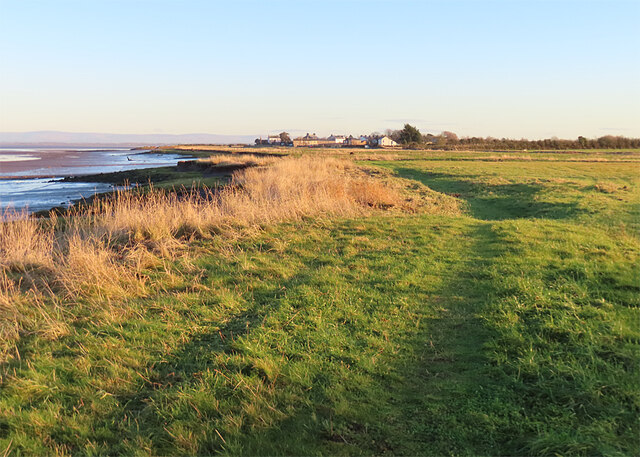
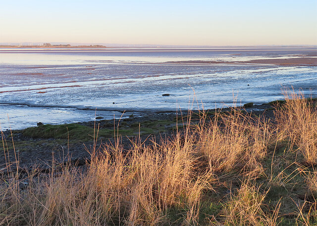
Kirkland Scar is a prominent coastal feature located in Cumberland, England. It is classified as a headland or point, extending out into the sea and forming a distinctive natural landmark along the coastline. The scar is situated in the northwestern region of Cumberland, near the small village of Kirkland.

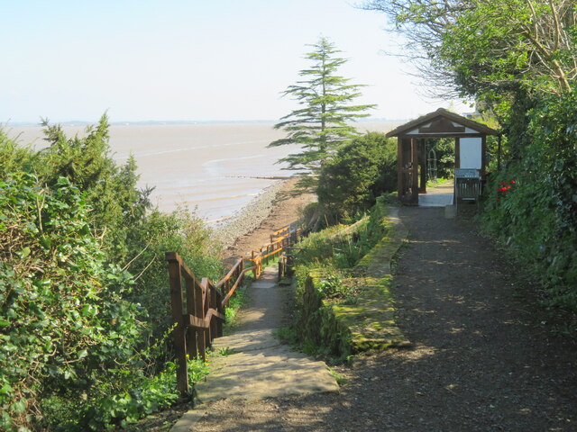
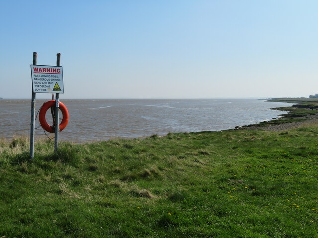
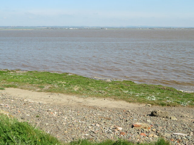
Rising to an impressive height, Kirkland Scar offers breathtaking panoramic views of the surrounding coastline and the Irish Sea. Its rugged cliffs are composed of sedimentary rocks, displaying layers of various geological formations, which provide valuable insights into the area's ancient history. The scar's exposed rock faces bear witness to the erosive forces of wind and waves, showcasing the dynamic nature of the coastal environment.

Kirkland Scar serves as an important habitat for a diverse range of flora and fauna. The sheer cliffs provide nesting sites for a variety of seabirds, including fulmars, kittiwakes, and guillemots. The surrounding waters are also home to a rich marine ecosystem, with species such as seals and dolphins frequently spotted in the area.

The scar's strategic location has made it a notable landmark for navigational purposes throughout history. Local fishermen and sailors often use Kirkland Scar as a visual reference point when navigating the treacherous waters of the Irish Sea.

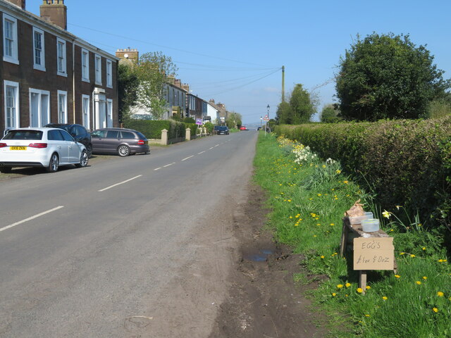
Today, Kirkland Scar attracts visitors from near and far, who come to admire its natural beauty and enjoy the stunning coastal scenery. The site offers opportunities for hiking, birdwatching, and photography, allowing visitors to immerse themselves in the raw and captivating landscape of Cumberland's coastline.

If you have any feedback on the listing, please let us know in the comments section below.

Kirkland Scar Images

Images are sourced within 2km of 54.949108/-3.1830483 or Grid Reference NY2462. Thanks to Geograph Open Source API. All images are credited.
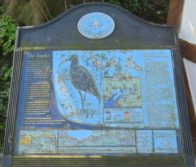
Coastal Path Officially, the Hadrian's Wall Path follows the road, but who could resist taking the unofficial route across the grass towards Port Carlisle?
Coastal Path
Officially, the Hadrian's Wall Path follows the road, but who could resist taking the unofficial route across the grass towards Port Carlisle?
Bowness Marsh To be more precise, the edge of Bowness Marsh with large areas of tidal sand and mud revealed at low tide.
Bowness Marsh
To be more precise, the edge of Bowness Marsh with large areas of tidal sand and mud revealed at low tide.
Bowness-on-Solway - St Michael's Church
Wesleyan Chapel, Bowness-on-Solway The foundation stone of the chapel -

WESLEYAN
HOME MISSION CHAPEL
BUILT BY
WILLIAM TOPPING
OF BOWNESS
1872
Wesleyan Chapel, Bowness-on-Solway
The foundation stone of the chapel - WESLEYAN HOME MISSION CHAPEL BUILT BY WILLIAM TOPPING OF BOWNESS 1872
Chapel, Bowness-on-Solway A small Wesleyan Chapel on the south side of the main street passing through the village, built in 1872, and now a private residence.
Chapel, Bowness-on-Solway
A small Wesleyan Chapel on the south side of the main street passing through the village, built in 1872, and now a private residence.
Path at Bowness-on-Solway Leading between houses, over the line of Hadrian's Wall, to the western end of the wall, the start of the National Trail, and a lookout and information point.
Path at Bowness-on-Solway
Leading between houses, over the line of Hadrian's Wall, to the western end of the wall, the start of the National Trail, and a lookout and information point.
National Trails - Hadrian's Wall Path A cast information panel, now somewhat weathered but still readable, with much information about the Roman occupation of the area at the western end of the wall. Part of The Solway Coast Area of Outstanding Natural Beauty and a World Heritage Site.
National Trails - Hadrian's Wall Path
A cast information panel, now somewhat weathered but still readable, with much information about the Roman occupation of the area at the western end of the wall. Part of The Solway Coast Area of Outstanding Natural Beauty and a World Heritage Site.
The Solway Firth Looking north from Bowness-on-Solway, about 2.6km across the firth, towards Annan. This was the lowest point at which it was feasible to ford the Solway Firth.
The Solway Firth
Looking north from Bowness-on-Solway, about 2.6km across the firth, towards Annan. This was the lowest point at which it was feasible to ford the Solway Firth.
Welcome to the Banks, Bowness-on-Solway [1] One of three panels with much interesting information about the area - history [from the Ice Age, through the Bronze Age, the Roman Occupation, the mediaeval period to the present], natural history, the National Trail and much more.
Welcome to the Banks, Bowness-on-Solway [1]
One of three panels with much interesting information about the area - history [from the Ice Age, through the Bronze Age, the Roman Occupation, the mediaeval period to the present], natural history, the National Trail and much more.
Welcome to the Banks, Bowness-on-Solway [2] One of three panels with much interesting information about the area - history [from the Ice Age, through the Bronze Age, the Roman Occupation, the mediaeval period to the present], natural history, the National Trail and much more.
Welcome to the Banks, Bowness-on-Solway [2]
One of three panels with much interesting information about the area - history [from the Ice Age, through the Bronze Age, the Roman Occupation, the mediaeval period to the present], natural history, the National Trail and much more.
Welcome to the Banks, Bowness-on-Solway [3] One of three panels with much interesting information about the area - history [from the Ice Age, through the Bronze Age, the Roman Occupation, the mediaeval period to the present], natural history, the National Trail and much more.
Welcome to the Banks, Bowness-on-Solway [3]
One of three panels with much interesting information about the area - history [from the Ice Age, through the Bronze Age, the Roman Occupation, the mediaeval period to the present], natural history, the National Trail and much more.
Wildlife mosaic at The Banks, Bowness-on-Solway A mosaic showing waders and water birds of the Solway area. It was composed from drawings by children from Bowness Primary School and  made by the artist Gilly Watson. It is in the shelter at the western end of Hadrian's Wall path.
Wildlife mosaic at The Banks, Bowness-on-Solway
A mosaic showing waders and water birds of the Solway area. It was composed from drawings by children from Bowness Primary School and made by the artist Gilly Watson. It is in the shelter at the western end of Hadrian's Wall path.
Hadrian's Wall National Trail The start of the trail for eastbound walkers at Bowness-on-Solway. The shelter contains information about the area.
Hadrian's Wall National Trail
The start of the trail for eastbound walkers at Bowness-on-Solway. The shelter contains information about the area.
Fort Maia, Bowness-on-Solway Entrance to Garrison Bistro and Visitor Centre at Bowness-on-Solway.
Fort Maia, Bowness-on-Solway
Entrance to Garrison Bistro and Visitor Centre at Bowness-on-Solway.
The Solway Coast Looking east between Bowness-on-Solway and Port Carlisle. The notice warns of 'fast moving tides, dangerous sinking sand and mud exposed at low tide'.
The Solway Coast
Looking east between Bowness-on-Solway and Port Carlisle. The notice warns of 'fast moving tides, dangerous sinking sand and mud exposed at low tide'.
The Solway Firth Looking northwest across the water towards Annan.
The Solway Firth
Looking northwest across the water towards Annan.
Roadside retailing Eggs for sale at Solwayside, Port Carlisle.
Roadside retailing
Eggs for sale at Solwayside, Port Carlisle.
Northlands and Sandheys, Port Carlisle Houses in a terrace, two of several with similar architecture on the main street of Port Carlisle.
Northlands and Sandheys, Port Carlisle
Houses in a terrace, two of several with similar architecture on the main street of Port Carlisle.
Show me another place!

Kirkland Scar is located at Grid Ref: NY2462 (Lat: 54.949108, Lng: -3.1830483)

Administrative County: Cumbria

District: Allerdale

Police Authority: Cumbria

What 3 Words

///brink.ground.saves. Near Eastriggs, Dumfries & Galloway

Related Wikis

Carlisle Canal

The Carlisle Canal opened in 1823, linking Carlisle to the Solway Firth, to facilitate the transport of goods to and from the city. It was a short-lived...

Port Carlisle

Port Carlisle is a coastal village in Allerdale, Cumbria, England. It is in the civil parish of Bowness-on-Solway. Its original name was Fisher's Cross...

Port Carlisle railway station

Port Carlisle railway station was a railway station in Port Carlisle, Cumbria; the terminus on the Port Carlisle Railway, serving the village and old port...

Milecastle 79

Milecastle 79 (Solway House) was one of a series of Milecastles or small fortlets built at intervals of approximately one Roman mile along Hadrian's Wall...

Nearby Amenities

Located within 500m of 54.949108,-3.1830483
Port Carlisle
Abandoned Railway: station
Railway: site
Wikidata: Q7230526
Wikipedia: en:Port Carlisle railway station
Lat/Long: 54.9471446/-3.1850822
Bus Stop
Hope and Anchor (N bound)
Naptan AtcoCode: 090002132338
Naptan Bearing: W
Naptan BusStopType: CUS
Naptan CommonName: Hope and Anchor (N bound)
Naptan Indicator: o/s
Naptan Landmark: Hope and Anchor PH
Naptan NaptanCode: cumadgmg
Naptan Street: No name
Naptan Verified: no
Shelter: no
Source: naptan_import
Lat/Long: 54.9487509/-3.1876383
Bus Stop
Hope and Anchor (S bound)
Check Date Shelter: 2021-10-09
Naptan AtcoCode: 090002133371
Naptan Bearing: SE
Naptan BusStopType: CUS
Naptan CommonName: Hope and Anchor (S bound)
Naptan Indicator: opp
Naptan Landmark: Hope and Anchor Pub
Naptan NaptanCode: cumadgpm
Naptan Street: No name
Naptan Verified: no
Shelter: no
Source: naptan_import
Lat/Long: 54.948772/-3.1874433
Post Box
Ref: CA7 167
Lat/Long: 54.9477327/-3.1864564
Westfield Marsh
Natural: wetland
Wetland: marsh
Lat/Long: 54.9451714/-3.1803223
Kirkland Scar
Place: locality
Lat/Long: 54.9492294/-3.1838832
Covered: no
Leisure: picnic_table
Lat/Long: 54.9480884/-3.1850321
Destination: Bowness on Solway;Glasson
Hiking: yes
Information: guidepost
Inscription: Hadrian's Wall Path;Public Footpath
Operator: National Trails
Tourism: information
Lat/Long: 54.9497109/-3.1886889
Power: pole
Lat/Long: 54.9492626/-3.1894327
Power: pole
Lat/Long: 54.9482673/-3.1891277
Power: pole
Lat/Long: 54.9474001/-3.1890757
Power: pole
Lat/Long: 54.9465105/-3.1890868
Power: pole
Lat/Long: 54.9468053/-3.1885215
Power: pole
Lat/Long: 54.9474994/-3.1874412
The data included in this document is from www.openstreetmap.org. The data is made available under ODbL.

Have you been to Kirkland Scar?

Leave your review of Kirkland Scar below (or comments, questions and feedback).