Angerton, Low

Settlement in Northumberland

England

Angerton, Low

St Andrew's Church, Hartburn A Grade I listed church with 11th century Anglo-Saxon tower.
The graveyard is on the edge of a steep ravine down to the Hart Burn.
St Andrew's Church, Hartburn Credit: Russel Wills

Angerton is a small village located in the county of Northumberland, in the northeast of England. It lies within the civil parish of Low, which is part of the larger district of Alnwick. Situated near the A697 road, Angerton is approximately 5 miles south of Alnwick and 35 miles north of Newcastle upon Tyne.

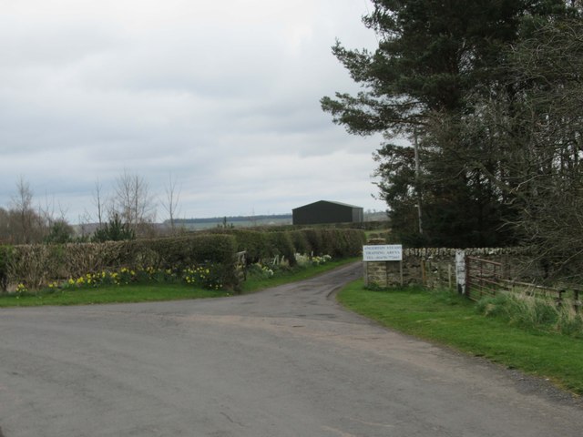
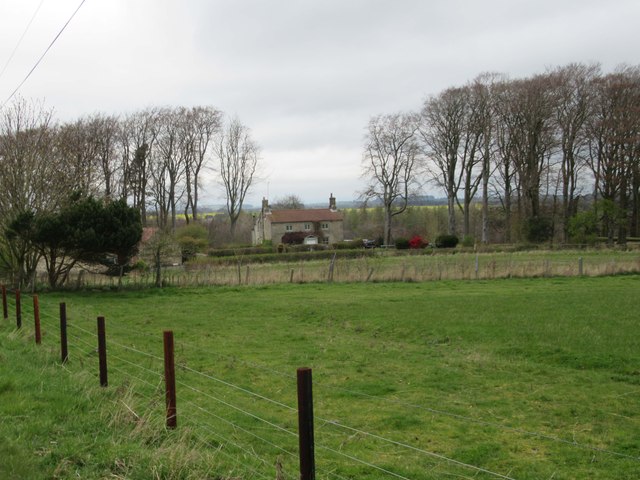
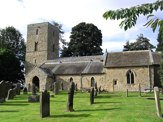
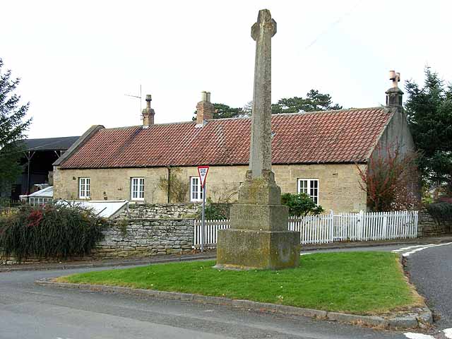
The village is characterized by its rural surroundings and picturesque landscapes. Nestled in the scenic Northumberland countryside, it offers residents and visitors a peaceful and tranquil environment. The area is known for its rolling hills, open fields, and rich wildlife, making it a popular destination for nature lovers.

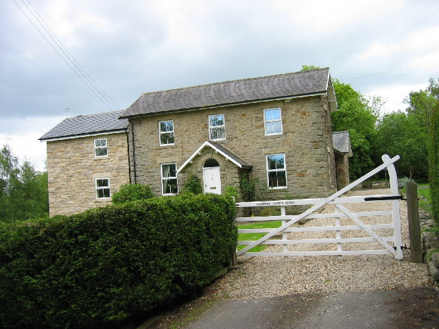
Angerton itself is a close-knit community with a small population. The village primarily consists of traditional stone-built houses, many of which have retained their original charm. There are limited amenities within the village, with a village hall being the main communal facility. However, the nearby town of Alnwick provides a range of services, including shops, schools, and healthcare facilities.

For those seeking outdoor activities, Angerton offers easy access to the Northumberland National Park, which is renowned for its stunning landscapes and opportunities for hiking, cycling, and wildlife spotting. The village is also a short drive away from the Northumberland coastline, where visitors can enjoy long sandy beaches and explore historic castles such as Bamburgh and Dunstanburgh.

Overall, Angerton is a peaceful and idyllic village that provides a serene countryside lifestyle, while still being within reach of essential amenities and nearby attractions.

If you have any feedback on the listing, please let us know in the comments section below.

Angerton, Low Images

Images are sourced within 2km of 55.152972/-1.851673 or Grid Reference NZ0984. Thanks to Geograph Open Source API. All images are credited.

St Andrew's Church, Hartburn A Grade I listed church with 11th century Anglo-Saxon tower.
The graveyard is on the edge of a steep ravine down to the Hart Burn.
St Andrew's Church, Hartburn
A Grade I listed church with 11th century Anglo-Saxon tower. The graveyard is on the edge of a steep ravine down to the Hart Burn.
View from St Andrew's Church graveyard Down to the Hart Burn.
View from St Andrew's Church graveyard
Down to the Hart Burn.
Gateway to St Andrew's Church Approached from the War Memorial past a convenient car park.
Gateway to St Andrew's Church
Approached from the War Memorial past a convenient car park.
Hartburn War Memorial On its triangular grass area where roads meet in the village.
Hartburn War Memorial was designed by renowned architect Sir Edwin Lutyens to his War Cross design. It was commissioned by Mr and Mrs Straker of nearby Angerton Hall, whose gardens Lutyens renovated in 1904, and unveiled on 31 July 1921. It is a grade II listed building.
Hartburn War Memorial
On its triangular grass area where roads meet in the village. Hartburn War Memorial was designed by renowned architect Sir Edwin Lutyens to his War Cross design. It was commissioned by Mr and Mrs Straker of nearby Angerton Hall, whose gardens Lutyens renovated in 1904, and unveiled on 31 July 1921. It is a grade II listed building.
Churchyard sundial Free standing sundial dated 1720, just inside the front gate of St Andrew's Church.  Sadly it has lost its gnomon but the face engravings are just about still visible.  Grade II listed

<span class="nowrap"><a title="https://historicengland.org.uk/listing/the-list/list-entry/1042119?section=official-list-entry" rel="nofollow ugc noopener" href="https://historicengland.org.uk/listing/the-list/list-entry/1042119?section=official-list-entry">Link</a><img style="margin-left:2px;" alt="External link" title="External link - shift click to open in new window" src="https://s1.geograph.org.uk/img/external.png" width="10" height="10"/></span>

<a href="https://www.geograph.org.uk/photo/7339065">NZ0985 : Sundial face</a>
Churchyard sundial
Free standing sundial dated 1720, just inside the front gate of St Andrew's Church. Sadly it has lost its gnomon but the face engravings are just about still visible. Grade II listed LinkExternal link NZ0985 : Sundial face
Sundial face Free standing sundial dated 1720, just inside the front gate of St Andrew's Church. Sadly it has lost its gnomon but the face engravings are just about still visible. Grade II listed

<span class="nowrap"><a title="https://historicengland.org.uk/listing/the-list/list-entry/1042119?section=official-list-entry" rel="nofollow ugc noopener" href="https://historicengland.org.uk/listing/the-list/list-entry/1042119?section=official-list-entry">Link</a><img style="margin-left:2px;" alt="External link" title="External link - shift click to open in new window" src="https://s1.geograph.org.uk/img/external.png" width="10" height="10"/></span>

<a href="https://www.geograph.org.uk/photo/7339056">NZ0985 : Churchyard sundial</a>
Sundial face
Free standing sundial dated 1720, just inside the front gate of St Andrew's Church. Sadly it has lost its gnomon but the face engravings are just about still visible. Grade II listed LinkExternal link NZ0985 : Churchyard sundial
Unnamed Stream in the Smithy Area
Unnamed Stream at Hartburn
Footpath and Farmland
Gatehouse at Angerton Hall
Angerton Hall (Hartburn) The hall was first designed and built by the regionally famous architect John Dobson in 1842. This is in the then-popular Tudor Gothic style of building. This style consciously copied the past for ornamental details. An example of such are the battlements parapet at the top of the building. There are many original features of this building that survive - this is a Listed Building so they are now protected. Some alterations to Dobson's work have taken place. A garden wall was added in 1904 by the nationally-famous Edwin Lutyens. Some of the changes can be seen in the various editions of the Ordnance Survey mapping of the area.
<span class="nowrap"><a title="https://keystothepast.info/search-records/results-of-search/results-of-search-2/site-details/?PRN=N17658" rel="nofollow ugc noopener" href="https://keystothepast.info/search-records/results-of-search/results-of-search-2/site-details/?PRN=N17658">Link</a><img style="margin-left:2px;" alt="External link" title="External link - shift click to open in new window" src="https://s1.geograph.org.uk/img/external.png" width="10" height="10"/></span>
Angerton Hall (Hartburn)
The hall was first designed and built by the regionally famous architect John Dobson in 1842. This is in the then-popular Tudor Gothic style of building. This style consciously copied the past for ornamental details. An example of such are the battlements parapet at the top of the building. There are many original features of this building that survive - this is a Listed Building so they are now protected. Some alterations to Dobson's work have taken place. A garden wall was added in 1904 by the nationally-famous Edwin Lutyens. Some of the changes can be seen in the various editions of the Ordnance Survey mapping of the area. LinkExternal link
Low Angerton Farm and River Wansbeck
Low Angerton Bridges (Hartburn) The southern bridge spans the River Wansbeck and the northern one is a flood bridge. They were built by The British Concrete Steel Company in 1908. This is a Grade II Listed Building protected by law.
<span class="nowrap"><a title="https://keystothepast.info/search-records/results-of-search/results-of-search-2/site-details/?PRN=N10657" rel="nofollow ugc noopener" href="https://keystothepast.info/search-records/results-of-search/results-of-search-2/site-details/?PRN=N10657">Link</a><img style="margin-left:2px;" alt="External link" title="External link - shift click to open in new window" src="https://s1.geograph.org.uk/img/external.png" width="10" height="10"/></span>
Low Angerton Bridges (Hartburn)
The southern bridge spans the River Wansbeck and the northern one is a flood bridge. They were built by The British Concrete Steel Company in 1908. This is a Grade II Listed Building protected by law. LinkExternal link
Ornate Railings on Low Angerton Bridge
Angerton Station House
Looking towards the line of The Old Railway Line
Entrance to Angerton Steads
Angertonmoor Cottage
Show me another place!

Angerton, Low is located at Grid Ref: NZ0984 (Lat: 55.152972, Lng: -1.851673)

Unitary Authority: Northumberland

Police Authority: Northumbria

What 3 Words

///airbag.dive.plotter. Near Hartburn, Northumberland

Related Wikis

Nearby Amenities

Located within 500m of 55.152972,-1.851673
Low Angerton Bridge
Place: locality
Lat/Long: 55.1532564/-1.8558786
The Park
Place: locality
Lat/Long: 55.1566395/-1.8530682
Post Box
Collection Times: Mo-Fr 16:15; Sa 08:30
Post Box Type: lamp
Ref: NE61 58
Royal Cypher: EIIR
Royal Cypher Wikidata: Q33102113
Source: survey
Lat/Long: 55.1528667/-1.8549004
The data included in this document is from www.openstreetmap.org. The data is made available under ODbL.

Have you been to Angerton, Low?

Leave your review of Angerton, Low below (or comments, questions and feedback).