Erens Geo

Coastal Feature, Headland, Point in Orkney

Scotland

Erens Geo

Vestra Fiold trig pillar
Vestra Fiold trig pillar Credit: John Ferguson

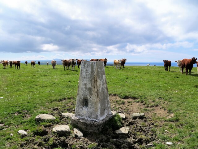
Erens Geo is a prominent coastal feature located in Orkney, an archipelago in the northernmost part of Scotland. It is classified as a headland or point due to its distinctive geographical characteristics and its prominent position in the coastal landscape.

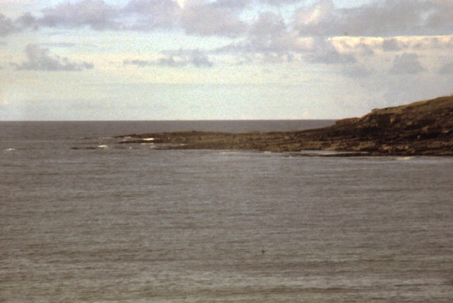
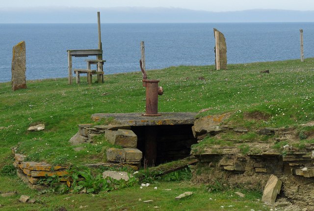
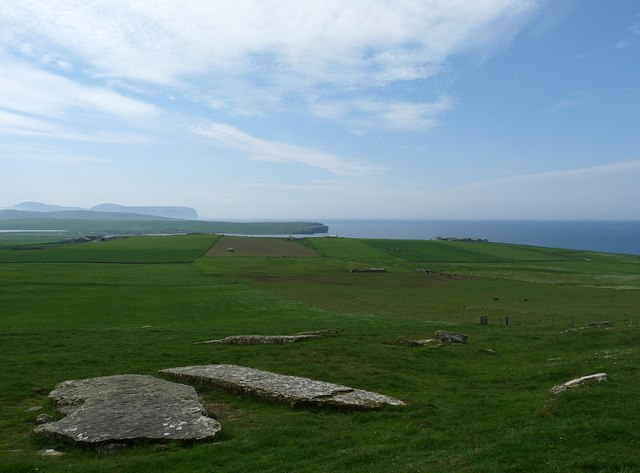
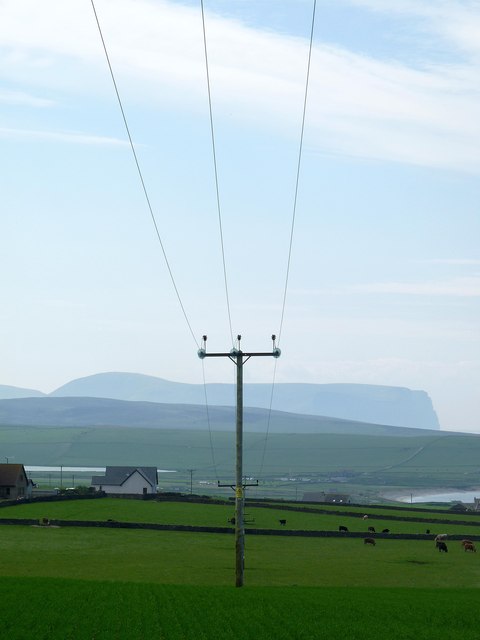
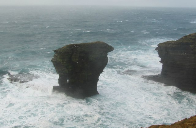
Situated on the west coast of the island of Shapinsay, Erens Geo juts out into the North Sea, providing breathtaking views of the surrounding coastal areas. The headland is characterized by its rugged cliffs, which rise steeply from the sea, creating an imposing and dramatic sight. These cliffs are composed of sedimentary rocks, primarily sandstone and shale, which display layers of different colors and textures, adding to the visual appeal of the area.

Erens Geo is also known for its diverse wildlife and rich biodiversity. The coastal waters surrounding the headland are home to a variety of seabirds, such as puffins, guillemots, and kittiwakes, making it a popular spot for birdwatching enthusiasts. The surrounding grasslands and heathland provide habitat for a range of plant species, including wildflowers and grasses.

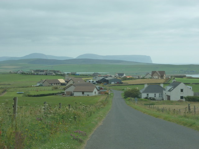
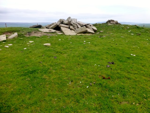
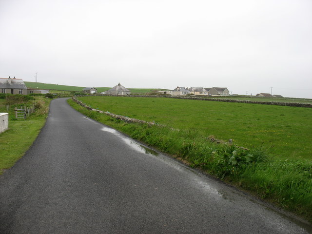
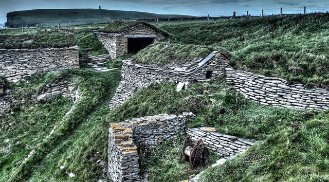
The headland is easily accessible to visitors, with well-maintained footpaths leading to its edge, allowing for stunning panoramic views of the coastline and the surrounding sea. The area is also of historical interest, with archaeological sites nearby, including the remains of a Viking settlement and a Neolithic chambered cairn.

Overall, Erens Geo in Orkney is a captivating coastal feature, offering visitors the opportunity to appreciate the rugged beauty of the Scottish coastline, observe diverse wildlife, and explore the rich history of the region.

If you have any feedback on the listing, please let us know in the comments section below.

Erens Geo Images

Images are sourced within 2km of 59.075016/-3.3472092 or Grid Reference HY2221. Thanks to Geograph Open Source API. All images are credited.

Vestra Fiold trig pillar
Bay of Skaill - 1979 Bay of Skaill and Knowe of Verron seen from Skara Brae.
The Bay of Skaill is a small bay on the west coast of the Orkney Mainland, Scotland.
Bay of Skaill is the location of the famous Neolithic settlement, Skara Brae, and a large residence, Skaill House, the property of the laird on whose estate Skara Brae was discovered.
Bay of Skaill - 1979
Bay of Skaill and Knowe of Verron seen from Skara Brae. The Bay of Skaill is a small bay on the west coast of the Orkney Mainland, Scotland. Bay of Skaill is the location of the famous Neolithic settlement, Skara Brae, and a large residence, Skaill House, the property of the laird on whose estate Skara Brae was discovered.
Quoyloo: approaching from the north Looking along the B9056 as it heads down into Quoyloo, with the lofty island of Hoy looming large in the distance.
Quoyloo: approaching from the north
Looking along the B9056 as it heads down into Quoyloo, with the lofty island of Hoy looming large in the distance.
Quoyloo: the shop/post office Like many village stores in the northern isles, Isbister Bros. Ltd. is not just a shop but also a petrol filling station and (weekday mornings) a post office. It is situated on the crossroads on the B9056.
Quoyloo: the shop/post office
Like many village stores in the northern isles, Isbister Bros. Ltd. is not just a shop but also a petrol filling station and (weekday mornings) a post office. It is situated on the crossroads on the B9056.
Quoyloo: postbox № KW16 18 This Elizabeth II-reign postbox is attached to the wall of <a href="https://www.geograph.org.uk/photo/2624174">HY2421 : Quoyloo: the shop/post office</a> and is emptied at 10:30 each weekday and Saturday morning.
Quoyloo: postbox № KW16 18
This Elizabeth II-reign postbox is attached to the wall of HY2421 : Quoyloo: the shop/post office and is emptied at 10:30 each weekday and Saturday morning.
Quoyloo: the church A simple, plain Victorian church on one of the back lanes.
Quoyloo: the church
A simple, plain Victorian church on one of the back lanes.
St. Peters kirk, Skaill, Sandwick,Orkney from 'Castle o Snusgar' View of St Peters' kirk  near the Bay of Skaill. Photograph take from the 'Castle o Snusgar' hill (small hill).
St. Peters kirk, Skaill, Sandwick,Orkney from 'Castle o Snusgar'
View of St Peters' kirk near the Bay of Skaill. Photograph take from the 'Castle o Snusgar' hill (small hill).
St Peter's Kirk Not in use but now in the care of the Scottish Redundant Churches Trust.
St Peter's Kirk
Not in use but now in the care of the Scottish Redundant Churches Trust.
War memorial by St Peter's Kirk Situated in the graveyard of the kirk, overlooking the Bay of Skaill.
War memorial by St Peter's Kirk
Situated in the graveyard of the kirk, overlooking the Bay of Skaill.
The interior of St Peter's Kirk The pulpit has a central location reflecting the priority of the church. It was fascinating to see the little room for the Sunday School children under the pulpit.
The interior of St Peter's Kirk
The pulpit has a central location reflecting the priority of the church. It was fascinating to see the little room for the Sunday School children under the pulpit.
Well on farmland, Northdyke, Orkney The well is shown on the OS 1:25,000 map.

The stile is on the coastal footpath which runs the length of mainland Orkney's west coast.
Well on farmland, Northdyke, Orkney
The well is shown on the OS 1:25,000 map. The stile is on the coastal footpath which runs the length of mainland Orkney's west coast.
Prehistoric building, Bay of Skail, Orkney This site is shown as a broch on the OS map, but the entries on its RCAHMS record describe it as a possible or probable broch: <span class="nowrap"><a title="http://canmore.rcahms.gov.uk/en/site/1675/details/verron/" rel="nofollow ugc noopener" href="http://canmore.rcahms.gov.uk/en/site/1675/details/verron/">Link</a><img style="margin-left:2px;" alt="External link" title="External link - shift click to open in new window" src="https://s1.geograph.org.uk/img/external.png" width="10" height="10"/></span> .
Prehistoric building, Bay of Skail, Orkney
This site is shown as a broch on the OS map, but the entries on its RCAHMS record describe it as a possible or probable broch: LinkExternal link .
Quarried slabs below Vestra Fiold, Orkney From <span class="nowrap"><a title="http://canmore.rcahms.gov.uk/en/site/1923/details/vestrafiold" rel="nofollow ugc noopener" href="http://canmore.rcahms.gov.uk/en/site/1923/details/vestrafiold">Link</a><img style="margin-left:2px;" alt="External link" title="External link - shift click to open in new window" src="https://s1.geograph.org.uk/img/external.png" width="10" height="10"/></span> : "What is believed to be an ancient quarry from which slabs have been taken for circles and standing stones lies on the S slope of Vestra Fiold; a quarter of a mile N of the farm-house of Breck. Across the shoulder of the hill, in two groups, a large number of massive slabs are still to be seen. In the upper group typical slabs measure 4ft 6in by 3ft 6in and 5ft by 3ft, but in the lower group some are much bigger, three in particular measuring 14ft 9in by 5ft 3in by 6in thick; 18ft 6in by 5ft 6in; 16ft by 6ft. The last mentioned stone appears to have been roughly wedged up as if in readiness for removal."
Quarried slabs below Vestra Fiold, Orkney
From LinkExternal link : "What is believed to be an ancient quarry from which slabs have been taken for circles and standing stones lies on the S slope of Vestra Fiold; a quarter of a mile N of the farm-house of Breck. Across the shoulder of the hill, in two groups, a large number of massive slabs are still to be seen. In the upper group typical slabs measure 4ft 6in by 3ft 6in and 5ft by 3ft, but in the lower group some are much bigger, three in particular measuring 14ft 9in by 5ft 3in by 6in thick; 18ft 6in by 5ft 6in; 16ft by 6ft. The last mentioned stone appears to have been roughly wedged up as if in readiness for removal."
Power lines crossing farmland below Vestra Fiold, Orkney Looking towards Loch of Skaill on the left and Bay of Skaill on the right.  Beyond are the northern cliffs of Hoy.
Power lines crossing farmland below Vestra Fiold, Orkney
Looking towards Loch of Skaill on the left and Bay of Skaill on the right. Beyond are the northern cliffs of Hoy.
Vestra Fiold Thirteenth TuMP of the day with Jim Bloomer and Tricky Speirs on a sunny afternoon.
Name: Vestra Fiold
Hill number: 4928
Height: 129m / 423ft
Parent (Ma/M): 1555  Milldoe - Mid Tooin
Area:23: Orkney Islands
Class: Hu,1
Grid ref: HY 24157 22106
Summit feature:most southerly of two cairns 60m S of trig point
Drop: 110m
Col: 19m  HY274243
Vestra Fiold
Thirteenth TuMP of the day with Jim Bloomer and Tricky Speirs on a sunny afternoon. Name: Vestra Fiold Hill number: 4928 Height: 129m / 423ft Parent (Ma/M): 1555 Milldoe - Mid Tooin Area:23: Orkney Islands Class: Hu,1 Grid ref: HY 24157 22106 Summit feature:most southerly of two cairns 60m S of trig point Drop: 110m Col: 19m HY274243
The Spord sea stack A stormy sea and stack just off West mainland
The Spord sea stack
A stormy sea and stack just off West mainland
Minor road in Scarwell Heading for Dounby.
Minor road in Scarwell
Heading for Dounby.
Restored Fishermen's Huts The restored Fishermen's Huts at Sand Geo, Marwick.
Restored Fishermen's Huts
The restored Fishermen's Huts at Sand Geo, Marwick.
Show me another place!

Erens Geo is located at Grid Ref: HY2221 (Lat: 59.075016, Lng: -3.3472092)

Unitary Authority: Orkney Islands

Police Authority: Highlands and Islands

What 3 Words

///eclipses.tiny.broom. Near Sandwick, Orkney Islands

Related Wikis

Bay of Skaill

The Bay of Skaill (from Old Norse Bugr Skála) is a small bay on the west coast of the Orkney Mainland, Scotland. == Visitor attractions == Bay of Skaill...

Skara Brae

Skara Brae is a stone-built Neolithic settlement, located on the Bay of Skaill on the west coast of Mainland, the largest island in the Orkney archipelago...
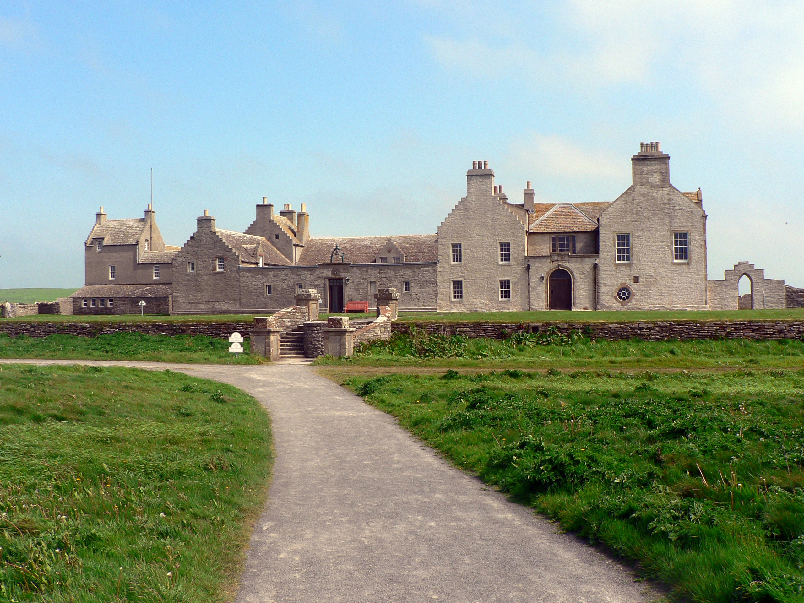
Skaill House

Skaill House is a historic manor house in Sandwick parish on Mainland, the largest of the Orkney Islands, Scotland. The house overlooks the neolithic site...

Kitchener Memorial

The Kitchener Memorial is a 48 ft tower war memorial in Birsay, Orkney Islands, erected after the sinking of British battleship HMS Hampshire. == History... ==

Have you been to Erens Geo?

Leave your review of Erens Geo below (or comments, questions and feedback).