West Gotten

Coastal Feature, Headland, Point in Caithness

Scotland

West Gotten

Caithness Oil drilling rig
Caithness Oil drilling rig Credit: sylvia duckworth

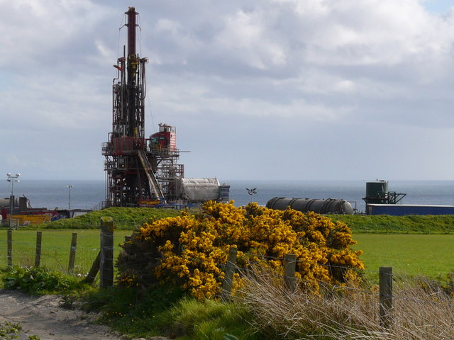
West Gotten is a prominent headland located on the northern coast of Caithness, a county in the Highland region of Scotland. Situated approximately 5 miles west of Thurso, this coastal feature is known for its rugged cliffs, stunning views, and historical significance.

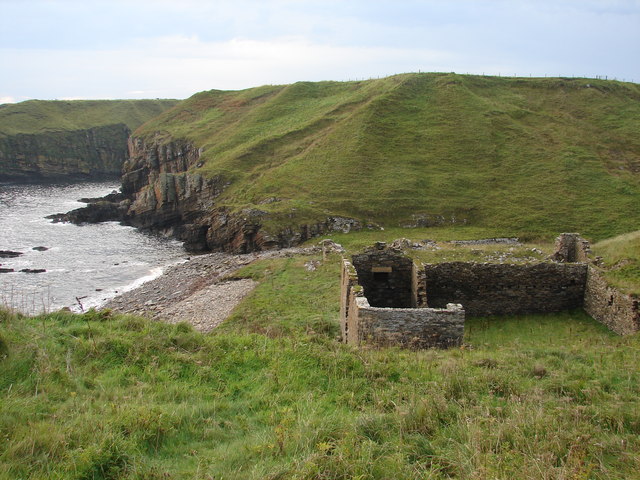
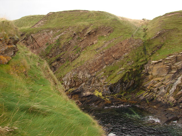
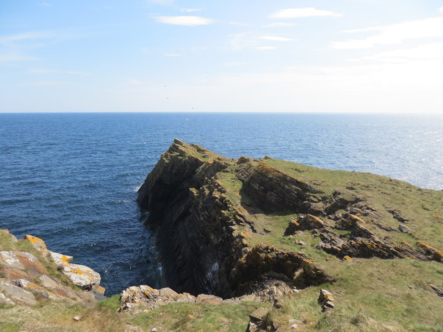
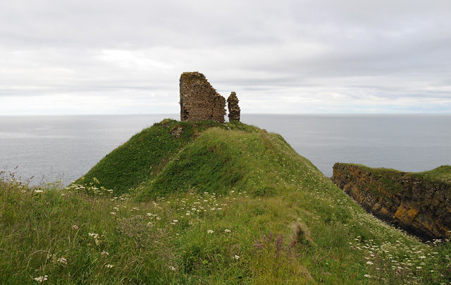
The headland juts out into the North Sea, forming a distinctive point that offers panoramic vistas of the surrounding landscape. The cliffs of West Gotten rise dramatically from the sea, reaching heights of up to 200 feet in some areas. These cliffs are composed of sedimentary rocks, primarily sandstone and flagstone, which have been weathered by the relentless pounding of the waves over centuries.

The area surrounding West Gotten is rich in wildlife, with seabird colonies nesting on the cliffs, including guillemots, razorbills, and puffins. The coastal waters are also home to seals, dolphins, and occasionally even whales, making it a popular spot for wildlife enthusiasts and birdwatchers.

Historically, West Gotten played a significant role as a defensive landmark, with the ruins of a broch, an Iron Age fortified structure, still visible on the headland. This ancient fortification provides insights into the area's past, serving as a reminder of its historical importance.

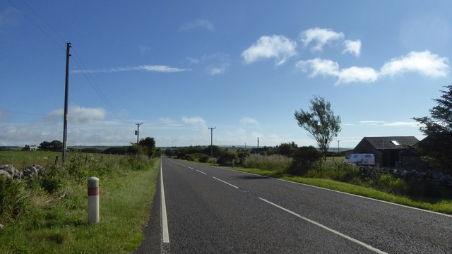
Access to West Gotten is relatively easy, with a well-maintained footpath leading visitors along the cliff edge, providing breathtaking views of the coastline and the North Sea. The headland is a popular destination for hikers, photographers, and those seeking a peaceful escape in nature.

If you have any feedback on the listing, please let us know in the comments section below.

West Gotten Images

Images are sourced within 2km of 58.285532/-3.3253233 or Grid Reference ND2233. Thanks to Geograph Open Source API. All images are credited.

Caithness Oil drilling rig
Peak of the cliff Facing westwards back towards land with the sheer cliff behind and on either side, I was definitely not tempted to take a step back to get a better view!
This is the northernmost of the two fingers pointing from Achastle-shore.
Peak of the cliff
Facing westwards back towards land with the sheer cliff behind and on either side, I was definitely not tempted to take a step back to get a better view! This is the northernmost of the two fingers pointing from Achastle-shore.
Ruins at Achastle-shore Not sure what the history of this property is.  There is a track leading to the main road although it is quite overgrown.
Ruins at Achastle-shore
Not sure what the history of this property is. There is a track leading to the main road although it is quite overgrown.
Remains of Swiney Castle This may appear to be a few mounds in the grass, but it is probably the remains of Swiney Castle <span class="nowrap"><a title="http://canmore.rcahms.gov.uk/en/site/8651/details/swiney+castle/" rel="nofollow ugc noopener" href="http://canmore.rcahms.gov.uk/en/site/8651/details/swiney+castle/">Link</a><img style="margin-left:2px;" alt="External link" title="External link - shift click to open in new window" src="https://s1.geograph.org.uk/img/external.png" width="10" height="10"/></span>.  To my back, left and right are some precipituous cliffs leading down to the sea.  An ideal location for a defensive position.
Remains of Swiney Castle
This may appear to be a few mounds in the grass, but it is probably the remains of Swiney Castle LinkExternal link. To my back, left and right are some precipituous cliffs leading down to the sea. An ideal location for a defensive position.
North of Swiney Castle Strata and cliffs marking the northern edge of the ruins of Swiney Castle. <span class="nowrap"><a title="http://canmore.rcahms.gov.uk/en/site/8651/details/swiney+castle/" rel="nofollow ugc noopener" href="http://canmore.rcahms.gov.uk/en/site/8651/details/swiney+castle/">Link</a><img style="margin-left:2px;" alt="External link" title="External link - shift click to open in new window" src="https://s1.geograph.org.uk/img/external.png" width="10" height="10"/></span>
North of Swiney Castle
Strata and cliffs marking the northern edge of the ruins of Swiney Castle. LinkExternal link
South of Swiney Castle Inlet and promontory to the south of the ancient monument known as Swiney Castle <span class="nowrap"><a title="http://canmore.rcahms.gov.uk/en/site/8651/details/swiney+castle/" rel="nofollow ugc noopener" href="http://canmore.rcahms.gov.uk/en/site/8651/details/swiney+castle/">Link</a><img style="margin-left:2px;" alt="External link" title="External link - shift click to open in new window" src="https://s1.geograph.org.uk/img/external.png" width="10" height="10"/></span>.
South of Swiney Castle
Inlet and promontory to the south of the ancient monument known as Swiney Castle LinkExternal link.
East of Swiney Castle Nowhere else to go apart from down  The grounds of Swiney Castle <span class="nowrap"><a title="http://canmore.rcahms.gov.uk/en/site/8651/details/swiney+castle/" rel="nofollow ugc noopener" href="http://canmore.rcahms.gov.uk/en/site/8651/details/swiney+castle/">Link</a><img style="margin-left:2px;" alt="External link" title="External link - shift click to open in new window" src="https://s1.geograph.org.uk/img/external.png" width="10" height="10"/></span> come to an abrupt end at Creag an Eich.
East of Swiney Castle
Nowhere else to go apart from down The grounds of Swiney Castle LinkExternal link come to an abrupt end at Creag an Eich.
Rocks in the North Sea near Port na Muic
Remains of an old herring fishing station at Achastle-shore
Headland of Creag an Eich
Cliffs at Leac Gallain
Trig pillar on Swiney Hill Overlooking the North Sea
Trig pillar on Swiney Hill
Overlooking the North Sea
A99 east of Latheron
Post Box, Forse Cast-iron pedestal-mounted post box at Forse beside the A99.
Post Box, Forse
Cast-iron pedestal-mounted post box at Forse beside the A99.
Forse Castle
Forse Castle
Ironwork, The Quarries This spot on the coast south of Lybster is known as the quarries. From here the stone was hewn and transported to build the harbour. Some bits of ironwork remains by the water edge.
Ironwork, The Quarries
This spot on the coast south of Lybster is known as the quarries. From here the stone was hewn and transported to build the harbour. Some bits of ironwork remains by the water edge.
Post box, Swiney A fine W.T. Allen & Co. London wall box at Swiney. It dates from the reign of King George V.
Post box, Swiney
A fine W.T. Allen & Co. London wall box at Swiney. It dates from the reign of King George V.
Show me another place!

West Gotten is located at Grid Ref: ND2233 (Lat: 58.285532, Lng: -3.3253233)

Unitary Authority: Highland

Police Authority: Highlands and Islands

What 3 Words

///strongman.confronts.squirts. Near Dunbeath, Highland

Related Wikis

Forse Castle

Forse Castle is a ruined building dating from 1200 in the hamlet of Forse in the Caithness region in the Scottish council area of Highland. It is protected...

Latheron

Latheron (from Scottish Gaelic Latharn 'muddy place') is a small village and civil parish in Caithness, in the Highland area of Scotland, centred on the...

Swiney

Swiney is a small village on the east coast of Scotland, 1 mile west of Lybster along the A99 road, in Caithness, Scottish Highlands and is in the Scottish...

Latheronwheel

Latheronwheel (from Scottish Gaelic Latharn a' Phuill 'muddy place of the pool') is a small village in Caithness, in the Highland area of Scotland. It...

Lybster

Lybster (, Scottish Gaelic: Liabost) is a village on the east coast of Caithness in northern Scotland. It was once a big herring fishing port. The Waterlines...

Lybster railway station

Lybster was a railway station located on the Wick and Lybster Railway in the Highland area of Scotland. The station building now serves as the clubhouse...

Parkside Halt railway station

Parkside Halt was a railway station located between Ulbster and Lybster, Highland. == History == The station was opened on the Wick and Lybster Railway...

Smerral

Smerral is a small hamlet on the eastern coast of Caithness, Scottish Highlands and is in the Scottish council area of Highland. It lies 1 mile (1.6 km...

Have you been to West Gotten?

Leave your review of West Gotten below (or comments, questions and feedback).