Bootle Stone

Coastal Feature, Headland, Point in Lancashire South Lakeland

England

Bootle Stone

Historic Vehicle Show at Earnsie Bay Scammel with trailer and tank at a show by the Historic Vehicle Society at Earnsie Bay car park.
Historic Vehicle Show at Earnsie Bay Credit: David Jackson

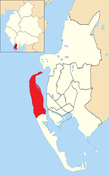
Bootle Stone is a prominent coastal feature situated in the county of Lancashire, England. It is located on the western coast of the country, specifically on the coast of the Irish Sea. Bootle Stone is categorized as a headland, also known as a point, due to its protrusion into the sea.

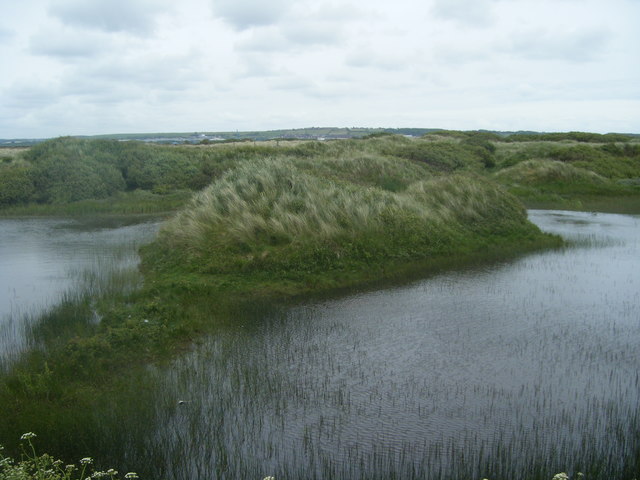
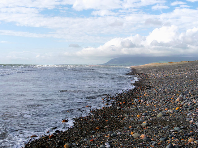
The headland is formed from a prominent outcrop of rock that juts out into the water, creating a distinctive feature along the coastline. The rock itself is a hard sedimentary type, likely composed of sandstone or limestone, which gives it its durability against the constant wave action.

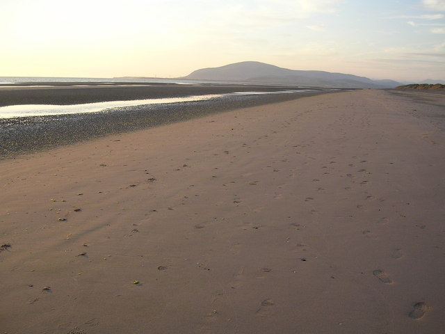
Bootle Stone provides a picturesque view, as it offers a stark contrast between the rugged rocky surface and the surrounding sandy beaches. It serves as a natural landmark for both locals and visitors, with its unique shape and position making it easily recognizable from a distance.

The headland is also home to a variety of marine life, attracting nature enthusiasts and wildlife observers. The coastal waters surrounding Bootle Stone are known to support a diverse range of aquatic species, such as seals, seabirds, and fish.

Additionally, the area around Bootle Stone offers recreational opportunities for visitors. The sandy beaches nearby are popular for coastal walks, beachcombing, and picnics. The headland also provides an excellent vantage point for birdwatching and photography, allowing visitors to capture the scenic beauty of the coastline.

Overall, Bootle Stone in Lancashire is a notable coastal feature that combines natural beauty, ecological importance, and recreational opportunities for both locals and tourists.

If you have any feedback on the listing, please let us know in the comments section below.
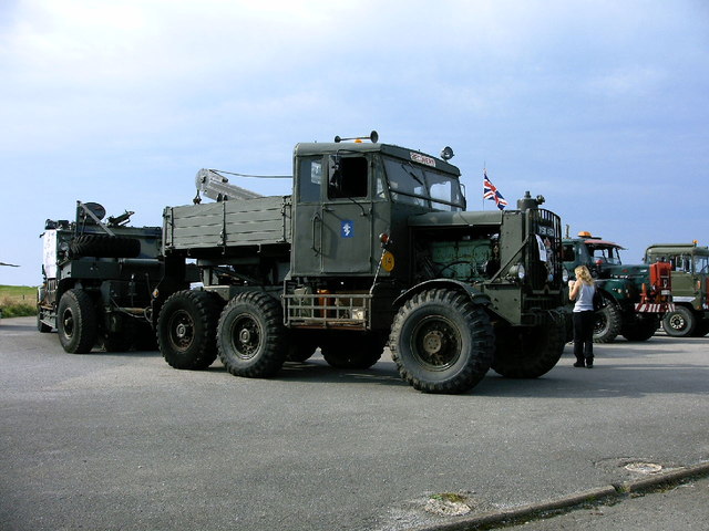
Bootle Stone Images

Images are sourced within 2km of 54.124236/-3.2950571 or Grid Reference SD1570. Thanks to Geograph Open Source API. All images are credited.

Historic Vehicle Show at Earnsie Bay Scammel with trailer and tank at a show by the Historic Vehicle Society at Earnsie Bay car park.
Historic Vehicle Show at Earnsie Bay
Scammel with trailer and tank at a show by the Historic Vehicle Society at Earnsie Bay car park.
Towards the breakwater at Earnse Point
Car park at Earnse Point
North Walney Reserve
Dunes on North Walney
Pebbled Beach North of Earnse point Walney Island is a long, comparatively narrow island across a narrow channel (The Walney Channel) from the southwestern end of the Furness Peninsula. It acts as a huge natural breakwater for that peninsula and for the town of Barrow in Furness in particular. It is attached to Barrow and the mainland by a swing bridge from Vickerstown, effectively a suburb of Barrow, which straddles the central section of the island.
Walney is about 11 miles (18km) long curling eastwards at its southern end; it is however only about a mile wide at its widest point, and for much of its length far narrower than this. It has an area of roughly 5 sq.miles (13 km²) making it the eighth largest offshore island of England; its population of 10,651 (2011 Census) makes it the sixth most populous however.
The central chunk of the island is built up with the estates of Vickerstown, but most of the rest of the island especially to the south is rural, unspoilt salt flats with an insteresting and convoluted coast. There is an airfield at the north of the island near the settlement of North Scales. The only other village on the island is Biggar, on the road southwards, which has a fine public house, The Queen's Arms.
Pebbled Beach North of Earnse point
Walney Island is a long, comparatively narrow island across a narrow channel (The Walney Channel) from the southwestern end of the Furness Peninsula. It acts as a huge natural breakwater for that peninsula and for the town of Barrow in Furness in particular. It is attached to Barrow and the mainland by a swing bridge from Vickerstown, effectively a suburb of Barrow, which straddles the central section of the island. Walney is about 11 miles (18km) long curling eastwards at its southern end; it is however only about a mile wide at its widest point, and for much of its length far narrower than this. It has an area of roughly 5 sq.miles (13 km²) making it the eighth largest offshore island of England; its population of 10,651 (2011 Census) makes it the sixth most populous however. The central chunk of the island is built up with the estates of Vickerstown, but most of the rest of the island especially to the south is rural, unspoilt salt flats with an insteresting and convoluted coast. There is an airfield at the north of the island near the settlement of North Scales. The only other village on the island is Biggar, on the road southwards, which has a fine public house, The Queen's Arms.
West Shore Walney Island is a long, comparatively narrow island across a narrow channel (The Walney Channel) from the southwestern end of the Furness Peninsula. It acts as a huge natural breakwater for that peninsula and for the town of Barrow in Furness in particular. It is attached to Barrow and the mainland by a swing bridge from Vickerstown, effectively a suburb of Barrow, which straddles the central section of the island.
Walney is about 11 miles (18km) long curling eastwards at its southern end; it is however only about a mile wide at its widest point, and for much of its length far narrower than this. It has an area of roughly 5 sq.miles (13 km²) making it the eighth largest offshore island of England; its population of 10,651 (2011 Census) makes it the sixth most populous however.
The central chunk of the island is built up with the estates of Vickerstown, but most of the rest of the island especially to the south is rural, unspoilt salt flats with an insteresting and convoluted coast. There is an airfield at the north of the island near the settlement of North Scales. The only other village on the island is Biggar, on the road southwards, which has a fine public house, The Queen's Arms.
West Shore
Walney Island is a long, comparatively narrow island across a narrow channel (The Walney Channel) from the southwestern end of the Furness Peninsula. It acts as a huge natural breakwater for that peninsula and for the town of Barrow in Furness in particular. It is attached to Barrow and the mainland by a swing bridge from Vickerstown, effectively a suburb of Barrow, which straddles the central section of the island. Walney is about 11 miles (18km) long curling eastwards at its southern end; it is however only about a mile wide at its widest point, and for much of its length far narrower than this. It has an area of roughly 5 sq.miles (13 km²) making it the eighth largest offshore island of England; its population of 10,651 (2011 Census) makes it the sixth most populous however. The central chunk of the island is built up with the estates of Vickerstown, but most of the rest of the island especially to the south is rural, unspoilt salt flats with an insteresting and convoluted coast. There is an airfield at the north of the island near the settlement of North Scales. The only other village on the island is Biggar, on the road southwards, which has a fine public house, The Queen's Arms.
Slipway at West Shore Walney Island is a long, comparatively narrow island across a narrow channel (The Walney Channel) from the southwestern end of the Furness Peninsula. It acts as a huge natural breakwater for that peninsula and for the town of Barrow in Furness in particular. It is attached to Barrow and the mainland by a swing bridge from Vickerstown, effectively a suburb of Barrow, which straddles the central section of the island.
Walney is about 11 miles (18km) long curling eastwards at its southern end; it is however only about a mile wide at its widest point, and for much of its length far narrower than this. It has an area of roughly 5 sq.miles (13 km²) making it the eighth largest offshore island of England; its population of 10,651 (2011 Census) makes it the sixth most populous however.
The central chunk of the island is built up with the estates of Vickerstown, but most of the rest of the island especially to the south is rural, unspoilt salt flats with an insteresting and convoluted coast. There is an airfield at the north of the island near the settlement of North Scales. The only other village on the island is Biggar, on the road southwards, which has a fine public house, The Queen's Arms.
Slipway at West Shore
Walney Island is a long, comparatively narrow island across a narrow channel (The Walney Channel) from the southwestern end of the Furness Peninsula. It acts as a huge natural breakwater for that peninsula and for the town of Barrow in Furness in particular. It is attached to Barrow and the mainland by a swing bridge from Vickerstown, effectively a suburb of Barrow, which straddles the central section of the island. Walney is about 11 miles (18km) long curling eastwards at its southern end; it is however only about a mile wide at its widest point, and for much of its length far narrower than this. It has an area of roughly 5 sq.miles (13 km²) making it the eighth largest offshore island of England; its population of 10,651 (2011 Census) makes it the sixth most populous however. The central chunk of the island is built up with the estates of Vickerstown, but most of the rest of the island especially to the south is rural, unspoilt salt flats with an insteresting and convoluted coast. There is an airfield at the north of the island near the settlement of North Scales. The only other village on the island is Biggar, on the road southwards, which has a fine public house, The Queen's Arms.
The end of West Shore Road Walney Island is a long, comparatively narrow island across a narrow channel (The Walney Channel) from the southwestern end of the Furness Peninsula. It acts as a huge natural breakwater for that peninsula and for the town of Barrow in Furness in particular. It is attached to Barrow and the mainland by a swing bridge from Vickerstown, effectively a suburb of Barrow, which straddles the central section of the island.
Walney is about 11 miles (18km) long curling eastwards at its southern end; it is however only about a mile wide at its widest point, and for much of its length far narrower than this. It has an area of roughly 5 sq.miles (13 km²) making it the eighth largest offshore island of England; its population of 10,651 (2011 Census) makes it the sixth most populous however.
The central chunk of the island is built up with the estates of Vickerstown, but most of the rest of the island especially to the south is rural, unspoilt salt flats with an insteresting and convoluted coast. There is an airfield at the north of the island near the settlement of North Scales. The only other village on the island is Biggar, on the road southwards, which has a fine public house, The Queen's Arms.
The end of West Shore Road
Walney Island is a long, comparatively narrow island across a narrow channel (The Walney Channel) from the southwestern end of the Furness Peninsula. It acts as a huge natural breakwater for that peninsula and for the town of Barrow in Furness in particular. It is attached to Barrow and the mainland by a swing bridge from Vickerstown, effectively a suburb of Barrow, which straddles the central section of the island. Walney is about 11 miles (18km) long curling eastwards at its southern end; it is however only about a mile wide at its widest point, and for much of its length far narrower than this. It has an area of roughly 5 sq.miles (13 km²) making it the eighth largest offshore island of England; its population of 10,651 (2011 Census) makes it the sixth most populous however. The central chunk of the island is built up with the estates of Vickerstown, but most of the rest of the island especially to the south is rural, unspoilt salt flats with an insteresting and convoluted coast. There is an airfield at the north of the island near the settlement of North Scales. The only other village on the island is Biggar, on the road southwards, which has a fine public house, The Queen's Arms.
West Shore near North Scale Walney Island is a long, comparatively narrow island across a narrow channel (The Walney Channel) from the southwestern end of the Furness Peninsula. It acts as a huge natural breakwater for that peninsula and for the town of Barrow in Furness in particular. It is attached to Barrow and the mainland by a swing bridge from Vickerstown, effectively a suburb of Barrow, which straddles the central section of the island.
Walney is about 11 miles (18km) long curling eastwards at its southern end; it is however only about a mile wide at its widest point, and for much of its length far narrower than this. It has an area of roughly 5 sq.miles (13 km²) making it the eighth largest offshore island of England; its population of 10,651 (2011 Census) makes it the sixth most populous however.
The central chunk of the island is built up with the estates of Vickerstown, but most of the rest of the island especially to the south is rural, unspoilt salt flats with an insteresting and convoluted coast. There is an airfield at the north of the island near the settlement of North Scales. The only other village on the island is Biggar, on the road southwards, which has a fine public house, The Queen's Arms.
West Shore near North Scale
Walney Island is a long, comparatively narrow island across a narrow channel (The Walney Channel) from the southwestern end of the Furness Peninsula. It acts as a huge natural breakwater for that peninsula and for the town of Barrow in Furness in particular. It is attached to Barrow and the mainland by a swing bridge from Vickerstown, effectively a suburb of Barrow, which straddles the central section of the island. Walney is about 11 miles (18km) long curling eastwards at its southern end; it is however only about a mile wide at its widest point, and for much of its length far narrower than this. It has an area of roughly 5 sq.miles (13 km²) making it the eighth largest offshore island of England; its population of 10,651 (2011 Census) makes it the sixth most populous however. The central chunk of the island is built up with the estates of Vickerstown, but most of the rest of the island especially to the south is rural, unspoilt salt flats with an insteresting and convoluted coast. There is an airfield at the north of the island near the settlement of North Scales. The only other village on the island is Biggar, on the road southwards, which has a fine public house, The Queen's Arms.
Pebbled Beach at West Shore, Walney Island Walney Island is a long, comparatively narrow island across a narrow channel (The Walney Channel) from the southwestern end of the Furness Peninsula. It acts as a huge natural breakwater for that peninsula and for the town of Barrow in Furness in particular. It is attached to Barrow and the mainland by a swing bridge from Vickerstown, effectively a suburb of Barrow, which straddles the central section of the island.
Walney is about 11 miles (18km) long curling eastwards at its southern end; it is however only about a mile wide at its widest point, and for much of its length far narrower than this. It has an area of roughly 5 sq.miles (13 km²) making it the eighth largest offshore island of England; its population of 10,651 (2011 Census) makes it the sixth most populous however.
The central chunk of the island is built up with the estates of Vickerstown, but most of the rest of the island especially to the south is rural, unspoilt salt flats with an insteresting and convoluted coast. There is an airfield at the north of the island near the settlement of North Scales. The only other village on the island is Biggar, on the road southwards, which has a fine public house, The Queen's Arms.
Pebbled Beach at West Shore, Walney Island
Walney Island is a long, comparatively narrow island across a narrow channel (The Walney Channel) from the southwestern end of the Furness Peninsula. It acts as a huge natural breakwater for that peninsula and for the town of Barrow in Furness in particular. It is attached to Barrow and the mainland by a swing bridge from Vickerstown, effectively a suburb of Barrow, which straddles the central section of the island. Walney is about 11 miles (18km) long curling eastwards at its southern end; it is however only about a mile wide at its widest point, and for much of its length far narrower than this. It has an area of roughly 5 sq.miles (13 km²) making it the eighth largest offshore island of England; its population of 10,651 (2011 Census) makes it the sixth most populous however. The central chunk of the island is built up with the estates of Vickerstown, but most of the rest of the island especially to the south is rural, unspoilt salt flats with an insteresting and convoluted coast. There is an airfield at the north of the island near the settlement of North Scales. The only other village on the island is Biggar, on the road southwards, which has a fine public house, The Queen's Arms.
Slipway, Earnse Point
Rocky shoreline, Earnse Point
Rocky shoreline and end of slipway, Earnse Point
Closed road past the caravan site, North Walney
North Walney Beach Looking north towards Black Combe
North Walney Beach
Looking north towards Black Combe
West Shore Park Looking north towards Black Combe
West Shore Park
Looking north towards Black Combe
Show me another place!

Bootle Stone is located at Grid Ref: SD1570 (Lat: 54.124236, Lng: -3.2950571)

Administrative County: Cumbria

District: South Lakeland

Police Authority: Cumbria

What 3 Words

///reasoning.loosely.translators. Near Barrow in Furness, Cumbria

Nearby Locations

Bootle Stone

Related Wikis

Earnse Bay

Earnse Bay (also known as 'West Shore') is a sand and shingle beach located along the western side of Walney Island in the Borough of Barrow-in-Furness...

Barrow/Walney Island Airport

Walney Aerodrome (IATA: BWF, ICAO: EGNL) (formerly RAF Walney Island) is located on Walney Island, 1.5 NM (1.7 mi; 2.8 km) northwest of the centre of Barrow...

Walney North

Walney North is one of two wards on Walney Island in the Borough of Barrow-in-Furness, North West England. The 2001 UK census showed 5,604 people were...

North Scale

North Scale is a village and one of only four settlements on the Isle of Walney, Cumbria, England. It is the northernmost settlement, lying a mile north...

Nearby Amenities

Located within 500m of 54.124236,-3.2950571
Bootle Stone
Place: locality
Source: OS7
Lat/Long: 54.1244317/-3.2950091
The data included in this document is from www.openstreetmap.org. The data is made available under ODbL.

Have you been to Bootle Stone?

Leave your review of Bootle Stone below (or comments, questions and feedback).