Partan Craig

Coastal Feature, Headland, Point in Kirkcudbrightshire

Scotland

Partan Craig

Grazing cows Looking over pastures towards Rough Firth.
Grazing cows Credit: Jonathan Wilkins

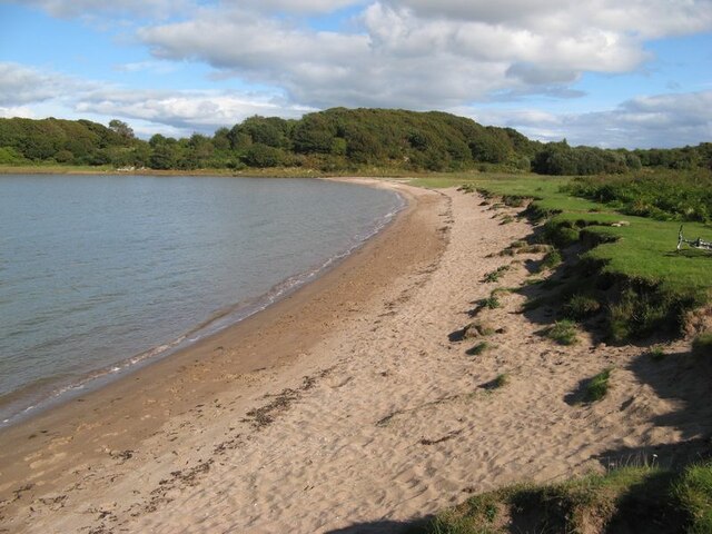
Partan Craig is a prominent coastal feature located in Kirkcudbrightshire, Scotland. It is a headland that extends into the Irish Sea, forming a distinct point along the coastline. The name "Partan Craig" is derived from the Scottish Gaelic words "partan," meaning crab, and "craig," meaning rock.

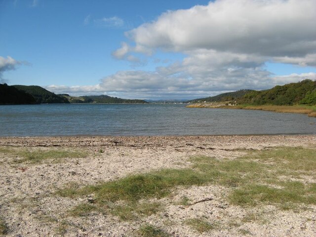
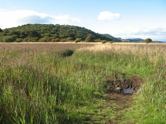
The headland is characterized by its rugged and rocky terrain, with cliffs jutting out into the sea. These cliffs provide a dramatic backdrop to the surrounding landscape, offering stunning views of the ocean and the nearby coastline. The area is known for its picturesque beauty, attracting both locals and tourists alike.

Partan Craig is renowned for its diverse wildlife and is a popular destination for birdwatchers. The headland serves as a nesting site for various seabirds, including gulls, kittiwakes, and fulmars. Visitors can often spot these birds soaring above the cliffs or nesting in the crevices of the rocks.

The headland is also rich in marine life, with numerous rock pools teeming with an array of fascinating creatures. During low tide, visitors can explore these pools and discover sea anemones, crabs, starfish, and other marine organisms.

Partan Craig is easily accessible by foot, with several walking trails leading to the headland. The coastal path offers breathtaking views of the surrounding countryside, and there are designated viewing points along the way for visitors to take in the beauty of the area.

In conclusion, Partan Craig is a remarkable coastal feature in Kirkcudbrightshire, offering stunning views, diverse wildlife, and opportunities for outdoor exploration.

If you have any feedback on the listing, please let us know in the comments section below.

Partan Craig Images

Images are sourced within 2km of 54.850686/-3.8385442 or Grid Reference NX8252. Thanks to Geograph Open Source API. All images are credited.

Grazing cows Looking over pastures towards Rough Firth.
Grazing cows
Looking over pastures towards Rough Firth.
Horse Isles Bay A surprising and secluded bay on the east side of Almorness.
Horse Isles Bay
A surprising and secluded bay on the east side of Almorness.
Rough Firth from Horse Isles Bay Looking northwards across the bay and onto Rough Firth.
Rough Firth from Horse Isles Bay
Looking northwards across the bay and onto Rough Firth.
Reed bed The marshy area of the merse is occupied by a wonderful reed bed.
Reed bed
The marshy area of the merse is occupied by a wonderful reed bed.
Shoreline, Old Torr Head of Auchencairn Bay.
Shoreline, Old Torr
Head of Auchencairn Bay.
Ruin, Old Torr
Ruin, Old Torr
Field, Old Torr The hill is rough with whins and grazed by cattle. There are several holiday huts here.
Field, Old Torr
The hill is rough with whins and grazed by cattle. There are several holiday huts here.
Rough pasture, Old Torr Grazed by cattle.
Rough pasture, Old Torr
Grazed by cattle.
Rough pasture, Torr Hill
Outcropping rock, Torr Hill
Drystane dyke, Torr Hill
Summit area, Torr Hill Can take a bit of getting to with a maze of whins on the slopes and summit.
Summit area, Torr Hill
Can take a bit of getting to with a maze of whins on the slopes and summit.
Scrub and rough grazing, Torr Hill
Red Haven Beach on the Torr peninsula.
Red Haven
Beach on the Torr peninsula.
Scrub near Torr Point Grazed by cattle.
Scrub near Torr Point
Grazed by cattle.
Path to Torr Point It's about to disappear into a barbed wired off woodland.
Path to Torr Point
It's about to disappear into a barbed wired off woodland.
Torr Point A spring high water, at low tide there are sands almost to Hestan island in the background. The beach is made of cockleshells.
Torr Point
A spring high water, at low tide there are sands almost to Hestan island in the background. The beach is made of cockleshells.
Torr Point Looking westward at a spring high water.
Torr Point
Looking westward at a spring high water.
Show me another place!

Partan Craig is located at Grid Ref: NX8252 (Lat: 54.850686, Lng: -3.8385442)

Unitary Authority: Dumfries and Galloway

Police Authority: Dumfries and Galloway

What 3 Words

///parading.lists.command. Near Dalbeattie, Dumfries & Galloway

Related Wikis

Orchardton Castle

Orchardton Castle overlooks the Solway Coast. Built in the 1880s, this is a Grade B listed property formerly known as Orchardton House. Built around a...

Urr Water

Urr Water or River Urr (arc. River Orr) is a river in which flows through the counties of Dumfriesshire and Kirkcudbrightshire in southwest Scotland....

Rough Firth

Rough Firth is an inlet on the northern coast of the Solway Firth in the Stewartry area of Dumfries and Galloway, Scotland. The firth lies between Almorness...

Auchencairn

Auchencairn ([ɔxən'kʰɛ:(r)n]) is a village in the historical county of Kirkcudbrightshire in the Dumfries and Galloway region of Scotland. It is located...

Related Videos

The Spectacular Cliffs of BALCARY BAY in DUMFRIES AND GALLOWAY - Scotland Walking Tour | 4K | 60FPS

Balcary Bay and Auchencairn Bay sit on a small coast, just over two miles long on the north side of the Solway Firth. The village of ...

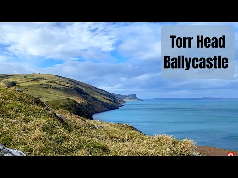
75 - Travel In Northern Ireland - Torr Point

On the north coast of Northern Ireland is Torr Point. Torr in local Gaelic means mound, and this lump of a headland is significant ...

Styled Shoot at Castle Volt in Scotland 🏴󠁧󠁢󠁳󠁣󠁴󠁿 Images Anna Frances Photography

Styled shoot organised by Makeup by Hania, at Castle Volt Dumfries and Galloway. A unique and eclectic exclusive use Scottish ...

Nearby Amenities

Located within 500m of 54.850686,-3.8385442
Source: PGS
Lat/Long: 54.84732/-3.8434064
Source: PGS
Lat/Long: 54.8470924/-3.8428598
Source: PGS
Lat/Long: 54.8470235/-3.8425985
Source: PGS
Lat/Long: 54.8469089/-3.8423512
Source: PGS
Lat/Long: 54.8467168/-3.8420015
Source: PGS
Lat/Long: 54.8468185/-3.8352286
Source: PGS
Lat/Long: 54.8469691/-3.8354433
Source: PGS
Lat/Long: 54.8471284/-3.8357339
Source: PGS
Lat/Long: 54.8480071/-3.8367428
Source: PGS
Lat/Long: 54.8485983/-3.8370558
Source: PGS
Lat/Long: 54.8489086/-3.8373741
Source: PGS
Lat/Long: 54.849374/-3.8381486
Source: PGS
Lat/Long: 54.8495783/-3.8385542
Source: PGS
Lat/Long: 54.8497601/-3.8388144
Source: PGS
Lat/Long: 54.8498792/-3.8388982
Source: PGS
Lat/Long: 54.8501783/-3.8394186
Source: PGS
Lat/Long: 54.8505018/-3.8398348
Source: PGS
Lat/Long: 54.8508267/-3.8402859
Source: PGS
Lat/Long: 54.8511167/-3.8407913
Source: PGS
Lat/Long: 54.8516584/-3.84195
Source: PGS
Lat/Long: 54.8519517/-3.8431988
Source: PGS
Lat/Long: 54.8518211/-3.8440941
Source: PGS
Lat/Long: 54.8520654/-3.8448607
Source: PGS
Lat/Long: 54.8523313/-3.845491
Source: PGS
Lat/Long: 54.8539779/-3.8429279
Source: PGS
Lat/Long: 54.8538781/-3.8425701
Source: PGS
Lat/Long: 54.8537447/-3.8422955
Source: PGS
Lat/Long: 54.853557/-3.8420331
Source: PGS
Lat/Long: 54.853402/-3.8419409
Source: PGS
Lat/Long: 54.853208/-3.841781
Source: PGS
Lat/Long: 54.8531651/-3.8413862
Source: PGS
Lat/Long: 54.8530576/-3.8411357
Source: PGS
Lat/Long: 54.8529356/-3.8408181
Source: PGS
Lat/Long: 54.8528807/-3.8405263
Source: PGS
Lat/Long: 54.8531413/-3.8399399
Source: PGS
Lat/Long: 54.8533785/-3.8398922
Source: PGS
Lat/Long: 54.8537608/-3.8408042
Source: PGS
Lat/Long: 54.8540566/-3.8406341
Source: PGS
Lat/Long: 54.8543762/-3.8406915
Source: PGS
Lat/Long: 54.8544673/-3.8410638
The data included in this document is from www.openstreetmap.org. The data is made available under ODbL.

Have you been to Partan Craig?

Leave your review of Partan Craig below (or comments, questions and feedback).