Old Harry Beacon

Coastal Feature, Headland, Point in Devon

England

Old Harry Beacon

Salcombe : Bay Scenery Looking out into the bay.
Salcombe : Bay Scenery Credit: Lewis Clarke

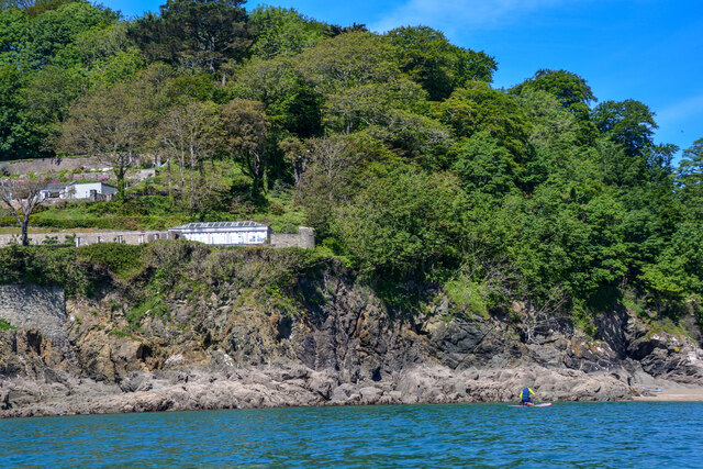
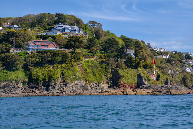
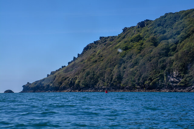
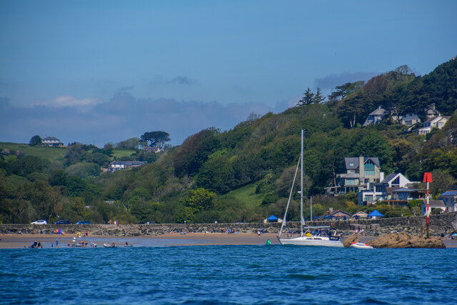
Old Harry Beacon, located in Devon, England, is a prominent coastal feature that stands as a majestic headland and point. Situated at the eastern end of the Jurassic Coast, it is an iconic landmark that attracts visitors with its natural beauty and historical significance.

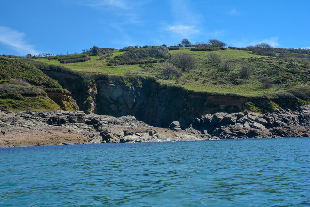
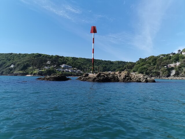
Rising 120 feet above sea level, Old Harry Beacon is composed of chalk cliffs that have been shaped by centuries of erosion. Over time, the elements have carved out distinct features, resulting in the formation of three impressive chalk stacks known as Old Harry Rocks. These stacks are a testament to the power of nature and stand proudly as a symbol of the area's geological history.

The headland offers breathtaking panoramic views of the surrounding coastline, including the Isle of Wight to the east and the Purbeck Hills to the west. On clear days, visitors can even catch a glimpse of the Needles, a row of distinctive chalk stacks off the coast of the Isle of Wight.

Aside from its natural beauty, Old Harry Beacon also holds historical significance. Legend has it that the name "Old Harry" originated from a notorious pirate who used the rocks to hide from authorities. Additionally, the area served as a strategic lookout point during World War II, with remnants of military structures still visible today.

Old Harry Beacon is a popular destination for outdoor enthusiasts, offering opportunities for hiking, birdwatching, and photography. Its unique geological formations and stunning vistas make it a must-visit location for anyone exploring the enchanting Devon coastline.

If you have any feedback on the listing, please let us know in the comments section below.

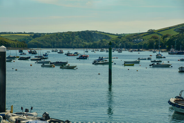
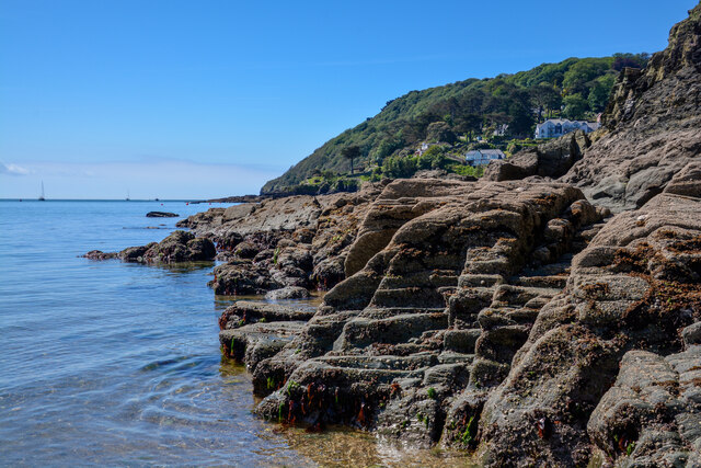
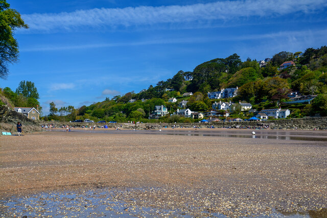
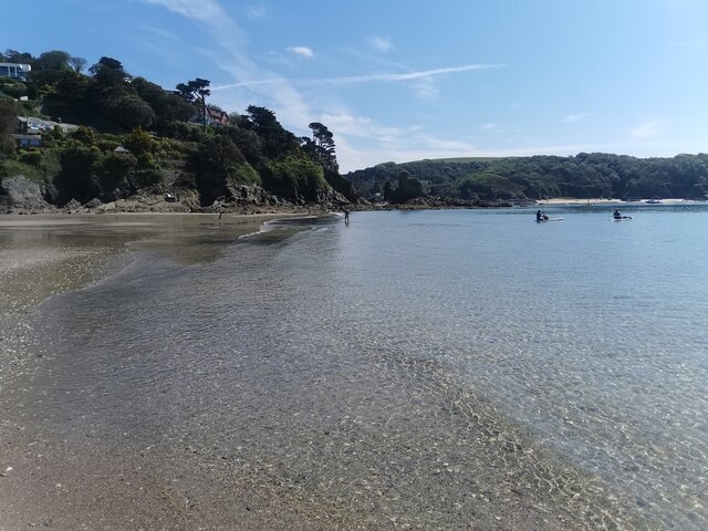
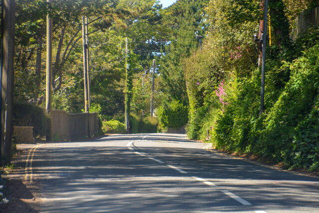
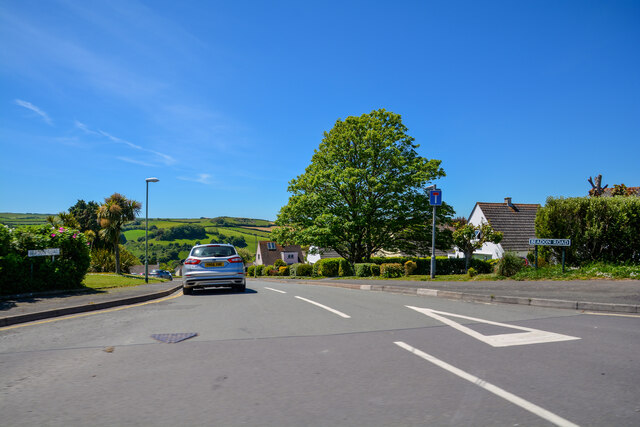
Old Harry Beacon Images

Images are sourced within 2km of 50.228233/-3.7763638 or Grid Reference SX7337. Thanks to Geograph Open Source API. All images are credited.

Salcombe : Bay Scenery Looking out into the bay.
Salcombe : Bay Scenery
Looking out into the bay.
Salcombe : Coastal Scenery Looking across the coastline.
Salcombe : Coastal Scenery
Looking across the coastline.
Salcombe : North Sands Looking across the beach.
Salcombe : North Sands
Looking across the beach.
Salcombe : North Sands Looking across the beach.
Salcombe : North Sands
Looking across the beach.
Salcombe : Coastal Scenery Looking towards the rocky shore.
Salcombe : Coastal Scenery
Looking towards the rocky shore.
Salcombe : Coastal Scenery Looking across the coast with Poundstone in view.
Salcombe : Coastal Scenery
Looking across the coast with Poundstone in view.
Salcombe : Bolt Head A view towards Bolt Head.
Salcombe : Bolt Head
A view towards Bolt Head.
East Portlemouth : Sunny Cove Looking towards a beach and cove.
East Portlemouth : Sunny Cove
Looking towards a beach and cove.
East Portlemouth : Coastal Scenery A view towards the rocks.
East Portlemouth : Coastal Scenery
A view towards the rocks.
East Portlemouth : Coastal Scenery A view along the coastline.
East Portlemouth : Coastal Scenery
A view along the coastline.
East Portlemouth : Coastal Scenery A house with a view overlooking the bay.
East Portlemouth : Coastal Scenery
A house with a view overlooking the bay.
Salcombe : Pound Stone A beacon on the stones.
Salcombe : Pound Stone
A beacon on the stones.
Salcombe : Beadon Road Looking along Beadon Road.
Salcombe : Beadon Road
Looking along Beadon Road.
Salcombe : Beadon Road A road with no entry to vehicles from here.
Salcombe : Beadon Road
A road with no entry to vehicles from here.
Salcombe : A381 Looking along the A381.
Salcombe : A381
Looking along the A381.
Salcombe : Tarmac A tarmac area off Main Road.
Salcombe : Tarmac
A tarmac area off Main Road.
Salcombe : Beadon Road Beadon Road off Main Road.
Salcombe : Beadon Road
Beadon Road off Main Road.
Salcombe : Gulf Petrol Station A Gulf garage off Main Road.
Salcombe : Gulf Petrol Station
A Gulf garage off Main Road.
Show me another place!

Old Harry Beacon is located at Grid Ref: SX7337 (Lat: 50.228233, Lng: -3.7763638)

Administrative County: Devon

Police Authority: Devon and Cornwall

What 3 Words

///undertone.fraction.nourished. Near Salcombe, Devon

Related Wikis

Salcombe Castle

Salcombe Castle or Fort Charles is a ruined fortification just off the beach of North Sands in Salcombe, Devon, England, within the South Devon Area of...

Overbeck's

Overbeck's Museum and Garden is an Edwardian house and 2.75 hectare (7 acre) garden at Sharpitor, Salcombe, Devon, England. It is named after its last...

Salcombe

Salcombe is a resort town in the South Hams district of Devon, south west England. The town is close to the mouth of the Kingsbridge Estuary, mostly built...

Salcombe Lifeboat Station

Salcombe Lifeboat Station is the base for Royal National Lifeboat Institution (RNLI) search and rescue operations at Salcombe, Devon in England. The first...

Hallowe'en (clipper)

Hallowe’en was a 920-ton iron clipper ship. She was built in 1870 by Maudslay, Son & Field at Greenwich, England, for Jock Willis & Sons (commissioned...

RAF Hope Cove

Royal Air Force Hope Cove or more simply RAF Hope Cove is a former Royal Air Force radar station. It is located about 1 mile (1.6 km) south west of Salcombe...

East Portlemouth

East Portlemouth is a small Devon village situated at the southern end of the Kingsbridge Estuary, on the south Devon Coast. The population of this parish...

Bolt Head

Bolt Head is a National Trust headland on the South Coast of Devon, England, United Kingdom, situated west of the Kingsbridge Estuary. It is a popular...

Nearby Amenities

Located within 500m of 50.228233,-3.7763638
Source: PGS
Lat/Long: 50.2290119/-3.7811114
Source: PGS
Lat/Long: 50.229277/-3.7814354
Source: PGS
Lat/Long: 50.2317026/-3.7721256
Source: PGS
Lat/Long: 50.2241483/-3.7738648
Maxwidth: 6'6"
Lat/Long: 50.2300829/-3.7797292
Post Box
Brand: Royal Mail
Brand Wikidata: Q638098
Brand Wikipedia: en:Royal Mail
Collection Times: Mo-Sa 11:15; Su off
Operator: Royal Mail
Operator Wikidata: Q638098
Post Box Design: type_b
Post Box Mounting: brick_gate_column
Post Box Type: wall
Ref: TQ8 40
Royal Cypher: EIIR
Royal Cypher Wikidata: Q33102113
Source: survey;streetlevel imagery;aerial imagery
Lat/Long: 50.2279678/-3.7825161
Bench
Backrest: yes
Lat/Long: 50.2294332/-3.7772281
Bench
Lat/Long: 50.2280267/-3.7825893
Toilets
Fee: no
Wheelchair: yes
Lat/Long: 50.2301796/-3.7798232
Bench
Backrest: yes
Lat/Long: 50.2302573/-3.7812227
Post Box
Brand: Royal Mail
Brand Wikidata: Q638098
Brand Wikipedia: en:Royal Mail
Collection Times: Mo-Sa 11:00; Su off
Operator: Royal Mail
Operator Wikidata: Q638098
Post Box Design: type_c
Post Box Mounting: stone_wall
Post Box Type: wall
Ref: TQ8 28
Royal Cypher: EVIIR
Royal Cypher Wikidata: Q33102324
Survey Date: 2022-08-20
Lat/Long: 50.2303436/-3.7803905
Telephone
Booth: K6
Check Date: 2024-03-02
Covered: booth
Lat/Long: 50.2302379/-3.7800177
Post Box
Brand: Royal Mail
Brand Wikidata: Q638098
Brand Wikipedia: en:Royal Mail
Collection Times: Mo-Fr 13:00; Sa 12:00; Su off
Operator: Royal Mail
Operator Wikidata: Q638098
Post Box Design: type_b
Post Box Mounting: stone_wall
Post Box Type: wall
Ref: TQ8 56
Royal Cypher: GR
Royal Cypher Wikidata: Q33102273
Source: survey;streetlevel imagery;aerial imagery
Survey Date: 2022-08-20
Lat/Long: 50.2314887/-3.7804602
Restaurant
The Winking Prawn
Addr City: Salcombe
Addr Housename: The Winking Prawn
Addr Postcode: TQ8 8LD
Addr Street: Cliff Road
Cuisine: seafood
Fhrs Id: 1428734
Source Addr: FHRS Open Data
Lat/Long: 50.2304911/-3.7809377
Post Box
Brand: Royal Mail
Brand Wikidata: Q638098
Brand Wikipedia: en:Royal Mail
Collection Times: Mo-Fr 13:00, Sa 11:45; Su off
Operator: Royal Mail
Operator Wikidata: Q638098
Post Box Design: type_b
Post Box Mounting: stone_wall
Post Box Type: wall
Ref: TQ8 47
Royal Cypher: EIIR
Royal Cypher Wikidata: Q33102113
Source: survey;streetlevel imagery;aerial imagery
Survey Date: 2022-08-20
Lat/Long: 50.2321294/-3.7779493
Bench
Backrest: yes
Lat/Long: 50.2301637/-3.7801114
Blackstone Rock
Seamark Beacon Lateral Category: starboard
Seamark Beacon Lateral Colour: green
Seamark Beacon Lateral System: iala-a
Seamark Light Character: Q
Seamark Light Colour: green
Seamark Light Group: 2
Seamark Light Height: 4
Seamark Light Period: 8
Seamark Light Range: 2
Seamark Light Reference: A 0221
Seamark Name: Blackstone Rock
Seamark Type: beacon_lateral
Source: US NGA Pub. 114. 2011-05-26.
Lat/Long: 50.2267833/-3.7751
Seamark Light 1 Character: Fl
Seamark Light 1 Colour: red
Seamark Light 1 Height: 27
Seamark Light 1 Period: 2
Seamark Light 1 Range: 7
Seamark Light 1 Sector End: 182.5
Seamark Light 1 Sector Start: 2.5
Seamark Light 1 Sequence: 0.5+(1.5)
Seamark Light 2 Character: Fl
Seamark Light 2 Colour: green
Seamark Light 2 Height: 27
Seamark Light 2 Period: 2
Seamark Light 2 Range: 7
Seamark Light 2 Sector End: 357.5
Seamark Light 2 Sector Start: 182.5
Seamark Light 2 Sequence: 0.5+(1.5)
Seamark Light 3 Character: Fl
Seamark Light 3 Colour: white
Seamark Light 3 Height: 27
Seamark Light 3 Period: 2
Seamark Light 3 Range: 10
Seamark Light 3 Sector End: 2.5
Seamark Light 3 Sector Start: 357.5
Seamark Light 3 Sequence: 0.5+(1.5)
Seamark Light Reference: A 0220
Seamark Type: light_minor
Source: US NGA Pub. 114. 2011-05-26.
Lat/Long: 50.2294833/-3.7778333
Shaw's Corner
Place: locality
Lat/Long: 50.2321043/-3.7776197
Seamark Buoy Lateral Category: port
Seamark Buoy Lateral Colour: red
Seamark Buoy Lateral Shape: can
Seamark Buoy Lateral System: iala-a
Seamark Light Character: Q
Seamark Light Colour: red
Seamark Type: buoy_lateral
Lat/Long: 50.2245402/-3.7786595
Wolf Rock
Seamark Buoy Lateral Category: starboard
Seamark Buoy Lateral Colour: green
Seamark Buoy Lateral Shape: can
Seamark Buoy Lateral System: iala-a
Seamark Light Character: Q
Seamark Light Colour: green
Seamark Type: buoy_lateral
Lat/Long: 50.2263682/-3.7762124
Seamark Buoy Lateral Category: port
Seamark Buoy Lateral Colour: red
Seamark Buoy Lateral Shape: can
Seamark Buoy Lateral System: iala-a
Seamark Light Character: Q
Seamark Light Colour: red
Seamark Type: buoy_lateral
Lat/Long: 50.2270295/-3.7776232
Seamark Buoy Lateral Category: starboard
Seamark Buoy Lateral Colour: green
Seamark Buoy Lateral Shape: can
Seamark Buoy Lateral System: iala-a
Seamark Light Character: Q
Seamark Light Colour: green
Seamark Type: buoy_lateral
Lat/Long: 50.2272541/-3.775308
Poundstone
Place: locality
Seamark Beacon Lateral Category: port
Seamark Beacon Lateral Colour: red
Seamark Beacon Lateral System: iala-a
Seamark Type: beacon_lateral
Lat/Long: 50.2275142/-3.777881
Old Harry Beacon
Place: locality
Seamark Beacon Lateral Category: port
Seamark Beacon Lateral Colour: red
Seamark Beacon Lateral System: iala-a
Seamark Type: beacon_lateral
Source: OS 1963
Lat/Long: 50.2281649/-3.7763578
Seamark Buoy Lateral Category: port
Seamark Buoy Lateral Colour: red
Seamark Buoy Lateral Shape: can
Seamark Buoy Lateral System: iala-a
Seamark Light Character: Q
Seamark Light Colour: red
Seamark Type: buoy_lateral
Lat/Long: 50.2285808/-3.7751208
Biddlehead Point
Place: locality
Lat/Long: 50.2287695/-3.7706803
Historic Transatlantic Cable
Historic: heritage
Lat/Long: 50.2296724/-3.7820759
The Cheesewring
Place: locality
Lat/Long: 50.2304784/-3.7763457
Bus Stop
Upper Devon Road
Bench: yes
Bin: no
Bus: yes
Lit: yes
Naptan AtcoCode: 1100DEA10146
Naptan NaptanCode: dvnawjdw
Operator: Tally Ho!
Public Transport: platform
Shelter: yes
Tactile Paving: no
Lat/Long: 50.2321451/-3.7774173
Hipples
Place: locality
Source: OS 1963
Lat/Long: 50.2257341/-3.7728016
Sandhill Point
Place: locality
Lat/Long: 50.230051/-3.7779548
Woodville Rocks
Place: locality
Lat/Long: 50.2318669/-3.772327
Ripple Sand
Natural: beach
Surface: sand
Lat/Long: 50.2262845/-3.7736261
Bench
Backrest: no
Lat/Long: 50.2261569/-3.7720845
Direction: 175
Generator Method: photovoltaic
Generator Output Electricity: yes
Generator Solar Modules: 10
Generator Source: solar
Generator Type: solar_photovoltaic_panel
Location: roof
Power: generator
Lat/Long: 50.2295883/-3.7775282
Direction: 175
Generator Method: photovoltaic
Generator Output Electricity: yes
Generator Solar Modules: 10
Generator Source: solar
Generator Type: solar_photovoltaic_panel
Location: roof
Power: generator
Lat/Long: 50.2295861/-3.7776219
Direction: SSW
Generator Method: photovoltaic
Generator Output Electricity: yes
Generator Solar Modules: 5
Generator Source: solar
Generator Type: solar_photovoltaic_panel
Location: roof
Power: generator
Lat/Long: 50.2299313/-3.7777088
Direction: 220
Generator Method: photovoltaic
Generator Output Electricity: yes
Generator Solar Modules: 16
Generator Source: solar
Generator Type: solar_photovoltaic_panel
Location: roof
Power: generator
Lat/Long: 50.2306642/-3.7807353
Direction: 215
Generator Method: photovoltaic
Generator Output Electricity: yes
Generator Solar Modules: 10
Generator Source: solar
Generator Type: solar_photovoltaic_panel
Location: roof
Note: panels curved
Power: generator
Lat/Long: 50.2305469/-3.7776663
Direction: 215
Generator Method: photovoltaic
Generator Output Electricity: yes
Generator Source: solar
Generator Type: solar_photovoltaic_panel
Location: roof
Note: panels curved
Power: generator
Lat/Long: 50.2305562/-3.7776533
Direction: SSW
Generator Method: photovoltaic
Generator Output Electricity: yes
Generator Solar Modules: 5
Generator Source: solar
Generator Type: solar_photovoltaic_panel
Location: roof
Power: generator
Lat/Long: 50.2299704/-3.7778428
Bench
Backrest: yes
Lat/Long: 50.2301532/-3.7800763
Bench
Backrest: yes
Lat/Long: 50.2301249/-3.7800092
Bench
Backrest: yes
Lat/Long: 50.2301406/-3.7800464
Bench
Backrest: no
Survey Date: 2022-03-19
Lat/Long: 50.2286937/-3.7701867
Life Ring
Emergency: life_ring
Survey Date: 2022-03-19
Lat/Long: 50.2281302/-3.7703678
Life Ring
Emergency: life_ring
Survey Date: 2022-03-19
Lat/Long: 50.2281973/-3.7703769
Waste Basket
Survey Date: 2022-08-20
Waste: dog_excrement
Lat/Long: 50.2318551/-3.7737074
Life Ring
Emergency: life_ring
Survey Date: 2022-08-20
Lat/Long: 50.22997/-3.7815947
Fire Hydrant
Emergency: fire_hydrant
Fire Hydrant Position: sidewalk
Fire Hydrant Type: underground
Survey Date: 2022-08-20
Lat/Long: 50.2294432/-3.7782336
Fire Hydrant
Emergency: fire_hydrant
Fire Hydrant Position: lane
Fire Hydrant Type: underground
Survey Date: 2022-08-20
Lat/Long: 50.2296308/-3.7786732
Fire Hydrant
Emergency: fire_hydrant
Fire Hydrant Type: underground
Survey Date: 2022-08-20
Lat/Long: 50.2321795/-3.7769275
Bench
Backrest: yes
Survey Date: 2022-08-20
Lat/Long: 50.2294367/-3.7771691
Bench
Backrest: yes
Survey Date: 2022-08-20
Lat/Long: 50.2301802/-3.7798475
Waste Basket
Survey Date: 2022-08-20
Lat/Long: 50.2301695/-3.7801898
Waste Basket
Survey Date: 2022-08-20
Lat/Long: 50.2301031/-3.7815644
Waste Basket
Survey Date: 2022-08-20
Lat/Long: 50.2300836/-3.781591
Fire Hydrant
Emergency: fire_hydrant
Fire Hydrant Diameter Signed: no
Fire Hydrant Position: sidewalk
Fire Hydrant Type: underground
Survey Date: 2022-08-20
Lat/Long: 50.2305473/-3.7804139
Fire Hydrant
Emergency: fire_hydrant
Fire Hydrant Type: underground
Survey Date: 2022-08-20
Lat/Long: 50.2320025/-3.779572
Bench
Survey Date: 2022-08-20
Lat/Long: 50.2321339/-3.7795727
Bench
Survey Date: 2022-08-20
Lat/Long: 50.2321347/-3.7796145
Fire Hydrant
Emergency: fire_hydrant
Fire Hydrant Type: underground
Survey Date: 2022-08-20
Lat/Long: 50.2321756/-3.7778967
Bus Stop
Bench: no
Bus: yes
Public Transport: platform
Shelter: no
Survey Date: 2022-08-20
Lat/Long: 50.2320935/-3.7774361
The data included in this document is from www.openstreetmap.org. The data is made available under ODbL.

Have you been to Old Harry Beacon?

Leave your review of Old Harry Beacon below (or comments, questions and feedback).