Loosegate

Settlement in Lincolnshire South Holland

England

Loosegate

Road junction
Road junction Credit: Alex McGregor

Loosegate is a picturesque village located in the county of Lincolnshire, England. Nestled amidst rolling hills and lush greenery, it offers a serene and idyllic setting for its residents and visitors. Situated just five miles north of the historic market town of Louth, Loosegate enjoys easy access to amenities while still maintaining its rural charm.

The village is characterized by its traditional architecture, with charming cottages and well-preserved historic buildings lining its streets. The centerpiece of Loosegate is its beautiful village green, a tranquil space where locals gather for community events and recreational activities. The green is surrounded by ancient oak trees, adding to the village's timeless appeal.

While Loosegate is primarily a residential area, it boasts a close-knit and welcoming community. The village has a local pub, The Loosegate Inn, where residents can gather for a drink or enjoy hearty meals made from locally sourced ingredients. There are also several small businesses and shops that cater to the needs of the community, including a village store and a post office.

Nature enthusiasts will appreciate the abundance of scenic walking trails and cycling routes that surround Loosegate. The village is situated near the Lincolnshire Wolds, an Area of Outstanding Natural Beauty, offering stunning views and opportunities for outdoor recreation.

Overall, Loosegate is a charming and peaceful village that captures the essence of rural England. With its picturesque surroundings and strong sense of community, it is an ideal place to live or visit for those seeking a slower pace of life and a connection to nature.

If you have any feedback on the listing, please let us know in the comments section below.
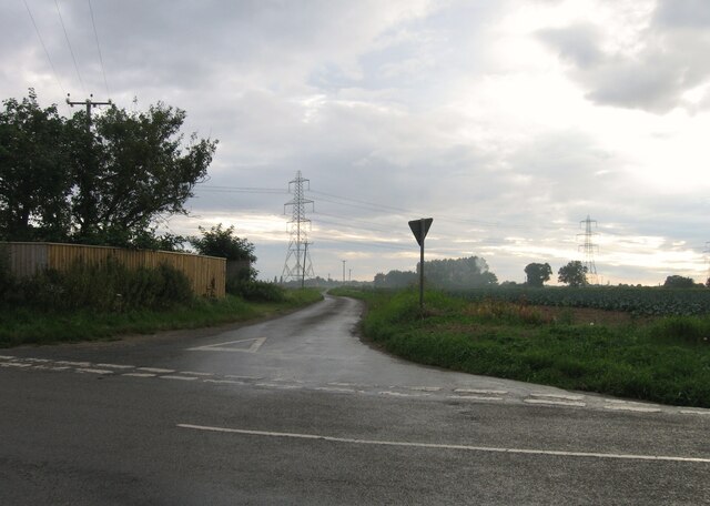
Loosegate Images

Images are sourced within 2km of 52.812699/-0.050341 or Grid Reference TF3125. Thanks to Geograph Open Source API. All images are credited.

Road junction
Road junction
Road junction
Road junction
Goddam's Lane
Goddam's Lane
Spalding Gate
Spalding Gate
Spalding Gate
Spalding Gate
Spalding Gate
Spalding Gate
Drain off Goddam's Lane
Fields off Spalding Gate
Field off Spalding Gate
Whaplode Village Hall
The churchyard, Whaplode Most of the churchyard has been cleared of gravestones though some remain in this south-east corner.
The churchyard, Whaplode
Most of the churchyard has been cleared of gravestones though some remain in this south-east corner.
Stubble field near Moulton The windmill and parish church prominent in the distance.
Stubble field near Moulton
The windmill and parish church prominent in the distance.
Harrox House, Moulton Dates from the late eighteenth century <span class="nowrap"><a title="https://historicengland.org.uk/listing/the-list/list-entry/1064506" rel="nofollow ugc noopener" href="https://historicengland.org.uk/listing/the-list/list-entry/1064506">Link</a><img style="margin-left:2px;" alt="External link" title="External link - shift click to open in new window" src="https://s1.geograph.org.uk/img/external.png" width="10" height="10"/></span>
Harrox House, Moulton
Dates from the late eighteenth century LinkExternal link
Now that's one tall windmill! Three images stitched together in order to take in the whole of Britain's tallest mill, Moulton Windmill.  I now have a stiff neck!
Now that's one tall windmill!
Three images stitched together in order to take in the whole of Britain's tallest mill, Moulton Windmill. I now have a stiff neck!
Moulton Fish & Chips What a pity it was closed. I could have done with a nice hot lunch.  
It might have been sunny, but the NW wind was cold and quite strong.
Moulton Fish & Chips
What a pity it was closed. I could have done with a nice hot lunch. It might have been sunny, but the NW wind was cold and quite strong.
Snowdrops at St Mary's Church
All Saint's Church, Moulton, Lincolnshire “The Queen of the Fens” dates back to about 1180, the spire is about 158 feet high.
All Saint's Church, Moulton, Lincolnshire
“The Queen of the Fens” dates back to about 1180, the spire is about 158 feet high.
Show me another place!

Loosegate is located at Grid Ref: TF3125 (Lat: 52.812699, Lng: -0.050341)

Division: Parts of Holland

Administrative County: Lincolnshire

District: South Holland

Police Authority: Lincolnshire

What 3 Words

///splints.clearly.toasted. Near Whaplode, Lincolnshire

Nearby Locations

Loosegate

Related Wikis

Whaplode

Whaplode is a village and civil parish in the South Holland district of Lincolnshire, England. It is just west of the Prime Meridian. The parish includes...

Moulton Seas End

Moulton Seas End is a village in the civil parish of The Moultons and the South Holland district of Lincolnshire, England. It is 5 miles (8 km) north...
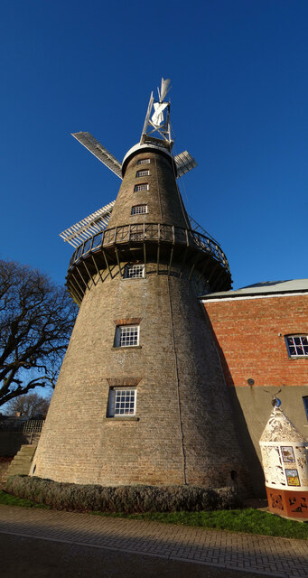
Moulton Windmill

Moulton Windmill in the Lincolnshire village of Moulton, between Spalding and Holbeach is a restored windmill claimed to be the tallest tower mill in the...

Moulton, Lincolnshire

Moulton is a village in the civil parish of The Moultons, in the South Holland district of Lincolnshire, England. It is situated on the A151 and B1537...

Related Videos

Recording of Jason Hunter speaking at Moulton near Spalding (Part 1)

On the evening of Friday 16th November the Lincolnshire branch of the European Movement welcomed Trade expert Jason J ...

Whaplode Service Station

Demolition and site clearance at Whaplode Service Station.

How to Clear Drain blockage | Drain Blockage Cleared Today

I was called today to get this Drain Blockage Cleared and hopefully remove this stubborn thick blocked drain. I tried to draw a ...

Can I really turn 2seats into a Double bed in under 60 seconds. Watch to find out 😂

How easy is it to make a double bed in our Mountain Tourer. Check out our other videos to see as a double. Visit our website ...

Nearby Amenities

Located within 500m of 52.812699,-0.050341
Bus Stop
Woodhouse Lane
Naptan AtcoCode: 270000009649
Naptan Bearing: SW
Naptan CommonName: Woodhouse Lane
Naptan Indicator: adj
Naptan Landmark: Woodhouse Lane
Naptan NaptanCode: linjdmpt
Naptan Street: Seas End Road
Naptan Verified: no
Source: naptan_import
Lat/Long: 52.8133194/-0.0488177
Bus Stop
Woodhouse Lane
Naptan AtcoCode: 270000009650
Naptan Bearing: NE
Naptan CommonName: Woodhouse Lane
Naptan Indicator: opp
Naptan Landmark: Woodhouse Lane
Naptan NaptanCode: linjdmpw
Naptan Street: Seas End Road
Naptan Verified: no
Source: naptan_import
Lat/Long: 52.8133929/-0.0489183
Post Box
Collection Times: Mo-Fr 16:15; Sa 10:30
Description: Very low to the ground.
Dark paint. Easy to miss.
Fixme: Correct road position to match BS and PB
Post Box Type: lamp
Ref: PE12 18
Lat/Long: 52.813099/-0.049031
Power: tower
Lat/Long: 52.8143696/-0.0438159
Aspland Farm
Place: farm
Source: Bing
Lat/Long: 52.8121515/-0.0504436
Loosegate
Place: hamlet
Source: Bing
Lat/Long: 52.8127988/-0.0497134
Chestnut Farm
Place: farm
Source: Bing
Lat/Long: 52.8127633/-0.0488403
College Farm
Place: farm
Source: Bing
Lat/Long: 52.8113682/-0.051562
Sycamore House
Place: isolated_dwelling
Source: Bing
Lat/Long: 52.8108964/-0.0518828
College Farm Cottages
Place: isolated_dwelling
Lat/Long: 52.8102022/-0.0528682
The Bungalow
Place: isolated_dwelling
Lat/Long: 52.8138112/-0.0442973
The data included in this document is from www.openstreetmap.org. The data is made available under ODbL.

Have you been to Loosegate?

Leave your review of Loosegate below (or comments, questions and feedback).