A' Chabach

Coastal Feature, Headland, Point in Sutherland

Scotland

A' Chabach

Farr Bay Looking towards Àrd Beag.
Farr Bay Credit: Carron K

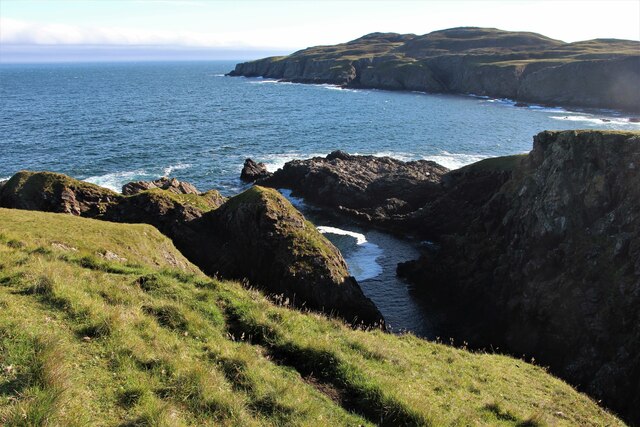
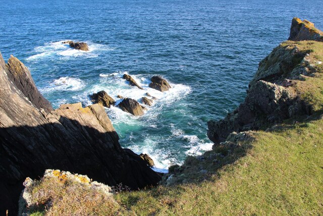
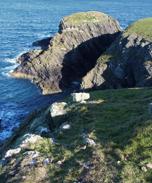
A' Chabach is a prominent coastal feature located in Sutherland, Scotland. It is primarily known as a headland or point, and it is situated along the rugged coastline of the North Atlantic Ocean. This coastal feature is characterized by its striking cliffs, which rise dramatically from the sea, offering breathtaking views of the surrounding landscape.

A' Chabach is composed of ancient rock formations, predominantly consisting of sandstone and shale. These rocks have been shaped and eroded over millions of years by the relentless force of the ocean waves, resulting in the impressive cliffs that we see today. The cliffs range in height, with some sections towering up to 100 meters above sea level.

The headland is a haven for a variety of bird species, including gulls, auks, and fulmars. It provides an important nesting site and feeding ground for these seabirds, as well as a haven for other marine wildlife such as seals and dolphins. A' Chabach is also home to a diverse range of plant species, with hardy coastal grasses and wildflowers clinging to the rocky slopes.

The headland is a popular destination for hikers and nature enthusiasts due to its stunning natural beauty and panoramic views. There are several walking trails that meander along the cliff edge, allowing visitors to explore the rugged coastline and observe the abundant wildlife. However, caution is advised as the cliffs can be steep and potentially dangerous.

A' Chabach is not only a significant coastal feature but also a place of natural wonder and beauty. Its dramatic cliffs, diverse wildlife, and breathtaking vistas make it a must-visit destination for those seeking an unforgettable coastal experience in Sutherland.

If you have any feedback on the listing, please let us know in the comments section below.
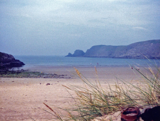
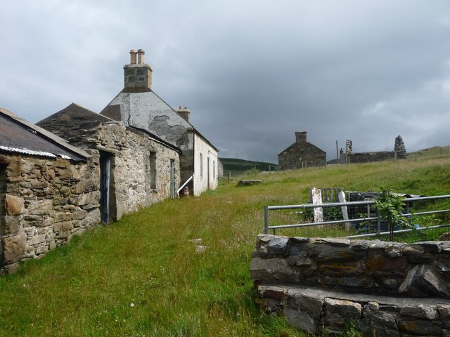
A' Chabach Images

Images are sourced within 2km of 58.545728/-4.2129441 or Grid Reference NC7164. Thanks to Geograph Open Source API. All images are credited.

Farr Bay Looking towards Àrd Beag.
Farr Bay
Looking towards Àrd Beag.
Farr Bay
Farr Bay
Old croft-house at Clerkhill
Footbridge to the Strathnaver Museum and graveyard, Clachan
Farr Bay, Bettyhill
Farr Bay, Bettyhill
Monument overlooking Farr Bay A small memorial plaque sits in the centre of the stone wall. Looking towards the rocks of Sgeir Dhubh across the bay.
Monument overlooking Farr Bay
A small memorial plaque sits in the centre of the stone wall. Looking towards the rocks of Sgeir Dhubh across the bay.
Former Farr Parish Church The church has been restored and is now a museum. It was known as 'St Columba's Church'
Former Farr Parish Church
The church has been restored and is now a museum. It was known as 'St Columba's Church'
Rough grazing on Creag Ruadh
Cliff nesting site at Creag Ruadh A dozen fulmars nest here.
Cliff nesting site at Creag Ruadh
A dozen fulmars nest here.
Creag Ruadh Ice-smoothed rocks facing Torrisdale Bay.
Creag Ruadh
Ice-smoothed rocks facing Torrisdale Bay.
NC500 The A836 runs 122 miles from Dornoch Bridge to John O' Groats <a href="https://www.geograph.org.uk/photo/7086916">ND3872 : A836, John O' Groats</a>. Much of it is still single track.
<span class="nowrap"><a title="https://www.sabre-roads.org.uk/wiki/index.php?title=A836" rel="nofollow ugc noopener" href="https://www.sabre-roads.org.uk/wiki/index.php?title=A836">Link</a><img style="margin-left:2px;" alt="External link" title="External link - shift click to open in new window" src="https://s1.geograph.org.uk/img/external.png" width="10" height="10"/></span>
NC500
The A836 runs 122 miles from Dornoch Bridge to John O' Groats ND3872 : A836, John O' Groats. Much of it is still single track. LinkExternal link
On Ard Beag
On Ard Beag
Tidal rocks at Ard Beag
Sgeir Dhubh
Sgeir Dhubh
Bettyhill
Bettyhill
Creag Ruadh Wild headland north west of Bettyhill
Creag Ruadh
Wild headland north west of Bettyhill
Creag Ruadh and Torrisdale Bay
Farr Parish Church Now a museum.
Farr Parish Church
Now a museum.
Show me another place!

A' Chabach is located at Grid Ref: NC7164 (Lat: 58.545728, Lng: -4.2129441)

Unitary Authority: Highland

Police Authority: Highlands and Islands

What 3 Words

///enlarge.honey.texts. Near Reay, Highland

Related Wikis

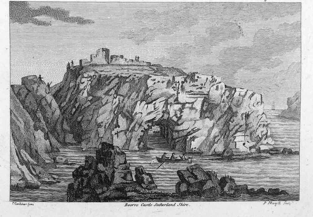
Borve Castle, Sutherland

Borve Castle in Sutherland, Scottish Highlands is now a ruin. Formerly called the House of Burro. It was built in Kirtomy Bay near the hamlet of Farr....

Farr, Sutherland

Farr (Scottish Gaelic: Fàrr) is a parish in the county of Sutherland in the Scottish council area of Highland. The parish also includes a small hamlet...

Bettyhill

Bettyhill (Scottish Gaelic: Am Blàran Odhar) is a village in the parish of Farr, on the north coast of Scotland.Bettyhill lies on the A836 road 32 miles...

Strathnaver Museum

Strathnaver Museum is located in Bettyhill, Sutherland, Scotland. It is a fully accredited volunteer-run independent museum which first opened in 1976...

Nearby Amenities

Located within 500m of 58.545728,-4.2129441
Source: PGS
Lat/Long: 58.5501876/-4.2140753
Source: PGS
Lat/Long: 58.5501129/-4.2140801
Source: PGS
Lat/Long: 58.5494495/-4.2136756
Source: PGS
Lat/Long: 58.5490207/-4.2137159
Source: PGS
Lat/Long: 58.5481491/-4.2128989
Source: PGS
Lat/Long: 58.547816/-4.2125598
Source: PGS
Lat/Long: 58.547893/-4.2135356
Source: PGS
Lat/Long: 58.5473388/-4.2136708
Source: PGS
Lat/Long: 58.5470312/-4.2135131
Source: PGS
Lat/Long: 58.5465388/-4.2129826
Source: PGS
Lat/Long: 58.5467487/-4.2116345
Source: PGS
Lat/Long: 58.5466138/-4.2113883
Source: PGS
Lat/Long: 58.5465223/-4.2118131
Source: PGS
Lat/Long: 58.5464128/-4.2123673
Source: PGS
Lat/Long: 58.5463034/-4.2126478
Source: PGS
Lat/Long: 58.5460769/-4.2129171
Source: PGS
Lat/Long: 58.5459775/-4.2128758
Source: PGS
Lat/Long: 58.5452789/-4.212348
Source: PGS
Lat/Long: 58.5454269/-4.2120631
Source: PGS
Lat/Long: 58.5451711/-4.2120068
Source: PGS
Lat/Long: 58.5449267/-4.2117842
Source: PGS
Lat/Long: 58.5443346/-4.2110744
Source: PGS
Lat/Long: 58.5440695/-4.2110063
Source: PGS
Lat/Long: 58.5439262/-4.2109393
Source: PGS
Lat/Long: 58.5439033/-4.2107719
Source: PGS
Lat/Long: 58.5432479/-4.2109886
Source: PGS
Lat/Long: 58.5431214/-4.2108368
Source: PGS
Lat/Long: 58.5430349/-4.2107188
Source: PGS
Lat/Long: 58.5429027/-4.2101292
Source: PGS
Lat/Long: 58.5428064/-4.2098868
Source: PGS
Lat/Long: 58.5426863/-4.2097494
Source: PGS
Lat/Long: 58.5417082/-4.2097355
Source: PGS
Lat/Long: 58.5418034/-4.2100681
The data included in this document is from www.openstreetmap.org. The data is made available under ODbL.

Have you been to A' Chabach?

Leave your review of A' Chabach below (or comments, questions and feedback).