Keaw Cove

Coastal Feature, Headland, Point in Kirkcudbrightshire

Scotland

Keaw Cove

Military training area, access point No red flag and no sentry on duty at the little hut, so one could venture into the danger area.
Military training area, access point Credit: Gordon Hatton

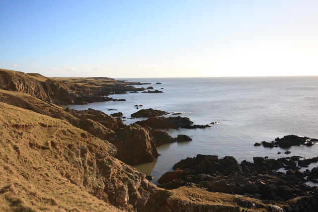
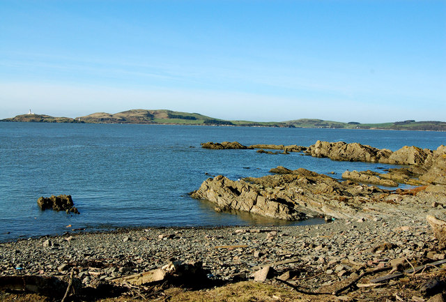
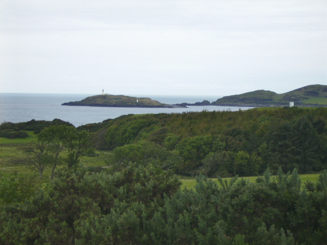
Keaw Cove is a stunning coastal feature located in Kirkcudbrightshire, Scotland. It is a headland that juts out into the Irish Sea, forming a picturesque point that offers breathtaking views and a serene atmosphere.

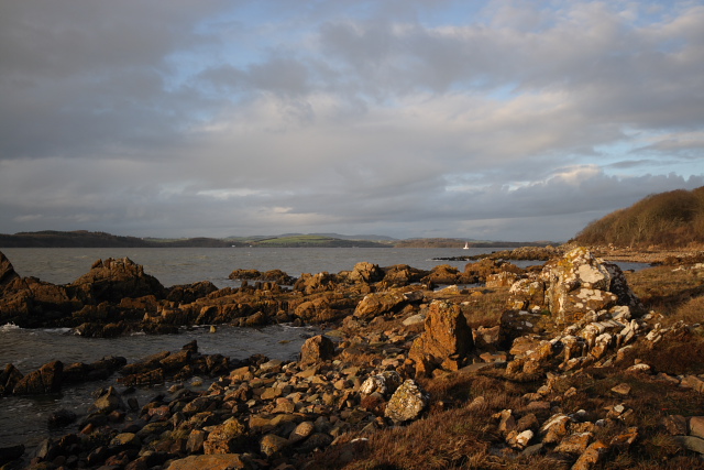
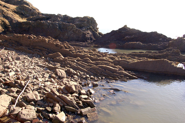
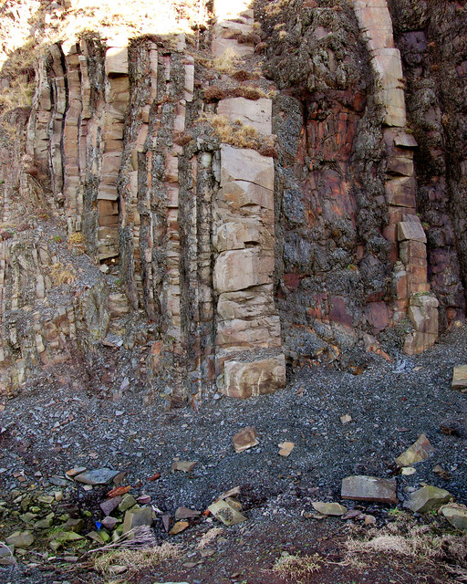
The cove is characterized by its rugged and rocky coastline, with towering cliffs that provide a dramatic backdrop to the crashing waves below. The cliffs are made up of a mix of sedimentary rock, including sandstone and shale, which have been shaped over thousands of years by the relentless action of the sea.

The area surrounding Keaw Cove is rich in biodiversity, with various species of seabirds nesting on the cliffs and marine life thriving in the waters below. Visitors to the cove can often spot gannets, puffins, and guillemots, among other bird species, soaring through the air or perched on the rocky ledges.

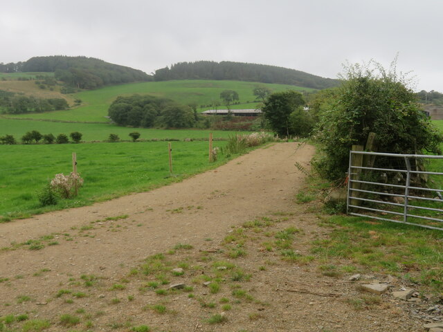
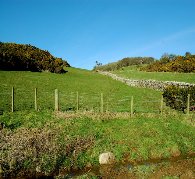
Access to Keaw Cove is relatively easy, with a well-maintained footpath leading from a nearby car park. The path winds its way along the cliff edge, providing stunning views of the surrounding coastline and the open sea. It is important for visitors to exercise caution and stay on the designated path, as the cliffs can be unstable in places.

Keaw Cove is a popular destination for nature enthusiasts, hikers, and photographers, who flock to the area to capture its raw beauty. Its remote location and unspoiled natural surroundings make it a peaceful and tranquil spot, perfect for those looking to escape the hustle and bustle of everyday life.

If you have any feedback on the listing, please let us know in the comments section below.

Keaw Cove Images

Images are sourced within 2km of 54.779011/-4.0597689 or Grid Reference NX6744. Thanks to Geograph Open Source API. All images are credited.
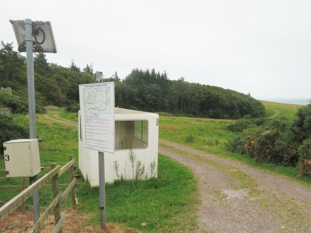
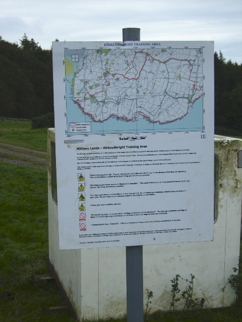
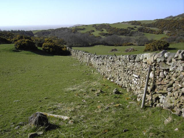
Military training area, access point No red flag and no sentry on duty at the little hut, so one could venture into the danger area.
Military training area, access point
No red flag and no sentry on duty at the little hut, so one could venture into the danger area.
Edge of the danger area A short stroll down the track from the road [no red flag flying] and one could photograph the track that leads towards the coast near Torrs Point.
Edge of the danger area
A short stroll down the track from the road [no red flag flying] and one could photograph the track that leads towards the coast near Torrs Point.
Farmland near Torrs Green pastures between the coast and Castle Hill.
Farmland near Torrs
Green pastures between the coast and Castle Hill.
Long Robin, Dee Estuary Rocky foreshore at Long Robin on the River Dee Estuary, looking NNW towards St Mary's Isle and Kirkcudbright.
Long Robin, Dee Estuary
Rocky foreshore at Long Robin on the River Dee Estuary, looking NNW towards St Mary's Isle and Kirkcudbright.
Kirkcudbright Lifeboat Station Looking SW across the Dee Estuary.
Kirkcudbright Lifeboat Station
Looking SW across the Dee Estuary.
Coastline at Balmae Ha'en The view over the Solway Firth, southwest of Torrs Point on the coastal path.
Coastline at Balmae Ha'en
The view over the Solway Firth, southwest of Torrs Point on the coastal path.
Gypsy Point Byron wrote about a wild and breaker beaten coast.Perhaps this is it.
Gypsy Point
Byron wrote about a wild and breaker beaten coast.Perhaps this is it.
Balmae Gardens The Head Gardener's cottage, hence its being situated in the wall of the walled gardens.
This house in its beautiful location, now owned by the MOD was built in the eighteenth century by people with vision and style. It now stands open to the elements and its huge walled garden is  overgrown with mature trees. To let a fine building like this to rot should be a crime.
Balmae Gardens
The Head Gardener's cottage, hence its being situated in the wall of the walled gardens. This house in its beautiful location, now owned by the MOD was built in the eighteenth century by people with vision and style. It now stands open to the elements and its huge walled garden is overgrown with mature trees. To let a fine building like this to rot should be a crime.
Gypsy point Interesting rock formation in vertical layers
Gypsy point
Interesting rock formation in vertical layers
Gypsy point Looking over to Little Ross,a tiny island with two lighthouses
Gypsy point
Looking over to Little Ross,a tiny island with two lighthouses
Verdant Galloway in February No wonder the Galloway steaks are good what with cattle feeding on grass like this all day and every day.
Verdant Galloway in February
No wonder the Galloway steaks are good what with cattle feeding on grass like this all day and every day.
Little Ross - both lighthouses can be seen Viewed from Balmae.
The larger lighthouse is in grid square <a href="https://www.geograph.org.uk/gridref/NX6543">NX6543</a>.
<span class="nowrap"><a title="http://www.scottishradiance.com/light/light204.htm" rel="nofollow ugc noopener" href="http://www.scottishradiance.com/light/light204.htm">Link</a><img style="margin-left:2px;" alt="External link" title="External link - shift click to open in new window" src="https://s1.geograph.org.uk/img/external.png" width="10" height="10"/></span>
The smaller lighthouse sits in grid square <a href="https://www.geograph.org.uk/gridref/NX6643">NX6643</a>.
Little Ross - both lighthouses can be seen
Viewed from Balmae. The larger lighthouse is in grid square NX6543. LinkExternal link The smaller lighthouse sits in grid square NX6643.
Rights of access notice board Some parts of the MoD ranges around the Kirkcudbright Training Area are open access for walkers when the red flags are not flying. This is for the majority of the time.
Rights of access notice board
Some parts of the MoD ranges around the Kirkcudbright Training Area are open access for walkers when the red flags are not flying. This is for the majority of the time.
Access road to part of the Kirkcudbright Training Area (MoD)
The Duck Pond The duck pond at Torrs Farm.
The Duck Pond
The duck pond at Torrs Farm.
Torrs Lochan The un-named lochan near Torrs Farm.
Torrs Lochan
The un-named lochan near Torrs Farm.
Danger Area Looking down over part of Dundrennan Range with Little Ross island in the background.
Danger Area
Looking down over part of Dundrennan Range with Little Ross island in the background.
Keep Out A locked side entrance to Dundrennan Range.
Keep Out
A locked side entrance to Dundrennan Range.
Show me another place!

Keaw Cove is located at Grid Ref: NX6744 (Lat: 54.779011, Lng: -4.0597689)

Unitary Authority: Dumfries and Galloway

Police Authority: Dumfries and Galloway

What 3 Words

///captive.crass.amicably. Near Kirkcudbright, Dumfries & Galloway

Related Wikis

Kirkcudbright Bay

Kirkcudbright Bay is an inlet of the Irish Sea on the coast of Galloway in southwest Scotland. Its coastline falls entirely within the modern administrative...

Little Ross

Little Ross is a 29-acre (12-hectare) island with a lighthouse on the Solway Coast south of the town of Kirkcudbright in Galloway, Scotland. It is next...

River Dee, Galloway

The River Dee (Scottish Gaelic: Dè / Uisge Dhè), in south-west Scotland, flows from its source in Loch Dee amongst the Galloway Hills, firstly to Clatteringshaws...

Dundrennan Range

Dundrennan Range is a weapons testing range on the Solway Firth, near Kirkcudbright in Dumfries and Galloway, in south west Scotland, it is part of the...

High Banks cup and ring markings

The High Banks cup and ring markings are a series of Neolithic or Bronze Age carvings on an outcrop of rock near High Banks farm, 3 km SE of Kirkcudbright...

Borgue Old House

Borgue Old House is a ruined Y-plan house, about 300 metres (0.2 mi) east of Borgue in Dumfries and Galloway, Scotland. Built in 1680, but probably incorporating...

Kirkcudbright

Kirkcudbright ( kur-KOO-bree; Scots: Kirkcoubrie; Scottish Gaelic: Cille Chùithbeirt) is a town, parish and a Royal Burgh from 1455 in Kirkcudbrightshire...

Borgue, Dumfries and Galloway

Borgue (pronounced /ˈbɔrɡ/; Scottish Gaelic: Borgh) is a village and parish in the Stewartry of Kirkcudbright in Dumfries and Galloway, Scotland. It lies...

Nearby Amenities

Located within 500m of 54.779011,-4.0597689
Source: PGS
Lat/Long: 54.7818734/-4.0649142
Source: PGS
Lat/Long: 54.7810212/-4.0648592
Source: PGS
Lat/Long: 54.7808519/-4.0646443
Source: PGS
Lat/Long: 54.7803678/-4.0639238
Source: PGS
Lat/Long: 54.7800276/-4.0637006
Source: PGS
Lat/Long: 54.7794783/-4.0629461
Source: PGS
Lat/Long: 54.7796722/-4.0622619
Source: PGS
Lat/Long: 54.7793448/-4.0621263
Source: PGS
Lat/Long: 54.779217/-4.0607482
Source: PGS
Lat/Long: 54.7789581/-4.0601913
Source: PGS
Lat/Long: 54.7784444/-4.0595776
Source: PGS
Lat/Long: 54.7782752/-4.0592677
Source: PGS
Lat/Long: 54.777995/-4.0590548
Source: PGS
Lat/Long: 54.7778871/-4.0588713
Source: PGS
Lat/Long: 54.7777415/-4.0586669
Source: PGS
Lat/Long: 54.7774942/-4.0587016
Source: PGS
Lat/Long: 54.7772709/-4.0586802
Source: PGS
Lat/Long: 54.7771522/-4.0586104
Source: PGS
Lat/Long: 54.7770692/-4.0583693
Source: PGS
Lat/Long: 54.7770572/-4.0577767
Source: PGS
Lat/Long: 54.7757762/-4.0552359
Source: PGS
Lat/Long: 54.7755082/-4.0553376
Torrs Point
Place: locality
Lat/Long: 54.7814314/-4.06507
Man Made: tower
Seamark Landmark Category: tower
Seamark Name: Lookout Tower
Tower Type: observation
Lat/Long: 54.7800099/-4.0596895
Barrier: cattle_grid
Lat/Long: 54.7804155/-4.0541993
The data included in this document is from www.openstreetmap.org. The data is made available under ODbL.

Have you been to Keaw Cove?

Leave your review of Keaw Cove below (or comments, questions and feedback).