Longworth

Settlement in Berkshire Vale of White Horse

England

Longworth

Old Bridge over a Dry Stream All this flat flood plain near the river is drained by lots of small ditches and backwaters, some in a better state than others.
This one clearly looks like nobody cares much about it these days.
There is probably a flow under here from time to time when river levels are high, but it's obviously not a maintained watercourse any more.
Old Bridge over a Dry Stream Credit: Des Blenkinsopp

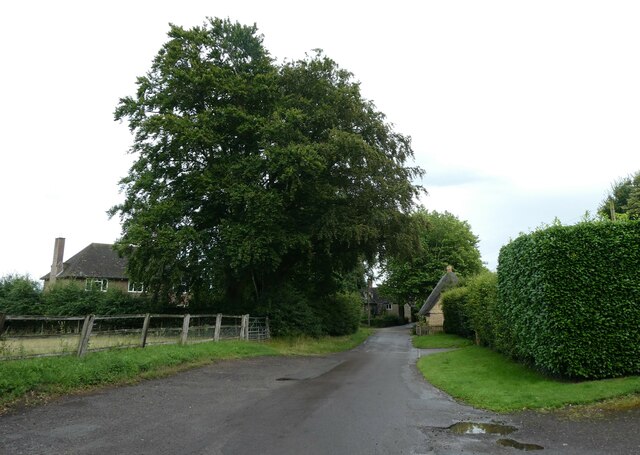
Longworth is a small village located in the county of Berkshire, England. Situated approximately 9 miles west of the historic city of Oxford, it lies in the Vale of White Horse district. Longworth is a rural community with a population of around 400 residents.

The village is known for its picturesque setting, surrounded by beautiful countryside and rolling hills. It boasts a charming and tranquil atmosphere, making it an ideal place for those seeking a peaceful retreat from city life. The village is characterized by its traditional stone houses, many of which date back several centuries, adding to its historic charm.

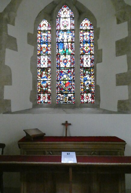
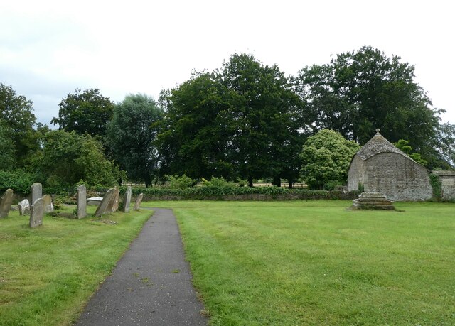
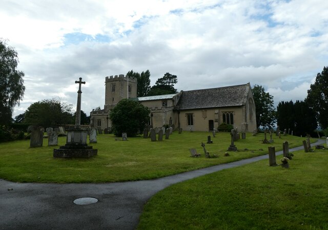
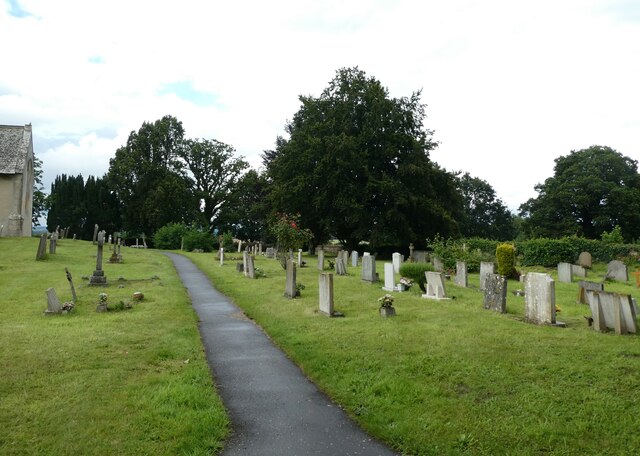
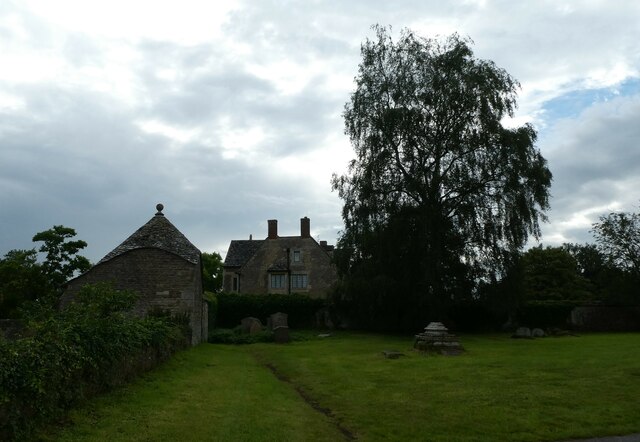
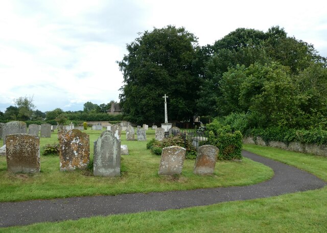
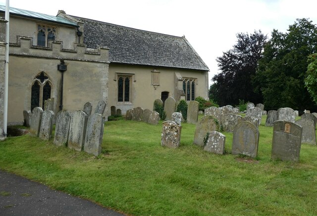
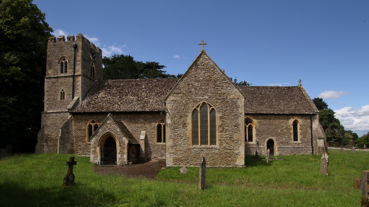
Longworth is home to St. Mary's Church, a medieval parish church that stands as a testament to the village's rich history. The church features stunning architectural details and serves as a hub for the local community, hosting regular services and events.

Despite its small size, Longworth offers a few amenities to its residents and visitors. The village has a primary school, providing education for the local children. Additionally, there is a village hall that serves as a venue for various community activities and gatherings.

The surrounding countryside provides ample opportunities for outdoor activities such as hiking, cycling, and horse riding. Longworth is also conveniently located near several larger towns and cities, including Oxford and Abingdon, offering access to a wider range of amenities and services.

In summary, Longworth is a quaint and idyllic village in Berkshire, renowned for its peaceful ambiance, historic architecture, and beautiful rural surroundings.

If you have any feedback on the listing, please let us know in the comments section below.
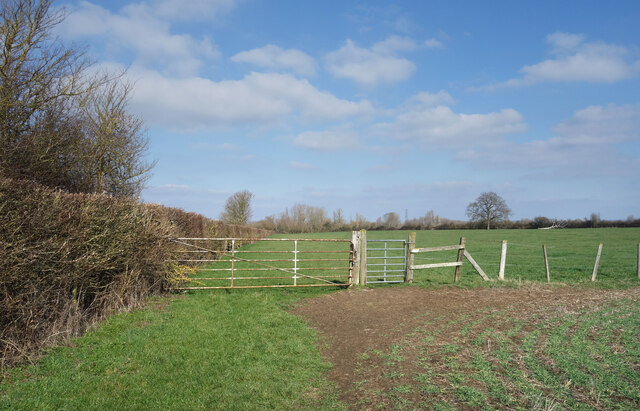
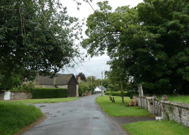
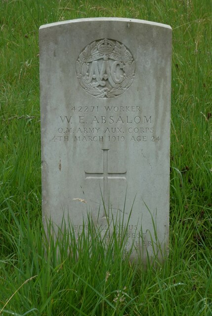
Longworth Images

Images are sourced within 2km of 51.691323/-1.437611 or Grid Reference SU3899. Thanks to Geograph Open Source API. All images are credited.

Old Bridge over a Dry Stream All this flat flood plain near the river is drained by lots of small ditches and backwaters, some in a better state than others.
This one clearly looks like nobody cares much about it these days.
There is probably a flow under here from time to time when river levels are high, but it's obviously not a maintained watercourse any more.
Old Bridge over a Dry Stream
All this flat flood plain near the river is drained by lots of small ditches and backwaters, some in a better state than others. This one clearly looks like nobody cares much about it these days. There is probably a flow under here from time to time when river levels are high, but it's obviously not a maintained watercourse any more.
Small Wood on Harrowdown Hill Harrowdown is a rather isolated small hill rising to just short of 100 metres aod. In common with many other similar hills it has a patch of woodland on the top.
Viewed from above it looks like this <a href="https://www.geograph.org.uk/photo/4263980">SP3800 : Aerial view of Harrowdown Hill, Oxon</a>
Small Wood on Harrowdown Hill
Harrowdown is a rather isolated small hill rising to just short of 100 metres aod. In common with many other similar hills it has a patch of woodland on the top. Viewed from above it looks like this SP3800 : Aerial view of Harrowdown Hill, Oxon
Path up Harrowdown Hill A small outlier from the ridge along the southern side of the Upper Thames Valley, Harrowdown Hill offers a typical view over the mostly flat landscape of the area.
Path up Harrowdown Hill
A small outlier from the ridge along the southern side of the Upper Thames Valley, Harrowdown Hill offers a typical view over the mostly flat landscape of the area.
Common Lane, Longworth Wide and level, almost a causeway with drainage ditches and neat hedges on both sides, this looks like a track that was made to be something more important than just a local bridleway. It's even got a proper name. An old drove road maybe?
Common Lane, Longworth
Wide and level, almost a causeway with drainage ditches and neat hedges on both sides, this looks like a track that was made to be something more important than just a local bridleway. It's even got a proper name. An old drove road maybe?
Common Lane continued The enclosed green lane behind us has given way to this wide open fieldside trackway.
Common Lane continued
The enclosed green lane behind us has given way to this wide open fieldside trackway.
Track to Newbridge Farm
A415 near Kingston Brake
Bridleway near Newbridge Just beyond the hedge in the far corner the bridleway ends abruptly at a busy main road, so I don't know how horse friendly it is.  
It's not all that good for walkers so I doubt that horses would like it much either.
Bridleway near Newbridge
Just beyond the hedge in the far corner the bridleway ends abruptly at a busy main road, so I don't know how horse friendly it is. It's not all that good for walkers so I doubt that horses would like it much either.
Rush hour in Hinton Waldrist Taken at the end of a rather wet and windy July, much in keeping with the rest of the summer: today was one squally shower after another, interspersed with the watery sunshine we have come to expect. Met office summary for July here <span class="nowrap"><a title="https://www.metoffice.gov.uk/binaries/content/assets/metofficegovuk/pdf/weather/learn-about/uk-past-events/summaries/uk_monthly_climate_summary_202107a.pdf" rel="nofollow ugc noopener" href="https://www.metoffice.gov.uk/binaries/content/assets/metofficegovuk/pdf/weather/learn-about/uk-past-events/summaries/uk_monthly_climate_summary_202107a.pdf">Link</a><img style="margin-left:2px;" alt="External link" title="External link - shift click to open in new window" src="https://s1.geograph.org.uk/img/external.png" width="10" height="10"/></span>
Rush hour in Hinton Waldrist
Taken at the end of a rather wet and windy July, much in keeping with the rest of the summer: today was one squally shower after another, interspersed with the watery sunshine we have come to expect. Met office summary for July here LinkExternal link
Unusual CWGC grave in Hinton Waldrist Churchyard A small piece of history for me: I've never seen a grave where the rank of the deceased is 'Worker' 
In other news this month: July 3 – a record temperature of 46° is recorded in British Columbia; July 7 – the  Haitian President Jovenel Moïse is assassinated; July 8 – the global death toll from COVID-19 surpasses 4 million; July 15 – heavy rain causes flooding in the border region of Germany and Belgium resulting in more than 200 deaths; July 19 - the Jeff Bezos backed Blue Origin successfully conducts its first human test flight; July 23 – the 2020 Summer Olympics begin a year late in Tokyo; July 28 – the first direct observation of light from behind a black hole is reported, confirming Einstein's theory of general relativity; July 31- Boris and Carrie Johnson announce their second child is due in December
Unusual CWGC grave in Hinton Waldrist Churchyard
A small piece of history for me: I've never seen a grave where the rank of the deceased is 'Worker' In other news this month: July 3 – a record temperature of 46° is recorded in British Columbia; July 7 – the Haitian President Jovenel Moïse is assassinated; July 8 – the global death toll from COVID-19 surpasses 4 million; July 15 – heavy rain causes flooding in the border region of Germany and Belgium resulting in more than 200 deaths; July 19 - the Jeff Bezos backed Blue Origin successfully conducts its first human test flight; July 23 – the 2020 Summer Olympics begin a year late in Tokyo; July 28 – the first direct observation of light from behind a black hole is reported, confirming Einstein's theory of general relativity; July 31- Boris and Carrie Johnson announce their second child is due in December
St Margaret, Hinton Waldrist: the Airey Neave Window Neave escaped from Colditz. He was the Tory MP who backed Margaret Thatcher for the party leadership when others held back. He was assassinated in 1979.
This month we have lost: July 7- FI legend Carlos Reutemann;  July 9- England international Paul Mariner, who played with great distinction for Pompey towards the end of his illustrious career; July 15, darts very own viking, Andy Fordham; July 18- Name that Tune's Tom O'Connor; July 28- the magnicent ZZ top bassist Dusty Hill; and on the 31st, Leeds left back Terry Cooper
St Margaret, Hinton Waldrist: the Airey Neave Window
Neave escaped from Colditz. He was the Tory MP who backed Margaret Thatcher for the party leadership when others held back. He was assassinated in 1979. This month we have lost: July 7- FI legend Carlos Reutemann; July 9- England international Paul Mariner, who played with great distinction for Pompey towards the end of his illustrious career; July 15, darts very own viking, Andy Fordham; July 18- Name that Tune's Tom O'Connor; July 28- the magnicent ZZ top bassist Dusty Hill; and on the 31st, Leeds left back Terry Cooper
Rush hour in Longworth
St Mary, Longworth: churchyard (i)
St Mary, Longworth: churchyard (ii)
St Mary, Longworth: churchyard (iii)
St Mary, Longworth: churchyard (iv)
St Mary, Longworth: churchyard (v)
St Mary, Longworth: churchyard (vi)
Show me another place!

Longworth is located at Grid Ref: SU3899 (Lat: 51.691323, Lng: -1.437611)

Administrative County: Oxfordshire

District: Vale of White Horse

Police Authority: Thames Valley

What 3 Words

///attitudes.piglet.shampoo. Near Kingston Bagpuize, Oxfordshire

Nearby Locations

Longworth Church Copse

Related Wikis

St Mary's Church, Longworth

St Mary's Church is a Church of England parish church in Longworth, Oxfordshire (formerly Berkshire). The church is a Grade I listed building. == History... ==

Longworth

Longworth is a village and civil parish in the Vale of White Horse, England. Historically within the north-west projection of Berkshire, boundary changes...

Longworth House

Longworth House is an historic country house at Longworth in the English county of Oxfordshire (formerly in Berkshire). It is a Grade II listed building...

Hinton Waldrist Castle

Hinton Waldrist Castle was in Hinton Waldrist about 7.5 miles (12.1 km) north of Wantage (grid reference SU376991). Hinton Waldrist spent most of its history...

Hinton Waldrist

Hinton Waldrist is a village and civil parish in the Vale of White Horse, England. It was part of Berkshire until the 1974 boundary changes transferred...

Southmoor

Southmoor is a village in the civil parish of Kingston Bagpuize with Southmoor, about 6 miles (9.7 km) west of Abingdon, Oxfordshire. Historically part...

Kingston Bagpuize with Southmoor

Kingston Bagpuize with Southmoor is a civil parish in the English county of Oxfordshire, England. The two principal settlements in the parish are the adjacent...

Kingston Bagpuize

Kingston Bagpuize () is a village in the civil parish of Kingston Bagpuize with Southmoor, about 6 miles (10 km) west of Abingdon. It was part of Berkshire...

Related Videos

Walking to the pub in Oxfordshire

Walking by the river Thames to the pub.

Walking on the riverbank on the river Thames in Oxfordshire

Watching to the pub in England Christmas Day.

193 - Narrowboat Alternator Belt Explodes Mid Cruise On The River Thames

After the last video, we moored on a 24-hour mooring spot, and the next day the land owner comes for is £15 for us to stay another ...

194 - The Most Beautiful Stretch Of River We've Ever Done | Newbridge - Rushey Lock, River Thames

Today me and mum walk back to get the car from our last mooring, taking you on our adventure with us, we also install our first ...

Nearby Amenities

Located within 500m of 51.691323,-1.437611
Longworth
Is In: Oxfordshire, England, UK
Place: village
Source: npe
Wikidata: Q2054042
Lat/Long: 51.6920893/-1.4379186
Pub
The Blue Boar
Food: yes
Wikidata: Q26573279
Lat/Long: 51.6918983/-1.4374391
Bus Stop
The Square NW-bound
Bus: yes
Naptan AtcoCode: 340000493OPT
Naptan Bearing: W
Naptan CommonName: The Square
Naptan Indicator: Opp Tucks Lane
Naptan Landmark: Square
Naptan NaptanCode: oxfapjtg
Naptan Street: Cow Lane
Naptan Verified: no
Public Transport: platform
Source: naptan_import
Lat/Long: 51.6912108/-1.4375285
Bus Stop
The Square SE-bound
Bus: yes
Naptan AtcoCode: 340000493TLC
Naptan Bearing: E
Naptan BusStopType: CUS
Naptan CommonName: The Square
Naptan Indicator: Tucks Lane Cnr
Naptan Landmark: Square
Naptan NaptanCode: oxfapjtd
Naptan Street: Cow Lane
Naptan Verified: no
Public Transport: platform
Source: naptan_import
Lat/Long: 51.691264/-1.4373831
Bus Stop
Cow Lane
Bus: yes
Naptan AtcoCode: 340001191COW
Naptan Bearing: E
Naptan CommonName: Cow Lane
Naptan Indicator: Corner
Naptan Landmark: Bus Shelter
Naptan NaptanCode: oxfadjgp
Naptan Street: Hinton Road
Naptan Verified: no
Public Transport: platform
Source: naptan_import
Lat/Long: 51.6878895/-1.4349368
Bus Stop
Cow Lane
Bus: yes
Naptan AtcoCode: 340001191GRE
Naptan Bearing: W
Naptan CommonName: Cow Lane
Naptan Indicator: Opposite
Naptan Landmark: Opp Bus Shelter
Naptan NaptanCode: oxfadjgm
Naptan Street: Hinton Road
Naptan Verified: no
Public Transport: platform
Source: naptan_import
Lat/Long: 51.6877598/-1.4341427
Bus Stop
Bowbank Close adj
Bus: yes
Naptan AtcoCode: 340001192CNR
Naptan Bearing: E
Naptan CommonName: Bowbank Close
Naptan Indicator: Corner
Naptan Landmark: Bus Shelter
Naptan NaptanCode: oxfadjgj
Naptan Street: Bowbank Close
Naptan Verified: no
Public Transport: platform
Source: naptan_import
Lat/Long: 51.6910049/-1.4358528
Bus Stop
Bowbank Close opp
Bus: yes
Naptan AtcoCode: 340001192OPP
Naptan Bearing: W
Naptan CommonName: Bowbank Close
Naptan Indicator: Opposite
Naptan Landmark: Rodney Place
Naptan NaptanCode: oxfadjgd
Naptan Street: Bowbank Close
Naptan Verified: no
Public Transport: platform
Source: naptan_import
Lat/Long: 51.6909272/-1.4346385
Bus Stop
Frilford Farm opp
Bus: yes
Naptan AtcoCode: 340001193OPP
Naptan Bearing: E
Naptan CommonName: Frilford Farm
Naptan Indicator: Opposite
Naptan Landmark: Frilford Farm
Naptan NaptanCode: oxfadjga
Naptan Street: Pine Woods Road
Naptan Verified: no
Public Transport: platform
Source: naptan_import
Lat/Long: 51.6886207/-1.4430723
Turning Circle
Lat/Long: 51.6912616/-1.4345174
Turning Circle
Lat/Long: 51.6918707/-1.4341655
Turning Circle
Lat/Long: 51.6911396/-1.4310972
Power: pole
Lat/Long: 51.6870665/-1.4384208
Bicycle Parking
Bicycle Parking: stands
Capacity: 8
Fee: no
Lat/Long: 51.6917932/-1.4398538
Defibrillator
Defibrillator Location: Next to front door of village hall
Emergency: defibrillator
Indoor: no
Lat/Long: 51.6918069/-1.4398028
Public Bookcase
Lat/Long: 51.6917591/-1.4398915
The data included in this document is from www.openstreetmap.org. The data is made available under ODbL.

Have you been to Longworth?

Leave your review of Longworth below (or comments, questions and feedback).