Geodha a' Bhrìdeoin

Coastal Feature, Headland, Point in Sutherland

Scotland

Geodha a' Bhrìdeoin

Loch nam Biast A remote loch on Whiten Head. There are trout in this loch.
Loch nam Biast Credit: david glass

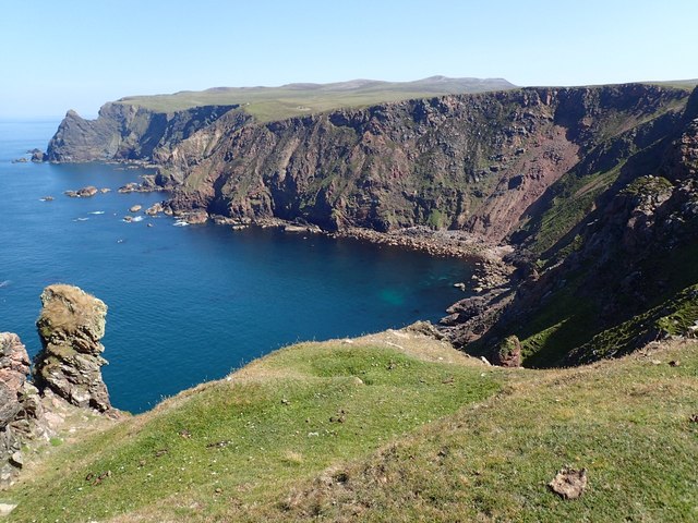
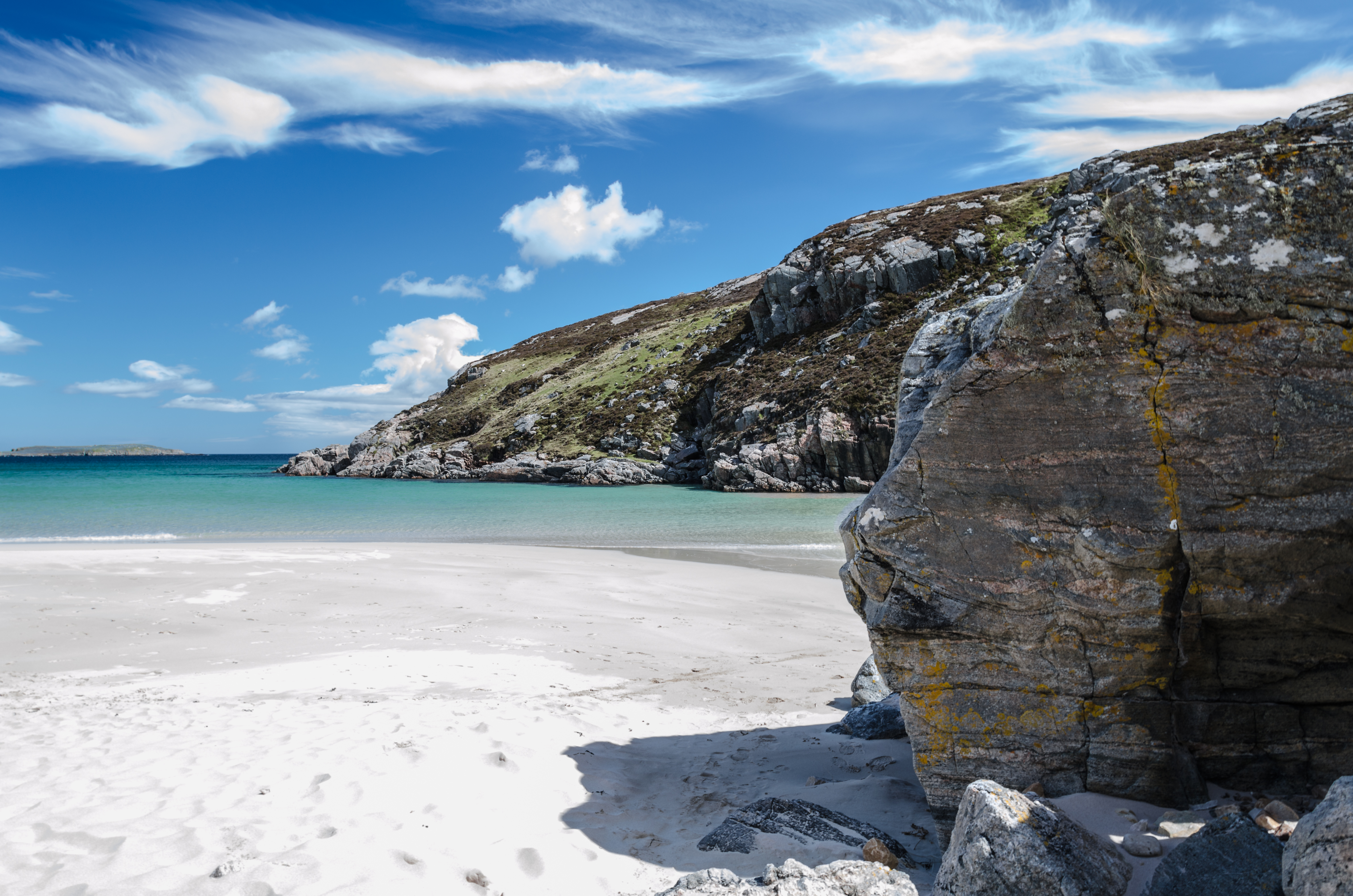
Geodha a' Bhrìdeoin, also known as Geodha na h-Iolaire, is a stunning coastal feature located in the county of Sutherland in the Scottish Highlands. It is a headland or point that juts out into the North Atlantic Ocean, offering breathtaking views of the surrounding landscape.

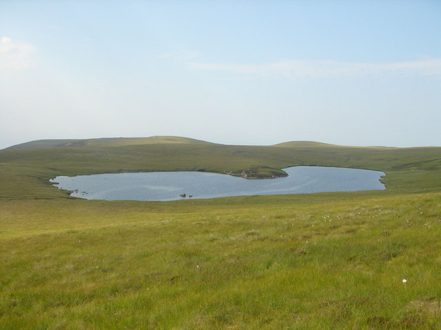
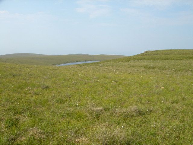
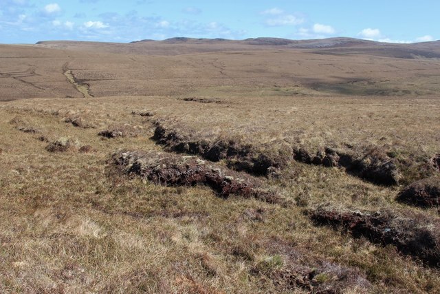
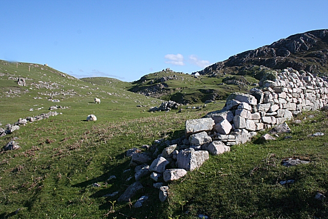
Geodha a' Bhrìdeoin is characterized by its rugged cliffs, which rise dramatically from the sea below. These cliffs are composed of ancient rock formations, showcasing the geological history of the area. The headland is mainly covered in grass and heather, with patches of wildflowers adding bursts of color to the landscape.

The coastal feature is a haven for wildlife enthusiasts, as it is home to a variety of seabirds, including puffins, razorbills, and guillemots. Visitors may also spot seals basking on the rocks or dolphins playing in the waters offshore.

Access to Geodha a' Bhrìdeoin is relatively easy, with a well-defined path leading from a nearby car park. The walk to the headland is about 1.5 kilometers long and offers breathtaking panoramic views of the coastline. It is advisable to wear sturdy footwear and take caution near the cliff edges, as they can be steep and unstable in some areas.

Overall, Geodha a' Bhrìdeoin is a captivating coastal feature that showcases the natural beauty and diversity of the Scottish Highlands. Its stunning cliffs, abundant wildlife, and panoramic views make it a must-visit destination for nature lovers and outdoor enthusiasts alike.

If you have any feedback on the listing, please let us know in the comments section below.

Geodha a' Bhrìdeoin Images

Images are sourced within 2km of 58.567473/-4.5966587 or Grid Reference NC4967. Thanks to Geograph Open Source API. All images are credited.

Loch nam Biast A remote loch on Whiten Head. There are trout in this loch.
Loch nam Biast
A remote loch on Whiten Head. There are trout in this loch.
Loch nam Biast A remote loch on Whiten Head, viewed from the slopes of Cnoc na Beiste.
Loch nam Biast
A remote loch on Whiten Head, viewed from the slopes of Cnoc na Beiste.
Lochan Riabhach A remote loch on Whiten Head.
Lochan Riabhach
A remote loch on Whiten Head.
Whiten Head Whiten head with Farraid head in distance
Whiten Head
Whiten head with Farraid head in distance
Peat hags on the moor at Whiten Head
Red deer on the moor at Whiten Head
Geodha Dearg
Geodha Dearg
Loch nam Biast Heather and stony ridge of Cnoc na Beiste led to pleasant grass land.
Loch nam Biast
Heather and stony ridge of Cnoc na Beiste led to pleasant grass land.
Geodha Dearg Taken from Whiten Head or An Ceann Geal.
Geodha Dearg
Taken from Whiten Head or An Ceann Geal.
Boggy Area South of An Ceann Geal Heather and tussocky grass moorland. Very dry at this time.
Boggy Area South of An Ceann Geal
Heather and tussocky grass moorland. Very dry at this time.
Sandstone cliffs on Whiten Head peninsula
Whiten Head Seen from above Traigh Allt Chailgeag.
Whiten Head
Seen from above Traigh Allt Chailgeag.
Cairn on Cnoc Ard an t-Siuil Drier plateau area with grass and cotton grass. Cliffs of Mol Mhor can just be seen in the distance.
Cairn on Cnoc Ard an t-Siuil
Drier plateau area with grass and cotton grass. Cliffs of Mol Mhor can just be seen in the distance.
Cliffs of Ceann Geal Beag This area was short grass and heather with few flowers. There were sheep grazing at the bottom of the cliffs and the grazing may have reduced the flowers.
Cliffs of Ceann Geal Beag
This area was short grass and heather with few flowers. There were sheep grazing at the bottom of the cliffs and the grazing may have reduced the flowers.
Multiple Natural Arches under Ceann Geal Beag The cliffs surrounding Mol Mhor are in the background.
Multiple Natural Arches under Ceann Geal Beag
The cliffs surrounding Mol Mhor are in the background.
Interesting Rocks on Rubh' Ard an t-Siuil This square consists almost entirely of sea, but there is also a narrow area on the cliff top.
Interesting Rocks on Rubh' Ard an t-Siuil
This square consists almost entirely of sea, but there is also a narrow area on the cliff top.
Grassy Clifftop under Ceann Geal Beag This square consists almost entirely of sea, but there is also a narrow area on the cliff top. Here there is short grass, but hardly any flowers. There were sheep grazing nearby.
Grassy Clifftop under Ceann Geal Beag
This square consists almost entirely of sea, but there is also a narrow area on the cliff top. Here there is short grass, but hardly any flowers. There were sheep grazing nearby.
Cliffs of Mol Mhor There was an interesting contrast between the white rock and the red.
Cliffs of Mol Mhor
There was an interesting contrast between the white rock and the red.
Show me another place!

Geodha a' Bhrìdeoin is located at Grid Ref: NC4967 (Lat: 58.567473, Lng: -4.5966587)

Unitary Authority: Highland

Police Authority: Highlands and Islands

What 3 Words

///drifters.notes.design. Near Oldshoremore, Highland

Related Wikis

Eilean Hoan

Eilean Hoan is an island in Loch Eriboll in Sutherland on the north coast of Scotland. It is about 28 hectares (69 acres) in extent and the highest point...

Ceannabeinne

Ceannabeinne (gaelic for the end of the mountains) is a ruined village within the parish of Durness, in the county of Sutherland, in the far north of the...

Leirinmore

Leirinmore (Scottish Gaelic: An Leithrinn Mhòr) is a crofting township in the parish of Durness on the northern coastline of Scotland, in Sutherland, Scottish...

Sangobeg

Sangobeg (Scottish Gaelic: Saingea Beag) is a remote coastal crofting township which overlooks Sangobeg Sands in Sutherland, Scottish Highlands in the...

Nearby Amenities

Located within 500m of 58.567473,-4.5966587
Source: PGS
Lat/Long: 58.5718213/-4.5975876
Source: PGS
Lat/Long: 58.5715209/-4.5976495
Source: PGS
Lat/Long: 58.5715383/-4.5984599
Source: PGS
Lat/Long: 58.5711672/-4.5982048
Source: PGS
Lat/Long: 58.5702702/-4.5990932
Source: PGS
Lat/Long: 58.5700104/-4.5996306
Source: PGS
Lat/Long: 58.5689265/-4.5997838
Source: PGS
Lat/Long: 58.5684174/-4.5988236
Source: PGS
Lat/Long: 58.5683989/-4.5985398
Source: PGS
Lat/Long: 58.5683285/-4.5980885
Source: PGS
Lat/Long: 58.5673371/-4.5970199
Source: PGS
Lat/Long: 58.5672074/-4.5972188
Source: PGS
Lat/Long: 58.5668235/-4.5977261
Source: PGS
Lat/Long: 58.5663486/-4.5980115
Source: PGS
Lat/Long: 58.5654069/-4.5973597
Source: PGS
Lat/Long: 58.5659132/-4.596357
Source: PGS
Lat/Long: 58.5657053/-4.5956708
Source: PGS
Lat/Long: 58.5650051/-4.5953423
Source: PGS
Lat/Long: 58.5645289/-4.5948268
Source: PGS
Lat/Long: 58.5642279/-4.5946187
Source: PGS
Lat/Long: 58.563943/-4.5946898
Source: PGS
Lat/Long: 58.5635766/-4.594788
Source: PGS
Lat/Long: 58.5633374/-4.5950059
Source: PGS
Lat/Long: 58.5631435/-4.5955236
Source: PGS
Lat/Long: 58.5630031/-4.5965237
The data included in this document is from www.openstreetmap.org. The data is made available under ODbL.

Have you been to Geodha a' Bhrìdeoin?

Leave your review of Geodha a' Bhrìdeoin below (or comments, questions and feedback).