Big Counting Hole

Coastal Feature, Headland, Point in Devon North Devon

England

Big Counting Hole

View across the bay at Lee, low tide
View across the bay at Lee, low tide Credit: David Martin

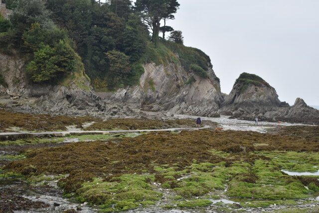
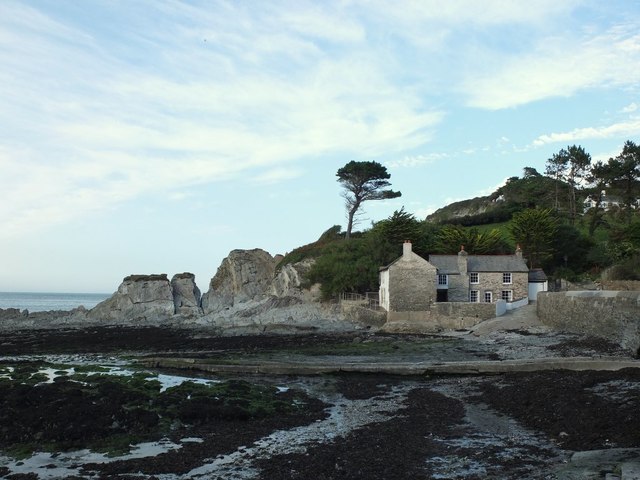
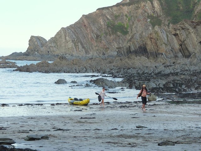
Big Counting Hole is a prominent coastal feature located in Devon, England. Situated on a headland, this natural wonder is known for its unique geological formation and picturesque views. The Big Counting Hole is also sometimes referred to as a point due to its jutting position into the sea.

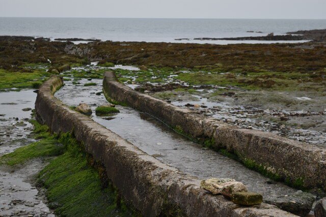
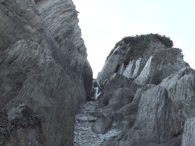
This impressive feature is characterized by its large hole, which has been formed by years of erosion caused by the relentless force of the ocean waves. The hole is believed to have been created by a combination of hydraulic action, where the force of the waves compresses air into cracks in the rock, and abrasion, where the water carries sediment that erodes the rock over time.

The Big Counting Hole stands as a testament to the power of nature and is a popular destination for both locals and tourists alike. Visitors are often in awe of the sheer size of the hole, which measures approximately 15 meters in diameter and 10 meters in depth.

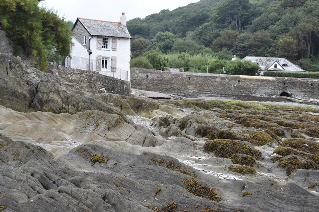
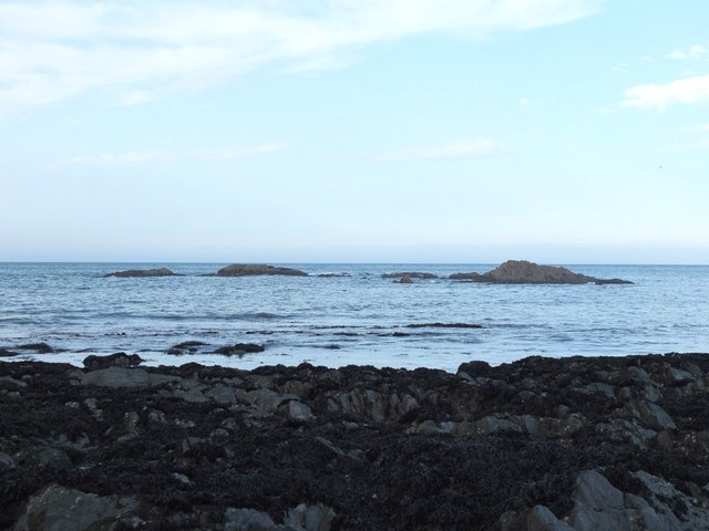
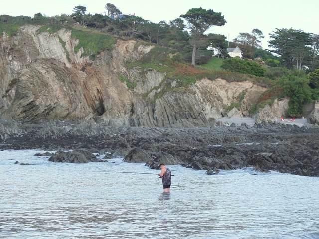
The headland on which the Big Counting Hole is situated provides stunning views of the surrounding coastline, making it a perfect spot for nature enthusiasts and photographers. The rugged cliffs and crashing waves create a dramatic backdrop against which the hole stands out.

In addition to its natural beauty, the Big Counting Hole is also home to a diverse range of coastal wildlife. Seabirds, such as gulls and cormorants, can often be seen nesting on the cliffs, while marine life, including seals and dolphins, can occasionally be spotted in the waters below.

Overall, the Big Counting Hole is a captivating coastal feature that combines natural beauty, geological intrigue, and abundant wildlife, making it a must-visit destination for anyone exploring the Devon coastline.

If you have any feedback on the listing, please let us know in the comments section below.

Big Counting Hole Images

Images are sourced within 2km of 51.200447/-4.1715147 or Grid Reference SS4846. Thanks to Geograph Open Source API. All images are credited.

View across the bay at Lee, low tide
Stream channel onto shore at Lee
House on the shore at Lee
Rocky shore at Lee
Rocky shore at Lee
The South West Coast Path
Sign at Women's Institute Car Park at Lee
Old Maid's Cottage, Lee, North Devon
Junction on Home Lane, Lee, North Devon
Footpath to Wrinkle Wood, Lee, North Devon
Lee Bay, North Devon
Passage from Lee Bay to Sandy Cove
Rocks in Lee Bay, North Devon
Sea fishing in Lee Bay, North Devon
Kayakers coming ashore at Lee Bay, North Devon
Path in Borough Valley near Lee, North Devon
Ordnance Survey Rivet This OS rivet can be found on the concrete base which once had a gatepost standing on it. West side of road. It marks a point 64.191m above mean sea level.
Ordnance Survey Rivet
This OS rivet can be found on the concrete base which once had a gatepost standing on it. West side of road. It marks a point 64.191m above mean sea level.
High scrub south of Bull Point The private road to Bull Point lighthouse runs around the side of this low hill.  My eye was caught by the gates which are aligned above and below that road
High scrub south of Bull Point
The private road to Bull Point lighthouse runs around the side of this low hill. My eye was caught by the gates which are aligned above and below that road
Footpath to Lee Bay The path leads inland to cross the valley near Damage Barton
Footpath to Lee Bay
The path leads inland to cross the valley near Damage Barton
Show me another place!

Big Counting Hole is located at Grid Ref: SS4846 (Lat: 51.200447, Lng: -4.1715147)

Administrative County: Devon

District: North Devon

Police Authority: Devon and Cornwall

What 3 Words

///founding.firelight.forecast. Near Ilfracombe, Devon

Related Wikis

Lee Bay

Lee Bay or just Lee is a small village on the North Devon coast near Woolacombe. Lee is situated on the rugged and inhospitable stretch of coast between...

Bull Point Lighthouse

Bull Point Lighthouse is a lighthouse on Bull Point, about one mile (1.6 km) north of the village of Mortehoe, on the northern coast of Devon, England...

The Torrs

The Torrs are a Local Nature Reserve and one of the four main hills in the North Devon coastal town of Ilfracombe. The Park originally was designed in...

Slade Reservoirs

The Slade Reservoirs are twin reservoirs in the North Devon town of Ilfracombe, England. They are owned by South West Water, and leased to South West Lakes...
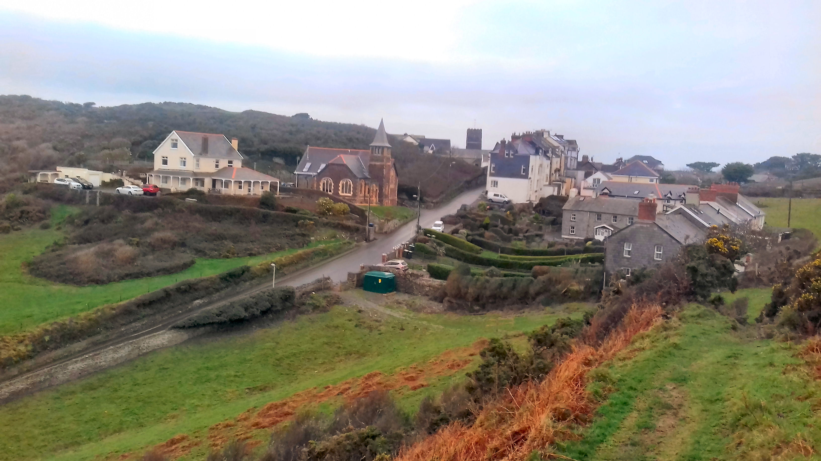
Mortehoe

Mortehoe () is a village and former manor on the north coast of Devon, England. It lies 10 miles north-west of Barnstaple, near Woolacombe and Lee Bay...

Mortehoe and Woolacombe railway station

Mortehoe and Woolacombe railway station was a station on the London and South Western Railway Ilfracombe Branch Line between Barnstaple and Ilfracombe...

Ilfracombe railway station (England)

Ilfracombe railway station was the terminus of the Ilfracombe branch line in north Devon, England. The line was opened as the Barnstaple and Ilfracombe...

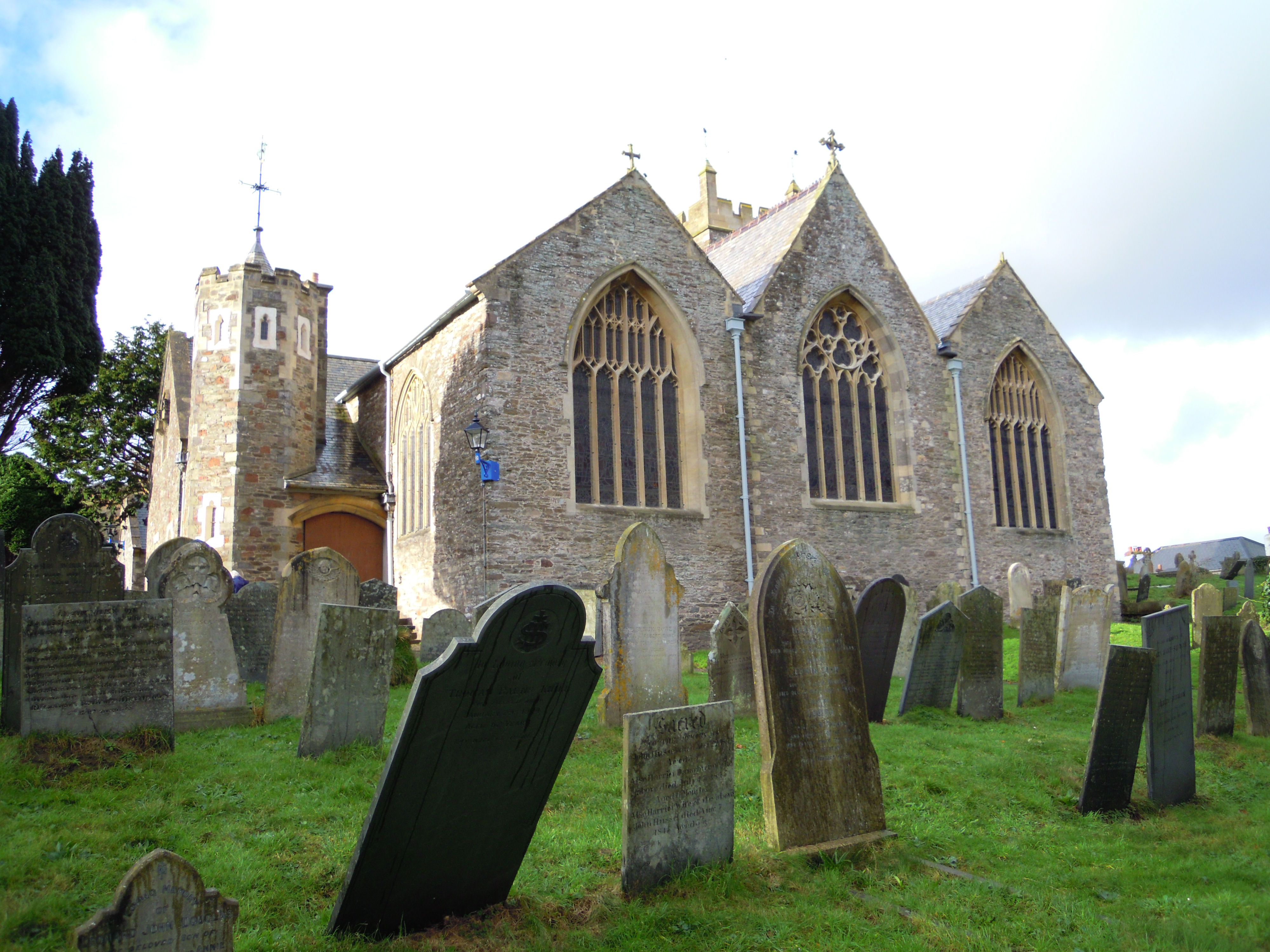
Holy Trinity Church, Ilfracombe

The Church of the Holy Trinity is the Anglican parish church for Ilfracombe in Devon. The building has been a Grade I listed building since 1951 and comes...

Nearby Amenities

Located within 500m of 51.200447,-4.1715147
Source: PGS
Lat/Long: 51.2031481/-4.1667147
Source: PGS
Lat/Long: 51.2028363/-4.1682293
Source: PGS
Lat/Long: 51.2026675/-4.1679129
Source: PGS
Lat/Long: 51.2025477/-4.1678976
Source: PGS
Lat/Long: 51.2024858/-4.1685017
Source: PGS
Lat/Long: 51.2022142/-4.1692398
Source: PGS
Lat/Long: 51.2018908/-4.1711205
Source: PGS
Lat/Long: 51.2017765/-4.1710191
Source: PGS
Lat/Long: 51.2012089/-4.1721585
Source: PGS
Lat/Long: 51.2008018/-4.1730682
Source: PGS
Lat/Long: 51.2006801/-4.1730633
Source: PGS
Lat/Long: 51.2004451/-4.1730733
Source: PGS
Lat/Long: 51.200407/-4.1732334
Source: PGS
Lat/Long: 51.2002314/-4.1731974
Source: PGS
Lat/Long: 51.200081/-4.1732317
Source: PGS
Lat/Long: 51.1999707/-4.1733406
Source: PGS
Lat/Long: 51.1997722/-4.1736466
Source: PGS
Lat/Long: 51.1996358/-4.1740306
Source: PGS
Lat/Long: 51.1995184/-4.1742909
Source: PGS
Lat/Long: 51.1994473/-4.1748429
Source: PGS
Lat/Long: 51.1994409/-4.1751069
Source: PGS
Lat/Long: 51.1994485/-4.1755988
Source: PGS
Lat/Long: 51.1994531/-4.176484
Source: PGS
Lat/Long: 51.1994837/-4.1767629
Source: PGS
Lat/Long: 51.1985532/-4.1767506
Source: PGS
Lat/Long: 51.1993568/-4.1773768
Source: PGS
Lat/Long: 51.1998804/-4.1785071
Lee
Is In: Devon, England, UK
Place: village
Lat/Long: 51.1962843/-4.1710719
Lee Bay
Natural: bay
Place: locality
Source: NPE
Lat/Long: 51.20151/-4.1780698
Barrier: stile
Lat/Long: 51.1975695/-4.1675014
Shag Point
Place: locality
Lat/Long: 51.2031722/-4.1664591
Outer Appledore Rocks
Place: locality
Lat/Long: 51.1998654/-4.1782433
Ulfred Point
Place: locality
Lat/Long: 51.2018165/-4.1721211
Source: PGS
Lat/Long: 51.1995067/-4.1771107
Barrier: kissing_gate
Foot: yes
Image: https://archive.org/details/lee-2021-09-06/PXL_20210906_111637270.jpg
Lat/Long: 51.1960203/-4.1725526
Barrier: kissing_gate
Lat/Long: 51.1991408/-4.1665986
Generator Method: photovoltaic
Generator Output Electricity: yes
Generator Source: solar
Generator Type: solar_photovoltaic_panel
Location: roof
Power: generator
Lat/Long: 51.1970551/-4.1725428
Generator Method: photovoltaic
Generator Output Electricity: yes
Generator Source: solar
Generator Type: solar_photovoltaic_panel
Location: roof
Power: generator
Lat/Long: 51.1970215/-4.1724382
Generator Method: photovoltaic
Generator Output Electricity: yes
Generator Source: solar
Generator Type: solar_photovoltaic_panel
Location: roof
Power: generator
Lat/Long: 51.1961718/-4.1706196
Generator Method: photovoltaic
Generator Output Electricity: yes
Generator Source: solar
Generator Type: solar_photovoltaic_panel
Location: roof
Power: generator
Lat/Long: 51.1959668/-4.1710944
Street Lamp
Lat/Long: 51.1977048/-4.1766158
Post Box
Collection Times: Mo-Fr 16:00; Sa 12:00
Image: https://archive.org/details/lee-2021-09-06/PXL_20210906_111403858.jpg
Operator: Royal Mail
Operator Wikidata: Q638098
Post Box Manufacturer: Derby Castings Limited, Derby
Post Box Type: wall
Ref: EX34 28
Royal Cypher: GR
Royal Cypher Wikidata: Q33102273
Lat/Long: 51.1959885/-4.1708989
The data included in this document is from www.openstreetmap.org. The data is made available under ODbL.

Have you been to Big Counting Hole?

Leave your review of Big Counting Hole below (or comments, questions and feedback).