St Patrick's Stone

Coastal Feature, Headland, Point in Renfrewshire

Scotland

St Patrick's Stone

Upper canal basin, Bowling Built about 1896, the basin on the Forth and Clyde Canal is Category B listed <span class="nowrap"><a title="http://portal.historicenvironment.scot/designation/LB18843" rel="nofollow ugc noopener" href="http://portal.historicenvironment.scot/designation/LB18843">Link</a><img style="margin-left:2px;" alt="External link" title="External link - shift click to open in new window" src="https://s1.geograph.org.uk/img/external.png" width="10" height="10"/></span>.
Upper canal basin, Bowling Credit: Richard Sutcliffe

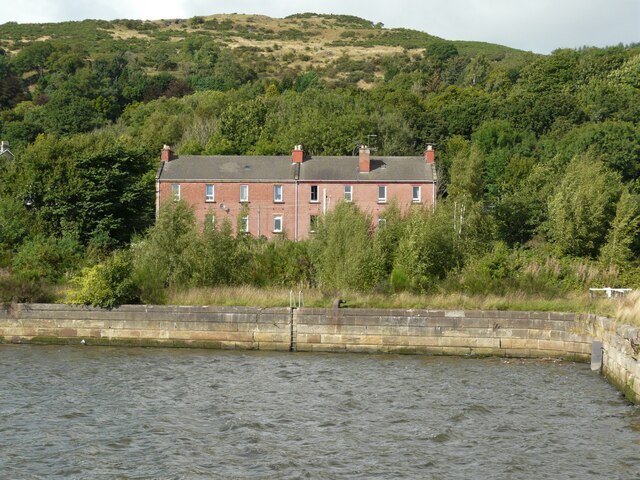
St Patrick's Stone is a coastal feature located in Renfrewshire, Scotland. Situated on a headland jutting out into the sea, this stone formation is a prominent point along the coastline. The stone is named after Saint Patrick, the patron saint of Ireland, as it is believed to have historical significance and connections to the saint himself.

The St Patrick's Stone is a large, weathered boulder that stands out on the headland. It is composed of a type of sandstone, displaying a mix of reddish and grayish hues. The stone has a smooth surface, likely due to years of erosion caused by wind and waves.

Local folklore surrounds the St Patrick's Stone, with tales suggesting that the saint himself stood on this very spot to bless the area. Some legends even claim that the stone was used as a pulpit during his sermons. These stories have contributed to the stone's cultural and historical importance in the region.

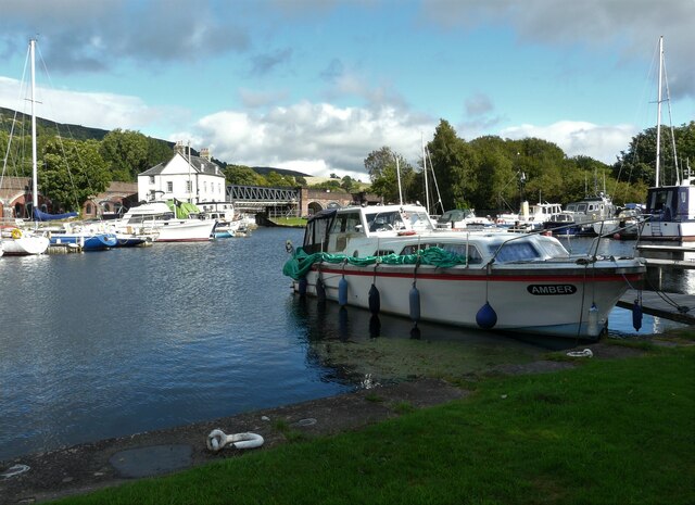
Visitors to St Patrick's Stone can enjoy breathtaking views of the coastline and the surrounding landscape. The headland offers an excellent vantage point to observe the crashing waves, nearby cliffs, and diverse marine life. Additionally, the stone has become a popular destination for nature enthusiasts, photographers, and those interested in the region's history and folklore.

Overall, St Patrick's Stone is an iconic coastal feature in Renfrewshire, offering visitors a unique blend of natural beauty and cultural significance.

If you have any feedback on the listing, please let us know in the comments section below.

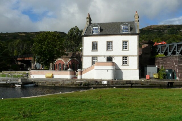
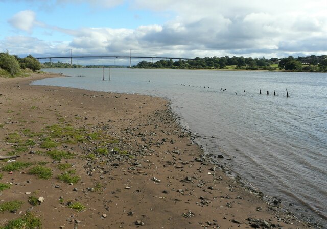
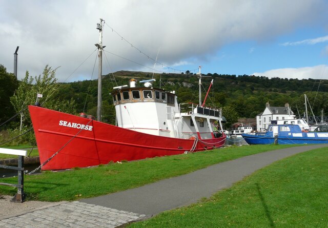
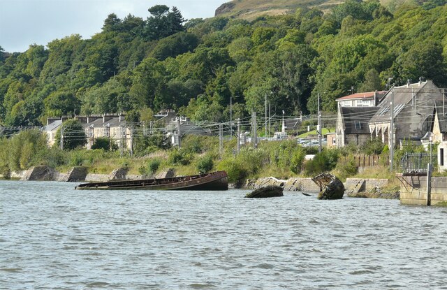
St Patrick's Stone Images

Images are sourced within 2km of 55.920278/-4.4642245 or Grid Reference NS4672. Thanks to Geograph Open Source API. All images are credited.

Upper canal basin, Bowling Built about 1896, the basin on the Forth and Clyde Canal is Category B listed <span class="nowrap"><a title="http://portal.historicenvironment.scot/designation/LB18843" rel="nofollow ugc noopener" href="http://portal.historicenvironment.scot/designation/LB18843">Link</a><img style="margin-left:2px;" alt="External link" title="External link - shift click to open in new window" src="https://s1.geograph.org.uk/img/external.png" width="10" height="10"/></span>.
Upper canal basin, Bowling
Built about 1896, the basin on the Forth and Clyde Canal is Category B listed LinkExternal link.
Former lock keepers' houses, Bowling Arts and craft style houses built in 1896 beside Lock 38 on the Forth and Clyde Canal at Bowling. They are Category C listed <span class="nowrap"><a title="http://portal.historicenvironment.scot/designation/LB18842" rel="nofollow ugc noopener" href="http://portal.historicenvironment.scot/designation/LB18842">Link</a><img style="margin-left:2px;" alt="External link" title="External link - shift click to open in new window" src="https://s1.geograph.org.uk/img/external.png" width="10" height="10"/></span>. The canal basin is Category B listed <span class="nowrap"><a title="http://portal.historicenvironment.scot/designation/LB18843" rel="nofollow ugc noopener" href="http://portal.historicenvironment.scot/designation/LB18843">Link</a><img style="margin-left:2px;" alt="External link" title="External link - shift click to open in new window" src="https://s1.geograph.org.uk/img/external.png" width="10" height="10"/></span>.
Former lock keepers' houses, Bowling
Arts and craft style houses built in 1896 beside Lock 38 on the Forth and Clyde Canal at Bowling. They are Category C listed LinkExternal link. The canal basin is Category B listed LinkExternal link.
Swing bridge, Bowling Basin Built in 1896 to carry the Lanarkshire and Dumbartonshire Railway over the Forth and Clyde Canal. It is Category B listed <span class="nowrap"><a title="http://portal.historicenvironment.scot/designation/LB18845" rel="nofollow ugc noopener" href="http://portal.historicenvironment.scot/designation/LB18845">Link</a><img style="margin-left:2px;" alt="External link" title="External link - shift click to open in new window" src="https://s1.geograph.org.uk/img/external.png" width="10" height="10"/></span>. 


The photograph was taken to replicate the first image for the square <a href="https://www.geograph.org.uk/photo/62292">NS4573 : Old Railway Bridge, Bowling</a>, photographed in 2001 and submitted in 2005.
Swing bridge, Bowling Basin
Built in 1896 to carry the Lanarkshire and Dumbartonshire Railway over the Forth and Clyde Canal. It is Category B listed LinkExternal link. The photograph was taken to replicate the first image for the square NS4573 : Old Railway Bridge, Bowling, photographed in 2001 and submitted in 2005.
Customs House, Bowling Basin The Category B listed <span class="nowrap"><a title="http://portal.historicenvironment.scot/designation/LB14411" rel="nofollow ugc noopener" href="http://portal.historicenvironment.scot/designation/LB14411">Link</a><img style="margin-left:2px;" alt="External link" title="External link - shift click to open in new window" src="https://s1.geograph.org.uk/img/external.png" width="10" height="10"/></span> Customs House has recently been redeveloped into a seven bedroom holiday accommodation property.
Customs House, Bowling Basin
The Category B listed LinkExternal link Customs House has recently been redeveloped into a seven bedroom holiday accommodation property.
River Clyde at Bowling Looking up-river towards the Erskine Bridge.
River Clyde at Bowling
Looking up-river towards the Erskine Bridge.
Seahorse Seahorse has been berthed at the Bowling Basin for many years. The former Customs House <a href="https://www.geograph.org.uk/photo/6959396">NS4573 : Customs House, Bowling Basin</a> can be seen in the distance.
Seahorse
Seahorse has been berthed at the Bowling Basin for many years. The former Customs House NS4573 : Customs House, Bowling Basin can be seen in the distance.
Bowling Harbour This is where the Forth and Clyde Canal enters the Clyde.
Bowling Harbour
This is where the Forth and Clyde Canal enters the Clyde.
Bowling Harbour ship graveyard Two of fourteen boats that have been recorded as lying in the harbour. They were probably taken to the harbour for breaking up, but are still there.

The railway line to Dumbarton runs immediately behind the harbour.
Bowling Harbour ship graveyard
Two of fourteen boats that have been recorded as lying in the harbour. They were probably taken to the harbour for breaking up, but are still there. The railway line to Dumbarton runs immediately behind the harbour.
Red Row Tenements on Dumbarton Road, Bowling, overlooking Bowling Harbour. The Hill of Dun is behind.
Red Row
Tenements on Dumbarton Road, Bowling, overlooking Bowling Harbour. The Hill of Dun is behind.
Hoist, Bowling Basin The hoist is used to remove masts from sailing boats that are intending to travel down the Forth and Clyde Canal, where the minimum clearance is just 3 metres.
Hoist, Bowling Basin
The hoist is used to remove masts from sailing boats that are intending to travel down the Forth and Clyde Canal, where the minimum clearance is just 3 metres.
Bowling Lower Basin Looking towards the former Customs House and swing bridge. The basin, which is Category B listed <span class="nowrap"><a title="http://portal.historicenvironment.scot/designation/LB18844," rel="nofollow ugc noopener" href="http://portal.historicenvironment.scot/designation/LB18844,">Link</a><img style="margin-left:2px;" alt="External link" title="External link - shift click to open in new window" src="https://s1.geograph.org.uk/img/external.png" width="10" height="10"/></span> is at the western end of the Forth and Clyde Canal.
Bowling Lower Basin
Looking towards the former Customs House and swing bridge. The basin, which is Category B listed LinkExternal link is at the western end of the Forth and Clyde Canal.
Boats in the Lower Basin, Bowling A selection of pleasure craft moored at the western end of the Forth and Clyde Canal.
Boats in the Lower Basin, Bowling
A selection of pleasure craft moored at the western end of the Forth and Clyde Canal.
Balance beam, Lock 40 The balace beam is made of angular steel <a href="https://www.geograph.org.uk/photo/6960262">NS4473 : Inside of a balance beam</a>.

This lock allows boats from the Forth and Clyde Canal to enter the Clyde through Bowling Harbour.
Balance beam, Lock 40
The balace beam is made of angular steel NS4473 : Inside of a balance beam. This lock allows boats from the Forth and Clyde Canal to enter the Clyde through Bowling Harbour.
Inside of a balance beam This view is looking inside, down the length of the balance beam for Lock 40 <a href="https://www.geograph.org.uk/photo/6960253">NS4473 : Balance beam, Lock 40</a>. The balance beam is made of angular steel, and has openings along its length.
Inside of a balance beam
This view is looking inside, down the length of the balance beam for Lock 40 NS4473 : Balance beam, Lock 40. The balance beam is made of angular steel, and has openings along its length.
Lock 40, Bowling The raised stone sets give a good grip when pushing the balance beam to open or close the lock.
Lock 40, Bowling
The raised stone sets give a good grip when pushing the balance beam to open or close the lock.
Low Flyer One of the many boats moored in the Lower Basin at Bowling.
Low Flyer
One of the many boats moored in the Lower Basin at Bowling.
Customs House, Bowling Basin The Category B listed <span class="nowrap"><a title="http://portal.historicenvironment.scot/designation/LB14411" rel="nofollow ugc noopener" href="http://portal.historicenvironment.scot/designation/LB14411">Link</a><img style="margin-left:2px;" alt="External link" title="External link - shift click to open in new window" src="https://s1.geograph.org.uk/img/external.png" width="10" height="10"/></span> Customs House has recently been redeveloped into a seven bedroom holiday accommodation property.
Customs House, Bowling Basin
The Category B listed LinkExternal link Customs House has recently been redeveloped into a seven bedroom holiday accommodation property.
Boats at Bowling Some of the narrowboats and  yachts moored on the Forth and Clyde Canal at Bowling.
Boats at Bowling
Some of the narrowboats and yachts moored on the Forth and Clyde Canal at Bowling.
Show me another place!

St Patrick's Stone is located at Grid Ref: NS4672 (Lat: 55.920278, Lng: -4.4642245)

Unitary Authority: Renfrewshire

Police Authority: Renfrewshire and Inverclyde

What 3 Words

///strong.hood.fewer. Near Old Kilpatrick, West Dunbartonshire

Related Wikis

St Patrick's Rock

St Patrick's Rock or St Patrick's Stone is located in the River Clyde (NS461724) close to the Erskine Bridge and the old Erskine Ferry on the Renfrewshire...

Old Kilpatrick railway station

Old Kilpatrick railway station was located in the village of Old Kilpatrick, Scotland on the Lanarkshire and Dunbartonshire Railway. The station opened...

Old Kilpatrick

Old Kilpatrick (Scots: Auld Kilpaitrick, Scottish Gaelic: Cille Phàdraig meaning "Patrick's church"), is a village in West Dunbartonshire, Scotland. It...

Donald's Quay

Donald's Quay was once the location of the northern terminus of the Erskine Ferry then run by Lord Blantyre of Erskine House that provided foot passengers...

Erskine Castle

Erskine Castle was a castle, about 5 miles (8 km) north of Erskine, Renfrewshire, Scotland, south of the River Clyde, on the shore. == History == The Erskines...

Kilpatrick railway station

Kilpatrick railway station serves the village of Old Kilpatrick in the West Dunbartonshire region of Scotland. The station is managed by ScotRail and is...

Mar Hall

Mar Hall is a 5-star hotel and golf resort in Bishopton, Renfrewshire. It is situated in Erskine House, a category A listed building. Formerly the building...

Erskine (charity)

Erskine is a veterans care and support charity headquartered in Erskine, Renfrewshire, but operating across the Central Belt of Scotland. It provides a...

Nearby Amenities

Located within 500m of 55.920278,-4.4642245
Source: PGS
Lat/Long: 55.9236205/-4.4652607
Source: PGS
Lat/Long: 55.9225574/-4.46355
Source: PGS
Lat/Long: 55.9214978/-4.462093
Source: PGS
Lat/Long: 55.9211507/-4.4616604
Created By: almien_coastlines
Lat/Long: 55.9219904/-4.4692436
Created By: almien_coastlines
Lat/Long: 55.9220761/-4.4700104
Recycling
Erskine Ferry Road Recycling Centre
Addr City: Old Kilpatrick
Addr Postcode: G60 5EU
Addr Street: Erskine Ferry Road
Owner: West Dunbartonshire Council
Ownership: municipal
Recycling Type: centre
Source Addr Postcode: code-point_open
Website: https://www.west-dunbarton.gov.uk/rubbish-and-recycling/recycling-centres/erskine-ferry-road-recycling-centre/
Lat/Long: 55.920224/-4.4585915
Leisure: slipway
Lat/Long: 55.9173083/-4.4615246
Barrier: bollard
Bicycle: yes
Foot: yes
Horse: yes
Source: survey
Lat/Long: 55.9171641/-4.4622938
Leisure: slipway
Lat/Long: 55.9196851/-4.458702
Seamark Light Character: Fl
Seamark Light Colour: green
Seamark Light Period: 5
Seamark Name: St.Patricks Stone
Seamark Type: light_minor
Lat/Long: 55.9203333/-4.4641944
Barrier: yes
Lat/Long: 55.9214367/-4.4572257
Telephone
Booth: K8
Covered: booth
Listed Status: Category B
Lat/Long: 55.9170682/-4.4692551
Telephone
Booth: K8
Covered: booth
Listed Status: Category B
Lat/Long: 55.917226/-4.4696575
Barrier: yes
Lat/Long: 55.9216168/-4.4567739
Barrier: cycle_barrier
Lat/Long: 55.9212928/-4.4573805
Bench
Lat/Long: 55.9226308/-4.4591368
Bench
Lat/Long: 55.9232875/-4.4608478
Waste Basket
Lat/Long: 55.9242606/-4.4643125
Bench
Lat/Long: 55.923812/-4.4626255
Barrier: yes
Lat/Long: 55.9198203/-4.4566696
Old Kilpatrick
Historic Railway: station
Railway: site
Wikidata: Q7084329
Wikipedia: en:Old Kilpatrick railway station
Lat/Long: 55.9212974/-4.4568203
Bench
Backrest: no
Material: wood
Lat/Long: 55.9179343/-4.4657773
Waste Basket
Lat/Long: 55.9175443/-4.4645985
Bench
Lat/Long: 55.9175393/-4.4645365
Leisure: picnic_table
Lat/Long: 55.9183221/-4.4649596
Bench
Backrest: no
Material: wood
Lat/Long: 55.917502/-4.466641
Bench
Lat/Long: 55.9177233/-4.4647819
Bench
Backrest: no
Material: wood
Seats: 1
Lat/Long: 55.9168021/-4.4651229
Leisure: picnic_table
Lat/Long: 55.9185499/-4.464955
Bench
Backrest: no
Lit: no
Material: wood
Lat/Long: 55.9168121/-4.4679457
Leisure: picnic_table
Lat/Long: 55.9186422/-4.465149
Leisure: picnic_table
Lat/Long: 55.9181322/-4.465007
Bench
Backrest: no
Material: wood
Seats: 1
Lat/Long: 55.9168227/-4.4651632
The data included in this document is from www.openstreetmap.org. The data is made available under ODbL.

Have you been to St Patrick's Stone?

Leave your review of St Patrick's Stone below (or comments, questions and feedback).