Ach' a Ghearraiseich

Coastal Feature, Headland, Point in Sutherland

Scotland

Ach' a Ghearraiseich

Sheep grazing beside Loch Eriboll Ard Neackie in the centre.
Sheep grazing beside Loch Eriboll Credit: Russel Wills

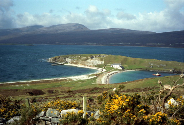
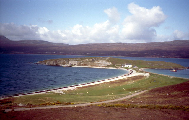
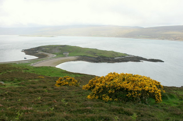
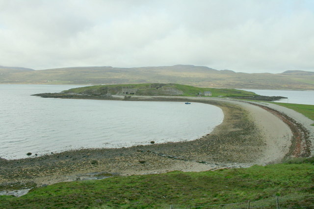
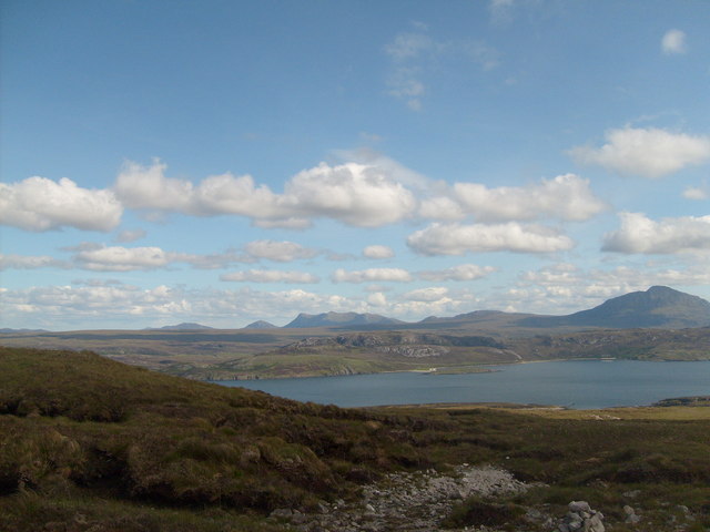
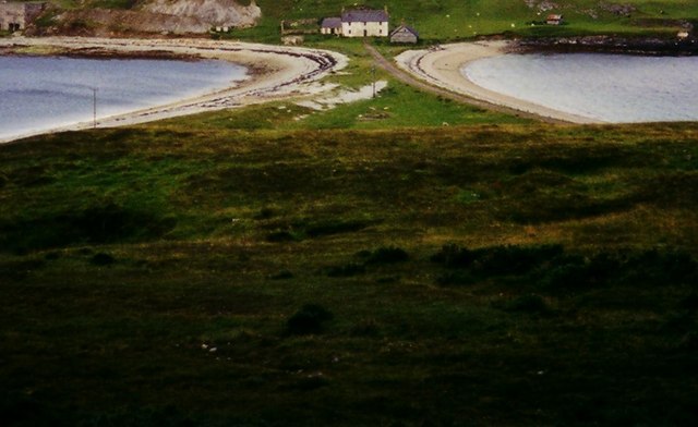
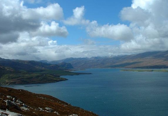
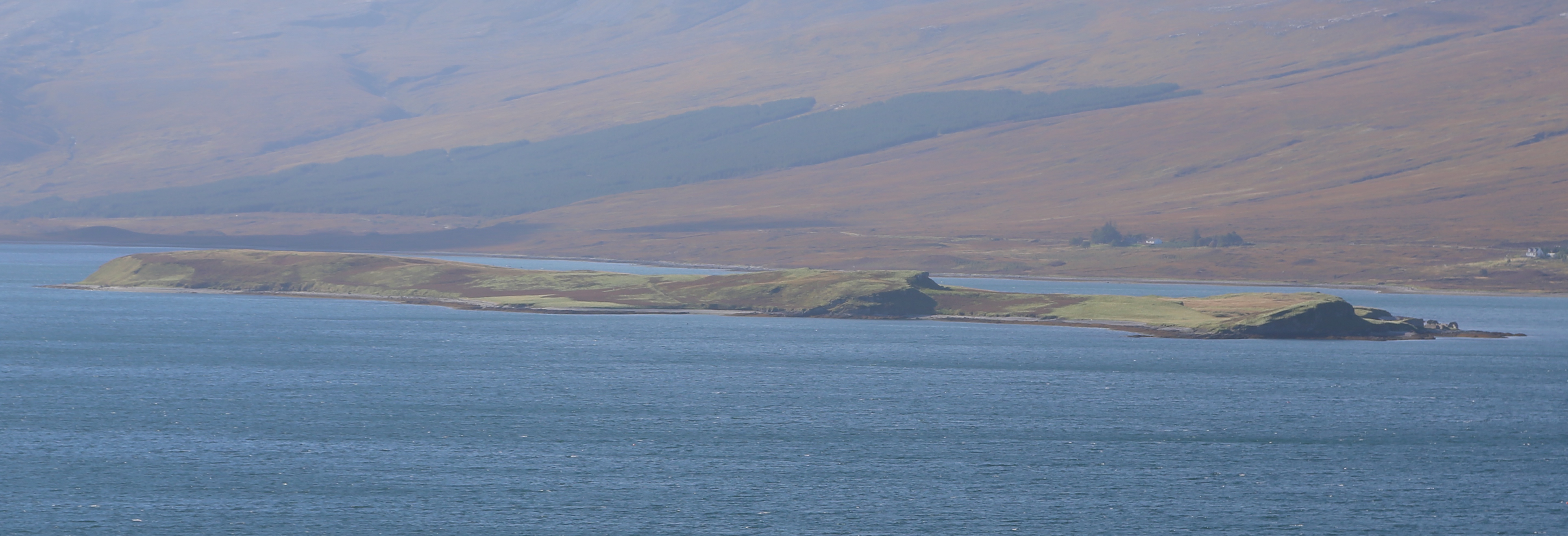
Ach' a Ghearraiseich is a prominent coastal feature located in Sutherland, a county in the northernmost part of Scotland. It is specifically classified as a headland or point due to its distinct geographical attributes. Situated along the rugged coastline of the North Atlantic Ocean, Ach' a Ghearraiseich boasts impressive cliffs that rise dramatically from the sea, providing breathtaking views of the surrounding landscape.

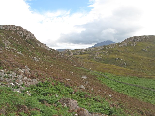
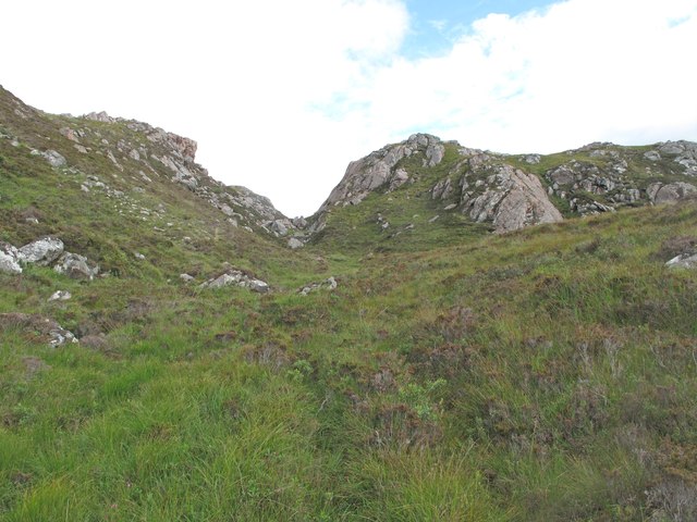
The headland is characterized by its towering and jagged rock formations, which have been shaped by centuries of erosion caused by the relentless crashing waves. These rock formations are composed of various types of sedimentary rocks, including sandstone and shale, which add to the visual appeal of the site.

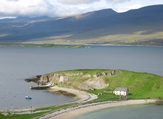
Ach' a Ghearraiseich is not only visually stunning but also serves as an important habitat for a diverse range of flora and fauna. The headland's rocky surfaces provide nesting grounds for seabirds such as puffins, guillemots, and razorbills, making it a popular spot for birdwatchers and nature enthusiasts. In addition, the surrounding waters are home to a variety of marine life, including seals, dolphins, and even occasional sightings of whales.

This coastal feature also holds historical significance, as it has witnessed human activity for thousands of years. Archaeological evidence suggests that ancient settlements were once present in the area, with remnants of ancient structures and tools discovered nearby. Today, Ach' a Ghearraiseich is a popular destination for tourists and locals alike, who come to appreciate its natural beauty, explore its rich history, and enjoy the tranquility of the surrounding coastal environment.

If you have any feedback on the listing, please let us know in the comments section below.

Ach' a Ghearraiseich Images

Images are sourced within 2km of 58.481876/-4.6630114 or Grid Reference NC4457. Thanks to Geograph Open Source API. All images are credited.

Sheep grazing beside Loch Eriboll Ard Neackie in the centre.
Sheep grazing beside Loch Eriboll
Ard Neackie in the centre.
Lime kilns on Ard Neackie The four large lime kilns were built in 1870. The Reay estate produced large amounts of lime here and on the nearby island of Eilean Choraidh and loaded it into ships at the quay.
Lime kilns on Ard Neackie
The four large lime kilns were built in 1870. The Reay estate produced large amounts of lime here and on the nearby island of Eilean Choraidh and loaded it into ships at the quay.
An t- Sròn and Loch Eriboll With the settlement of Kempie on the left. The A838 making its way over the top of An t- Sròn.
An t- Sròn and Loch Eriboll
With the settlement of Kempie on the left. The A838 making its way over the top of An t- Sròn.
Gorse in full bloom overlooking Ard Neackie Loch Eriboll and its environs offer some of Scotland's finest and wildest scenery.
Gorse in full bloom overlooking Ard Neackie
Loch Eriboll and its environs offer some of Scotland's finest and wildest scenery.
The pier and lime kilns of Ard Neackie
Eriboll kirk, a Church of Scotland outpost
Loch Eriboll &  Árd Neackie From the end of the mountain path between Beinn Ceannabeinne & Meall Meadhonach (a small cairn is just visible). Ben Loyal & Ben Hope can also be seen in the background.
Loch Eriboll & Árd Neackie
From the end of the mountain path between Beinn Ceannabeinne & Meall Meadhonach (a small cairn is just visible). Ben Loyal & Ben Hope can also be seen in the background.
The A838 on the eastern edge of Loch Eriboll
An t-Sron, Loch Eriboll An t-Sron (The Nose), a rocky promontory on the coast of Loch Eriboll.
An t-Sron, Loch Eriboll
An t-Sron (The Nose), a rocky promontory on the coast of Loch Eriboll.
Loch Eriboll Limestone coast on the east side of Loch Eriboll.
Loch Eriboll
Limestone coast on the east side of Loch Eriboll.
Inbhirean, a harbour at Loch Eriboll Stones have been cleared from the shore to create a landing place for boats.
Inbhirean, a harbour at Loch Eriboll
Stones have been cleared from the shore to create a landing place for boats.
Aspen Tree An Aspen clinging to a crag where deer cannot reach it.
Aspen Tree
An Aspen clinging to a crag where deer cannot reach it.
Moorland above Eriboll The southern slopes of Ben Arnaboll.
Moorland above Eriboll
The southern slopes of Ben Arnaboll.
Glac an Tioraidh This hollow is at the head of a valley where it reaches the watershed between Loch Eriboll and Loch Hope.
Glac an Tioraidh
This hollow is at the head of a valley where it reaches the watershed between Loch Eriboll and Loch Hope.
Allt Glac an Tioraidh A burn above Eriboll.
Allt Glac an Tioraidh
A burn above Eriboll.
Meall Bad a' Mhartuin Meall Bad a' Mhartuin viewed from the col to the south.
Meall Bad a' Mhartuin
Meall Bad a' Mhartuin viewed from the col to the south.
Ard Neackie and pier Ard Neakie was used as the eastern terminus of the Heilam Ferry, which crossed the loch to the Heilam Inn on the west bank of the loch at Portnancon. The ferry ceased operation in the 1890s when the road around the loch was completed, but the ferry house built in 1831 still stands, though sadly increasingly derelict. Ard Neakie is also notable for the four large lime kilns built in 1870. The Reay estate produced large amounts of lime here and on the nearby island of Eilean Choraidh and loaded it into ships.

Almost an island, Ard Neackie is linked to the mainland by a tombolo.
Ard Neackie and pier
Ard Neakie was used as the eastern terminus of the Heilam Ferry, which crossed the loch to the Heilam Inn on the west bank of the loch at Portnancon. The ferry ceased operation in the 1890s when the road around the loch was completed, but the ferry house built in 1831 still stands, though sadly increasingly derelict. Ard Neakie is also notable for the four large lime kilns built in 1870. The Reay estate produced large amounts of lime here and on the nearby island of Eilean Choraidh and loaded it into ships. Almost an island, Ard Neackie is linked to the mainland by a tombolo.
Hillside near Ard Neackie Looking down the hill from the A838 towards the shoreline.
Hillside near Ard Neackie
Looking down the hill from the A838 towards the shoreline.
Show me another place!

Ach' a Ghearraiseich is located at Grid Ref: NC4457 (Lat: 58.481876, Lng: -4.6630114)

Unitary Authority: Highland

Police Authority: Highlands and Islands

What 3 Words

///explained.replaying.coping. Near Oldshoremore, Highland

Nearby Locations

Ach' a Ghearraiseich

Related Wikis

Eriboll

Eriboll (Scottish Gaelic: Earabol) is a village in Sutherland, Scotland. The village is situated on the south eastern shore of Loch Eriboll, in the northern...

Loch Eriboll

Loch Eriboll (Scottish Gaelic: "Loch Euraboil") is a 16 km (9.9 mi) long sea loch on the north coast of Scotland, which has been used for centuries as...

Eilean Choraidh

Eilean Choraidh, also known as Horse Island is an island in Loch Eriboll in Sutherland on the north coast of Scotland. It is about 26 hectares (64 acres...

Portnancon

Portnacon is a small remote crofting township, and former fishing station, on the west shore of Loch Eriboll in Sutherland, Scottish Highlands in the...

Nearby Amenities

Located within 500m of 58.481876,-4.6630114
Source: PGS
Lat/Long: 58.4858586/-4.6618474
Source: PGS
Lat/Long: 58.4852905/-4.6619199
Source: PGS
Lat/Long: 58.4847653/-4.6620582
Source: PGS
Lat/Long: 58.4843747/-4.6621427
Source: PGS
Lat/Long: 58.4840594/-4.6623328
Source: PGS
Lat/Long: 58.4837155/-4.6625588
Source: PGS
Lat/Long: 58.4834915/-4.6627544
Source: PGS
Lat/Long: 58.4832018/-4.6630964
Source: PGS
Lat/Long: 58.4829455/-4.6633793
Source: PGS
Lat/Long: 58.4826095/-4.6638778
Source: PGS
Lat/Long: 58.4819998/-4.665255
Source: PGS
Lat/Long: 58.4820605/-4.6667423
Source: PGS
Lat/Long: 58.4823608/-4.6668187
Source: PGS
Lat/Long: 58.4822268/-4.6673255
Source: PGS
Lat/Long: 58.4823807/-4.6677032
Source: PGS
Lat/Long: 58.4831178/-4.6703329
Power: pole
Lat/Long: 58.4820181/-4.6680917
Power: pole
Lat/Long: 58.482011/-4.6692053
Power: pole
Lat/Long: 58.482011/-4.6703344
Power: pole
Lat/Long: 58.4818145/-4.6714168
Kempie
Place: hamlet
Source: os_opendata_streetview
Source Name: os_opendata_streetview
Lat/Long: 58.4819372/-4.6669525
Passing Place
Lat/Long: 58.4815433/-4.6688153
The data included in this document is from www.openstreetmap.org. The data is made available under ODbL.

Have you been to Ach' a Ghearraiseich?

Leave your review of Ach' a Ghearraiseich below (or comments, questions and feedback).