Skinham Point

Coastal Feature, Headland, Point in Cornwall

England

Skinham Point

Eastbound A38 near Burraton Blue signs giving advance notice of toll charges on the Tamar Bridge ahead (although traffic will have to negotiate the Saltash Tunnel before reaching the bridge).
Eastbound A38 near Burraton Credit: David Dixon

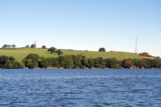
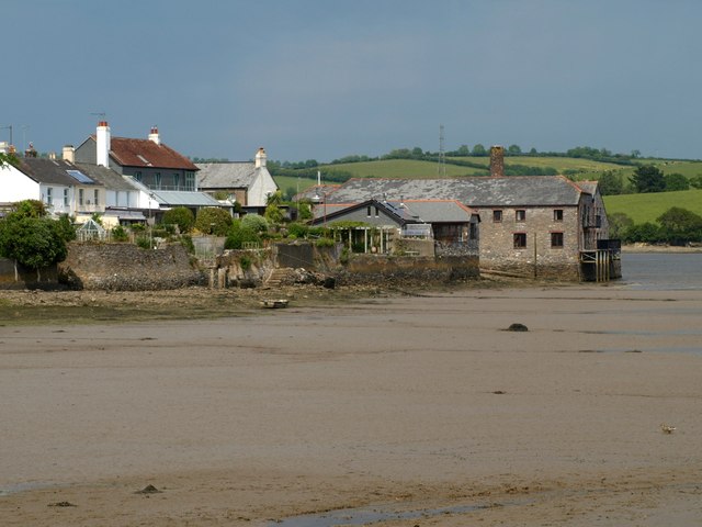
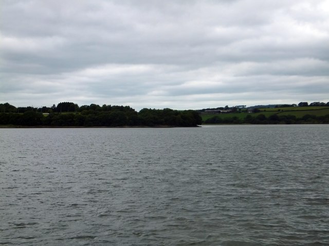
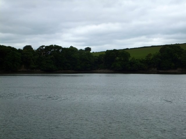
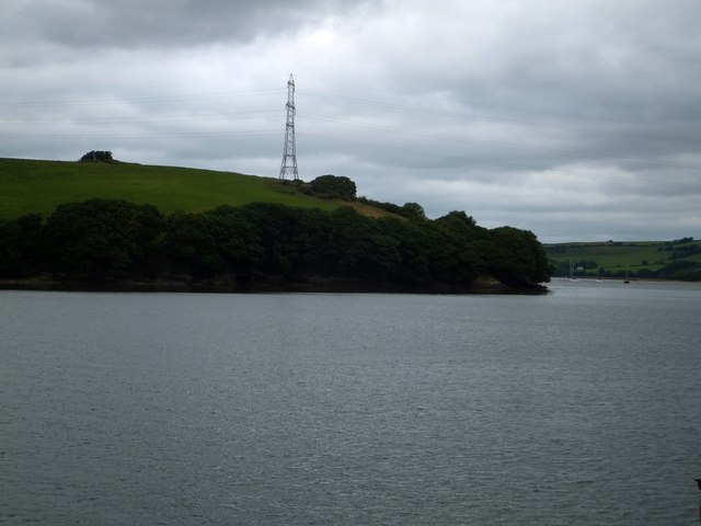
Skinham Point is a picturesque coastal feature located in Cornwall, England. Situated on the southwestern coast, it is specifically positioned on the northern side of the popular St. Ives Bay. This prominent headland, also known as a point, offers breathtaking views of the surrounding area and is a well-known destination for tourists and locals alike.

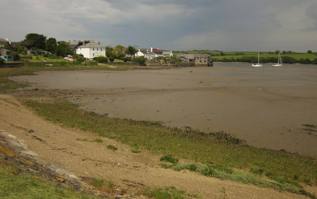
The point is characterized by its rugged and rocky landscape, with towering cliffs that rise majestically from the Atlantic Ocean. These cliffs are composed mainly of granite, providing a stunning contrast against the deep blue waters below. At low tide, small coves and sandy beaches can be discovered, offering opportunities for beachcombing and relaxation.

Skinham Point is also home to an array of diverse wildlife, making it a haven for nature enthusiasts. Seabirds such as gulls and cormorants can be observed nesting on the cliffs, while seals and dolphins can often be spotted swimming offshore. The surrounding waters are abundant with marine life, attracting fishermen and divers alike.

The area surrounding Skinham Point is rich in history and culture. The remnants of an ancient fortification, believed to have been built during the Iron Age, can still be seen atop the headland. These archaeological remains provide a glimpse into the area's ancient past and offer a fascinating insight into its historical significance.

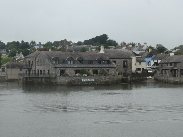
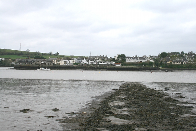
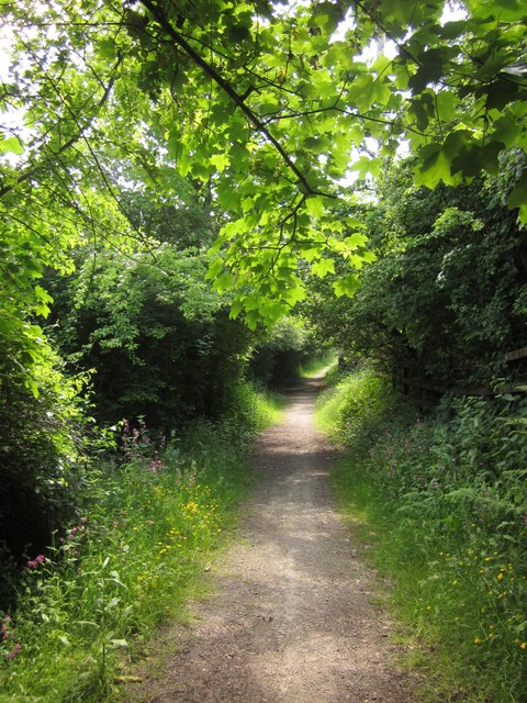
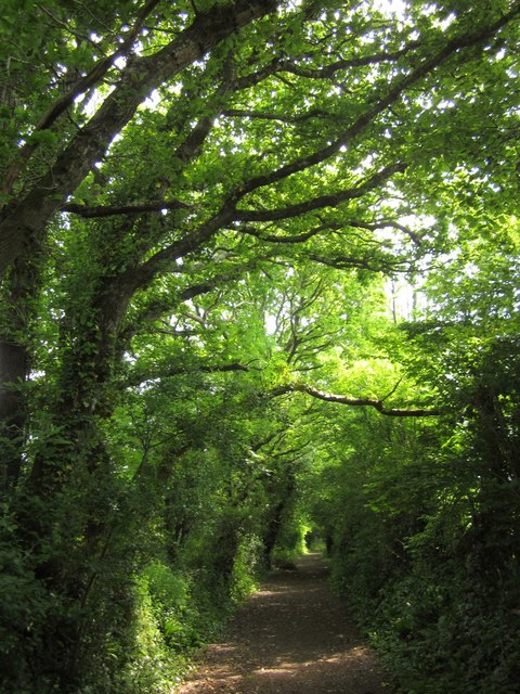
Visitors to Skinham Point can enjoy coastal walks along the cliff-top paths, taking in the breathtaking scenery and discovering hidden viewpoints along the way. The point is easily accessible by foot, with nearby parking and public transportation options available. Whether it's for its natural beauty, wildlife, or historical significance, Skinham Point is a must-visit destination for anyone exploring the stunning coast of Cornwall.

If you have any feedback on the listing, please let us know in the comments section below.

Skinham Point Images

Images are sourced within 2km of 50.425894/-4.210426 or Grid Reference SX4360. Thanks to Geograph Open Source API. All images are credited.

Eastbound A38 near Burraton Blue signs giving advance notice of toll charges on the Tamar Bridge ahead (although traffic will have to negotiate the Saltash Tunnel before reaching the bridge).
Eastbound A38 near Burraton
Blue signs giving advance notice of toll charges on the Tamar Bridge ahead (although traffic will have to negotiate the Saltash Tunnel before reaching the bridge).
'Firestorm' off Skinham Point The yacht plods gently downstream along the River Tamar north of Saltash.
'Firestorm' off Skinham Point
The yacht plods gently downstream along the River Tamar north of Saltash.
River Tamar, near Landulph Looking from the water to the bank on the Cornish side between Neal Point and Weir Point.
River Tamar, near Landulph
Looking from the water to the bank on the Cornish side between Neal Point and Weir Point.
Moored yacht, River Tamar Between Thorn Point and Weir Point. The boat is pointing downstream as the tide comes in. On the east bank are fields near New Barn Farm.
Moored yacht, River Tamar
Between Thorn Point and Weir Point. The boat is pointing downstream as the tide comes in. On the east bank are fields near New Barn Farm.
Quay and slipway, off Fore Street, Cargreen On the Cornish side of the River Tamar.
Quay and slipway, off Fore Street, Cargreen
On the Cornish side of the River Tamar.
Thorn Point ferry hard Ferry hard extending to the river edge at low water, with Cargreen quay visible opposite.
Thorn Point ferry hard
Ferry hard extending to the river edge at low water, with Cargreen quay visible opposite.
Saltash: Waitrose Off the A388 and close to its junction with the A38 trunk road, north of Saltash town
Saltash: Waitrose
Off the A388 and close to its junction with the A38 trunk road, north of Saltash town
Warleigh Woods
Warleigh Woods
Meadow, Tamar Park A flower-filled field beside Pill Lane, south of <a href="https://www.geograph.org.uk/photo/66868">SX4260 : China Fleet Country Club, Saltash</a>.
Meadow, Tamar Park
A flower-filled field beside Pill Lane, south of SX4260 : China Fleet Country Club, Saltash.
Cargreen As <a href="https://www.geograph.org.uk/photo/2260056">SX4362 : Cargreen seen from footpath in 1992</a> shows, the village is on a promontory jutting out into the Tamar estuary.
Cargreen
As SX4362 : Cargreen seen from footpath in 1992 shows, the village is on a promontory jutting out into the Tamar estuary.
Cargreen A closer look at the buildings at the end of the promontory shown in <a href="https://www.geograph.org.uk/photo/3506051">SX4362 : Cargreen</a>.
Cargreen
A closer look at the buildings at the end of the promontory shown in SX4362 : Cargreen.
Bridleway to Pill Lane A little further down bridleway 636/9/1 shown in <a href="https://www.geograph.org.uk/photo/817860">SX4160 : Bridleway from Carkeel</a>.
Bridleway to Pill Lane
A little further down bridleway 636/9/1 shown in SX4160 : Bridleway from Carkeel.
Pill Lane A reverse view of <a href="https://www.geograph.org.uk/photo/817784">SX4260 : Green Lane near Pill Farm</a>, with a route with public access following the green lane as a continuation of bridleway 636/9/1.
Pill Lane
A reverse view of SX4260 : Green Lane near Pill Farm, with a route with public access following the green lane as a continuation of bridleway 636/9/1.
Tavy Bridge from Tamar Park Over two and half kilometres from the camera, across and up the Tamar estuary to the mouth of the Tavy.
Tavy Bridge from Tamar Park
Over two and half kilometres from the camera, across and up the Tamar estuary to the mouth of the Tavy.
Skinham Point seen from the Tamar The wooded point is the end of the Kingsmill Lake inlet.  The tide was high so the inlet was full of water
Skinham Point seen from the Tamar
The wooded point is the end of the Kingsmill Lake inlet. The tide was high so the inlet was full of water
The bay on the Tamar at Parsons Quay A wooded bay on the Cornish bank of the river, whose access is now a riverside footpath
The bay on the Tamar at Parsons Quay
A wooded bay on the Cornish bank of the river, whose access is now a riverside footpath
Weir Point and electricity pylon The pylon is higher than usual to allow the cables to cross the river.
Weir Point and electricity pylon
The pylon is higher than usual to allow the cables to cross the river.
Pylons on Bere Ferrers peninsula The southern point of the peninsula bounded by the Tamar and Tavy is farmland, crossed by the railway from Plymouth.  The land lies south of the village of Bere Ferrers and there is one farm.  The banks of both rivers have wide mudbanks, which has probably been a factor against settlement along the rivers.
Pylons on Bere Ferrers peninsula
The southern point of the peninsula bounded by the Tamar and Tavy is farmland, crossed by the railway from Plymouth. The land lies south of the village of Bere Ferrers and there is one farm. The banks of both rivers have wide mudbanks, which has probably been a factor against settlement along the rivers.
Show me another place!

Skinham Point is located at Grid Ref: SX4360 (Lat: 50.425894, Lng: -4.210426)

Unitary Authority: Cornwall

Police Authority: Devon and Cornwall

What 3 Words

///denim.newsstand.gentle. Near Saltash, Cornwall

Nearby Locations

Skinham Point

Related Wikis

Landulph

Landulph (Cornish: Lanndhylyk) is a hamlet and a rural civil parish in south-east Cornwall, England, United Kingdom. It is about 3 miles (5 km) north of...

Warren Point County Wildlife Site

Warren Point County Wildlife Site is a wildlife park owned and managed by the city of Plymouth, Devon, England. Located in an industrial area, northwest...

South Pill

South Pill is a suburb of Saltash in the civil parish of Saltash, east Cornwall, England, the word "pill" deriving from a tidal pool related to the estuary...

Saltash Tunnel

The Saltash Tunnel is a road tunnel on the A38 at Saltash in Cornwall, UK and was opened in 1988. The central lane operates as a reversible lane to cope...

Nearby Amenities

Located within 500m of 50.425894,-4.210426
Source: PGS
Lat/Long: 50.421485/-4.2114376
Source: PGS
Lat/Long: 50.4216042/-4.2112958
Source: PGS
Lat/Long: 50.4220119/-4.2110998
Source: PGS
Lat/Long: 50.4222039/-4.2105434
Source: PGS
Lat/Long: 50.4222694/-4.2106257
Source: PGS
Lat/Long: 50.4231651/-4.211254
Source: PGS
Lat/Long: 50.4240363/-4.2112783
Source: PGS
Lat/Long: 50.4246986/-4.2105147
Source: PGS
Lat/Long: 50.4247916/-4.2104403
Source: PGS
Lat/Long: 50.4255837/-4.2099187
Source: PGS
Lat/Long: 50.42602/-4.2106866
Source: PGS
Lat/Long: 50.4262545/-4.2124282
Source: PGS
Lat/Long: 50.4266834/-4.2134285
Source: PGS
Lat/Long: 50.4267555/-4.2143
Source: PGS
Lat/Long: 50.4263318/-4.2149834
Source: PGS
Lat/Long: 50.4262606/-4.2150254
Source: PGS
Lat/Long: 50.4261431/-4.2165675
Source: PGS
Lat/Long: 50.4261006/-4.2160768
Source: PGS
Lat/Long: 50.4258854/-4.2165453
Source: PGS
Lat/Long: 50.4258125/-4.2168817
Source: PGS
Lat/Long: 50.4296576/-4.2115887
Source: PGS
Lat/Long: 50.429563/-4.208816
Source: PGS
Lat/Long: 50.4295119/-4.2086721
Source: PGS
Lat/Long: 50.429507/-4.2074445
Source: PGS
Lat/Long: 50.4295721/-4.2068049
Source: PGS
Lat/Long: 50.429527/-4.2065068
Source: PGS
Lat/Long: 50.4294726/-4.2062349
Source: PGS
Lat/Long: 50.4292709/-4.2061194
Skinham Point
Direction: E
Place: locality
Tourism: viewpoint
Lat/Long: 50.4254483/-4.2098661
China Fleet Country Club
Addr City: Saltash
Addr Postcode: PL12 6LJ
Leisure: sports_centre;golf_course
Phone: +44 1752 854661
Website: https://www.china-fleet.co.uk/
Lat/Long: 50.42358/-4.2141703
The data included in this document is from www.openstreetmap.org. The data is made available under ODbL.

Have you been to Skinham Point?

Leave your review of Skinham Point below (or comments, questions and feedback).