Black Rocks

Coastal Feature, Headland, Point in Wigtownshire

Scotland

Black Rocks

Front Bay, Monreith Viewed from the Gavin Maxwell Otter Memorial. Looking towards St Medan Golf Course.
Front Bay, Monreith Credit: Billy McCrorie

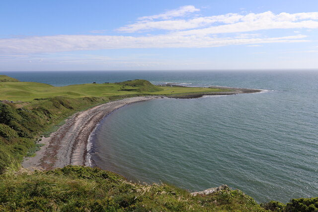
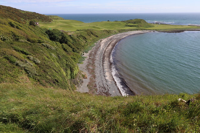
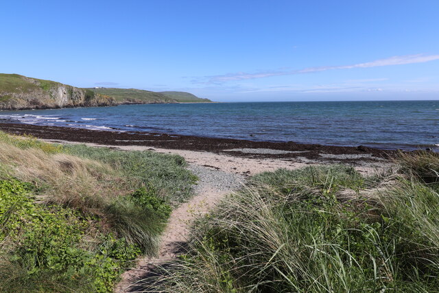
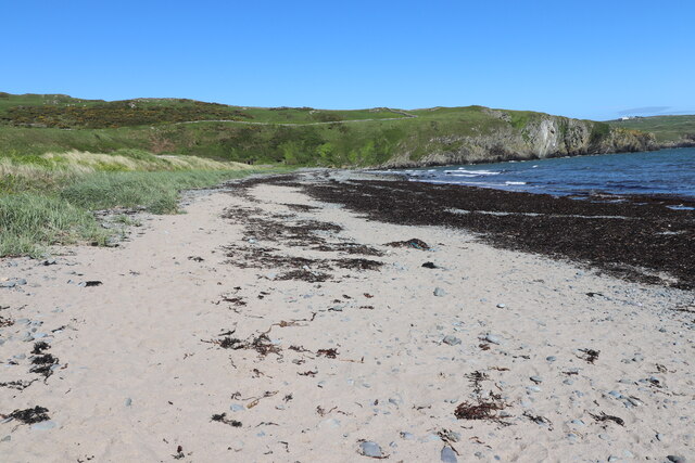
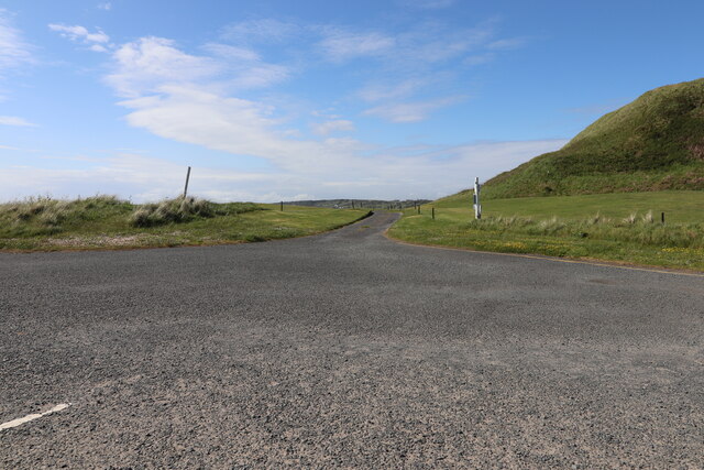
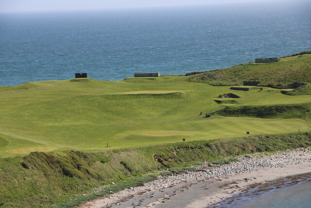
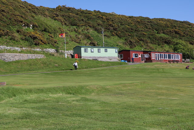
Black Rocks is a prominent coastal feature located in Wigtownshire, Scotland. It is a headland that juts out into the Irish Sea, forming a distinctive point along the coastline. The site is known for its unique geological formations and stunning natural beauty.

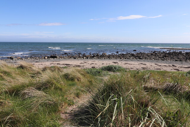
The rocks themselves are composed of dark, weathered sandstone, giving them their characteristic black appearance. They are believed to have been formed during the Carboniferous period, around 300 million years ago, when the area was submerged under a shallow tropical sea. Over time, the combination of erosion and geological movements has shaped the rocks into their current dramatic formations.

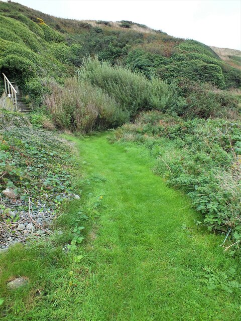
The headland offers breathtaking views of the surrounding coastline and sea, making it a popular spot for tourists and nature enthusiasts alike. The rugged cliffs and crashing waves provide a sense of awe-inspiring power and tranquility.

The area surrounding Black Rocks is rich in biodiversity, hosting a variety of plant and animal species. Seabirds, such as gulls and fulmars, can be observed nesting on the cliffs, while seals and dolphins are occasionally spotted in the waters below. The site is also home to a variety of plant life, including coastal grasses, heather, and gorse.

Black Rocks is not only a natural wonder but also holds historical significance. It has been utilized by humans for centuries, with archaeological evidence suggesting human occupation dating back thousands of years. Today, it serves as a reminder of the area's rich cultural heritage.

Overall, Black Rocks in Wigtownshire is a captivating coastal feature that combines geological beauty, diverse wildlife, and historical importance. It is a must-visit destination for those seeking to immerse themselves in the dramatic landscapes of Scotland's west coast.

If you have any feedback on the listing, please let us know in the comments section below.
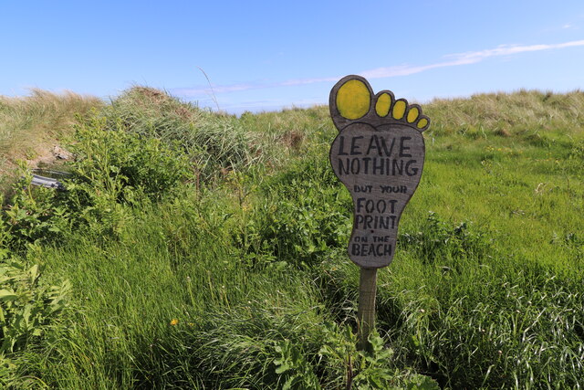
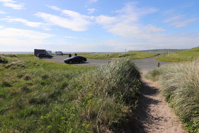
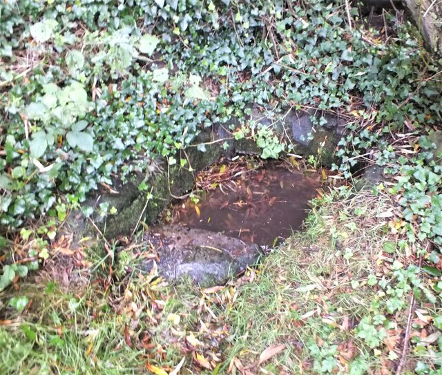
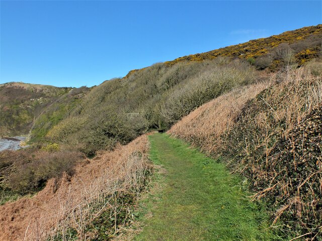
Black Rocks Images

Images are sourced within 2km of 54.735063/-4.5521953 or Grid Reference NX3540. Thanks to Geograph Open Source API. All images are credited.

Front Bay, Monreith Viewed from the Gavin Maxwell Otter Memorial. Looking towards St Medan Golf Course.
Front Bay, Monreith
Viewed from the Gavin Maxwell Otter Memorial. Looking towards St Medan Golf Course.
Shore at Front Bay, Monreith At Point of Lag looking over St Medan Golf Course. Viewed from the Gavin Maxwell Otter Memorial.
Shore at Front Bay, Monreith
At Point of Lag looking over St Medan Golf Course. Viewed from the Gavin Maxwell Otter Memorial.
Beware of Stray Golf Balls At St Medan Golf Course, viewed from Back Bay Car Park.
Beware of Stray Golf Balls
At St Medan Golf Course, viewed from Back Bay Car Park.
Car Park at Back Bay At Point of Lag, on the left is the toilet block.
Car Park at Back Bay
At Point of Lag, on the left is the toilet block.
Leave Nothing at Back Bay Sign at the car park at Point of Lag.
Leave Nothing at Back Bay
Sign at the car park at Point of Lag.
Back Bay near Monreith
Back Bay Car Park At Point of Lag near Monreith.
Back Bay Car Park
At Point of Lag near Monreith.
Shore at Back Bay Near Monreith.
Shore at Back Bay
Near Monreith.
Exit Road from Back Bay Car Park Road passes through St. Medan Golf Course.
Exit Road from Back Bay Car Park
Road passes through St. Medan Golf Course.
Rocks at Back Bay At Point of Lag near Monreith.
Rocks at Back Bay
At Point of Lag near Monreith.
St. Medan Golf Course With Clubhouse, viewed from Gavin Maxwell Otter Memorial.
St. Medan Golf Course
With Clubhouse, viewed from Gavin Maxwell Otter Memorial.
St. Medan Golf Course Near Monreith, vehicles are in a car park at Back Bay.
St. Medan Golf Course
Near Monreith, vehicles are in a car park at Back Bay.
St. Medan Golf Course Viewed from the Gavin Maxwell Otter Memorial near Monreith.
St. Medan Golf Course
Viewed from the Gavin Maxwell Otter Memorial near Monreith.
St. Medan Clubhouse Golf Course near Monreith.
St. Medan Clubhouse
Golf Course near Monreith.
St. Medan Golf Club Flag Golf Course near Monreith.
St. Medan Golf Club Flag
Golf Course near Monreith.
Entrance to Boden Walls Well Situated to the right of the St Medan's Golf Club's fifth green on The Lag, the little-known Boden Walls Well is probably named after the Bodden Cliffs behind it.
Entrance to Boden Walls Well
Situated to the right of the St Medan's Golf Club's fifth green on The Lag, the little-known Boden Walls Well is probably named after the Bodden Cliffs behind it.
Boden Walls Well Situated to the right of the St Medan's Golf Club's fifth green on The Lag, the little-known and very non-descript Boden Walls Well is possibly named after the Bodden Cliffs behind it. It was probably used as a source of fresh water for fishermen.
Boden Walls Well
Situated to the right of the St Medan's Golf Club's fifth green on The Lag, the little-known and very non-descript Boden Walls Well is possibly named after the Bodden Cliffs behind it. It was probably used as a source of fresh water for fishermen.
Path to Kirkmaiden The path from the golf course car park to the old kirk.
Path to Kirkmaiden
The path from the golf course car park to the old kirk.
Show me another place!

Black Rocks is located at Grid Ref: NX3540 (Lat: 54.735063, Lng: -4.5521953)

Unitary Authority: Dumfries and Galloway

Police Authority: Dumfries and Galloway

What 3 Words

///parkway.poem.crabmeat. Near Whithorn, Dumfries & Galloway

Nearby Locations

Monreith Bay Black Rocks

Related Wikis

Monreith

Monreith ([mɒn'ri:θ] / 'mon-REETH'; Scottish Gaelic: Am Monadh Rèidh) is a small seaside village in the Machars, in the historical county of Wigtownshire...

Wren's Egg

The Wren's Egg (grid reference NX 3610 4199) is the name given to a set of late Neolithic or Bronze Age stone monuments in the parish of Glasserton, Wigtownshire...

Monreith House

Monreith House is a category A listed Georgian mansion located 1.5 kilometres (0.93 mi) east of the village of Port William in Mochrum parish in the historical...

Port William, Dumfries and Galloway

Port William (Scottish Gaelic: Cill na Tràghad) is a fishing village in the parish of Mochrum in the historical county of Wigtownshire, Dumfries and Galloway...

Drumtroddan standing stones

The Drumtroddan standing stones (grid reference NX 36449 44300) are a small Neolithic or Bronze Age stone alignment in the parish of Mochrum, Wigtownshire...

Glasserton

Glasserton is a civil parish in Dumfries and Galloway, south-west Scotland. It is on the Machars peninsula, in the traditional county of Wigtownshire....

Rispain Camp

Rispain Camp is the remains of a fortified farmstead 1 mile west of Whithorn, Dumfries and Galloway, Scotland. It is one of the major Iron Age archaeological...

Mochrum

Mochrum () is a coastal civil and Church of Scotland parish situated to the east of Luce Bay on the Machars peninsula and 8 miles (13 km) southwest of...

Nearby Amenities

Located within 500m of 54.735063,-4.5521953
Source: PGS
Lat/Long: 54.7368905/-4.5587024
Source: PGS
Lat/Long: 54.736779/-4.5581016
Source: PGS
Lat/Long: 54.7367046/-4.5575866
Source: PGS
Lat/Long: 54.7366055/-4.5571575
Source: PGS
Lat/Long: 54.7365064/-4.5565352
Source: PGS
Lat/Long: 54.7364197/-4.556149
Source: PGS
Lat/Long: 54.7363578/-4.5557198
Source: PGS
Lat/Long: 54.7362834/-4.5551405
Source: PGS
Lat/Long: 54.7361595/-4.5547328
Source: PGS
Lat/Long: 54.7360109/-4.5542607
Source: PGS
Lat/Long: 54.7359489/-4.5537243
Source: PGS
Lat/Long: 54.7357507/-4.5529089
Source: PGS
Lat/Long: 54.7351065/-4.5528016
Source: PGS
Lat/Long: 54.7349331/-4.5517502
Source: PGS
Lat/Long: 54.7348216/-4.550806
Source: PGS
Lat/Long: 54.7348835/-4.5503769
Source: PGS
Lat/Long: 54.7347596/-4.5494542
Source: PGS
Lat/Long: 54.7342269/-4.5479736
Monreith
Naptan AtcoCode: 680000303333
Naptan Bearing: NW
Naptan BusStopType: CUS
Naptan CommonName: Village
Naptan Indicator: opp West Fell
Naptan Landmark: West Fell
Naptan NaptanCode: 34236957
Naptan Notes: none
Naptan Street: Main Street
Naptan Verified: no
Source: naptan_import
Lat/Long: 54.7368091/-4.5491157
Beach
Naptan AtcoCode: 680000868333
Naptan Bearing: W
Naptan BusStopType: CUS
Naptan CommonName: Beach
Naptan Indicator: at steps
Naptan Landmark: Monreith Bay
Naptan NaptanCode: 34236958
Naptan Notes: none
Naptan Street: A747
Naptan Verified: no
Source: naptan_import
Lat/Long: 54.7363302/-4.5522239
Beach
Naptan AtcoCode: 680000868444
Naptan Bearing: E
Naptan BusStopType: CUS
Naptan CommonName: Beach
Naptan Indicator: opp Steps
Naptan Landmark: Monreith Bay
Naptan NaptanCode: 34236959
Naptan Notes: none
Naptan Street: A747
Naptan Verified: no
Source: naptan_import
Lat/Long: 54.7364999/-4.5527007
Toilets
Access: yes
Fee: no
Lat/Long: 54.736018/-4.5527878
Monreith
Name En: Monreith
Name Gd: Am Monadh Rèidh
Name Sco: Menreith
Place: village
Lat/Long: 54.7372224/-4.5484106
Power: pole
Lat/Long: 54.7388359/-4.551715
Power: pole
Lat/Long: 54.7392763/-4.5528477
Power: pole
Lat/Long: 54.7391726/-4.5535641
Power: pole
Lat/Long: 54.7390091/-4.5547518
Power: pole
Lat/Long: 54.7388371/-4.5558719
Power: pole
Lat/Long: 54.7374194/-4.5576217
Power: pole
Lat/Long: 54.737151/-4.5567531
Power: pole
Lat/Long: 54.7369631/-4.5561487
Power: pole
Lat/Long: 54.7383613/-4.5504956
Power: pole
Lat/Long: 54.7380929/-4.5493121
Power: pole
Lat/Long: 54.7377025/-4.5481308
Power: pole
Lat/Long: 54.7373657/-4.5471037
Power: pole
Lat/Long: 54.7369362/-4.5457955
The data included in this document is from www.openstreetmap.org. The data is made available under ODbL.

Have you been to Black Rocks?

Leave your review of Black Rocks below (or comments, questions and feedback).