Longridge

Settlement in Staffordshire South Staffordshire

England

Longridge

Railway crossing the River Penk north of Penkridge
Railway crossing the River Penk north of Penkridge Credit: Roy Hughes

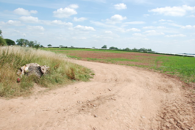
Longridge is a small village located in the county of Staffordshire, England. Situated on the edge of the Peak District National Park, it is surrounded by picturesque countryside and offers stunning views of the nearby rolling hills and valleys.

The village itself is characterized by its quaint and traditional charm, with a mix of historic stone cottages and more modern houses. It has a close-knit community, and residents often enjoy a peaceful and tranquil way of life.

Longridge is well-connected to the surrounding area, with good transport links to nearby towns and cities. The village is situated just off the A523 road, providing easy access to Stoke-on-Trent, which is approximately 10 miles to the south. The M6 motorway is also within a short drive, offering convenient connections to Manchester and Birmingham.

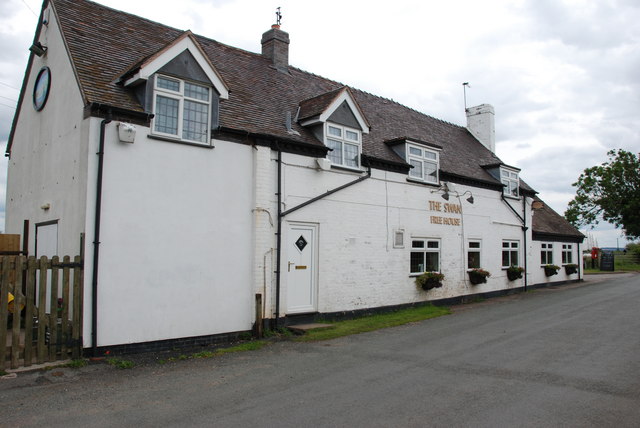
Although Longridge is a relatively small village, it has a few amenities to cater to its residents' needs. There is a local pub, providing a focal point for the community, as well as a village hall that hosts various events and activities throughout the year.

For those who enjoy outdoor pursuits, Longridge is an ideal location. The village is surrounded by beautiful countryside, offering plenty of opportunities for hiking, cycling, and exploring nature. The nearby Peak District National Park provides further options for outdoor enthusiasts, with its vast network of trails, caves, and stunning landscapes.

In conclusion, Longridge is a charming village in Staffordshire, offering a peaceful and idyllic setting amidst beautiful countryside. Its close-knit community and convenient location make it an appealing place to live for those seeking a quieter way of life, while still being within easy reach of larger towns and cities.

If you have any feedback on the listing, please let us know in the comments section below.

Longridge Images

Images are sourced within 2km of 52.737477/-2.138451 or Grid Reference SJ9015. Thanks to Geograph Open Source API. All images are credited.

Railway crossing the River Penk north of Penkridge
St Michael  & All Angels, Penkridge
St Michael & All Angels, Penkridge
Penkridge - Parish Church Medieval St Michael and All Angels was a collegiate church and replaced earlier Anglo-Saxon and Norman churches.
<span class="nowrap"><a title="www.stmichaelspenkridge.co.uk" rel="nofollow ugc noopener" href="http://www.stmichaelspenkridge.co.uk">Link</a><img style="margin-left:2px;" alt="External link" title="External link - shift click to open in new window" src="https://s1.geograph.org.uk/img/external.png" width="10" height="10"/></span>
Penkridge - Parish Church
Medieval St Michael and All Angels was a collegiate church and replaced earlier Anglo-Saxon and Norman churches. LinkExternal link
Through Gate to Field of Grass Looking across field to Cannock Chase, the communications towers at Pye Green  can be seen in the distance.
Through Gate to Field of Grass
Looking across field to Cannock Chase, the communications towers at Pye Green can be seen in the distance.
Looking over Pool to House
Collecting Yard and Cattle Crush, Levedale Farm
The Swan, Whiston
The Swan, Whiston
Farm Track off Mitton to Levedale Road This farm track runs along to another cluster of Poly tunnels.
Farm Track off Mitton to Levedale Road
This farm track runs along to another cluster of Poly tunnels.
The Swan at Whiston
The Swan at Whiston
Polytunnels in a field near Whiston Mill Most unusually for March, the temperature was approaching 20C, and these polytunnels seemed a bit superfluous in term of protecting the crops - which look like a soft fruit of some sort.
Polytunnels in a field near Whiston Mill
Most unusually for March, the temperature was approaching 20C, and these polytunnels seemed a bit superfluous in term of protecting the crops - which look like a soft fruit of some sort.
Straw bales and clutter outside a small barn A collection of scattered farm equipment and paraphernalia in a field beside a small barn on the bridleway between Whiston and Congreve.
Straw bales and clutter outside a small barn
A collection of scattered farm equipment and paraphernalia in a field beside a small barn on the bridleway between Whiston and Congreve.
Barns and a farmyard There is no domestic residence here - just a couple of barns with cattle, and two (fortunately not very aggressive) dogs running in a compound nearby.
Barns and a farmyard
There is no domestic residence here - just a couple of barns with cattle, and two (fortunately not very aggressive) dogs running in a compound nearby.
Polytunnels near the Swan at Whiston
Whiston Brook In the grounds of Mitton Manor
Whiston Brook
In the grounds of Mitton Manor
Green Pool at Willow Farm
Cottage at Levedale Lane end
Whiston Brook downstream of the bridge The stream here is in the well kept grounds of Mitton Manor.
Whiston Brook downstream of the bridge
The stream here is in the well kept grounds of Mitton Manor.
St.Michael and All Angels Church, Penkridge Set back from the main road, it is nonetheless quite visible due to its high clock tower.
St.Michael and All Angels Church, Penkridge
Set back from the main road, it is nonetheless quite visible due to its high clock tower.
Show me another place!

Longridge is located at Grid Ref: SJ9015 (Lat: 52.737477, Lng: -2.138451)

Administrative County: Staffordshire

District: South Staffordshire

Police Authority: Staffordshire

What 3 Words

///optimally.lights.producers. Near Penkridge, Staffordshire

Nearby Locations

Longridge

Related Wikis

Levedale

Levedale is a small somewhat elongated English village situated some 4 miles southwest of Stafford, 2 miles northwest of Penkridge and a mile west of Dunston...

Penkridge Viaduct

Penkridge Viaduct is a railway viaduct on the West Coast Main Line where it crosses the River Penk and Levedale Road near the village of Penkridge, Staffordshire...

Whiston, South Staffordshire

Whiston is a hamlet in the South Staffordshire district of Staffordshire, England. Population details taken at the 2011 census can be found under Penkridge...

Penkridge railway station

Penkridge railway station is a railway station serving the large village of Penkridge in Staffordshire, England. It is situated on the Birmingham loop...

Nearby Amenities

Located within 500m of 52.737477,-2.138451
Power: tower
Lat/Long: 52.7372055/-2.1422678
Power: tower
Lat/Long: 52.7396525/-2.1425472
The data included in this document is from www.openstreetmap.org. The data is made available under ODbL.

Have you been to Longridge?

Leave your review of Longridge below (or comments, questions and feedback).