Beacontree Heath

Settlement in Essex

England

Beacontree Heath

Coral Romford Greyhound Stadium, from the railway
Coral Romford Greyhound Stadium, from the railway Credit: Christopher Hilton

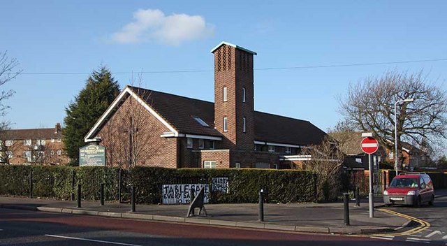
Beacontree Heath is a suburban area located in the borough of Barking and Dagenham, Essex, England. It is situated approximately 12 miles east of central London. This residential neighborhood is part of the larger Beacontree Estate, which was developed in the early 20th century as a response to the housing shortage after World War I.

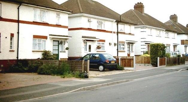
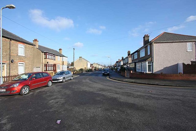
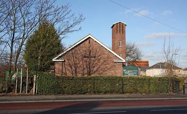
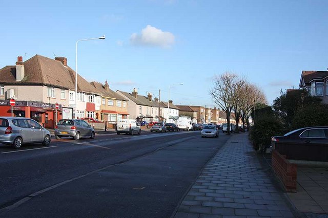
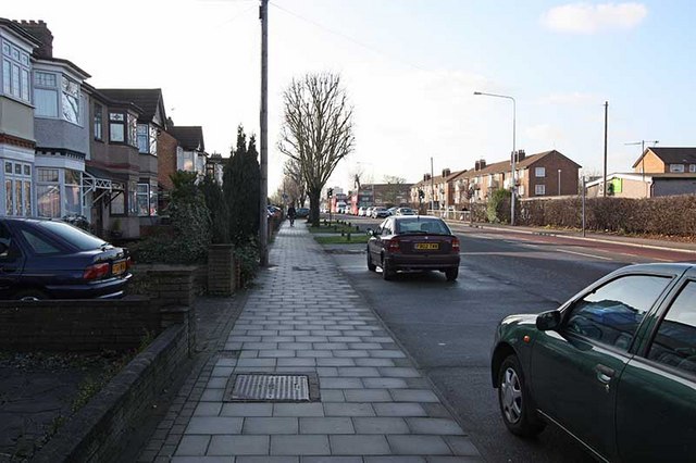
The area is characterized by its well-maintained, tree-lined streets and a mix of housing types, including semi-detached houses, terraced homes, and small apartment blocks. The architecture reflects the period in which the estate was built, with many properties featuring distinctive red-brick exteriors.

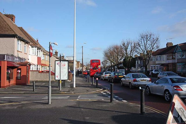
Beacontree Heath benefits from its proximity to several amenities and transport links. The nearby Heathway Underground station provides easy access to central London via the District Line, while numerous bus routes connect the area to other parts of Essex and beyond. Residents also enjoy a range of local shops, supermarkets, restaurants, and leisure facilities.

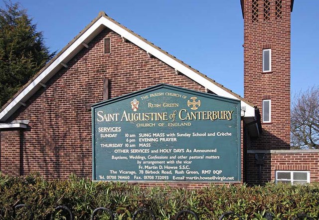
The area is known for its strong sense of community, with various community centers, schools, and parks providing spaces for social activities and recreational pursuits. Parsloes Park, a large green space with a lake, playgrounds, and sports facilities, is a popular destination for locals.

Overall, Beacontree Heath offers a peaceful suburban lifestyle within easy reach of the bustling city. Its well-established community, convenient location, and range of amenities make it an attractive place to live for families and professionals alike.

If you have any feedback on the listing, please let us know in the comments section below.

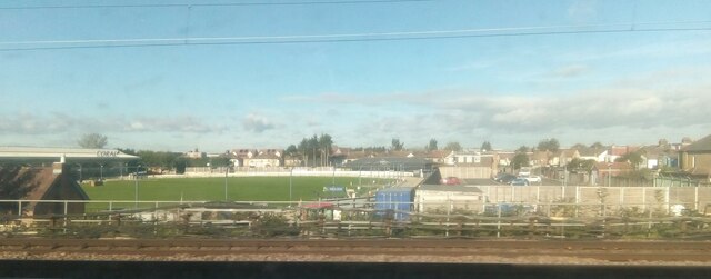
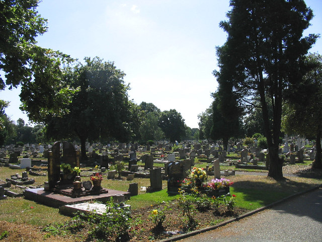
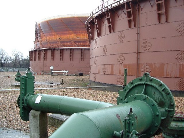
Beacontree Heath Images

Images are sourced within 2km of 51.562201/0.14816366 or Grid Reference TQ4987. Thanks to Geograph Open Source API. All images are credited.

Coral Romford Greyhound Stadium, from the railway
Meadow Road, Romford
Oldchurch Cemetery, Oldchurch Road, Romford, Essex
Gate to the Park The gate to the western side of the Easterbrookend Country Park that keeps apart Hornchurch and Dagenham
Gate to the Park
The gate to the western side of the Easterbrookend Country Park that keeps apart Hornchurch and Dagenham
The Gas Works, Romford The Gas Works, Nursery Walk, Romford
The Gas Works, Romford
The Gas Works, Nursery Walk, Romford
Victoria Road, Dagenham Victoria Road, Dagenham home to Dagenham & Redbridge FC.
Victoria Road, Dagenham
Victoria Road, Dagenham home to Dagenham & Redbridge FC.
St Augustine, Rush Green Road
St Augustine, Rush Green Road - Notice board
Rush Green Road
Rush Green Road
Birkbeck Road, Rush Green
St Augustine, Rush Green Road
Rush Green Road
Rush Green Road
Rush Green Road
Rush Green Road
Eastbrook End Country Park and Dagenham Road On this occasion (May 2004), Eastbrook End Country park was a mass of wild flowers (admittedly with some encouragement from the park managers). This part of the park has been landscaped to produce a rolling terrain. Here students are studying the insects on the sward. In the background is one of the lakes on another part of the park, separated by Dagenham Road.
Eastbrook End Country Park and Dagenham Road
On this occasion (May 2004), Eastbrook End Country park was a mass of wild flowers (admittedly with some encouragement from the park managers). This part of the park has been landscaped to produce a rolling terrain. Here students are studying the insects on the sward. In the background is one of the lakes on another part of the park, separated by Dagenham Road.
Eastbrook End Country Park: insect sampling On this occasion (May 2004), Eastbrook End Country park was a mass of wild flowers (admittedly with some encouragement from the park managers). This part of the park has been landscaped to produce a rolling terrain. Here, students are sampling insects from the sward.
Eastbrook End Country Park: insect sampling
On this occasion (May 2004), Eastbrook End Country park was a mass of wild flowers (admittedly with some encouragement from the park managers). This part of the park has been landscaped to produce a rolling terrain. Here, students are sampling insects from the sward.
Eastbrook End Country Park On this occasion (May 2004), Eastbrook End Country park was a mass of wild flowers (admittedly with some encouragement from the park managers). This part of the park has been levelled, and seeded to provide a variety of wild flowers. In the background are the houses on Hooks Hall Drive, and a tower block off Hardie Road.
Eastbrook End Country Park
On this occasion (May 2004), Eastbrook End Country park was a mass of wild flowers (admittedly with some encouragement from the park managers). This part of the park has been levelled, and seeded to provide a variety of wild flowers. In the background are the houses on Hooks Hall Drive, and a tower block off Hardie Road.
Conservative Party Election poster, London Road, Romford This advertising hoarding is at the corner of London Road and Esher Avenue.
Conservative Party Election poster, London Road, Romford
This advertising hoarding is at the corner of London Road and Esher Avenue.
Derelict building, London Road, Romford Thank you to Michael Champion for the following:

I'm almost 100% certain that this building was never a pub but actually the offices (and an apartment, if I recall correctly) for the old United Dairies.

Driving through the entrance, to the left was a small shop dispensing products other than milk for the milkmen, beyond that was the milk store. Directly opposite that was the empty bottle bank and to the rear, about midway down the site was the garage & float charging area. Behind that on the left was unused land and opposite that on the right was a workshop/store where a few old floats were kept.

Every weekend from about 1965 onwards I'd work as a milk-boy, loading up the floats and work either Chadwell Heath (round 10), Romford (Round 4 centred on the old football stadium) or round 11 (Gidea Park).

As I got older, the milkmen would allow me to park their floats once they'd been emptied, while they retired to the rest room to count their day's takings, balance their books and enjoy a cup of tea and a game of snooker.
Derelict building, London Road, Romford
Thank you to Michael Champion for the following: I'm almost 100% certain that this building was never a pub but actually the offices (and an apartment, if I recall correctly) for the old United Dairies. Driving through the entrance, to the left was a small shop dispensing products other than milk for the milkmen, beyond that was the milk store. Directly opposite that was the empty bottle bank and to the rear, about midway down the site was the garage & float charging area. Behind that on the left was unused land and opposite that on the right was a workshop/store where a few old floats were kept. Every weekend from about 1965 onwards I'd work as a milk-boy, loading up the floats and work either Chadwell Heath (round 10), Romford (Round 4 centred on the old football stadium) or round 11 (Gidea Park). As I got older, the milkmen would allow me to park their floats once they'd been emptied, while they retired to the rest room to count their day's takings, balance their books and enjoy a cup of tea and a game of snooker.
Show me another place!

Beacontree Heath is located at Grid Ref: TQ4987 (Lat: 51.562201, Lng: 0.14816366)

Unitary Authority: Barking and Dagenham

Police Authority: Metropolitan

What 3 Words

///rabble.trap.fame. Near Chadwell Heath, London

Related Wikis

Robert Clack School

Robert Clack School is a sixteen form entry comprehensive school in the London Borough of Barking and Dagenham. Russell Taylor is the Headteacher of Robert...

All Saints Catholic School, Dagenham

All Saints Catholic School is a Roman Catholic secondary school located on Terling Road, Dagenham in the London Borough of Barking and Dagenham, England...

Becontree Heath

Becontree Heath (also spelt Beacontree Heath) is an open space in the London Borough of Barking and Dagenham. The name has also been applied to the local...

Municipal Borough of Dagenham

Dagenham was a local government district in south west Essex, England from 1926 to 1965 covering the parish of Dagenham. Initially created as an urban...

CU London

CU London is a Higher Education institute owned and governed by Coventry University. CU London began offering courses to students in September 2017. It...

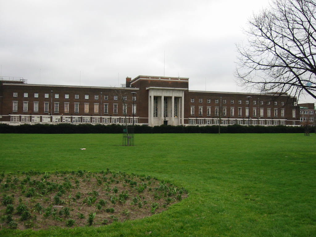
Civic Centre, Dagenham

The Civic Centre in Dagenham is a former municipal building in Becontree Heath, an area within the London Borough of Barking and Dagenham. The building...

Dagenham (UK Parliament constituency)

Dagenham was a borough constituency represented in the House of Commons of the UK Parliament that elected one Member of Parliament (MP) by the first past...

Valence House Museum

Valence House Museum is the only surviving of the five manor houses of Dagenham. The timber-framed museum building, partially surrounded by a moat, is...

Nearby Amenities

Located within 500m of 51.562201,0.14816366
Crossing
Crossing: traffic_signals
Crossing Island: no
Crossing Ref: pelican
Lat/Long: 51.561211/0.1481114
Traffic Signals
Traffic Signals Direction: forward
Lat/Long: 51.5611418/0.14839
Crossing
Crossing: traffic_signals
Crossing Island: no
Crossing Ref: pelican
Lat/Long: 51.5609948/0.1475392
Cycleway: asl
Direction: forward
Lat/Long: 51.5611174/0.1475599
Crossing
Crossing: traffic_signals
Crossing Island: no
Crossing Ref: pelican
Lat/Long: 51.560842/0.1478917
Crossing
Crossing: traffic_signals
Crossing Island: no
Crossing Ref: pelican
Lat/Long: 51.561308/0.1478084
Crossing
Crossing: traffic_signals
Crossing Island: no
Crossing Ref: pelican
Lat/Long: 51.5609188/0.1480786
Traffic Signals
Traffic Signals Direction: forward
Lat/Long: 51.5613814/0.1480047
Traffic Signals
Traffic Signals Direction: backward
Lat/Long: 51.5610006/0.1440407
Turning Circle
Lat/Long: 51.5629903/0.1441048
Turning Circle
Lat/Long: 51.5622463/0.1488277
Turning Circle
Lat/Long: 51.5607776/0.1455177
Fuel
Shell
Addr City: Dagenham
Addr Postcode: RM10 7RP
Addr Street: Wood Lane
Brand: Shell
Brand Wikidata: Q110716465
Fhrs Id: 415706
Fuel Diesel: yes
Fuel Electricity: yes
Fuel Octane 95: yes
Fuel Octane 98: yes
Opening Hours: 24/7
Phone: +44 20 8593 1039
Ref Navads: NVDS353_12038473
Self Service: yes
Website: https://find.shell.com/gb/fuel/12038473-shell-dagenham
Wheelchair: yes
Lat/Long: 51.5604944/0.1483514
Post Box
Lat/Long: 51.5645139/0.1462321
Post Box
Lat/Long: 51.559399/0.1477266
Crossing
Crossing: traffic_signals
Crossing Ref: pelican
Lat/Long: 51.5621736/0.1472801
Fast Food
McDonald's
Addr City: Dagenham
Addr Housename: Eldonwall Trading Estate
Addr Postcode: RM8 1AT
Addr Street: Whalebone Lane South
Brand: McDonald's
Brand Wikidata: Q38076
Brand Wikipedia: en:McDonald's
Contact Website: https://www.mcdonalds.com/gb/en-gb/location/dagenham/dagenham-fs-dt/whalebone-lane-south/8260300.html
Cuisine: burger
Drive Through: yes
Fhrs Id: 128791
Fhrs Local Authority Id: 5905
Operator: McDonald's Restaurants Ltd
Takeaway: yes
Lat/Long: 51.5652681/0.1451656
Bus Stop
Morris Road
Bus: yes
Local Ref: C
Naptan AtcoCode: 490003762C
Naptan Bearing: N
Naptan CommonName: Morris Road
Naptan Indicator: Stop C
Naptan Verified: no
Public Transport: platform
Ref: 76240
Source Ref: naptan
Lat/Long: 51.5599207/0.1478244
Bus Stop
Becontree Heath Leisure Centre
Bus: yes
Local Ref: G
Naptan AtcoCode: 490003763G
Naptan Bearing: E
Naptan CommonName: Becontree Heath Bus Station
Naptan Indicator: Stop G
Naptan Verified: no
Public Transport: platform
Ref: 55714
Source Ref: naptan
Lat/Long: 51.5614307/0.1491707
Bus Stop
Becontree Heath Bus Station
Bench: yes
Bin: no
Bus: yes
Local Ref: H
Naptan AtcoCode: 490003763H
Naptan Bearing: N
Naptan CommonName: Becontree Heath Bus Station
Naptan Indicator: Stop H
Naptan Verified: no
Public Transport: platform
Shelter: yes
Tactile Paving: yes
Lat/Long: 51.5609308/0.1519168
Bus Stop
James Avenue
Bus: yes
Local Ref: T
Naptan AtcoCode: 490008536T
Naptan Bearing: S
Naptan CommonName: James Avenue
Naptan Indicator: Stop T
Naptan Street: WHALEBONE LANE SOUTH
Naptan Verified: no
Public Transport: platform
Ref: T
Lat/Long: 51.5631889/0.1466819
Bus Stop
Heathway
Local Ref: K
Naptan AtcoCode: 490008033N
Naptan Bearing: N
Naptan CommonName: Heathway Wood Lane
Naptan Indicator: Stop K
Naptan Verified: no
Public Transport: platform
Lat/Long: 51.5579547/0.1472163
Bus Stop
James Avenue
Bus: yes
Local Ref: V
Naptan AtcoCode: 490011698V
Naptan Bearing: N
Naptan CommonName: James Avenue Rosemary Gardens
Naptan Indicator: Stop V
Naptan Verified: no
Public Transport: platform
Ref: 53025
Source Ref: naptan
Lat/Long: 51.563361/0.1464461
Bus Stop
Stanley Avenue
Local Ref: U
Naptan AtcoCode: 490012547N
Naptan Bearing: N
Naptan CommonName: Stanley Avenue (RM8)
Naptan Indicator: Stop U
Naptan Street: WHALEBONE LANE SOUTH
Naptan Verified: no
Public Transport: platform
Lat/Long: 51.5661686/0.1453299
Bus Stop
Winifred Road
Bus: yes
Naptan AtcoCode: 490013456E
Naptan Bearing: E
Naptan CommonName: Winifred Road
Naptan Verified: no
Public Transport: platform
Ref: 55809
Source Ref: naptan
Lat/Long: 51.5612538/0.1417188
Bus Stop
Whalebone Lane South
Bus: yes
Local Ref: A
Naptan AtcoCode: 490014550A
Naptan Bearing: W
Naptan CommonName: Whalebone Lane South
Naptan Indicator: Stop A
Naptan Street: GREEN LANE
Naptan Verified: no
Public Transport: platform
Ref: 77527
Source Ref: naptan
Lat/Long: 51.5609231/0.1460223
Bus Stop
Whalebone Lane South
Bus: yes
Local Ref: B
Naptan AtcoCode: 490014550B
Naptan Bearing: E
Naptan CommonName: Whalebone Lane South
Naptan Indicator: Stop B
Naptan Street: GREEN LANE
Naptan Verified: no
Public Transport: platform
Ref: 50401
Source Ref: naptan
Lat/Long: 51.5610899/0.1466648
Becontree Heath
Alt Name: Beacontree Heath
Is In: Dagenham
Note: http://www.openstreetmap.org/note/737035
Place: suburb
Wikidata: Q1800604
Lat/Long: 51.5610299/0.1478793
Check Date: 2017-10-20
Ref GB Tflcid: RWG168472
Surface: asphalt
Traffic Calming: hump
Lat/Long: 51.5599568/0.1505538
Crossing
Crossing: unmarked
Lat/Long: 51.5601182/0.1521026
Bus Stop
Becontree Heath Leisure Centre
Bus: yes
Local Ref: K
Naptan AtcoCode: 490003763K
Naptan Bearing: W
Naptan CommonName: Becontree Heath Bus Station
Naptan Indicator: Stop K
Naptan Verified: no
Public Transport: platform
Ref: 52288
Source Ref: naptan
Lat/Long: 51.5612694/0.1497676
Check Date: 2017-10-20
Ref GB Tflcid: RWG168608
Surface: asphalt
Traffic Calming: hump
Lat/Long: 51.5618509/0.1511406
Turning Circle
Lat/Long: 51.5636402/0.1451305
Turning Circle
Lat/Long: 51.5642687/0.1449644
Bus Stop
Morris Road
Bench: yes
Bus: yes
Local Ref: E
Naptan AtcoCode: 490003762E
Naptan Bearing: S
Naptan CommonName: Morris Road
Naptan Indicator: Stop E
Naptan Street: Morris Road
Naptan Verified: no
Public Transport: platform
Ref: 57270
Shelter: yes
Source: gps+mapnoter
Source Ref: naptan
Lat/Long: 51.5592346/0.1478888
Building: public
Lat/Long: 51.5599368/0.1539192
Traffic Signals
Traffic Signals Direction: forward
Lat/Long: 51.560762/0.147893
Traffic Signals
Traffic Signals Direction: forward
Lat/Long: 51.5611119/0.1475021
Traffic Signals
Traffic Signals Direction: forward
Lat/Long: 51.5604412/0.1545633
M.O.T Garage
Shop: car_repair
Lat/Long: 51.5633333/0.1461218
Self Service: yes
Shop: laundry
Lat/Long: 51.562647/0.1471709
Pharmacy
Healthcare: pharmacy
Lat/Long: 51.5626942/0.1471541
Corner shop-(lotto and Oyster)
Shop: convenience
Lat/Long: 51.5645556/0.1462348
Traffic Signals
Traffic Signals Direction: forward
Lat/Long: 51.5610737/0.1516887
Crossing
Crossing: traffic_signals
Crossing Island: no
Crossing Ref: pelican
Lat/Long: 51.56127/0.1479819
Give Way
Direction: backward
Lat/Long: 51.5612757/0.1502236
Give Way
Direction: backward
Lat/Long: 51.561423/0.1499791
Give Way
Direction: backward
Lat/Long: 51.5618707/0.1477009
Atm
Brand: Barclays
Brand Wikidata: Q245343
Brand Wikipedia: en:Barclays
Cash In: no
Currency GBP: yes
Drive Through: no
Network: Link
Operator: Barclays
Operator Wikidata: Q245343
Lat/Long: 51.5657199/0.1439107
Ref GB Tflcid: RWG170804
Traffic Calming: cushion
Lat/Long: 51.5602859/0.1468763
Cafe
Morrisons Cafe
Brand: Morrisons
Brand Wikidata: Q922344
Cuisine: coffee_shop
Operator: Morrisons
Takeaway: yes
Website: https://my.morrisons.com/storefinder/296/becontree-heath
Lat/Long: 51.5596059/0.1485976
Crossing
Crossing: unmarked
Lat/Long: 51.561475/0.1499933
Crossing
Crossing: traffic_signals
Crossing Island: no
Lat/Long: 51.5611049/0.1516019
Crossing
Crossing: unmarked
Lat/Long: 51.5607898/0.1513692
Barrier: yes
Lat/Long: 51.5621841/0.1482802
Barrier: yes
Lat/Long: 51.5621612/0.1483077
Crossing
Lat/Long: 51.5621938/0.1543923
Check Date: 2017-10-20
Ref GB Tflcid: RWG168474
Surface: asphalt
Traffic Calming: hump
Lat/Long: 51.5599762/0.151582
Crossing
Lat/Long: 51.5621574/0.1532013
Crossing
Crossing: marked
Lat/Long: 51.5605267/0.1492209
Bicycle Parking
Bicycle Parking: stands
Capacity: 6
Lat/Long: 51.5643834/0.1462798
Bicycle Parking
Bicycle Parking: stands
Capacity: 10
Lat/Long: 51.5653648/0.1449851
Bicycle Parking
Bicycle Parking: stands
Capacity: 6
Lat/Long: 51.56332/0.1466615
Bicycle Parking
Bicycle Parking: stands
Capacity: 4
Lat/Long: 51.5625633/0.1470548
Bicycle Parking
Bicycle Parking: stands
Capacity: 6
Lat/Long: 51.5636414/0.1465282
Bicycle Parking
Bicycle Parking: stands
Capacity: 6
Lat/Long: 51.5619574/0.1476462
Bicycle Parking
Bicycle Parking: stands
Capacity: 24
Covered: yes
Lat/Long: 51.561135/0.1487011
Bicycle Parking
Bicycle Parking: stands
Capacity: 16
Covered: yes
Lat/Long: 51.5609816/0.1494581
Bicycle Parking
Bicycle Parking: lockers
Capacity: 4
Note: Own lock
Lat/Long: 51.5608949/0.1494673
Bicycle Parking
Bicycle Parking: stands
Capacity: 8
Lat/Long: 51.5611206/0.1494395
Bicycle Parking
Bicycle Parking: stands
Capacity: 6
Lat/Long: 51.5604483/0.1474385
Bicycle Parking
Bicycle Parking: stands
Capacity: 4
Lat/Long: 51.5601649/0.1478324
Bicycle Parking
Bicycle Parking: stands
Capacity: 10
Lat/Long: 51.560385/0.1476991
Bicycle Parking
Bicycle Parking: stands
Capacity: 2
Lat/Long: 51.5604298/0.1471965
Bicycle Parking
Bicycle Parking: stands
Capacity: 2
Lat/Long: 51.5603603/0.1470935
Bicycle Parking
Bicycle Parking: stands
Capacity: 6
Lat/Long: 51.5612133/0.1476914
Bicycle Parking
Bicycle Parking: stands
Capacity: 2
Lat/Long: 51.5608696/0.1469211
Bicycle Parking
Bicycle Parking: stands
Capacity: 2
Lat/Long: 51.5602233/0.1478431
Bicycle Parking
Bicycle Parking: stands
Capacity: 4
Lat/Long: 51.5605368/0.1471137
Bicycle Parking
Bicycle Parking: stands
Capacity: 2
Lat/Long: 51.5611492/0.147062
Bicycle Parking
Bicycle Parking: stands
Capacity: 4
Lat/Long: 51.5607138/0.1470438
Bicycle Parking
Bicycle Parking: stands
Capacity: 2
Lat/Long: 51.5609532/0.1466349
Bicycle Parking
Bicycle Parking: stands
Capacity: 4
Lat/Long: 51.5599187/0.1480467
Bicycle Parking
Bicycle Parking: stands
Capacity: 4
Lat/Long: 51.5599763/0.1480472
Bicycle Parking
Bicycle Parking: stands
Capacity: 2
Lat/Long: 51.5603283/0.1540148
Check Date: 2017-10-20
Ref GB Tflcid: RWG168483
Surface: asphalt
Traffic Calming: hump
Lat/Long: 51.5597136/0.1535456
Crossing
Check Date: 2017-10-20
Crossing: uncontrolled
Crossing Island: no
Crossing Markings: zebra
Not Crossing Ref: zebra
Ref GB Tflcid: RWG168560
Surface: asphalt
Tactile Paving: yes
Traffic Calming: hump
Lat/Long: 51.5601848/0.1496825
Check Date: 2017-10-20
Ref GB Tflcid: RWG168511
Surface: asphalt
Traffic Calming: hump
Lat/Long: 51.5611163/0.1502387
Check Date: 2017-10-20
Ref GB Tflcid: RWG168746
Surface: asphalt
Traffic Calming: hump
Lat/Long: 51.5618621/0.1542923
Check Date: 2017-10-20
Ref GB Tflcid: RWG168623
Surface: asphalt
Traffic Calming: hump
Lat/Long: 51.5621657/0.1553423
Check Date: 2017-10-20
Ref GB Tflcid: RWG168486
Surface: asphalt
Traffic Calming: hump
Lat/Long: 51.559712/0.1541478
Check Date: 2017-10-20
Ref GB Tflcid: RWG168512
Surface: asphalt
Traffic Calming: hump
Lat/Long: 51.5604564/0.1502813
Check Date: 2017-10-20
Ref GB Tflcid: RWG168744
Surface: asphalt
Traffic Calming: hump
Lat/Long: 51.5619471/0.1534492
Traffic Calming: hump
Lat/Long: 51.5612638/0.1529472
Check Date: 2017-10-20
Ref GB Tflcid: RWG168621
Surface: asphalt
Traffic Calming: hump
Lat/Long: 51.5621411/0.1546384
Check Date: 2017-10-20
Ref GB Tflcid: RWG168617
Surface: asphalt
Traffic Calming: hump
Lat/Long: 51.5621199/0.1540382
Traffic Calming: cushion
Lat/Long: 51.5600406/0.1465351
Traffic Calming: hump
Lat/Long: 51.5585111/0.1443749
Traffic Calming: cushion
Lat/Long: 51.5593451/0.1454814
Traffic Calming: cushion
Lat/Long: 51.5596719/0.1459977
Traffic Calming: cushion
Lat/Long: 51.5591795/0.143824
Traffic Calming: hump
Lat/Long: 51.5607747/0.1433138
Traffic Calming: hump
Lat/Long: 51.5594383/0.1433687
Traffic Calming: cushion
Lat/Long: 51.559194/0.1446455
Traffic Calming: hump
Lat/Long: 51.559843/0.143346
Traffic Calming: hump
Lat/Long: 51.5585185/0.1449629
Traffic Calming: hump
Lat/Long: 51.5603068/0.1433204
Traffic Calming: cushion
Lat/Long: 51.5591575/0.1428759
Recycling
Recycling Paper: yes
Recycling Type: container
Lat/Long: 51.5600642/0.1478349
Recycling
Recycling Glass Bottles: yes
Recycling Type: container
Lat/Long: 51.5601158/0.1478357
Recycling
Recycling Textiles: yes
Recycling Type: container
Lat/Long: 51.5600933/0.1478349
Recycling
Recycling Plastic: yes
Recycling Type: container
Lat/Long: 51.5601418/0.1478358
Shell
Brand: Shell
Brand Wikidata: Q110716465
Brand Wikipedia: en:Royal Dutch Shell
Shop: convenience
Lat/Long: 51.5602523/0.1483198
Car Wash
Shell
Brand: Shell
Brand Wikidata: Q110716465
Operator: Shell
Lat/Long: 51.5603954/0.1485393
Charging Station
Lat/Long: 51.5605959/0.148282
Atm
Brand: NoteMachine
Brand Wikidata: Q104368525
Cash In: no
Currency GBP: yes
Drive Through: no
Operator: NoteMachine
Operator Short: NMATM
Operator Wikidata: Q104368525
Lat/Long: 51.5602731/0.1482164
Jolly Jungle
Playground: structure
Playground Theme: softplay
Lat/Long: 51.5610476/0.1487498
Cafe
Beacontree Heath Leisure Centre Cafe
Outdoor Seating: no
Lat/Long: 51.5610467/0.1486453
Entrance: yes
Lat/Long: 51.5657218/0.1437738
Entrance: yes
Lat/Long: 51.5657932/0.1439152
Entrance: yes
Lat/Long: 51.5611566/0.1489209
Entrance: yes
Lat/Long: 51.5608721/0.1494648
Crossing
Crossing: traffic_signals
Crossing Island: no
Crossing Ref: puffin
Lat/Long: 51.561762/0.1553531
Atm
Brand: Bank of Ireland
Brand Wikidata: Q806689
Brand Wikipedia: en:Bank of Ireland
Cash In: no
Drive Through: no
Network: Link
Operator: Bank of Ireland
Operator Wikidata: Q806689
Lat/Long: 51.563182/0.1468178
Post Box
Lat/Long: 51.5632191/0.1467533
Waste Basket
Lat/Long: 51.5631893/0.1467676
Atm
Lat/Long: 51.5630449/0.1471074
Barrier: yes
Lat/Long: 51.5608307/0.1504258
Traffic Signals
Traffic Signals Direction: backward
Lat/Long: 51.5622066/0.1472485
Traffic Signals
Traffic Signals Direction: forward
Lat/Long: 51.562152/0.1473035
Traffic Signals
Traffic Signals Direction: forward
Lat/Long: 51.5603013/0.1546709
Crossing
Crossing: traffic_signals
Crossing Island: no
Crossing Ref: puffin
Lat/Long: 51.5603238/0.1546184
Crossing
Crossing: traffic_signals
Crossing Island: no
Crossing Ref: puffin
Lat/Long: 51.5604215/0.1546175
Traffic Signals
Traffic Signals Direction: backward
Lat/Long: 51.5617433/0.1552876
Traffic Signals
Traffic Signals Direction: backward
Lat/Long: 51.5656189/0.1452687
Cycleway: asl
Direction: forward
Lat/Long: 51.5655251/0.1457036
Traffic Signals
Traffic Signals Direction: forward
Lat/Long: 51.565479/0.1457211
Traffic Signals
Traffic Signals Direction: backward
Lat/Long: 51.5611404/0.1514966
Cycleway: asl
Direction: forward
Lat/Long: 51.5607886/0.1478939
Cycleway: asl
Direction: forward
Lat/Long: 51.5611241/0.1483154
Cycleway: asl
Direction: forward
Lat/Long: 51.5613083/0.1479639
Cycleway: asl
Direction: forward
Lat/Long: 51.5613581/0.1480572
Traffic Signals
Traffic Signals Direction: forward
Lat/Long: 51.5613389/0.1479492
Crossing
Crossing: traffic_signals
Crossing Island: no
Crossing Ref: pelican
Lat/Long: 51.5611054/0.1482436
Crossing
Crossing: traffic_signals
Crossing Island: no
Crossing Ref: pelican
Lat/Long: 51.5611266/0.147626
Crossing
Crossing: unmarked
Crossing Markings: no
Traffic Calming: table
Lat/Long: 51.5609143/0.146968
Crossing
Crossing: traffic_signals
Crossing Island: no
Crossing Ref: pelican
Lat/Long: 51.5613376/0.1481042
Crossing
Crossing: unmarked
Crossing Island: yes
Crossing Markings: no
Tactile Paving: yes
Lat/Long: 51.5586484/0.1476346
Crossing
Crossing: unmarked
Lat/Long: 51.5616539/0.1552302
Check Date: 2017-10-19
Ref GB Tflcid: RWG168126
Surface: asphalt
Traffic Calming: hump
Lat/Long: 51.5617511/0.150243
Barrier: bollard
Lat/Long: 51.5611335/0.1495487
Barrier: bollard
Lat/Long: 51.5616613/0.1488444
Turning Circle
Lat/Long: 51.5578535/0.1478052
Barrier: bollard
Lat/Long: 51.5578373/0.1479055
Barrier: kerb
Kerb: flush
Tactile Paving: yes
Lat/Long: 51.5578649/0.1475322
Crossing
Crossing: unmarked
Crossing Island: no
Tactile Paving: yes
Lat/Long: 51.5578952/0.147547
Crossing
Crossing: unmarked
Lat/Long: 51.5605494/0.1521044
Crossing
Crossing: unmarked
Lat/Long: 51.5600954/0.1531769
Crossing
Crossing: unmarked
Lat/Long: 51.5600163/0.1530587
Crossing
Crossing: unmarked
Lat/Long: 51.5599552/0.1531772
Crossing
Crossing: unmarked
Lat/Long: 51.5598941/0.153261
Crossing
Crossing: unmarked
Lat/Long: 51.5598335/0.1531793
Crossing
Crossing: unmarked
Lat/Long: 51.5597144/0.153113
Crossing
Crossing: unmarked
Lat/Long: 51.5600167/0.1526937
Crossing
Crossing: unmarked
Lat/Long: 51.5603697/0.1519694
Crossing
Crossing: unmarked
Lat/Long: 51.5597984/0.1515638
Check Date: 2017-10-20
Ref GB Tflcid: RWG168743
Surface: asphalt
Traffic Calming: hump
Lat/Long: 51.561434/0.1534961
Crossing
Crossing: marked
Lat/Long: 51.5605582/0.1493646
Barrier: kerb
Kerb: flush
Tactile Paving: yes
Lat/Long: 51.5601548/0.1496773
Barrier: kerb
Kerb: flush
Tactile Paving: yes
Lat/Long: 51.5602092/0.1496867
Crossing
Crossing: marked
Lat/Long: 51.5604108/0.1500885
Crossing
Crossing: marked
Lat/Long: 51.5603999/0.1498163
Crossing
Crossing: marked
Lat/Long: 51.5621669/0.1514398
Crossing
Crossing: unmarked
Crossing Markings: no
Lat/Long: 51.5609546/0.1433196
Traffic Signals
Traffic Signals Direction: forward
Lat/Long: 51.5610002/0.144186
Crossing
Crossing: traffic_signals
Crossing Island: yes
Lat/Long: 51.5610004/0.1441103
Portland Tyres
Addr City: Dagenham
Addr Housenumber: 937
Addr Postcode: RM8 1DJ
Addr Street: Green Lane
Shop: tyres
Lat/Long: 51.561411/0.1410848
Restaurant
New China Gold
Addr City: Dagenham
Addr Housenumber: 939
Addr Postcode: RM8 1DJ
Addr Street: Green Lane
Cuisine: chinese
Lat/Long: 51.561406/0.1411734
Bajwa Foods
Addr City: Dagenham
Addr Housenumber: 941
Addr Postcode: RM8 1DJ
Addr Street: Green Lane
Shop: greengrocer
Lat/Long: 51.5614027/0.1412607
Advertising: totem
Lat/Long: 51.5613201/0.1412942
Entrance: yes
Lat/Long: 51.5613158/0.1416616
Charging Station
Lat/Long: 51.5598626/0.1481086
Charging Station
Lat/Long: 51.5605834/0.1477161
Charging Station
Lat/Long: 51.5605619/0.1477104
Charging Station
Lat/Long: 51.560538/0.1477008
Crossing
Crossing: unmarked
Lat/Long: 51.560029/0.147812
Crossing
Crossing: traffic_signals
Lat/Long: 51.5596358/0.1479092
Crossing
Crossing: unmarked
Crossing Island: yes
Crossing Markings: no
Tactile Paving: yes
Lat/Long: 51.558374/0.1475582
Crossing
Crossing: unmarked
Crossing Island: yes
Crossing Markings: no
Tactile Paving: yes
Lat/Long: 51.5584728/0.1477275
Crossing
Crossing: unmarked
Crossing Markings: no
Tactile Paving: yes
Lat/Long: 51.5585684/0.1474467
Addr Housenumber: 663
Addr Street: Becontree Avenue
Source: NLS - OS 1:1,250/1:2,500 National Grid maps, 1947-1963
Lat/Long: 51.5593576/0.1431914
Addr Housenumber: 665
Addr Street: Becontree Avenue
Source: NLS - OS 1:1,250/1:2,500 National Grid maps, 1947-1963
Lat/Long: 51.5593674/0.1435811
Addr Housenumber: 648
Addr Street: Becontree Avenue
Source: NLS - OS 1:1,250/1:2,500 National Grid maps, 1947-1963
Lat/Long: 51.5590583/0.1446649
Addr Housenumber: 697
Addr Street: Becontree Avenue
Source: NLS - OS 1:1,250/1:2,500 National Grid maps, 1947-1963
Lat/Long: 51.5593841/0.1450343
Addr Housenumber: 707
Addr Street: Becontree Avenue
Source: NLS - OS 1:1,250/1:2,500 National Grid maps, 1947-1963
Lat/Long: 51.5596124/0.1455135
Addr Housenumber: 658
Addr Street: Becontree Avenue
Source: NLS - OS 1:1,250/1:2,500 National Grid maps, 1947-1963
Lat/Long: 51.559405/0.1458785
Addr Housenumber: 650
Addr Street: Becontree Avenue
Source: NLS - OS 1:1,250/1:2,500 National Grid maps, 1947-1963
Lat/Long: 51.5591613/0.1457643
Addr Housenumber: 717
Addr Street: Becontree Avenue
Source: NLS - OS 1:1,250/1:2,500 National Grid maps, 1947-1963
Lat/Long: 51.5598032/0.1457913
Addr Housenumber: 668
Addr Street: Becontree Avenue
Source: NLS - OS 1:1,250/1:2,500 National Grid maps, 1947-1963
Lat/Long: 51.5595992/0.1461497
Addr Housenumber: 743
Addr Street: Becontree Avenue
Source: NLS - OS 1:1,250/1:2,500 National Grid maps, 1947-1963
Lat/Long: 51.560116/0.1462512
Addr Housenumber: 670
Addr Street: Becontree Avenue
Source: NLS - OS 1:1,250/1:2,500 National Grid maps, 1947-1963
Lat/Long: 51.5599119/0.146614
Addr Housenumber: 682
Addr Street: Becontree Avenue
Source: NLS - OS 1:1,250/1:2,500 National Grid maps, 1947-1963
Lat/Long: 51.5601428/0.1469616
Addr Housenumber: 755
Addr Street: Becontree Avenue
Source: NLS - OS 1:1,250/1:2,500 National Grid maps, 1947-1963
Lat/Long: 51.5603576/0.1465924
Check Date: 2017-10-20
Ref GB Tflcid: RWG168610
Surface: asphalt
Traffic Calming: hump
Lat/Long: 51.5615441/0.1511872
Check Date: 2017-10-20
Ref GB Tflcid: RWG168473
Surface: asphalt
Traffic Calming: hump
Lat/Long: 51.5597452/0.1512443
Traffic Signals
Traffic Signals Direction: forward
Lat/Long: 51.5658608/0.1456562
Crossing
Bicycle: yes
Crossing: traffic_signals
Crossing Island: no
Crossing Ref: toucan
Lat/Long: 51.5658144/0.1456741
Crossing
Crossing: uncontrolled
Crossing Island: yes
Crossing Ref: zebra
Lat/Long: 51.5644907/0.1460935
Crossing
Bicycle: yes
Crossing: traffic_signals
Crossing Island: no
Crossing Ref: toucan
Lat/Long: 51.565863/0.1455045
The data included in this document is from www.openstreetmap.org. The data is made available under ODbL.

Have you been to Beacontree Heath?

Leave your review of Beacontree Heath below (or comments, questions and feedback).