Rubh' an t-Socaich Ghlais

Coastal Feature, Headland, Point in Sutherland

Scotland

Rubh' an t-Socaich Ghlais

Loch a' Gheodha Ruaidh Parph moor, relatively dry ground, but I'd imagine it would be very boggy in other months.
Loch a' Gheodha Ruaidh Credit: Chris

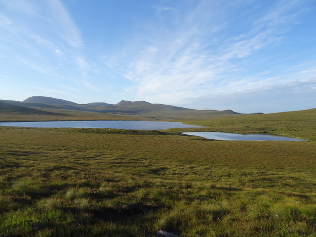
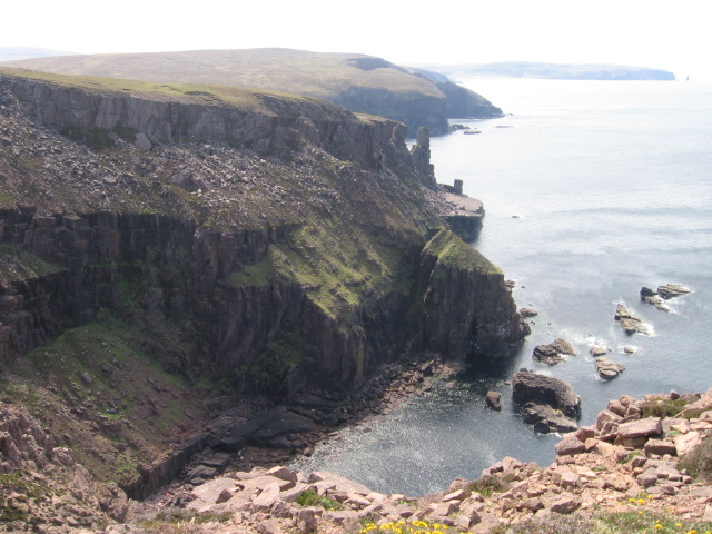
Rubh' an t-Socaich Ghlais is a stunning coastal feature located in Sutherland, Scotland. Also known as Green Point, it is a headland that juts out into the North Atlantic Ocean, offering breathtaking views and a unique natural environment.

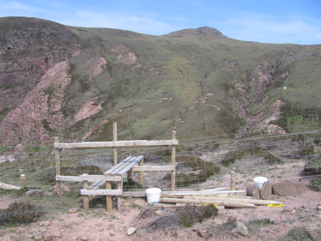
The headland is characterized by its rugged and rocky terrain, with cliffs towering over the crashing waves below. The rocks are mainly composed of gneiss, a metamorphic rock formed from ancient volcanic activity. These cliffs provide nesting sites for various seabirds, including puffins, guillemots, and razorbills, making it a haven for birdwatchers.

At low tide, the headland reveals fascinating rock formations and rock pools teeming with marine life. The intertidal zone is home to a diverse array of plants and animals, such as barnacles, limpets, and seaweeds. Exploring these pools is a popular activity for visitors, who can observe the rich biodiversity up close.

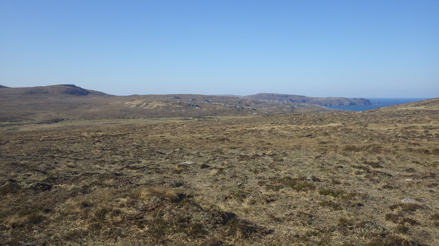
The coastal path that runs along Rubh' an t-Socaich Ghlais offers a scenic walk with panoramic views of the surrounding landscape. On a clear day, it is possible to see the distant mountains of Assynt and the Isle of Lewis. The headland also provides a fantastic vantage point for spotting marine mammals, such as seals and dolphins, as they swim and play in the crystal-clear waters.

Rubh' an t-Socaich Ghlais is a place of natural beauty and tranquility, offering visitors a chance to connect with nature and appreciate the stunning coastal scenery that Scotland has to offer.

If you have any feedback on the listing, please let us know in the comments section below.

Rubh' an t-Socaich Ghlais Images

Images are sourced within 2km of 58.56816/-5.0330554 or Grid Reference NC2368. Thanks to Geograph Open Source API. All images are credited.

Loch a' Gheodha Ruaidh Parph moor, relatively dry ground, but I'd imagine it would be very boggy in other months.
Loch a' Gheodha Ruaidh
Parph moor, relatively dry ground, but I'd imagine it would be very boggy in other months.
Cape Wrath range boundary Just south of Keisgaig River, looking to Sithean na h-Iolaireich
Cape Wrath range boundary
Just south of Keisgaig River, looking to Sithean na h-Iolaireich
Wave cut platform at Keisgaig Bay Looking south along the shoreline of Keisgaig Bay
Wave cut platform at Keisgaig Bay
Looking south along the shoreline of Keisgaig Bay
MoD Range fence at Keisgaig Bay The western end of the MoD firing range fence. Taken from the "hot" side of the wire looking towards the northern side of Keisgaig Bay.
MoD Range fence at Keisgaig Bay
The western end of the MoD firing range fence. Taken from the "hot" side of the wire looking towards the northern side of Keisgaig Bay.
Keisgaig River Reputedly the most northerly salmon stream on mainland Britain, in this photo the Keisgaig is running far too low for any fish to run. I camped comfortably on the small promontory across the river.
Keisgaig River
Reputedly the most northerly salmon stream on mainland Britain, in this photo the Keisgaig is running far too low for any fish to run. I camped comfortably on the small promontory across the river.
View South West from Loch a' Gheodha Ruaidh Looking across the open area from the outlet from the Loch.... Am Buachaille is seen in the distance on the right.
View South West from Loch a' Gheodha Ruaidh
Looking across the open area from the outlet from the Loch.... Am Buachaille is seen in the distance on the right.
Keisgaig River
Keisgaig River
Building ruins near Bay of Keisgaig
Stile over fence at Bay of Keisgaig
Cliffside at Bay of Keisgaig
Old fence posts along clifftop near Rubh' an t- Socaich Ghlais
Sandstone slabs near Rubh' an t- Socaich Ghlais
Cliff face near Cnoc a' Gheodha Ruaidh
Hillside towards Sandwood Bay
Burn on hillside towards Sandwood Bay
Feeder burn for Loch a' Gheodha Ruaidh Loch a' Gheodha Ruaidh is a faint line in the distance below Cnoc a' Gheoda Ruaidh. A foul day of rain and wind. Nothing remarkable about this grid square apart from the unrelenting bog slog to get here en route to fish Keisgaig.
Feeder burn for Loch a' Gheodha Ruaidh
Loch a' Gheodha Ruaidh is a faint line in the distance below Cnoc a' Gheoda Ruaidh. A foul day of rain and wind. Nothing remarkable about this grid square apart from the unrelenting bog slog to get here en route to fish Keisgaig.
Geodha Cul an Fhraochaidh
Valley leading to Sandwood Bay An unnamed valley, just north of Strath Chailleach, looking down towards the northern end of the bay.
Valley leading to Sandwood Bay
An unnamed valley, just north of Strath Chailleach, looking down towards the northern end of the bay.
Show me another place!

Rubh' an t-Socaich Ghlais is located at Grid Ref: NC2368 (Lat: 58.56816, Lng: -5.0330554)

Unitary Authority: Highland

Police Authority: Highlands and Islands

What 3 Words

///grow.masterpiece.both. Near Oldshoremore, Highland

Nearby Locations

Rubh' an t-Socaich Ghlais

Related Wikis

Sandwood Bay

Sandwood Bay (Scottish Gaelic: Bàgh Seannabhad) is a natural bay in Sutherland, on the far north-west coast of mainland Scotland. It is best known for...
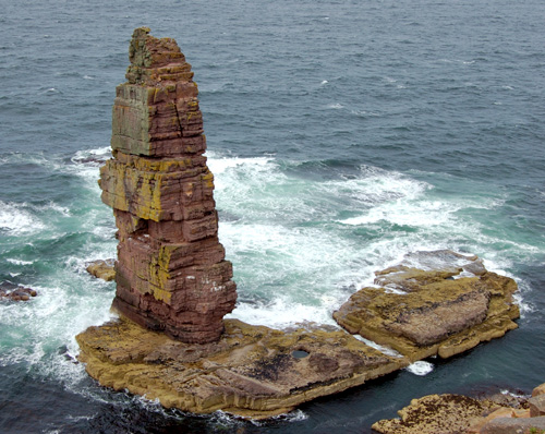
Am Buachaille

Am Buachaille is a sea stack, or vertical rock formation composed of Torridonian Sandstone, 1 mile (1.5 kilometres) southwest of Sandwood Bay in the Scottish...

Cape Wrath

Cape Wrath (Scottish Gaelic: Am Parbh, known as An Carbh in Lewis) is a cape in the Durness parish of the county of Sutherland in the Highlands of Scotland...

Cape Wrath Lighthouse

Cape Wrath Lighthouse at Cape Wrath was built in 1828 by Robert Stevenson and was manned until 1998, when it was converted to automatic operation by the...

Nearby Amenities

Located within 500m of 58.56816,-5.0330554
Source: PGS
Lat/Long: 58.5698779/-5.0270006
Source: PGS
Lat/Long: 58.5694815/-5.0272823
Source: PGS
Lat/Long: 58.5691491/-5.0278522
Source: PGS
Lat/Long: 58.5689417/-5.0288367
Source: PGS
Lat/Long: 58.5690499/-5.029328
Source: PGS
Lat/Long: 58.5696405/-5.0309005
Source: PGS
Lat/Long: 58.5695008/-5.0316068
Source: PGS
Lat/Long: 58.5690294/-5.0322992
Rubh' an t-Socaich Ghlais
Natural: cape
Source: PGS
Source Name: OS7
Lat/Long: 58.5687512/-5.0326743
Source: PGS
Lat/Long: 58.5684024/-5.0337138
Source: PGS
Lat/Long: 58.5678717/-5.0333258
Source: PGS
Lat/Long: 58.5676033/-5.0322039
Source: PGS
Lat/Long: 58.5679165/-5.0308061
Source: PGS
Lat/Long: 58.5671028/-5.0306171
Source: PGS
Lat/Long: 58.5664876/-5.0304059
Source: PGS
Lat/Long: 58.5655837/-5.0297729
The data included in this document is from www.openstreetmap.org. The data is made available under ODbL.

Have you been to Rubh' an t-Socaich Ghlais?

Leave your review of Rubh' an t-Socaich Ghlais below (or comments, questions and feedback).