Carreg y Defaid

Coastal Feature, Headland, Point in Caernarfonshire

Wales

Carreg y Defaid

Porth Colmon This natural harbour is regularly used by a small boat which provides sea-fishing expeditions. Seaweed clogs the entrance, making access to the sea difficult. The tractor is used to tow the boat above the high-water line.
Porth Colmon Credit: Bob Jones

Carreg y Defaid is a prominent headland located in Caernarfonshire, a county in northwest Wales. Situated on the coast, this stunning coastal feature is widely recognized for its sheer cliffs, rugged terrain, and captivating panoramic views of the surrounding landscape.

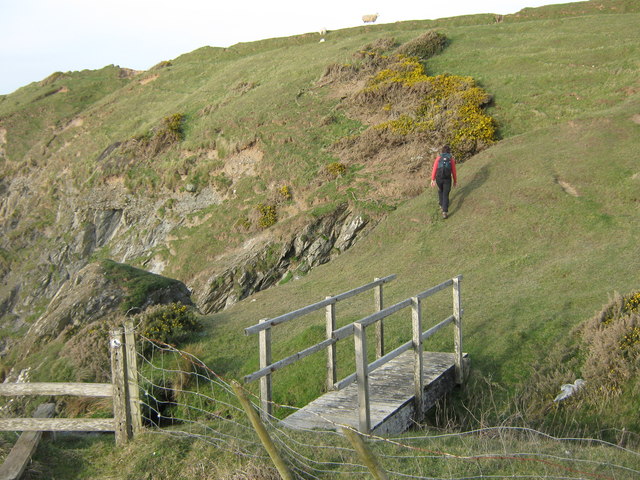
At an elevation of approximately 150 meters, Carreg y Defaid offers a striking vantage point from which to admire the vast expanse of the Irish Sea. Its strategic location makes it an ideal spot for visitors to witness the mesmerizing interplay between land and sea, as crashing waves collide with the imposing cliffs below.

This headland is a haven for wildlife enthusiasts, as it hosts a wide variety of seabirds such as gulls, razorbills, and puffins. The area surrounding Carreg y Defaid is also rich in marine life, with seals and dolphins occasionally spotted frolicking in the nearby waters.

Access to Carreg y Defaid can be gained via a well-maintained footpath, which guides visitors through the undulating terrain and offers breathtaking vistas along the way. The headland is a popular destination for hikers and nature lovers, providing ample opportunities for exploration and photography.

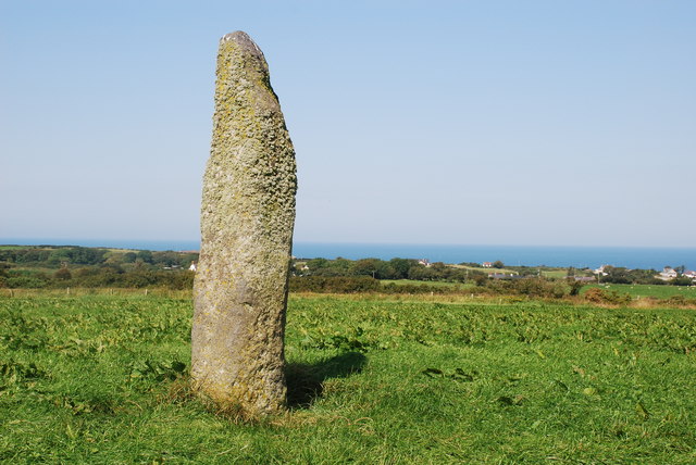
Additionally, Carreg y Defaid holds historical significance, with remnants of ancient settlements and burial sites dating back to the Iron Age. Archaeological enthusiasts can delve into the rich cultural heritage of the region by visiting these historic landmarks.

In conclusion, Carreg y Defaid is a remarkable headland in Caernarfonshire, offering visitors a chance to witness the beauty of Wales' rugged coastline, observe diverse wildlife, and delve into its intriguing history.

If you have any feedback on the listing, please let us know in the comments section below.

Carreg y Defaid Images

Images are sourced within 2km of 52.876097/-4.6845393 or Grid Reference SH1934. Thanks to Geograph Open Source API. All images are credited.

Porth Colmon This natural harbour is regularly used by a small boat which provides sea-fishing expeditions. Seaweed clogs the entrance, making access to the sea difficult. The tractor is used to tow the boat above the high-water line.
Porth Colmon
This natural harbour is regularly used by a small boat which provides sea-fishing expeditions. Seaweed clogs the entrance, making access to the sea difficult. The tractor is used to tow the boat above the high-water line.
Porth Colmon Two men prepare a boat at Porth Colmon.
Porth Colmon
Two men prepare a boat at Porth Colmon.
House at Porth Colmon Handsome property at this little bay.
House at Porth Colmon
Handsome property at this little bay.
Porth Colmon on Lleyn Nice place for a bench.
Porth Colmon on Lleyn
Nice place for a bench.
John Deere at Porth Colmon A nice one for John Deere  fans like me.
John Deere at Porth Colmon
A nice one for John Deere fans like me.
At Porth Colmon on Lleyn Nice spot on the Wales Coast Path.
At Porth Colmon on Lleyn
Nice spot on the Wales Coast Path.
Porth Colmon on Lleyn Idyllic spot.
Porth Colmon on Lleyn
Idyllic spot.
On the Wales Coast Path between Porth Colmon and Traeth Penllech on Lleyn Looking towards Traeth Penllech.
On the Wales Coast Path between Porth Colmon and Traeth Penllech on Lleyn
Looking towards Traeth Penllech.
Old boathouse or workshop near Traeth Penllech on Lleyn Interesting old building complete with anchor branding.
Old boathouse or workshop near Traeth Penllech on Lleyn
Interesting old building complete with anchor branding.
Porth Colmon Coasters would call regularly at Porth Colmon during the summer - coal and a variety of goods would be offloaded and corn, butter, cheese and eggs were exported.
Porth Colmon
Coasters would call regularly at Porth Colmon during the summer - coal and a variety of goods would be offloaded and corn, butter, cheese and eggs were exported.
The Wales Coast Path heading west at Porth Colmon
The footbridge above the waterfall
The waterfall into Porth Tŷ-mawr
Looking back to the footbridge
Looking towards Porth Colmon farm
Fields near Porth Colmon farm
Ty-llŵyd cottage
Ty-llŵyd cottage
Show me another place!

Carreg y Defaid is located at Grid Ref: SH1934 (Lat: 52.876097, Lng: -4.6845393)

Unitary Authority: Gwynedd

Police Authority: North Wales

What 3 Words

///kickbacks.spindles.funnels. Near Nefyn, Gwynedd

Related Wikis

Llangwnnadl

Llangwnnadl is a village and former civil parish in the Welsh county of Gwynedd. The parish was abolished in 1934, and incorporated into Tudweiliog....

St Mary's Church, Penllech

St Mary's Church, Penllech, is a redundant church in the village of Penllech, Gwynedd, Wales. It is designated by Cadw as a Grade II* listed building...

Penllech

Penllech is a hamlet and former civil parish in the Welsh county of Gwynedd. The parish was abolished in 1934, and incorporated into Tudweiliog. ��2...

Bodferin

Bodferin is a former civil parish in the Welsh county of Gwynedd. It was abolished in 1934, and incorporated into Aberdaron. == References ==

Bryncroes

Bryncroes is a hamlet and former civil parish in Gwynedd in Wales, and lies on the Llŷn Peninsula approximately 2 km west of Sarn Meyllteyrn. The parish...

Sarn Meyllteyrn

Sarn Meyllteyrn is a village and former civil parish (known at the time as Mellteyrn) in the Welsh county of Gwynedd. It is in the west of the Llŷn Peninsula...

Tudweiliog

Tudweiliog is a small, predominantly Welsh-speaking village, community and electoral ward on the northern coast of the Llŷn Peninsula in the Welsh county...
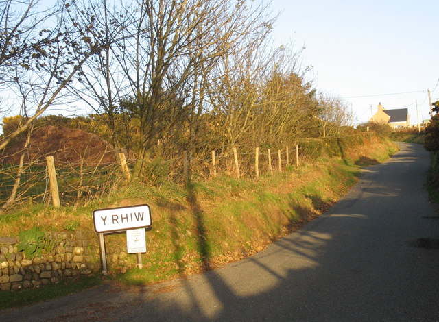
Y Rhiw

Y Rhiw () is a small village on the south west tip of the Llŷn Peninsula in Gwynedd, Wales. The village forms part of the community of Aberdaron. From...

Nearby Amenities

Located within 500m of 52.876097,-4.6845393
Source: PGS
Lat/Long: 52.8751373/-4.6775534
Source: PGS
Lat/Long: 52.8749854/-4.6783097
Source: PGS
Lat/Long: 52.87475/-4.6792464
Source: PGS
Lat/Long: 52.8749006/-4.6797565
Source: PGS
Lat/Long: 52.8749323/-4.6801503
Created By: dmgroom_coastlines
Source: PGS
Lat/Long: 52.8751344/-4.6811034
Created By: dmgroom_coastlines
Source: PGS
Lat/Long: 52.8752788/-4.6816632
Created By: dmgroom_coastlines
Source: PGS
Lat/Long: 52.87546/-4.682608
Source: PGS
Lat/Long: 52.875416/-4.6830658
Source: PGS
Lat/Long: 52.8755637/-4.6838769
Created By: dmgroom_coastlines
Source: PGS
Lat/Long: 52.875697/-4.683888
Created By: dmgroom_coastlines
Source: PGS
Lat/Long: 52.875936/-4.685167
Parking
Lat/Long: 52.8752205/-4.6837803
Porth Colmon
Place: locality
Lat/Long: 52.8751914/-4.684129
Barrier: stile
Lat/Long: 52.8747716/-4.6811268
Porth Colmon
Natural: bay
Lat/Long: 52.875953/-4.6833004
Porth Lydan
Natural: bay
Lat/Long: 52.8755709/-4.6886112
Man Made: utility_pole
Source: bing
Lat/Long: 52.8724771/-4.6810019
Man Made: utility_pole
Source: bing
Lat/Long: 52.8730247/-4.6811501
Man Made: utility_pole
Source: bing
Lat/Long: 52.8729858/-4.681307
Man Made: utility_pole
Source: bing
Lat/Long: 52.8734007/-4.6816966
Man Made: utility_pole
Source: bing
Lat/Long: 52.8738208/-4.6821405
Man Made: utility_pole
Source: bing
Lat/Long: 52.8740555/-4.6823899
Man Made: utility_pole
Source: bing
Lat/Long: 52.874287/-4.6828137
Man Made: utility_pole
Source: bing
Lat/Long: 52.8744416/-4.6830712
Man Made: utility_pole
Source: bing
Lat/Long: 52.8744756/-4.6838075
Power: pole
Source: bing
Lat/Long: 52.8753518/-4.684462
Power: pole
Source: bing
Lat/Long: 52.87506/-4.6840315
Power: pole
Source: bing
Lat/Long: 52.8748099/-4.6836439
Power: pole
Source: bing
Lat/Long: 52.8745404/-4.6833636
Power: pole
Source: bing
Lat/Long: 52.8741996/-4.6828419
Power: pole
Source: bing
Lat/Long: 52.8733521/-4.6823108
Power: pole
Source: bing
Lat/Long: 52.8727401/-4.681828
Power: pole
Source: bing
Lat/Long: 52.8721715/-4.6813888
Power: pole
Source: bing
Lat/Long: 52.8741543/-4.682917
The data included in this document is from www.openstreetmap.org. The data is made available under ODbL.

Have you been to Carreg y Defaid?

Leave your review of Carreg y Defaid below (or comments, questions and feedback).