Black Neuk

Coastal Feature, Headland, Point in Ayrshire

Scotland

Black Neuk

Monument on Byne Hill Decrepit monument on hillside near Girvan
Monument on Byne Hill Credit: Chris Wimbush

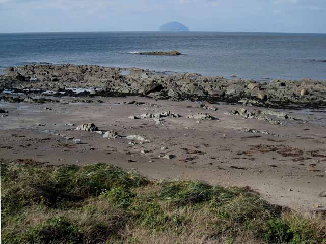
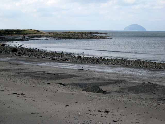
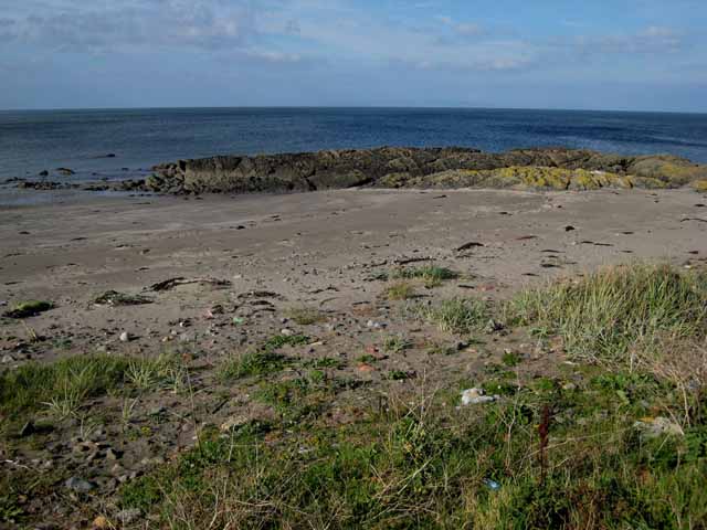
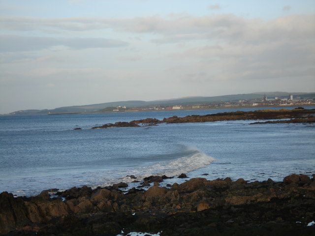
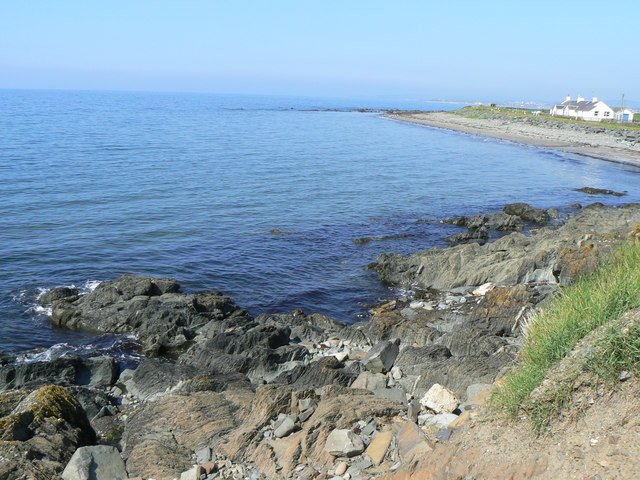
Black Neuk is a prominent coastal feature located in Ayrshire, Scotland. It is a headland that juts out into the Firth of Clyde, forming a distinct point along the coastline. The name "Black Neuk" derives from the Scots language, with "neuk" meaning "corner" or "nook."

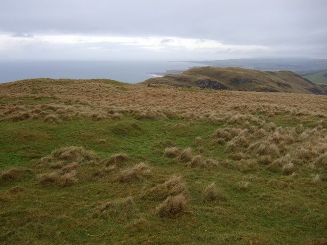
Situated near the town of Ayr, Black Neuk offers stunning panoramic views of the surrounding area. The headland is composed of rugged cliffs that tower over the crashing waves below, creating a dramatic and picturesque landscape. The cliffs are primarily made up of exposed rock formations, displaying layers of sedimentary rock, which are a testament to the geological history of the area.

Black Neuk is known for its rich biodiversity and serves as a habitat for a variety of flora and fauna. The headland provides nesting sites for seabirds such as gulls, fulmars, and cormorants, while the adjacent waters are home to numerous marine species, including seals and dolphins. The surrounding coastal vegetation consists of hardy grasses, heather, and wildflowers, adding to the area's natural beauty.

The headland is a popular destination for nature enthusiasts, hikers, and photographers who are drawn to its rugged beauty and abundant wildlife. It offers opportunities for coastal walks along its cliffs, allowing visitors to immerse themselves in the stunning coastal scenery. Additionally, the area is a popular spot for fishing and birdwatching, attracting both locals and tourists alike.

In summary, Black Neuk is a captivating coastal feature in Ayrshire, Scotland, boasting breathtaking cliffs, diverse wildlife, and stunning views of the Firth of Clyde. It is a must-visit location for those seeking to explore Scotland's rugged coastal landscapes and immerse themselves in its natural wonders.

If you have any feedback on the listing, please let us know in the comments section below.

Black Neuk Images

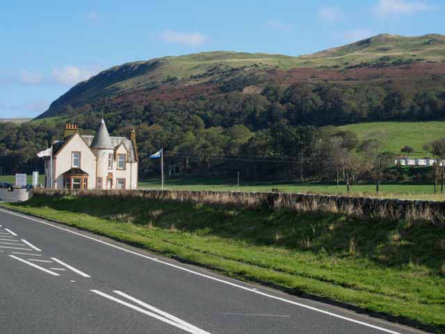
Images are sourced within 2km of 55.21822/-4.8754788 or Grid Reference NX1795. Thanks to Geograph Open Source API. All images are credited.
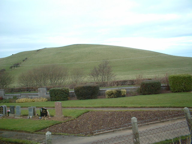
Monument on Byne Hill Decrepit monument on hillside near Girvan
Monument on Byne Hill
Decrepit monument on hillside near Girvan
Shalloch Hill and cemetery
Ardmillan Castle Holiday Park Sited on the A77 just south of Girvan
Ardmillan Castle Holiday Park
Sited on the A77 just south of Girvan
Rocky shoreline at Black Neuk, south of Girvan Ailsa Craig <a href="https://www.geograph.org.uk/gridref/NX0199">NX0199</a> dominates the horizon.
Rocky shoreline at Black Neuk, south of Girvan
Ailsa Craig NX0199 dominates the horizon.
Woodland Bay, south of Girvan Ailsa Craig <a href="https://www.geograph.org.uk/gridref/NX0199">NX0199</a> dominates the horizon.
Woodland Bay, south of Girvan
Ailsa Craig NX0199 dominates the horizon.
Horse Rock, south of Girvan
Small reservoir south of Girvan Popular with anglers. Byne Hill <a href="https://www.geograph.org.uk/gridref/NX1794">NX1794</a> in the background.
Small reservoir south of Girvan
Popular with anglers. Byne Hill NX1794 in the background.
Cemetery south of Girvan
Girvan - home of Ailsa Craig! A fine brick sculpture on the roundabout where the A77 and A714 join on the southern edge of Girvan.
Girvan - home of Ailsa Craig!
A fine brick sculpture on the roundabout where the A77 and A714 join on the southern edge of Girvan.
Woodlands Bay Looking across bay towards Girvan.
Woodlands Bay
Looking across bay towards Girvan.
Ardmillan Castle Holiday Park Viewed from the lodge on the A77.
Ardmillan Castle Holiday Park
Viewed from the lodge on the A77.
Ainslie Manor Nursing Home Built right on the coast to the south of Girvan.
Ainslie Manor Nursing Home
Built right on the coast to the south of Girvan.
The valley of the Bynehill Burn Viewed from Pinminnoch Farm. The hill on the skyline is Byne Hill [<a href="https://www.geograph.org.uk/gridref/NX1794">NX1794</a>]
The valley of the Bynehill Burn
Viewed from Pinminnoch Farm. The hill on the skyline is Byne Hill [NX1794]
Small reservoir south of Girvan On the A714. Very popular with anglers.
Small reservoir south of Girvan
On the A714. Very popular with anglers.
Ainslie Manor Nursing Home Situated right on the coast on the A77 south of Girvan.
Ainslie Manor Nursing Home
Situated right on the coast on the A77 south of Girvan.
Ardwell Bay On the coast south of Girvan.
Ardwell Bay
On the coast south of Girvan.
Shingle beach near Girvan
Summit of Cairn Hill Looking north towards Girvan
Summit of Cairn Hill
Looking north towards Girvan
Show me another place!

Black Neuk is located at Grid Ref: NX1795 (Lat: 55.21822, Lng: -4.8754788)

Unitary Authority: South Ayrshire

Police Authority: Ayrshire

What 3 Words

///lifeboats.editor.clouding. Near Girvan, South Ayrshire

Related Wikis

Ardmillan Castle

Ardmillan Castle is a ruinous Scottish castle dating from the late 16th century. It lies on the A77 on the edge of the Firth of Clyde south of Girvan....

Ian Henderson (RAF officer)

Captain Ian Henry David Henderson (2 October 1896 – 21 June 1918) was a British World War I flying ace credited with seven aerial victories. == Biography... ==
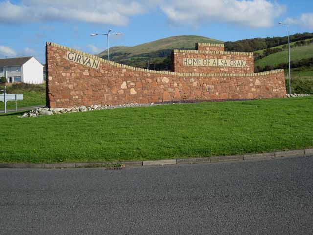
Girvan

Girvan (Scottish Gaelic: Inbhir Gharbhain, "mouth of the River Girvan") is a burgh and harbour town in Carrick, South Ayrshire, Scotland. Girvan is situated...

Girvan Steeple

The Girvan Steeple is a steeple and the site of a former townhouse in Girvan, South Ayrshire, Scotland. Its popular name, "Stumpy Tower", "Stumpy Jail...

Related Videos

Thoughts on a Hill Near Girvan

We open the video beside Stumpy Tower in the centre of Girvan, and wander along Dalrymple Street where we wonder at the ...

BYNE HILL (GIRVAN)

A walk up byne hill from girvan and doing it as a loop.

Nearby Amenities

Located within 500m of 55.21822,-4.8754788
Created By: almien_coastlines
Lat/Long: 55.219942/-4.868823
Created By: almien_coastlines
Lat/Long: 55.219679/-4.869259
Created By: almien_coastlines
Lat/Long: 55.219545/-4.869701
Created By: almien_coastlines
Lat/Long: 55.21903/-4.869901
Created By: almien_coastlines
Lat/Long: 55.218767/-4.870337
Created By: almien_coastlines
Lat/Long: 55.218504/-4.870773
Created By: almien_coastlines
Lat/Long: 55.217847/-4.871861
Created By: almien_coastlines
Lat/Long: 55.217712/-4.872303
Created By: almien_coastlines
Lat/Long: 55.218121/-4.879043
Created By: almien_coastlines
Lat/Long: 55.217985/-4.879484
Created By: almien_coastlines
Lat/Long: 55.217851/-4.879926
Created By: almien_coastlines
Lat/Long: 55.217336/-4.880127
Created By: almien_coastlines
Lat/Long: 55.215281/-4.880478
Parking
Lat/Long: 55.2166053/-4.8735341
Woodland
Natural: bay
Lat/Long: 55.2188682/-4.8745318
Power: pole
Lat/Long: 55.2138472/-4.8765428
Power: pole
Lat/Long: 55.2141866/-4.8756221
Power: pole
Lat/Long: 55.214689/-4.8742056
Power: pole
Lat/Long: 55.2150499/-4.873181
Power: pole
Lat/Long: 55.2154122/-4.8721375
Power: pole
Lat/Long: 55.2157678/-4.8711484
Power: pole
Lat/Long: 55.2162311/-4.8703976
Power: pole
Lat/Long: 55.216685/-4.8696823
Power: pole
Lat/Long: 55.2171469/-4.8689174
Power: pole
Lat/Long: 55.2175846/-4.8682186
Power: pole
Lat/Long: 55.2165233/-4.8719652
Power: pole
Lat/Long: 55.216794/-4.8722225
Power: pole
Lat/Long: 55.2170755/-4.8721541
The data included in this document is from www.openstreetmap.org. The data is made available under ODbL.

Have you been to Black Neuk?

Leave your review of Black Neuk below (or comments, questions and feedback).