Bendhu

Coastal Feature, Headland, Point in Wigtownshire

Scotland

Bendhu

Mull of Galloway Lighthouse The Mull of Galloway is the southernmost point on the mainland of Scotland

Mull of Galloway Lighthouse

Light Established: 1830
Engineer: Robert Stevenson
Position: Latitude 54° 38.1’N Longitude 04° 51.4’W
Character: Flashing White every 20 seconds
Elevation: 99 metres
Nominal Range: 28 miles
Structure: White round tower 26 metres high. There are 114 steps to the top of the tower.
Mull of Galloway Lighthouse Credit: Beth Loft

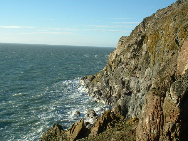
Bendhu is a picturesque headland located in Wigtownshire, a region in the southwest of Scotland. Situated along the rugged coastline, it is known for its stunning natural beauty and dramatic cliffs that overlook the Irish Sea.

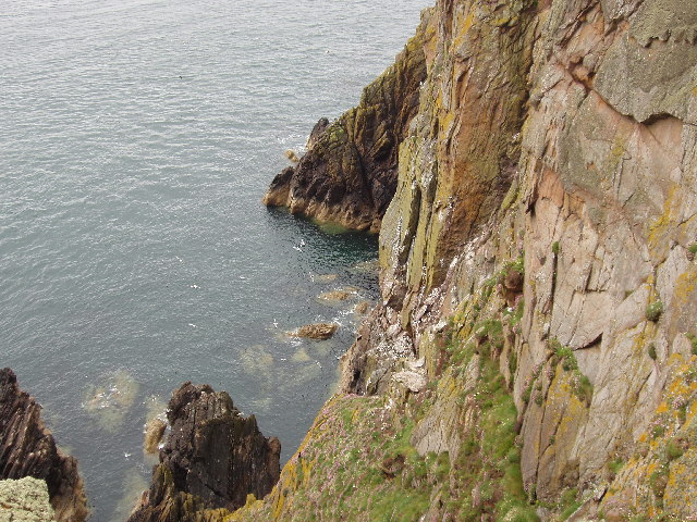
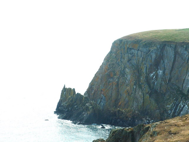
The headland of Bendhu is characterized by its prominent rocky outcrop that juts out into the sea, forming a distinctive point. Its name, which translates to "black head" in Gaelic, is derived from the dark-colored rocks that dominate the area. These rocks, mainly composed of shale and sandstone, have been shaped by centuries of erosion and weathering, resulting in unique formations and caves.

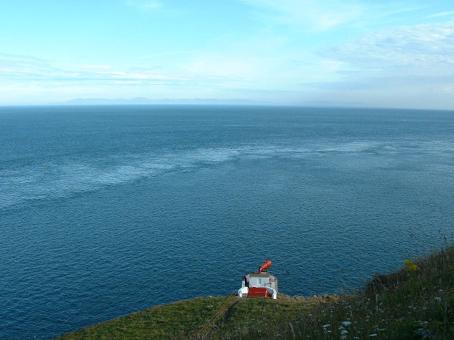
The headland is a popular destination for nature enthusiasts and hikers, offering breathtaking panoramic views of the surrounding coastline and the crashing waves below. It is also home to a diverse range of flora and fauna, including various seabirds such as gulls and kittiwakes that nest in the cliffs.

Bendhu is also of historical significance, as it is believed to have been inhabited as early as the Iron Age. Archaeological finds, including remnants of ancient settlements and burial sites, have been discovered in the area, providing insights into the region's rich cultural heritage.

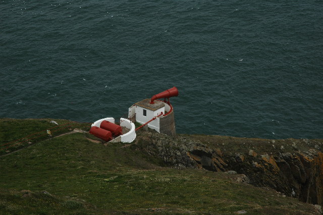
Visitors to Bendhu can enjoy leisurely walks along the coastal path, exploring the rugged terrain and admiring the abundant wildlife. The headland's remote location and unspoiled beauty make it an ideal spot for those seeking tranquility and a connection with nature.

If you have any feedback on the listing, please let us know in the comments section below.
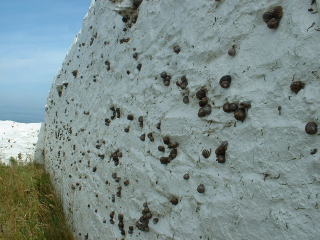
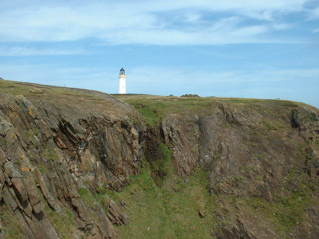
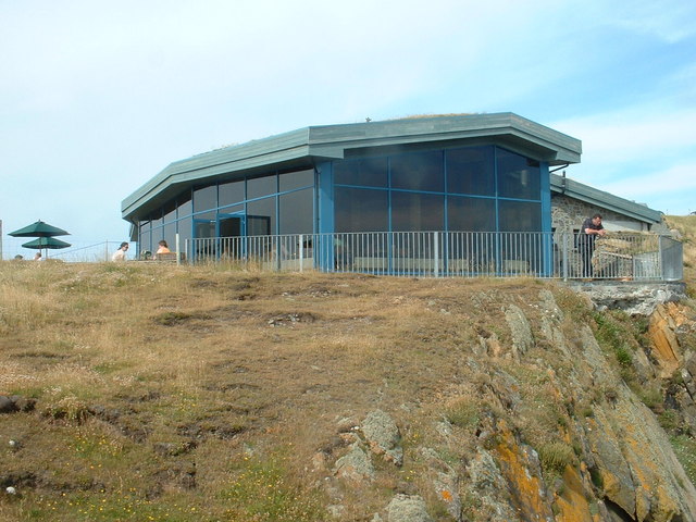
Bendhu Images

Images are sourced within 2km of 54.638397/-4.8833281 or Grid Reference NX1430. Thanks to Geograph Open Source API. All images are credited.
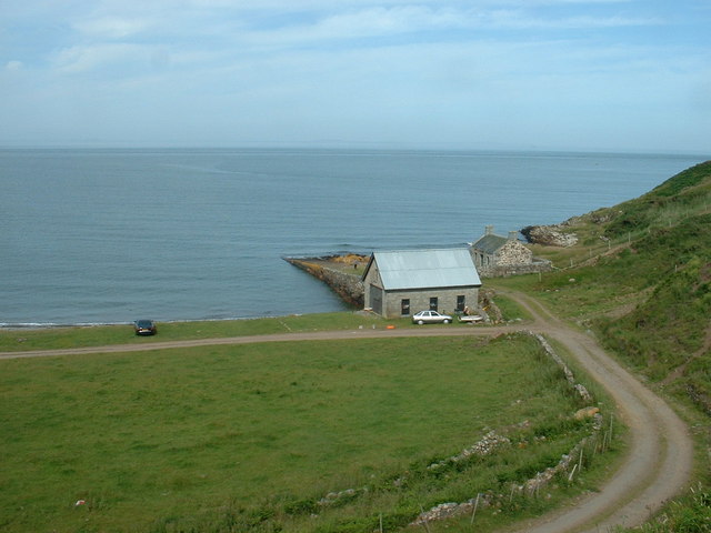
Mull of Galloway Lighthouse The Mull of Galloway is the southernmost point on the mainland of Scotland

Mull of Galloway Lighthouse

Light Established: 1830
Engineer: Robert Stevenson
Position: Latitude 54° 38.1’N Longitude 04° 51.4’W
Character: Flashing White every 20 seconds
Elevation: 99 metres
Nominal Range: 28 miles
Structure: White round tower 26 metres high. There are 114 steps to the top of the tower.
Mull of Galloway Lighthouse
The Mull of Galloway is the southernmost point on the mainland of Scotland Mull of Galloway Lighthouse Light Established: 1830 Engineer: Robert Stevenson Position: Latitude 54° 38.1’N Longitude 04° 51.4’W Character: Flashing White every 20 seconds Elevation: 99 metres Nominal Range: 28 miles Structure: White round tower 26 metres high. There are 114 steps to the top of the tower.
Southernmost point of Scotland Cliffs at the Mull of Galloway. This is as far as you can go, in a southerly direction in Scotland. Due East is Hartlepool!

On a better day, you can see the Isle of Man and Ireland from here.
Southernmost point of Scotland
Cliffs at the Mull of Galloway. This is as far as you can go, in a southerly direction in Scotland. Due East is Hartlepool! On a better day, you can see the Isle of Man and Ireland from here.
Cliffs by Gallie Craig and Carrick-Kee, Mull of Galloway These cliffs are at the southernmost point of Scotland. Many seabirds nest on the cliffs.
Cliffs by Gallie Craig and Carrick-Kee, Mull of Galloway
These cliffs are at the southernmost point of Scotland. Many seabirds nest on the cliffs.
Fog Horn, Mull of Galloway This is the now disused fog horn on the Mull of Galloway. Picture taken from the lighthouse.
Fog Horn, Mull of Galloway
This is the now disused fog horn on the Mull of Galloway. Picture taken from the lighthouse.
Mull of Galloway Lighthouse The Mull of Galloway is at the end of this peninsula in Scotland.  However, Carrick-kee, less than a mile to the west <a href="https://www.geograph.org.uk/photo/14826">NX1430 : Cliffs by Gallie Craig and Carrick-Kee, Mull of Galloway</a>, is actually the most southerly point in Scotland.
Mull of Galloway Lighthouse
The Mull of Galloway is at the end of this peninsula in Scotland. However, Carrick-kee, less than a mile to the west NX1430 : Cliffs by Gallie Craig and Carrick-Kee, Mull of Galloway, is actually the most southerly point in Scotland.
Wall This picture was taken looking SE from NX141313. The dry stone wall typical of this area is clearly shown. In the distance can be seen the Mull of Galloway Lighthouse.
Wall
This picture was taken looking SE from NX141313. The dry stone wall typical of this area is clearly shown. In the distance can be seen the Mull of Galloway Lighthouse.
Lythe Mead rocks, Mull of Galloway, Scotland's most South Westerly point. The stunning scenery and sea views at the Mull of Galloway. This is also an RSPB reserve where thousands of seabirds nest and breed each year.
Lythe Mead rocks, Mull of Galloway, Scotland's most South Westerly point.
The stunning scenery and sea views at the Mull of Galloway. This is also an RSPB reserve where thousands of seabirds nest and breed each year.
Foghorn, Mull of Galloway
Mull of Galloway Visitors' Centre Taken from the viewing platform at the top of the lighthouse.
Mull of Galloway Visitors' Centre
Taken from the viewing platform at the top of the lighthouse.
Mull of Galloway car park Taken looking westwards, from the viewing platform at the top of the lighthouse. The car park serves visitors to the light and to the nature reserve. The narrow neck of the Mull is visible in the middle distance - it is almost an island.
Mull of Galloway car park
Taken looking westwards, from the viewing platform at the top of the lighthouse. The car park serves visitors to the light and to the nature reserve. The narrow neck of the Mull is visible in the middle distance - it is almost an island.
Snail sanctuary? This is the northern wall of the lighthouse compound, and it's covered with snails, as was the eastern wall. Clearly they like the shade, but what else attracts them?  The colour?  The taste? The sense of history?  Or just being in a Nature Reserve?
Snail sanctuary?
This is the northern wall of the lighthouse compound, and it's covered with snails, as was the eastern wall. Clearly they like the shade, but what else attracts them? The colour? The taste? The sense of history? Or just being in a Nature Reserve?
Gallie Craig Cafe This is an interesting building, built into the rock a few metres from the cliff edge, with an earth, grass covered roof. Its large picture windows, looking south west, give fantastic exposure to the cliff scenery. And the coffee's good too.
Gallie Craig Cafe
This is an interesting building, built into the rock a few metres from the cliff edge, with an earth, grass covered roof. Its large picture windows, looking south west, give fantastic exposure to the cliff scenery. And the coffee's good too.
Mull of Galloway Lighthouse Taken from the viewing gallery at Gallie Craig Cafe.
Mull of Galloway Lighthouse
Taken from the viewing gallery at Gallie Craig Cafe.
Gallie Craig Cafe The gallery railings are right on the edge of the cliff.
Gallie Craig Cafe
The gallery railings are right on the edge of the cliff.
Gallie Craig rocks
Gallie Craig rocks
Cottage and Quay On the eastern, Luce Bay, side of the Mull of Galloway.  The cottage appears intact from this angle, but the other side of the roof is missing.
Cottage and Quay
On the eastern, Luce Bay, side of the Mull of Galloway. The cottage appears intact from this angle, but the other side of the roof is missing.
East Tarbet This is the 'neck' of the Mull of Galloway. A tarbet is a place where a boat could be dragged from one side of a headland or island to the other [which is probably not done much these days]. This side is on Luce Bay, the point on the other side of the headland is on the Irish Sea and is called, somewhat predictably, West Tarbet.
East Tarbet
This is the 'neck' of the Mull of Galloway. A tarbet is a place where a boat could be dragged from one side of a headland or island to the other [which is probably not done much these days]. This side is on Luce Bay, the point on the other side of the headland is on the Irish Sea and is called, somewhat predictably, West Tarbet.
East Tarbet Quay, Mull of Galloway A swimmer was rescued and treated for hypothermia after trying to swim out to his boat.  The currents hereabouts are notoriously treacherous.
East Tarbet Quay, Mull of Galloway
A swimmer was rescued and treated for hypothermia after trying to swim out to his boat. The currents hereabouts are notoriously treacherous.
Show me another place!

Bendhu is located at Grid Ref: NX1430 (Lat: 54.638397, Lng: -4.8833281)

Unitary Authority: Dumfries and Galloway

Police Authority: Dumfries and Galloway

What 3 Words

///upwardly.wager.length. Near Drummore, Dumfries & Galloway

Related Wikis

Cairngaan

Cairngaan, Wigtownshire, is the southmost settlement in Scotland. The hamlet of Cairngaan lies just north of the Mull of Galloway (which contains Scotland...

Mull of Galloway

The Mull of Galloway (Scottish Gaelic: Maol nan Gall, pronounced [mɯːlˠ̪ nəŋ ˈkaulˠ̪]; grid reference NX158303) is the southernmost point of Scotland....

Drummore

Drummore (drum-ORE; (from Gaelic An Druim Mòr meaning "the great ridge") is the southernmost village in Scotland, located at the southern end of the Rhins...

Kirkmaiden (village)

Kirkmaiden (sometimes Maidenkirk; Scottish Gaelic: Cill M'Eudan) is a small settlement in Galloway, Scotland, located approximately 17 miles (27 km) south...

Kirkmaiden

Kirkmaiden is a parish in the Rhins of Galloway, the most southerly in Scotland; the present Church of Scotland parish has the same name as and is approximately...

Pasages (steam trawler)

ST Pasages (FD 119) was originally a Canadian "Castle" – TR series minesweeping trawler built by the Dominion Shipbuilding Company, Toronto, in 1917 for...

Nearby Amenities

Located within 500m of 54.638397,-4.8833281
Source: PGS
Lat/Long: 54.6392235/-4.8765201
Source: PGS
Lat/Long: 54.638954/-4.8770035
Source: PGS
Lat/Long: 54.6395272/-4.8776788
Source: PGS
Lat/Long: 54.6400965/-4.8781021
Source: PGS
Lat/Long: 54.6405211/-4.8781419
Source: PGS
Lat/Long: 54.6406532/-4.8780448
Source: PGS
Lat/Long: 54.6407942/-4.877844
Source: PGS
Lat/Long: 54.6410798/-4.8774577
Source: PGS
Lat/Long: 54.6389633/-4.8902943
Source: PGS
Lat/Long: 54.639201/-4.886692
Source: PGS
Lat/Long: 54.639333/-4.886478
Source: PGS
Lat/Long: 54.639464/-4.886262
Source: PGS
Lat/Long: 54.639471/-4.885821
Source: PGS
Lat/Long: 54.639478/-4.88538
Source: PGS
Lat/Long: 54.6398007/-4.8841311
Source: PGS
Lat/Long: 54.6396269/-4.8832942
Source: PGS
Lat/Long: 54.6394282/-4.8826505
Source: PGS
Lat/Long: 54.6388942/-4.8823286
Source: PGS
Lat/Long: 54.6385962/-4.8824359
Source: PGS
Lat/Long: 54.6383602/-4.8834444
Source: PGS
Lat/Long: 54.6380746/-4.8837663
Source: PGS
Lat/Long: 54.6379008/-4.8842383
Source: PGS
Lat/Long: 54.6377517/-4.8847319
Source: PGS
Lat/Long: 54.6373295/-4.8847748
Source: PGS
Lat/Long: 54.6369818/-4.8840023
Source: PGS
Lat/Long: 54.6370315/-4.883423
Source: PGS
Lat/Long: 54.6365347/-4.8830367
Source: PGS
Lat/Long: 54.636205/-4.881695
Source: PGS
Lat/Long: 54.636081/-4.881469
Source: PGS
Lat/Long: 54.635956/-4.881242
Source: PGS
Lat/Long: 54.635842/-4.880353
Source: PGS
Lat/Long: 54.634306/-4.880283
Passing Place
Lat/Long: 54.6379001/-4.8765463
West Tarbet
Natural: bay
Lat/Long: 54.6380433/-4.8861324
Leisure: slipway
Lat/Long: 54.6395315/-4.8776075
Barrier: cattle_grid
Lat/Long: 54.6399665/-4.8809879
Bench
Source: survey;gps
Lat/Long: 54.6411311/-4.8782234
Power: pole
Lat/Long: 54.6420568/-4.8829549
Power: pole
Lat/Long: 54.6412035/-4.8822487
Power: pole
Lat/Long: 54.6404894/-4.8816666
Power: pole
Lat/Long: 54.6397169/-4.8810089
Power: pole
Lat/Long: 54.6391488/-4.8799729
Power: pole
Lat/Long: 54.6384863/-4.8787176
Power: pole
Lat/Long: 54.6382729/-4.8773847
Power: pole
Lat/Long: 54.6380495/-4.875947
The data included in this document is from www.openstreetmap.org. The data is made available under ODbL.

Have you been to Bendhu?

Leave your review of Bendhu below (or comments, questions and feedback).