Loup of Grennan

Coastal Feature, Headland, Point in Wigtownshire

Scotland

Loup of Grennan

Myroch Point Looking across Luce Bay, to The Machars peninsula, just visible through the haze.
Myroch Point Credit: David Medcalf

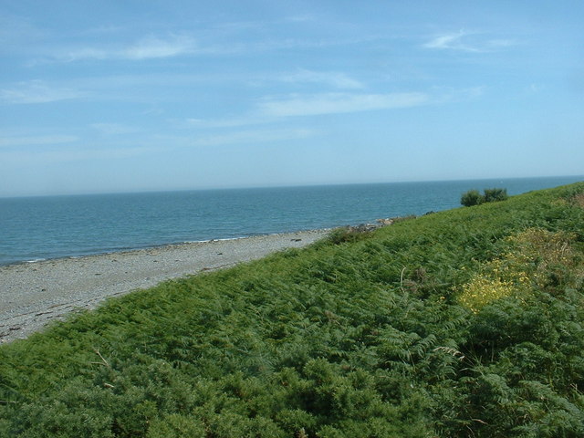
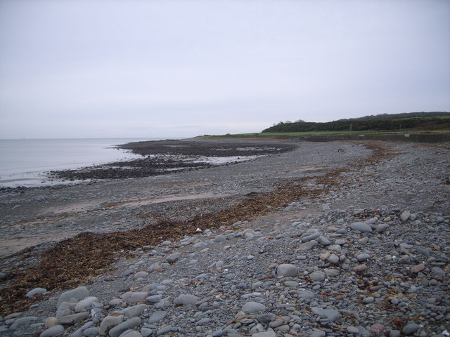
Loup of Grennan is a prominent coastal feature located in Wigtownshire, Scotland. It is a headland that juts out into the Irish Sea, forming a distinctive point along the coastline. The name "Loup" is derived from the Scots word for "leap" or "jump," which accurately describes the dramatic cliffs that drop down into the crashing waves below.

The headland is characterized by its rugged beauty and stunning views. It is composed of layered sedimentary rocks, including sandstone and shale, which have been weathered over time to create unique formations and patterns. The cliffs rise to a height of approximately 30 meters, providing a commanding vantage point for observing the surrounding sea and landscape.

Loup of Grennan is known for its rich biodiversity and serves as an important habitat for various bird species. It is a popular spot for birdwatching, particularly during the breeding season when colonies of seabirds, such as fulmars, kittiwakes, and guillemots, can be observed nesting on the cliffs.

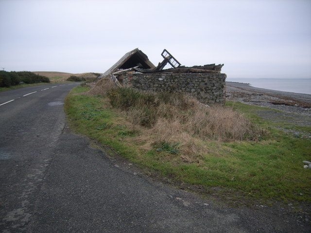
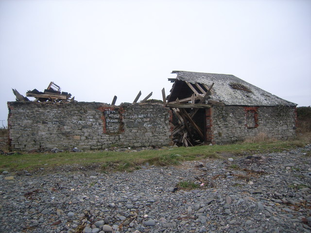
In addition to its natural beauty, the headland has historical significance. It is believed that the ruins of an ancient fort can be found atop the cliffs, serving as evidence of human occupation in the area dating back centuries. The site offers a glimpse into the region's past and provides an opportunity for visitors to explore its historical heritage.

Overall, Loup of Grennan is a captivating coastal feature that combines stunning natural scenery, diverse wildlife, and a touch of history. Its towering cliffs and panoramic views make it a must-visit destination for nature enthusiasts and history buffs alike.

If you have any feedback on the listing, please let us know in the comments section below.

Loup of Grennan Images

Images are sourced within 2km of 54.717137/-4.9091689 or Grid Reference NX1239. Thanks to Geograph Open Source API. All images are credited.

Myroch Point Looking across Luce Bay, to The Machars peninsula, just visible through the haze.
Myroch Point
Looking across Luce Bay, to The Machars peninsula, just visible through the haze.
The A716 near Terally Point Luce Bay to the left.
The A716 near Terally Point
Luce Bay to the left.
Minor road meets the A716 At Terally Bay - Luce Bay ahead.
Minor road meets the A716
At Terally Bay - Luce Bay ahead.
Approaching Terally Bay
Centre for wild boar  near Terally
Centre for wild boar near Terally
Self-explanatory! Wild boar compound.
Self-explanatory!
Wild boar compound.
Derelict cafe & snackbar I stopped for a much-needed coffee, but alas, it was all gone!
Derelict cafe & snackbar
I stopped for a much-needed coffee, but alas, it was all gone!
Terally Bay It was soooo cold here!
Terally Bay
It was soooo cold here!
Derelict cafe & snackbar (front view) No more snacks here then :(
Derelict cafe & snackbar (front view)
No more snacks here then :(
Kirkbride Farmhouse Kirkbride farmhouse stands in an elevated position with fantastic views over Luce Bay and beyond to the Galloway Hills.
Kirkbride Farmhouse
Kirkbride farmhouse stands in an elevated position with fantastic views over Luce Bay and beyond to the Galloway Hills.
Bull in a field I trusted the farmer when he said that his bull would be OK if I walked through his fields!  Bridge Cottages can be seen, top left.
Bull in a field
I trusted the farmer when he said that his bull would be OK if I walked through his fields! Bridge Cottages can be seen, top left.
A field with cows and their calves The farm in the distance is Killumpha.
A field with cows and their calves
The farm in the distance is Killumpha.
Farmland at Kirkbride farm This is the view of the farmland when standing on the farm track and looking north.
Farmland at Kirkbride farm
This is the view of the farmland when standing on the farm track and looking north.
Terally Bay, Mull of Galloway Trail
A716 near Myroch House
Mull of Galloway Trail, Terally Bay,
Terally Bay
Terally Bay
A716 at Terally Bay
A716 at Terally Bay
Show me another place!

Loup of Grennan is located at Grid Ref: NX1239 (Lat: 54.717137, Lng: -4.9091689)

Unitary Authority: Dumfries and Galloway

Police Authority: Dumfries and Galloway

What 3 Words

///witless.penned.guitars. Near Drummore, Dumfries & Galloway

Related Wikis

Kirkmaiden

Kirkmaiden is a parish in the Rhins of Galloway, the most southerly in Scotland; the present Church of Scotland parish has the same name as and is approximately...

Kirkmaiden (village)

Kirkmaiden (sometimes Maidenkirk; Scottish Gaelic: Cill M'Eudan) is a small settlement in Galloway, Scotland, located approximately 17 miles (27 km) south...

Port Logan

Port Logan, formerly Port Nessock, is a small village in the parish of Kirkmaiden in the Rhins of Galloway in Wigtownshire. The Gaelic name is Port Neasaig...

Drummore

Drummore (drum-ORE; (from Gaelic An Druim Mòr meaning "the great ridge") is the southernmost village in Scotland, located at the southern end of the Rhins...

Nearby Amenities

Located within 500m of 54.717137,-4.9091689
Source: PGS
Lat/Long: 54.7133943/-4.9062135
Source: PGS
Lat/Long: 54.7137959/-4.9065841
Source: PGS
Lat/Long: 54.7144374/-4.9072725
Source: PGS
Lat/Long: 54.7152135/-4.9077903
Source: PGS
Lat/Long: 54.716084/-4.9080014
Source: PGS
Lat/Long: 54.7165819/-4.9079578
Source: PGS
Lat/Long: 54.7169011/-4.9082895
Source: PGS
Lat/Long: 54.7182143/-4.9087498
Source: PGS
Lat/Long: 54.7189843/-4.9092
Source: PGS
Lat/Long: 54.7197844/-4.9096929
Source: PGS
Lat/Long: 54.7207854/-4.9102246
Grennan
Place: farm
Lat/Long: 54.7145548/-4.9151401
Power: pole
Lat/Long: 54.7149884/-4.9156625
Power: pole
Lat/Long: 54.7157628/-4.9155363
Power: pole
Lat/Long: 54.7143238/-4.9126261
Power: pole
Lat/Long: 54.7139708/-4.9123933
Power: pole
Lat/Long: 54.713648/-4.912176
Power: pole
Lat/Long: 54.7133521/-4.9115182
Power: pole
Lat/Long: 54.7148024/-4.9148418
Power: pole
Lat/Long: 54.7145872/-4.9138561
The data included in this document is from www.openstreetmap.org. The data is made available under ODbL.

Have you been to Loup of Grennan?

Leave your review of Loup of Grennan below (or comments, questions and feedback).