Creag an Fhithich

Coastal Feature, Headland, Point in Buteshire

Scotland

Creag an Fhithich

Overlooking Garroch Head A view of Garroch Head, the most southerly point of the Isle of Bute.

This photograph was taken during the Coronavirus (COVID-19) pandemic of 2020/21.
Overlooking Garroch Head Credit: James T M Towill

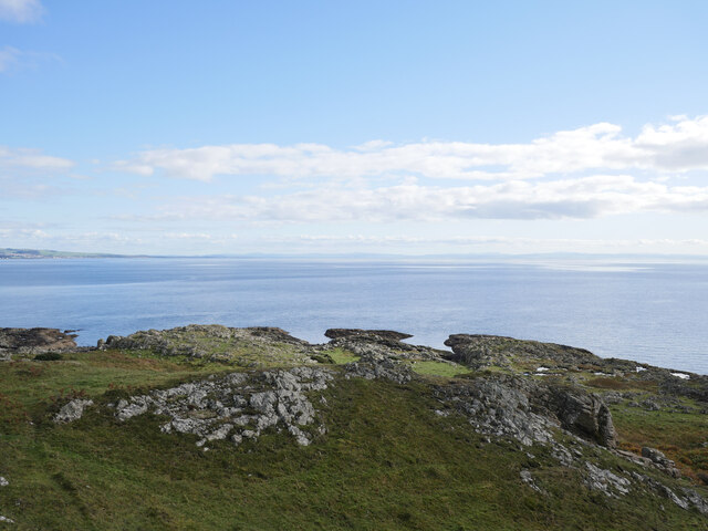
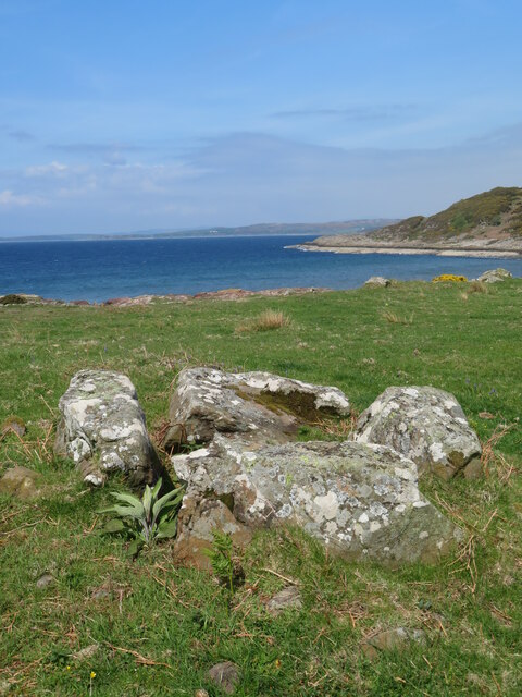
Creag an Fhithich, also known as the Raven's Crag, is a prominent coastal feature located in Buteshire, Scotland. This imposing headland juts out into the sea, forming a distinctive point that offers breathtaking views of the surrounding landscape and the ocean beyond.

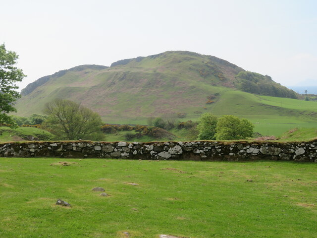
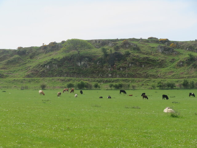
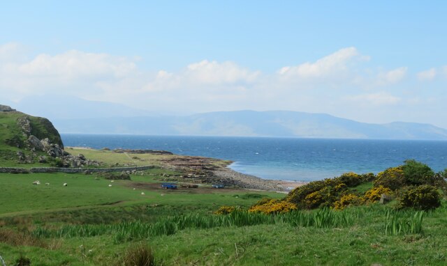
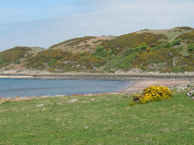
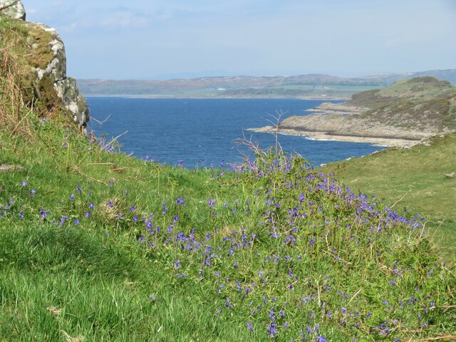
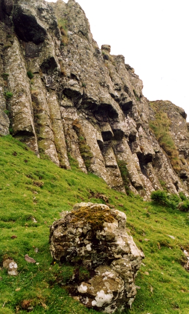
Situated on the western coast of the Isle of Bute, Creag an Fhithich is characterized by its rugged cliffs, which soar to heights of approximately 40 meters (131 feet) above sea level. These sheer rock faces are composed of sandstone and limestone, displaying a variety of colors and textures that add to the natural beauty of the area.

The headland is a haven for wildlife, attracting numerous species of birds that nest and roost on the cliffs. The name "Raven's Crag" is derived from the large number of ravens that inhabit the area, adding an air of mystery and intrigue to the landscape. Visitors can often spot these majestic birds soaring overhead or perched on the crag's ledges.

Creag an Fhithich is a popular destination for outdoor enthusiasts and nature lovers alike. It offers opportunities for hiking, birdwatching, and photography, with several trails leading to the viewpoint at the top of the headland. From this vantage point, visitors can admire the dramatic cliffs, the sparkling waters of the Firth of Clyde, and the distant peaks of the Isle of Arran.

In summary, Creag an Fhithich is a striking coastal feature in Buteshire, known for its towering cliffs, abundant birdlife, and stunning views. It is a must-visit destination for those seeking a connection with nature and an appreciation for the rugged beauty of Scotland's coastline.

If you have any feedback on the listing, please let us know in the comments section below.

Creag an Fhithich Images

Images are sourced within 2km of 55.728746/-5.0413457 or Grid Reference NS0952. Thanks to Geograph Open Source API. All images are credited.
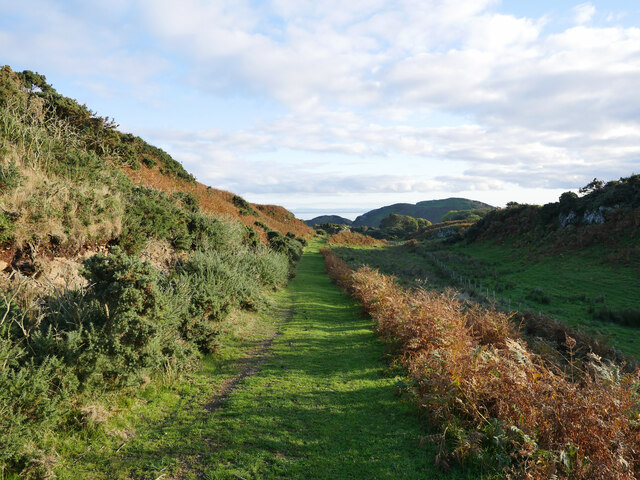
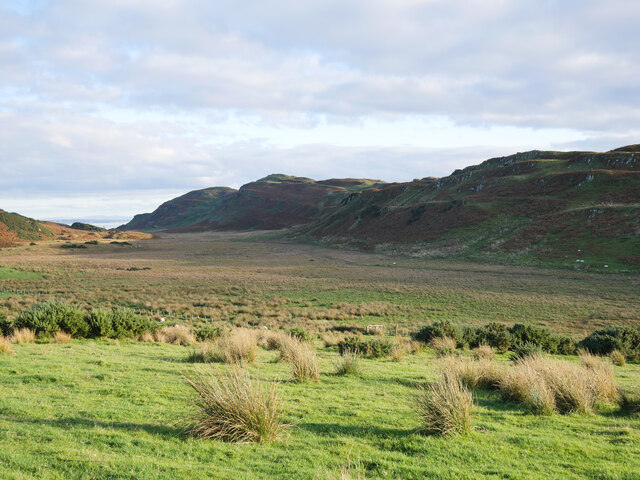
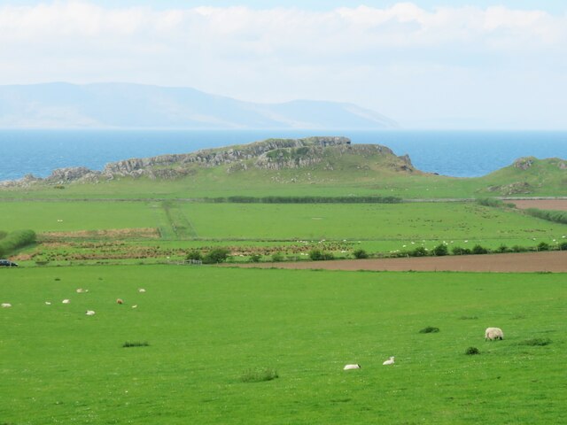
Overlooking Garroch Head A view of Garroch Head, the most southerly point of the Isle of Bute.

This photograph was taken during the Coronavirus (COVID-19) pandemic of 2020/21.
Overlooking Garroch Head
A view of Garroch Head, the most southerly point of the Isle of Bute. This photograph was taken during the Coronavirus (COVID-19) pandemic of 2020/21.
Plain by The Plan Well, perhaps more just a little bit of level ground rather than a 'plain'!  On the West Island Way heading back inland after a brief detour to Garroch Head.

This photograph was taken during the Coronavirus (COVID-19) pandemic of 2020/21.
Plain by The Plan
Well, perhaps more just a little bit of level ground rather than a 'plain'! On the West Island Way heading back inland after a brief detour to Garroch Head. This photograph was taken during the Coronavirus (COVID-19) pandemic of 2020/21.
View to St Blane's Hill from St Blane's Churchyard A view from a shaded corner of St Blane's Churchyard in an October mid-afternoon.  The distinctive outline of Holy Island off the Isle of Arran can be seen to the right of shot.

This photograph was taken during the Coronavirus (COVID-19) pandemic of 2020/21.
View to St Blane's Hill from St Blane's Churchyard
A view from a shaded corner of St Blane's Churchyard in an October mid-afternoon. The distinctive outline of Holy Island off the Isle of Arran can be seen to the right of shot. This photograph was taken during the Coronavirus (COVID-19) pandemic of 2020/21.
St Blane's Church A view across the churchyard to the medieval Church of St Blane in the south of the Isle of Bute.

This photograph was taken during the Coronavirus (COVID-19) pandemic of 2020/21.
St Blane's Church
A view across the churchyard to the medieval Church of St Blane in the south of the Isle of Bute. This photograph was taken during the Coronavirus (COVID-19) pandemic of 2020/21.
West Island Way above St Blane's Church This section of the West Island Way utilises an old farm track.  

This photograph was taken during the Coronavirus (COVID-19) pandemic of 2020/21.
West Island Way above St Blane's Church
This section of the West Island Way utilises an old farm track. This photograph was taken during the Coronavirus (COVID-19) pandemic of 2020/21.
View to Branzet Moss A view to Branzet Moss, and beyond Glen Callum, from the West Island Way.

This photograph was taken during the Coronavirus (COVID-19) pandemic of 2020/21.
View to Branzet Moss
A view to Branzet Moss, and beyond Glen Callum, from the West Island Way. This photograph was taken during the Coronavirus (COVID-19) pandemic of 2020/21.
St Blane's monastic site and church What a fascinating site this is. Remains of a very early 6th century monastic site with a medieval church within its boundary. Here one can see very ancient walls with the 12thC church on the higher ground.
St Blane's monastic site and church
What a fascinating site this is. Remains of a very early 6th century monastic site with a medieval church within its boundary. Here one can see very ancient walls with the 12thC church on the higher ground.
Ancient well at monastic site Fresh water would have been a priority for the monks at the 6thC monastery here.
Ancient well at monastic site
Fresh water would have been a priority for the monks at the 6thC monastery here.
St Blane's church The ruins of the 12thC church set within the walls of the 6thC monastic site. The original monastery was destroyed by Viking raiders in the 8thC, but by 1200 that had accepted Christianity and had this church constructed. One might describe the chancel arch as 'Norman' in style, although the Normans never reached this far north.
St Blane's church
The ruins of the 12thC church set within the walls of the 6thC monastic site. The original monastery was destroyed by Viking raiders in the 8thC, but by 1200 that had accepted Christianity and had this church constructed. One might describe the chancel arch as 'Norman' in style, although the Normans never reached this far north.
Fields below St Blane's church A scattering of sheep across the field that borders the road. Ahead is the rocky headland of Dunagoil, site of a prehistoric vitrified fort.
Fields below St Blane's church
A scattering of sheep across the field that borders the road. Ahead is the rocky headland of Dunagoil, site of a prehistoric vitrified fort.
St Blane's monastic site towards St Blane's Hill Looking south from within the old monastic site towards the 123m high St Blane's Hill, most of which is composed of volcanic rocks from the carboniferous period.
St Blane's monastic site towards St Blane's Hill
Looking south from within the old monastic site towards the 123m high St Blane's Hill, most of which is composed of volcanic rocks from the carboniferous period.
Contented cattle - and a few sheep Cattle and sheep on pasture land at Garrochty Farm.
Contented cattle - and a few sheep
Cattle and sheep on pasture land at Garrochty Farm.
Burial chamber at Dunagoil This was the one item marked on the OS map that was relatively easy to find, although it is hardly a large round or long barrow. I'd describe this as a cist as it is rather small, and if it once contained a body, then it would have been in a curled position.
Burial chamber at Dunagoil
This was the one item marked on the OS map that was relatively easy to find, although it is hardly a large round or long barrow. I'd describe this as a cist as it is rather small, and if it once contained a body, then it would have been in a curled position.
Dunagoil Bay A view of the bay and part of the Dunagoil headland. The northern hills of Arran are visible in the distance.
Dunagoil Bay
A view of the bay and part of the Dunagoil headland. The northern hills of Arran are visible in the distance.
Dunagoil Bay and beach On a whirlwind tour of Bute, this struck me as the nicest sandy beach on the island. A quiet bay with a view across to Arran.
Dunagoil Bay and beach
On a whirlwind tour of Bute, this struck me as the nicest sandy beach on the island. A quiet bay with a view across to Arran.
Bluebells above the bay Bluebells above Dunagoil Bay with a view along the south west coast of the island.
Bluebells above the bay
Bluebells above Dunagoil Bay with a view along the south west coast of the island.
Track to Dunagoil Headland composed of volcanic rocks overlooking a fine sandy bay [off photo to the right]. There's traces of a vitrified fort on the highest part of the hill, a burial cist below, a couple of interesting caves, plus some items that this contributor couldn't find, such as cup marked stones and St Blane's Stone.
Track to Dunagoil
Headland composed of volcanic rocks overlooking a fine sandy bay [off photo to the right]. There's traces of a vitrified fort on the highest part of the hill, a burial cist below, a couple of interesting caves, plus some items that this contributor couldn't find, such as cup marked stones and St Blane's Stone.
Bute - St Blane's - Former monastery and church  A view of the ruins of St Blane's monastery and church as seen when approaching from the south.
See shared description below:
Bute - St Blane's - Former monastery and church
A view of the ruins of St Blane's monastery and church as seen when approaching from the south. See shared description below:
Show me another place!

Creag an Fhithich is located at Grid Ref: NS0952 (Lat: 55.728746, Lng: -5.0413457)

Unitary Authority: Argyll and Bute

Police Authority: Argyll and West Dunbartonshire

What 3 Words

///lifeguard.choppers.recitals. Near Millport, North Ayrshire

Related Wikis

Strathclyde

Strathclyde (Ystrad Clud in Northern Brittonic; Srath Chluaidh [s̪t̪ɾa ˈxl̪ˠɯi] in Gaelic, meaning "strath (valley) of the River Clyde") was one of nine...
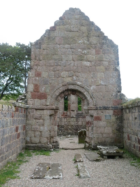
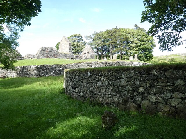
Dunagoil

Dunagoil is a vitrified fort or dun on the Isle of Bute – an Iron Age hill fort whose ramparts have been melted by intense heat. It stands on a volcanic...
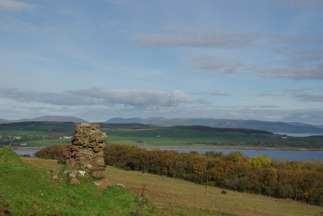
Kelspoke Castle

Kelspoke Castle is a ruined castle overlooking Kilchattan Bay, Isle of Bute, Scotland. Only a small amount of the ruins are above ground. == Notes ==

Kilchattan Bay

Kilchattan Bay is a village on the Isle of Bute, Scotland. It lies on the island's southern end, along the coast road at the foot of a steep hill called...
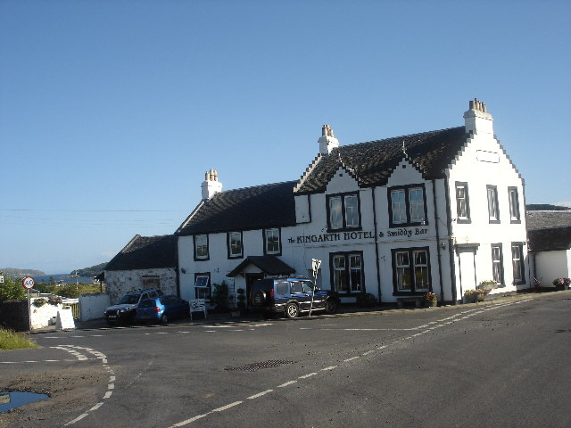
Kingarth

Kingarth (Old Irish: Cenn Garad; Scottish Gaelic: Ceann a' Gharaidh) is a historic village and parish on the Isle of Bute, off the coast of south-western...

Little Cumbrae

Little Cumbrae (Scots: Wee Cumbrae, Scottish Gaelic: Cumaradh Beag) or Little Cumbrae Island is an island in the Firth of Clyde, in North Ayrshire, Scotland...

Castle Island, Scotland

Castle Island (Scottish Gaelic: Eilean a' Chaisteil) or Allimturrail is a small tidal island, lying off the east coast of Little Cumbrae, and to the west...

River Clyde

The River Clyde (Scottish Gaelic: Abhainn Chluaidh, pronounced [ˈavɪɲ ˈxl̪ˠuəj], Scots: Clyde Watter, or Watter o Clyde) is a river that flows into the...

Nearby Amenities

Located within 500m of 55.728746,-5.0413457
Power: pole
Lat/Long: 55.7291217/-5.0373817
Power: pole
Lat/Long: 55.7303966/-5.0374413
Power: pole
Lat/Long: 55.7309635/-5.0368051
The data included in this document is from www.openstreetmap.org. The data is made available under ODbL.

Have you been to Creag an Fhithich?

Leave your review of Creag an Fhithich below (or comments, questions and feedback).