Beacon Lough

Settlement in Durham

England

Beacon Lough

Angel Of The North, Gateshead With Me for Scale :) I am 6ft 3. I had to sprint up the hill as only had 10 seconds. 

The steel sculpture is 20 metres (66 ft) tall, with wings measuring 54 metres (177 ft) across. Sculpted by Antony Gormley and was installed on 15 February 1998

<span class="nowrap"><a title="https://en.wikipedia.org/wiki/Angel_of_the_North" rel="nofollow ugc noopener" href="https://en.wikipedia.org/wiki/Angel_of_the_North">Link</a><img style="margin-left:2px;" alt="External link" title="External link - shift click to open in new window" src="https://s1.geograph.org.uk/img/external.png" width="10" height="10"/></span>
Angel Of The North, Gateshead Credit: Brian Deegan

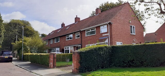
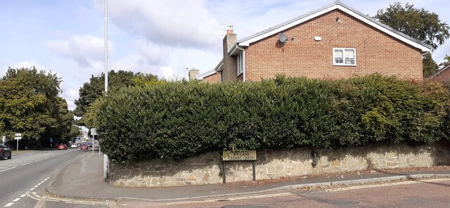
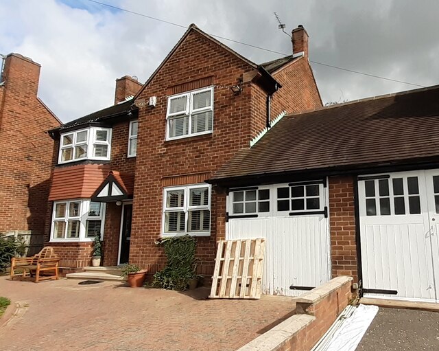
Beacon Lough is a residential area located in Durham, England. Situated in the southern part of the city, it falls within the civil parish of Lamesley and is part of the Gateshead Metropolitan Borough Council. The area is characterized by a mix of housing types, including both traditional terraced houses and modern developments.

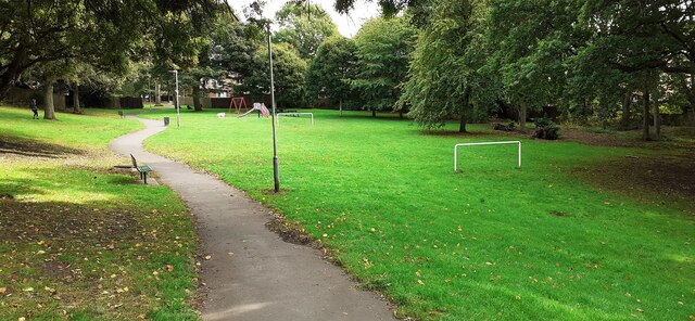
One of the prominent features of Beacon Lough is its namesake, Beacon Lough itself. This small lake is surrounded by green open spaces, making it a popular spot for recreational activities such as walking, jogging, and picnicking. The lake is also home to various species of waterfowl, adding to its natural beauty.

In terms of amenities, Beacon Lough offers several local shops, including a convenience store and a pharmacy, to cater to the needs of its residents. There are also a number of well-regarded primary and secondary schools in the area, making it an attractive place for families with children.

Transport links in Beacon Lough are convenient, with the nearby A1(M) providing easy access to other parts of the region. Additionally, there are regular bus services connecting the area with Durham city center and other nearby towns.

Overall, Beacon Lough is a desirable residential area known for its peaceful environment, beautiful lake, and convenient amenities. Its location within Durham makes it a popular choice for those looking for a balance between suburban living and easy access to urban facilities.

If you have any feedback on the listing, please let us know in the comments section below.
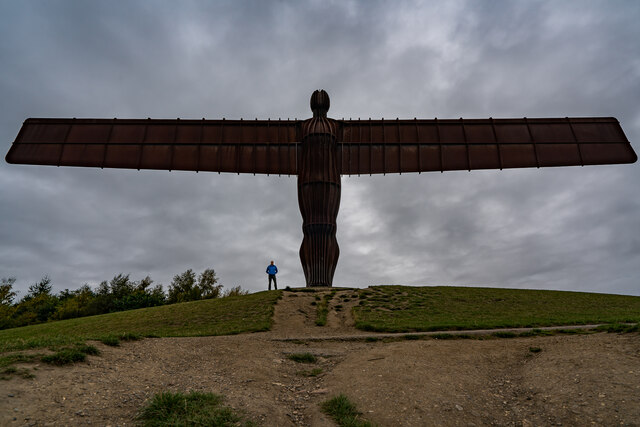
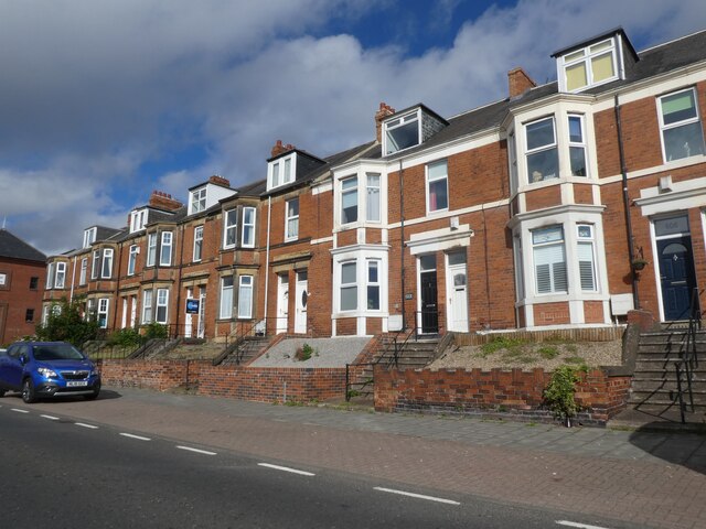
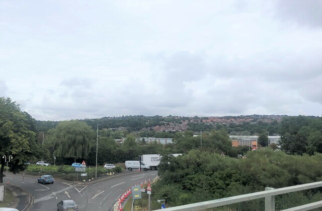
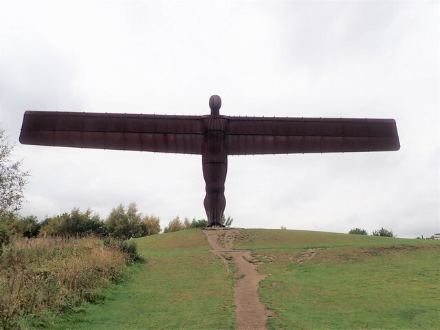
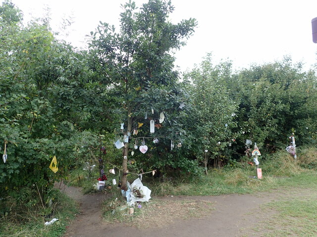
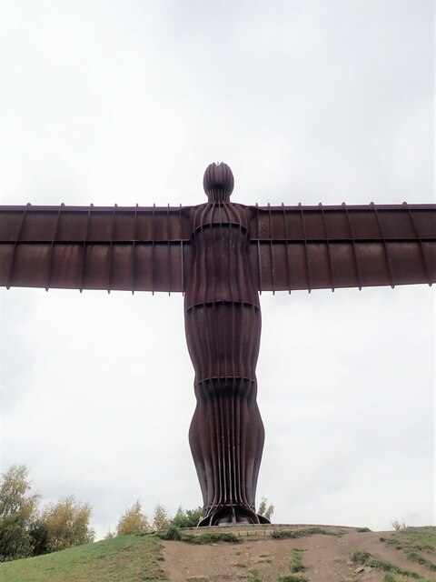
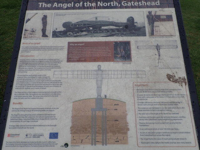
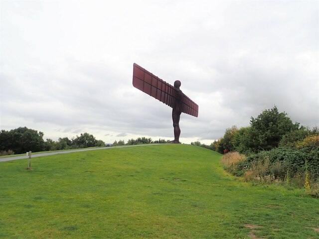
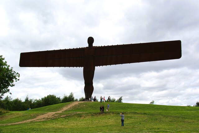
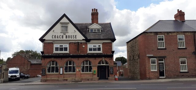
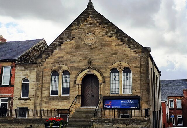
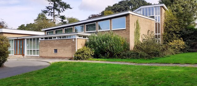
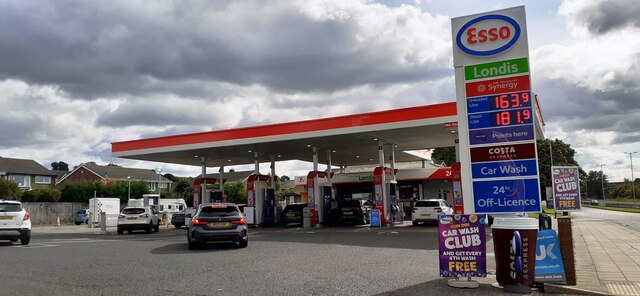
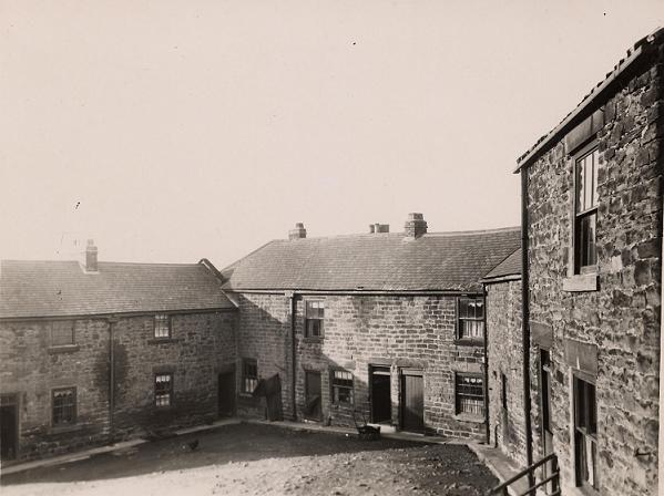
Beacon Lough Images

Images are sourced within 2km of 54.929499/-1.586427 or Grid Reference NZ2659. Thanks to Geograph Open Source API. All images are credited.

Angel Of The North, Gateshead With Me for Scale :) I am 6ft 3. I had to sprint up the hill as only had 10 seconds. 

The steel sculpture is 20 metres (66 ft) tall, with wings measuring 54 metres (177 ft) across. Sculpted by Antony Gormley and was installed on 15 February 1998

<span class="nowrap"><a title="https://en.wikipedia.org/wiki/Angel_of_the_North" rel="nofollow ugc noopener" href="https://en.wikipedia.org/wiki/Angel_of_the_North">Link</a><img style="margin-left:2px;" alt="External link" title="External link - shift click to open in new window" src="https://s1.geograph.org.uk/img/external.png" width="10" height="10"/></span>
Angel Of The North, Gateshead
With Me for Scale :) I am 6ft 3. I had to sprint up the hill as only had 10 seconds. The steel sculpture is 20 metres (66 ft) tall, with wings measuring 54 metres (177 ft) across. Sculpted by Antony Gormley and was installed on 15 February 1998 LinkExternal link
Terraced houses on Durham Road
The Angel of the North, Gateshead
Road junctions below the A1 The roundabout for access to the A1 and the road on the left into Team Valley
Road junctions below the A1
The roundabout for access to the A1 and the road on the left into Team Valley
The Angel of the North A contemporary sculpture by Antony Gormley, it is believed to be the largest sculpture of an angel in the world. Despite considerable opposition during its design and construction phases, it is now widely recognised as an iconic example of public art and as a symbol of Gateshead. It can withstand wind speeds over 100 mph.
The Angel of the North
A contemporary sculpture by Antony Gormley, it is believed to be the largest sculpture of an angel in the world. Despite considerable opposition during its design and construction phases, it is now widely recognised as an iconic example of public art and as a symbol of Gateshead. It can withstand wind speeds over 100 mph.
Prayers and wishes Just south of the Angel of the North, people have left tributes and mementos of lost loved ones hanging on the trees and bushes.
Prayers and wishes
Just south of the Angel of the North, people have left tributes and mementos of lost loved ones hanging on the trees and bushes.
Up close to the Angel of the North Missing half its wingspan of 175 ft when so close
Up close to the Angel of the North
Missing half its wingspan of 175 ft when so close
Information Board - Angel of the North An information board relating the birth of the concept, its construction and various facts.
Information Board - Angel of the North
An information board relating the birth of the concept, its construction and various facts.
Angel of the North A contemporary sculpture by Antony Gormley, it is believed to be the largest sculpture of an angel in the world. Despite considerable opposition during its design and construction phases, it is now widely recognised as an iconic example of public art and as a symbol of Gateshead. It can withstand wind speeds over 100 mph.
Angel of the North
A contemporary sculpture by Antony Gormley, it is believed to be the largest sculpture of an angel in the world. Despite considerable opposition during its design and construction phases, it is now widely recognised as an iconic example of public art and as a symbol of Gateshead. It can withstand wind speeds over 100 mph.
Angel of the North In silhouette
Angel of the North
In silhouette
The Coach House on west side of Durham Road
Chowdene Church, #660 Durham Road
St Ninian's Church on NW side of Ivy Lane
Nos 1-4 Cedars Green
Junction of Ivy Lane and Durham Road Ordnance Survey documents describe a benchmark levelled at 88.800m above Newlyn Datum on a wall at this location
Junction of Ivy Lane and Durham Road
Ordnance Survey documents describe a benchmark levelled at 88.800m above Newlyn Datum on a wall at this location
#771 Durham Road Ordnance Survey documents indicate that a benchmark was levelled at 76.023m above Newlyn Datum on the far corner of the house
#771 Durham Road
Ordnance Survey documents indicate that a benchmark was levelled at 76.023m above Newlyn Datum on the far corner of the house
Play area and goalposts in Calderwood Park
Esso filling station on east side of A167
Show me another place!

Beacon Lough is located at Grid Ref: NZ2659 (Lat: 54.929499, Lng: -1.586427)

Unitary Authority: Gateshead

Police Authority: Northumbria

What 3 Words

///paused.fixed.safely. Near Lamesley, Tyne & Wear

Nearby Locations

Beacon Lough Lyndhurst

Related Wikis

Gateshead Fell

Gateshead Fell was a district in County Durham, England. It was located on the immediate border of the town of Gateshead, 2.3 miles from the city of Newcastle...

Cardinal Hume Catholic School

Cardinal Hume Catholic School is a coeducational secondary school and sixth form located in the Beacon Lough area of Gateshead, Tyne and Wear, England...

Sheriff Hill Colliery

Sheriff Hill Colliery or Ellison Main Colliery was a coal mine at Gateshead Fell in County Durham, England. The colliery had two shafts and provided...

Low Fell

Low Fell is a suburb of Gateshead situated in the Metropolitan Borough of Gateshead in Tyne and Wear, England. Built predominantly on sandstone, grindstone...

Sheriff Hill Lunatic Asylum

Sheriff Hill Lunatic Asylum (also known as Gateshead Fell Lunatic Asylum) was located at Sourmilk Hill in Sheriff Hill, Gateshead, Tyne and Wear. At that...

St John's Church, Gateshead Fell

St John's Church, Gateshead Fell, is in Church Road, Sheriff Hill, Gateshead, Tyne and Wear, England. It is an active Anglican parish church in the deanery...

Wrekenton

Wrekenton is a residential area in Gateshead, located around 3.5 miles (5.6 km) from Newcastle upon Tyne, 11 miles (18 km) from Sunderland, and 14 miles...

Sheriff Hill

Sheriff Hill is a suburb in the Metropolitan Borough of Gateshead in Tyne and Wear, England. It lies on the B1296 road 2 miles (3.2 km) south of Gateshead...

Nearby Amenities

Located within 500m of 54.929499,-1.586427
Bus Stop
Old Durham Road
Bus: yes
Departures Board: timetable
Local Ref: NW
Naptan AtcoCode: 410000022001
Naptan Bearing: NW
Naptan CommonName: OLD DURHAM ROAD-WHITEHOUSE LANE-NW/B
Naptan Indicator: NW
Naptan Landmark: OUTSIDE BRAMBLELAW
Naptan NaptanCode: twrdpjpg
Naptan PlusbusZoneRef: NWCSTLE
Naptan Street: OLD DURHAM ROAD
Naptan Verified: no
Public Transport: platform
Shelter: yes
Source: naptan_import
Lat/Long: 54.9314836/-1.5795787
Bus Stop
Old Durham Road
Bench: yes
Bus: yes
Departures Board: timetable
Lit: yes
Local Ref: N
Naptan AtcoCode: 410000022030
Naptan Bearing: N
Naptan CommonName: OLD DURHAM ROAD-ASPENLAW-N/B
Naptan Indicator: N
Naptan Landmark: OPPOSITE ASPENLAW
Naptan NaptanCode: twrdpmdj
Naptan PlusbusZoneRef: NWCSTLE
Naptan Street: OLD DURHAM ROAD
Naptan Verified: no
Public Transport: platform
Shelter: yes
Source: naptan_import
Lat/Long: 54.9306604/-1.5790416
Bus Stop
BEACON LOUGH
Bus: yes
Local Ref: E
Naptan AtcoCode: 410000022104
Naptan Bearing: E
Naptan CommonName: BEACON LOUGH
Naptan Indicator: E
Naptan Landmark: OUTSIDE LORTON ROAD JUNCTION
Naptan NaptanCode: twrdptmg
Naptan PlusbusZoneRef: NWCSTLE
Naptan Street: BEACON LOUGH ROAD
Naptan Verified: no
Public Transport: platform
Source: naptan_import
Lat/Long: 54.9314403/-1.590307
Bus Stop
BEACON LOUGH ROAD-KENDAL CRESCENT-E/B
Local Ref: E
Naptan AtcoCode: 410000022105
Naptan Bearing: E
Naptan CommonName: BEACON LOUGH ROAD-KENDAL CRESCENT-E/B
Naptan Indicator: E
Naptan Landmark: 90M E.OF LYNDHURST COMPREHNSIVE SCHOOL
Naptan NaptanCode: twrdptmj
Naptan PlusbusZoneRef: NWCSTLE
Naptan Street: BEACON LOUGH ROAD
Naptan Verified: no
Source: naptan_import
Lat/Long: 54.9330244/-1.5856726
Bus Stop
Beacon Lough Road
Bus: yes
Departures Board: timetable
Local Ref: SW
Naptan AtcoCode: 410000022107
Naptan Bearing: SW
Naptan CommonName: BEACON LOUGH ROAD-CARNFORTH GARDENS-SW/B
Naptan Indicator: SW
Naptan Landmark: OUTSIDE LYNDHURST COMPREHENSIVE SCHOOL
Naptan NaptanCode: twrdptmt
Naptan PlusbusZoneRef: NWCSTLE
Naptan Street: BEACON LOUGH ROAD
Naptan Verified: no
Public Transport: platform
Shelter: yes
Source: naptan_import
Lat/Long: 54.9327392/-1.5862195
Bus Stop
Beacon Lough
Bench: yes
Bin: no
Bus: yes
Departures Board: timetable
Local Ref: W
Naptan AtcoCode: 410000022108
Naptan Bearing: W
Naptan CommonName: BEACON LOUGH
Naptan Indicator: W
Naptan Landmark: OUTSIDE NO.67 BEACON LOUGH ROAD
Naptan NaptanCode: twrdptmw
Naptan PlusbusZoneRef: NWCSTLE
Naptan Street: BEACON LOUGH ROAD
Naptan Verified: no
Public Transport: platform
Shelter: yes
Source: naptan_import
Lat/Long: 54.9313108/-1.5905877
Bus Stop
BEACON LOUGH
Local Ref: S
Naptan AtcoCode: 410000022111
Naptan Bearing: S
Naptan CommonName: BEACON LOUGH
Naptan Indicator: S
Naptan Landmark: OUTSIDE LYNDHURST COMPREHENSIVE SCHOOL
Naptan NaptanCode: twrdptpg
Naptan PlusbusZoneRef: NWCSTLE
Naptan Street: EASTDALE GARDENS
Naptan Verified: no
Source: naptan_import
Lat/Long: 54.9312646/-1.5887807
Bus Stop
EASEDALE GARDENS-BORROWDALE GARDENS-S/B
Local Ref: S
Naptan AtcoCode: 410000022112
Naptan Bearing: S
Naptan CommonName: EASEDALE GARDENS-BORROWDALE GARDENS-S/B
Naptan Indicator: S
Naptan Landmark: OPPOSITE THE THREE FEATHERS PUBLIC HOUSE
Naptan NaptanCode: twrdptpj
Naptan PlusbusZoneRef: NWCSTLE
Naptan Street: EASEDALE GARDENS
Naptan Verified: no
Source: naptan_import
Lat/Long: 54.9281245/-1.587658
Bus Stop
EASEDALE GARDENS-TROUTBECK GARDENS-S/B
Local Ref: S
Naptan AtcoCode: 410000022113
Naptan Bearing: S
Naptan CommonName: EASEDALE GARDENS-TROUTBECK GARDENS-S/B
Naptan Indicator: S
Naptan Landmark: OPPOSITE TROUTBECK GARDENS
Naptan NaptanCode: twrdptpm
Naptan PlusbusZoneRef: NWCSTLE
Naptan Street: EASDALE GARDENS
Naptan Verified: no
Source: naptan_import
Wheelchair: yes
Lat/Long: 54.9263256/-1.587177
Bus Stop
EASEDALE GARDENS-TROUTBECK GARDENS-N/B
Local Ref: N
Naptan AtcoCode: 410000022118
Naptan Bearing: N
Naptan CommonName: EASEDALE GARDENS-TROUTBECK GARDENS-N/B
Naptan Indicator: N
Naptan Landmark: OUTSIDE TROUTBECK GARDENS
Naptan NaptanCode: twrdptwg
Naptan PlusbusZoneRef: NWCSTLE
Naptan Street: EASEDALE GARDENS
Naptan Verified: no
Source: naptan_import
Lat/Long: 54.9263174/-1.5874112
Bus Stop
EASEDALE GARDENS-WETHERAL GARDENS-N/B
Local Ref: N
Naptan AtcoCode: 410000022119
Naptan Bearing: N
Naptan CommonName: EASEDALE GARDENS-WETHERAL GARDENS-N/B
Naptan Indicator: N
Naptan Landmark: OUTSIDE THE THREE FEATHERS PUBLIC HOUSE
Naptan NaptanCode: twrdptwj
Naptan PlusbusZoneRef: NWCSTLE
Naptan Street: EASEDALE GARDENS
Naptan Verified: no
Source: naptan_import
Wheelchair: yes
Lat/Long: 54.927577/-1.5878508
Bus Stop
BEACON LOUGH
Local Ref: N
Naptan AtcoCode: 410000022120
Naptan Bearing: N
Naptan CommonName: BEACON LOUGH
Naptan Indicator: N
Naptan Landmark: OPPOSITE LYNDHURST SCHOOL PLAYING FIELDS
Naptan NaptanCode: twrdptwm
Naptan PlusbusZoneRef: NWCSTLE
Naptan Street: EASEDALE GARDENS
Naptan Verified: no
Source: naptan_import
Lat/Long: 54.9304008/-1.5884462
The Co-operative Food
Addr City: Gateshead
Addr Postcode: NE9 6TA
Addr Street: Beacon Lough Road
Addr Suburb: Beacon Lough
Brand: The Co-operative Food
Brand Wikidata: Q107617274
Fhrs Id: 664582
Operator: The Co-operative Group
Operator Wikidata: Q117202
Shop: convenience
Source Addr: FHRS Open Data
Website: https://www.coop.co.uk/store-finder/NE9-6TA/beacon-lough-road
Wheelchair: limited
Lat/Long: 54.9325935/-1.5874998
Mossheap Quarries
Historic: quarry
Source: OS 1:25k
Lat/Long: 54.9296931/-1.5806572
Post Office
Lyndhurst Post Office
Addr City: Gateshead
Addr Housenumber: 29
Addr Postcode: NE9 6PY
Addr Street: Wetheral Gardens
Addr Suburb: Beacon Lough
Brand: Post Office
Brand Wikidata: Q1783168
Fhrs Id: 846170
Opening Hours: Mo-Sa 06:00-17:30; Su 06:00-12:30
Operator: Premier
Ref Pol Id: 14623
Source: OS OpenData StreetView
Source Addr: FHRS Open Data
Website: https://www.postoffice.co.uk/branch-finder/4063295/lyndhurst
Lat/Long: 54.9274309/-1.5886855
Crossing
Crossing: unmarked
Crossing Island: no
Tactile Paving: yes
Lat/Long: 54.9310909/-1.5791914
Premier
Addr City: Gateshead
Addr Street: Wetheral Gardens
Brand: Premier
Brand Wikidata: Q7240340
Shop: convenience
Lat/Long: 54.9274208/-1.5887922
Strands Unisex Hair Salon
Addr City: Gateshead
Addr Street: Wetheral Gardens
Phone: +44 191 482 5233
Shop: hairdresser
Lat/Long: 54.9274428/-1.5885811
Fast Food
Park Lane
Addr City: Gateshead
Addr Housenumber: 35
Addr Postcode: NE9 6PY
Addr Street: Wetheral Gardens
Addr Suburb: Beacon Lough
Cuisine: chinese
Drive Through: no
Fhrs Id: 339526
Phone: +44 191 482 2876
Source Addr: FHRS Open Data
Takeaway: only
Lat/Long: 54.927465/-1.5884693
Post Box
Ref: NE9 162
Lat/Long: 54.9273612/-1.5886308
Finlays Newsagents
Addr City: Gateshead
Addr Street: Southend Road
Shop: newsagent
Lat/Long: 54.9324492/-1.5883885
Gemini Hair & Beauty
Addr City: Gateshead
Addr Postcode: NE9 6XS
Addr Street: Southend Road
Phone: +44 191 482 5796
Shop: hairdresser
Website: www.geminibeautygateshead.co.uk
Lat/Long: 54.9325177/-1.5883722
Fast Food
Southend Plaice
Addr City: Gateshead
Addr Housenumber: 111
Addr Postcode: NE9 6XS
Addr Street: Southend Road
Addr Suburb: Sheriff Hill
Cuisine: fish_and_chips
Drive Through: no
Fhrs Id: 706646
Phone: +44 191 487 5000
Source Addr: FHRS Open Data
Takeaway: only
Lat/Long: 54.9325727/-1.5883582
Tattoos
Addr City: Gateshead
Addr Street: Southend Road
Shop: tattoo
Lat/Long: 54.9326344/-1.5883558
Recycling
Recycling Clothes: yes
Lat/Long: 54.9326719/-1.5884329
1st Stop Local
Addr City: Gateshead
Addr Street: Beacon Lough Road
Shop: convenience
Lat/Long: 54.9324103/-1.5877837
Fast Food
Rainbow Chinese Takeaway
Addr City: Gateshead
Addr Street: Beacon Lough Road
Cuisine: chinese
Drive Through: no
Takeaway: only
Lat/Long: 54.9323714/-1.5878865
Coral
Addr City: Gateshead
Addr Street: Beacon Lough Road
Brand: Coral
Brand Wikidata: Q54621344
Brand Wikipedia: en:Coral (bookmaker)
Shop: bookmaker
Lat/Long: 54.9323272/-1.5879986
Post Box
Collection Times: Mo-Fr 09:00; Sa 07:00
Ref: NE9 55
Lat/Long: 54.9326821/-1.590351
Doctors
Beacon View Medical Centre
Addr City: Gateshead
Addr Postcode: NE9 6YS
Addr Street: Beacon Lough Road
Phone: +44 191 4824000
Website: https://www.beaconviewmedicalcentre.co.uk/
Lat/Long: 54.9338028/-1.5845987
Pharmacy
Beacon View Pharmacy
Addr City: Gateshead
Addr Housenumber: 6
Addr Postcode: NE9 6YS
Addr Street: Beacon Lough Road
Phone: +44 191 487 2121
Website: https://www.nhs.uk/Services/pharmacies/Overview/DefaultView.aspx?id=4716
Lat/Long: 54.9337286/-1.5848252
Operator: Northern Powergrid
Operator Wikidata: Q7058871
Power: substation
Lat/Long: 54.9322067/-1.5808159
Generator Method: photovoltaic
Generator Output Electricity: yes
Generator Source: solar
Generator Type: solar_photovoltaic_panel
Location: roof
Power: generator
Lat/Long: 54.927823/-1.5800197
Generator Method: photovoltaic
Generator Output Electricity: yes
Generator Source: solar
Generator Type: solar_photovoltaic_panel
Location: roof
Power: generator
Lat/Long: 54.9277978/-1.5801011
Generator Method: photovoltaic
Generator Output Electricity: yes
Generator Source: solar
Generator Type: solar_photovoltaic_panel
Location: roof
Power: generator
Lat/Long: 54.9261501/-1.5914055
Generator Method: photovoltaic
Generator Output Electricity: yes
Generator Source: solar
Generator Type: solar_photovoltaic_panel
Location: roof
Power: generator
Lat/Long: 54.9289037/-1.5907917
Generator Method: photovoltaic
Generator Output Electricity: yes
Generator Source: solar
Generator Type: solar_photovoltaic_panel
Location: roof
Power: generator
Lat/Long: 54.929064/-1.590105
Generator Method: photovoltaic
Generator Output Electricity: yes
Generator Source: solar
Generator Type: solar_photovoltaic_panel
Location: roof
Power: generator
Lat/Long: 54.9263021/-1.5904323
Generator Method: photovoltaic
Generator Output Electricity: yes
Generator Source: solar
Generator Type: solar_photovoltaic_panel
Location: roof
Power: generator
Lat/Long: 54.9263099/-1.5904966
Generator Method: photovoltaic
Generator Output Electricity: yes
Generator Source: solar
Generator Type: solar_photovoltaic_panel
Location: roof
Power: generator
Lat/Long: 54.9313183/-1.5839588
Generator Method: photovoltaic
Generator Output Electricity: yes
Generator Source: solar
Generator Type: solar_photovoltaic_panel
Location: roof
Power: generator
Lat/Long: 54.9313237/-1.5840352
Generator Method: photovoltaic
Generator Output Electricity: yes
Generator Source: solar
Generator Type: solar_photovoltaic_panel
Location: roof
Power: generator
Lat/Long: 54.9330966/-1.5818103
Generator Method: photovoltaic
Generator Output Electricity: yes
Generator Source: solar
Generator Type: solar_photovoltaic_panel
Location: roof
Power: generator
Lat/Long: 54.9328962/-1.5867161
Generator Method: photovoltaic
Generator Output Electricity: yes
Generator Source: solar
Generator Type: solar_photovoltaic_panel
Location: roof
Power: generator
Lat/Long: 54.9328685/-1.5868287
Generator Method: photovoltaic
Generator Output Electricity: yes
Generator Source: solar
Generator Type: solar_photovoltaic_panel
Location: roof
Power: generator
Lat/Long: 54.9310239/-1.5923514
Crossing
Crossing: traffic_signals
Crossing Ref: toucan
Lat/Long: 54.9309078/-1.5791414
Crossing
Crossing: unmarked
Crossing Island: no
Tactile Paving: yes
Lat/Long: 54.9311407/-1.5792424
Camera Mount: pole
Camera Type: dome
Man Made: surveillance
Surveillance Type: camera
Lat/Long: 54.9315164/-1.5803651
Traffic Calming: hump
Lat/Long: 54.9267242/-1.592465
The data included in this document is from www.openstreetmap.org. The data is made available under ODbL.

Have you been to Beacon Lough?

Leave your review of Beacon Lough below (or comments, questions and feedback).